
Sponsored by Farm Data Services & AgRisk Insurance

PREVIEW: WHAT MEMBERS HAVE ACCESS TO 24/7
APPLY CODE OCA2025 DURING CHECKOUT FOR A DISCOUNTED MEMBERSHIP RATE.
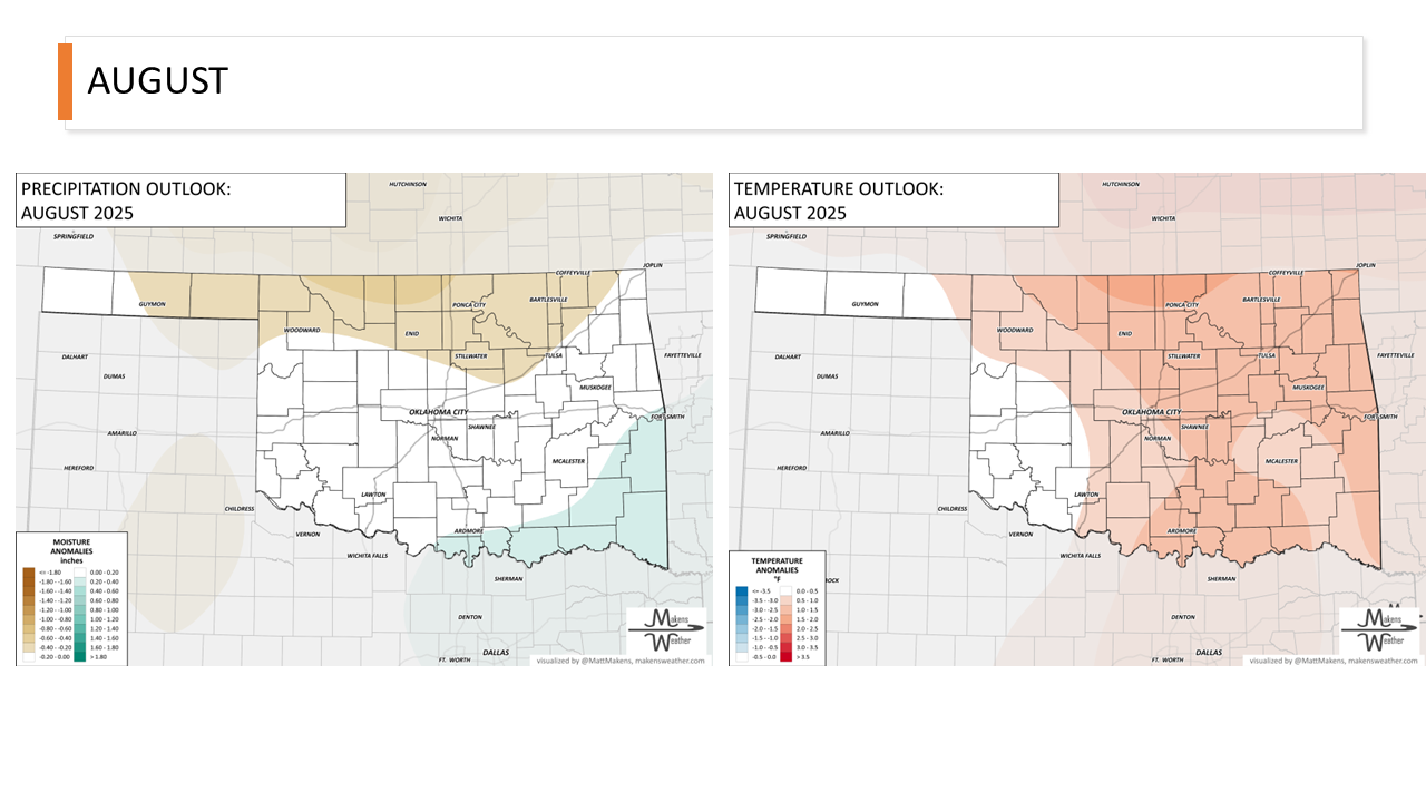
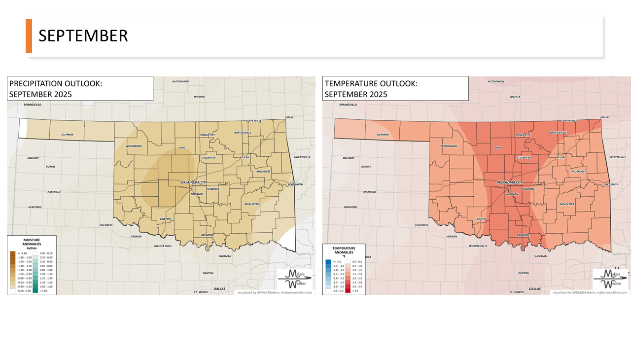
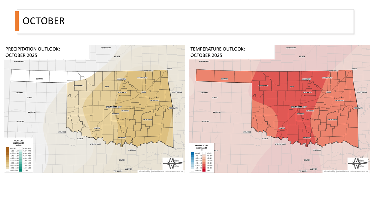
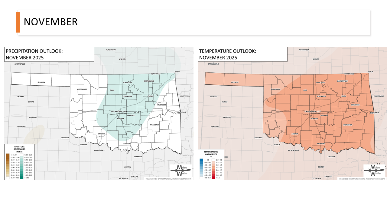
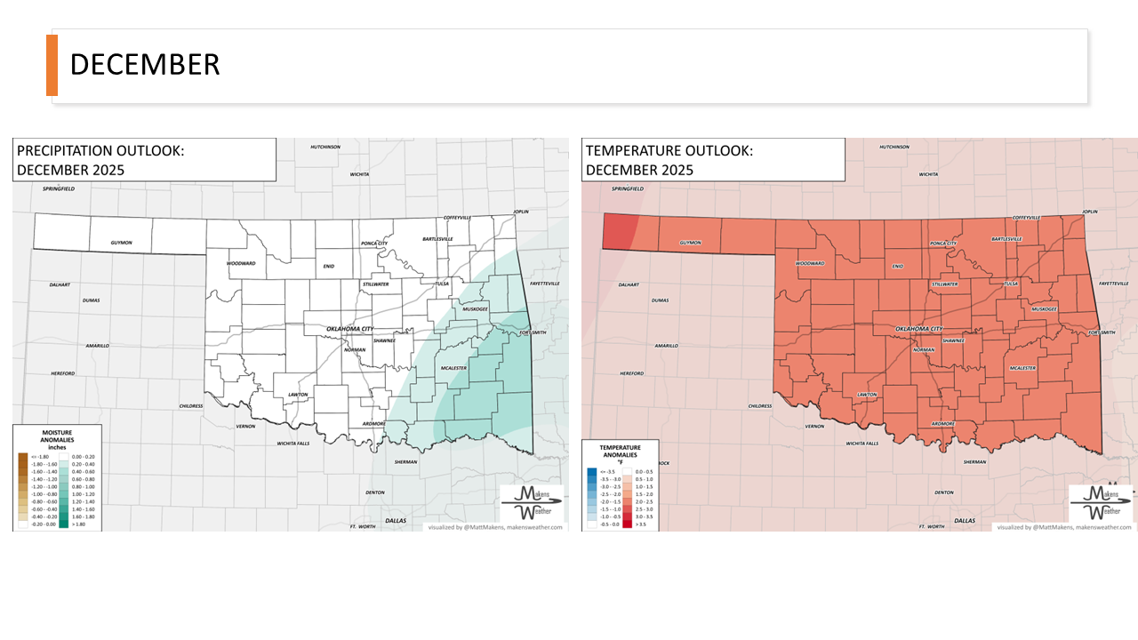
MONTHLY OUTLOOK
DASHBOARD
When Does the Moisture Arrive? Forecast Radar ▸
How Much Precipitation is On The Way (Blended-Model Forecast) ▸
Daily Temperatures (Blended-Model Forecast) ▸
Wind - Sustained and Gusts - Expected (Blended-Model Forecast) ▸
The Chances for Thunderstorms, Tornadoes, Wind, and Hail ▸
What are the Odds? Ensemble Probability Forecasts Through the Next 10 Days ▸
Experimental Cattle Health Index ▸
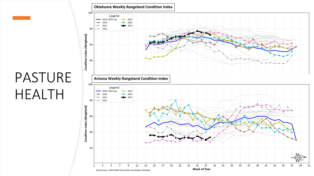
PASTURE AND RANGELAND HEALTH


CATTLE COMFORT INDEX


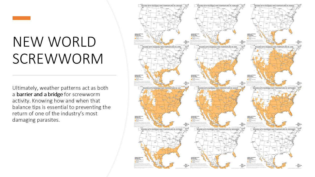
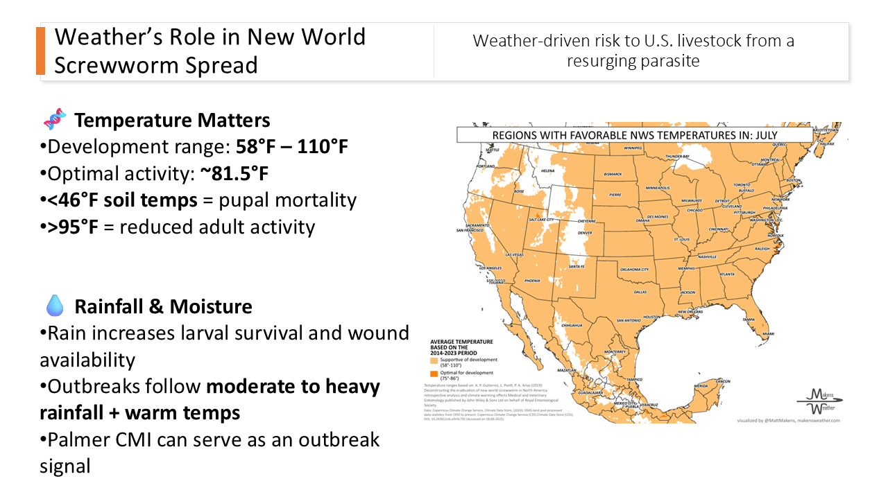
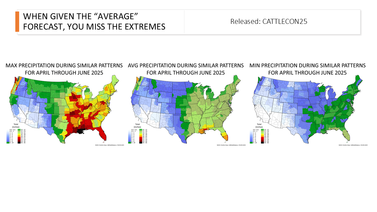
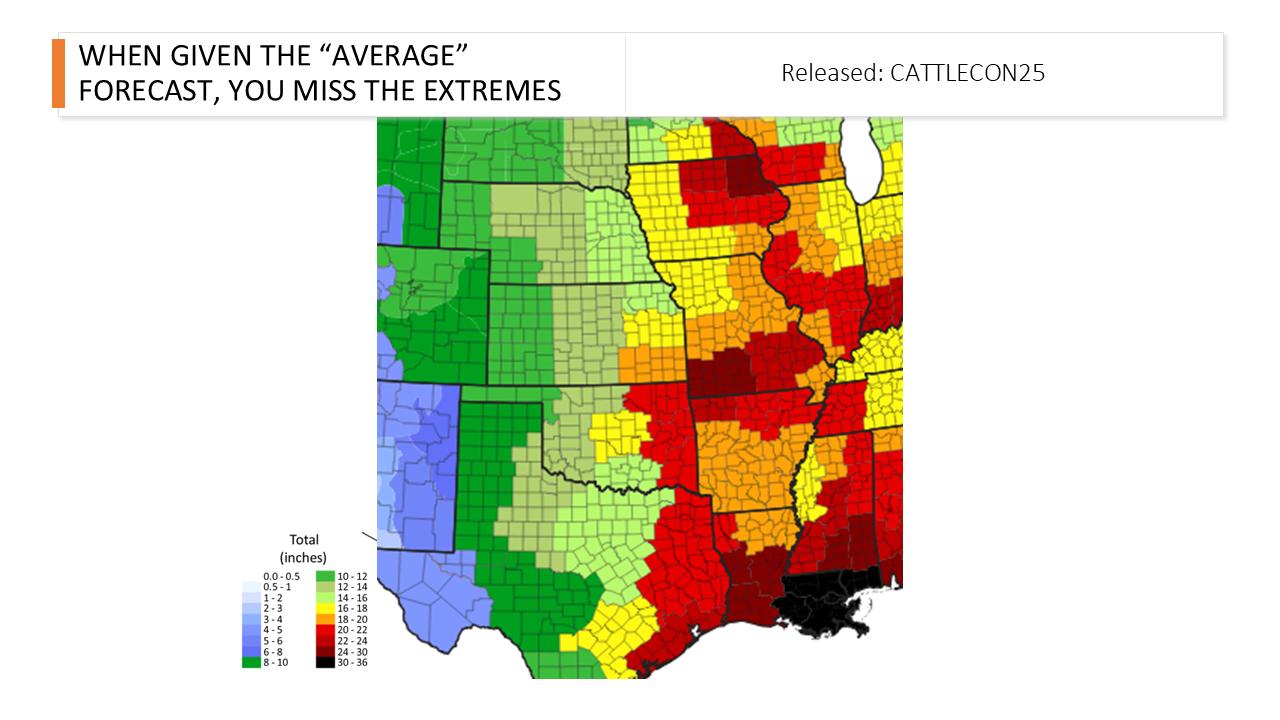
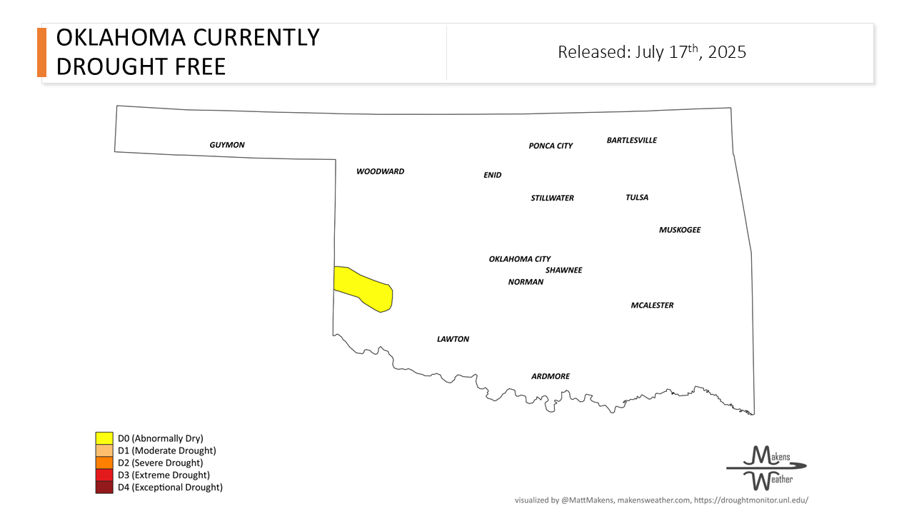
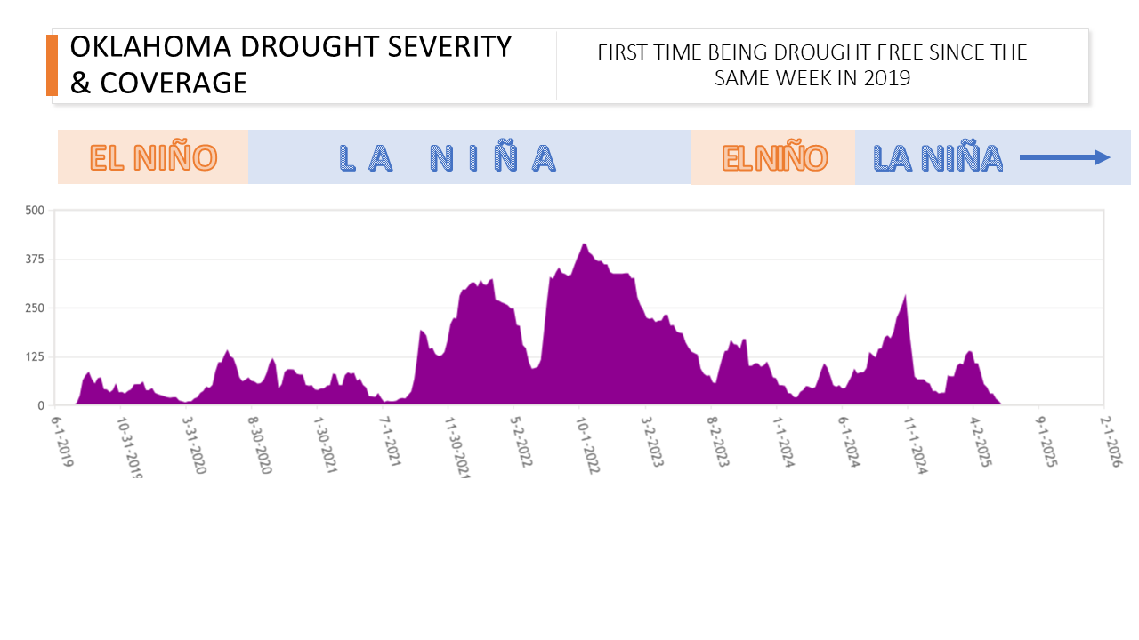
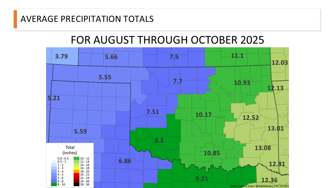
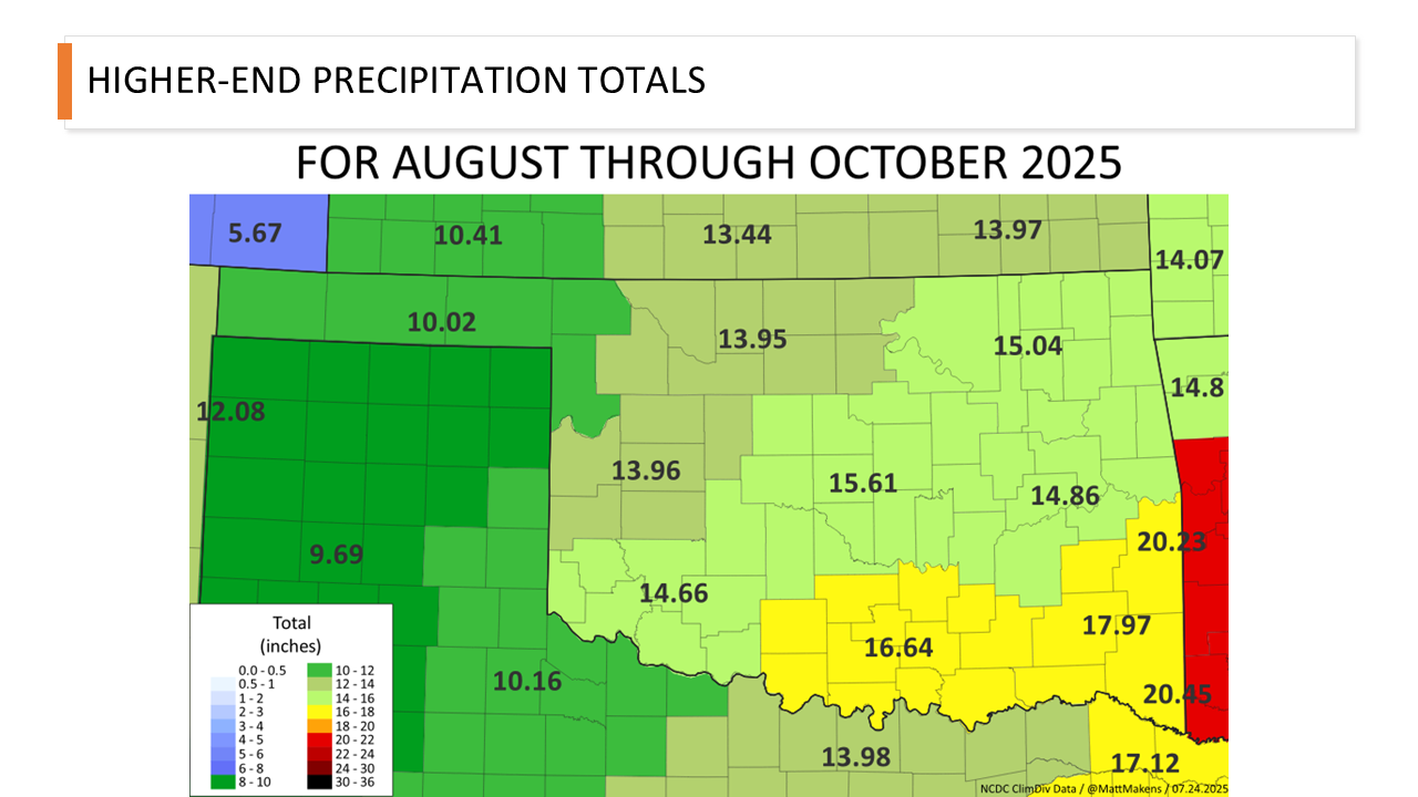
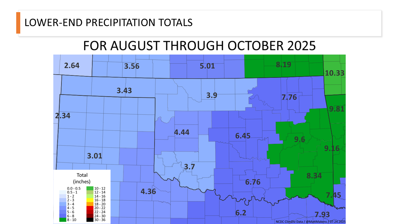
SLIDES SHOWN DURING THE PRESENTATION
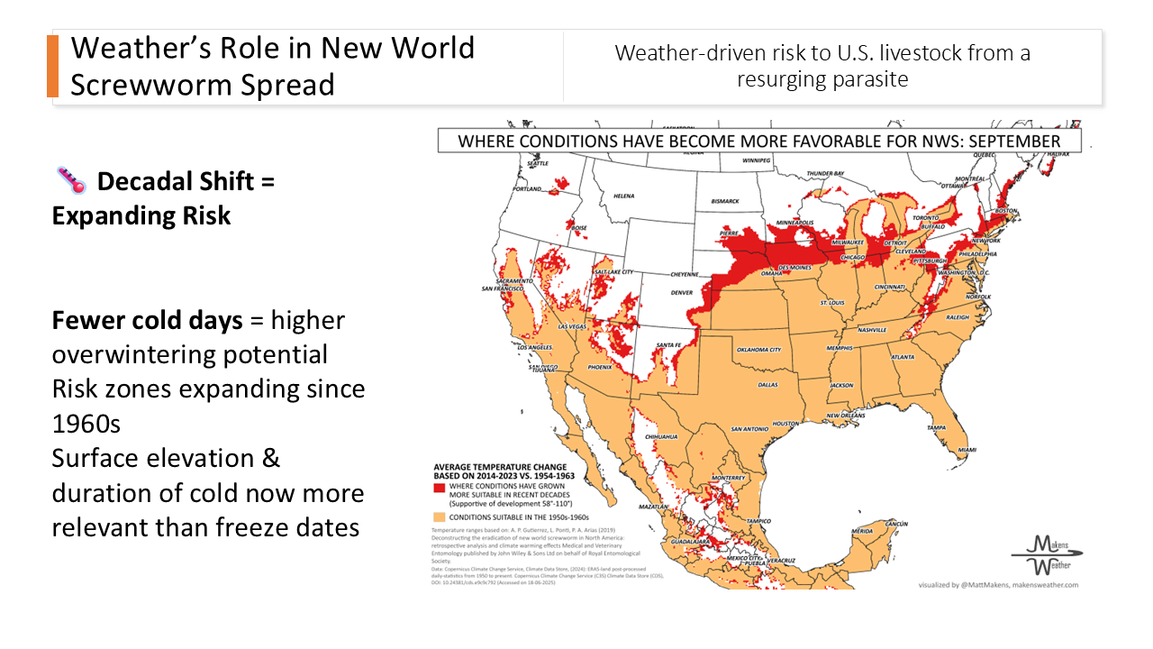
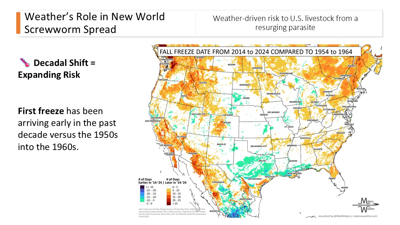
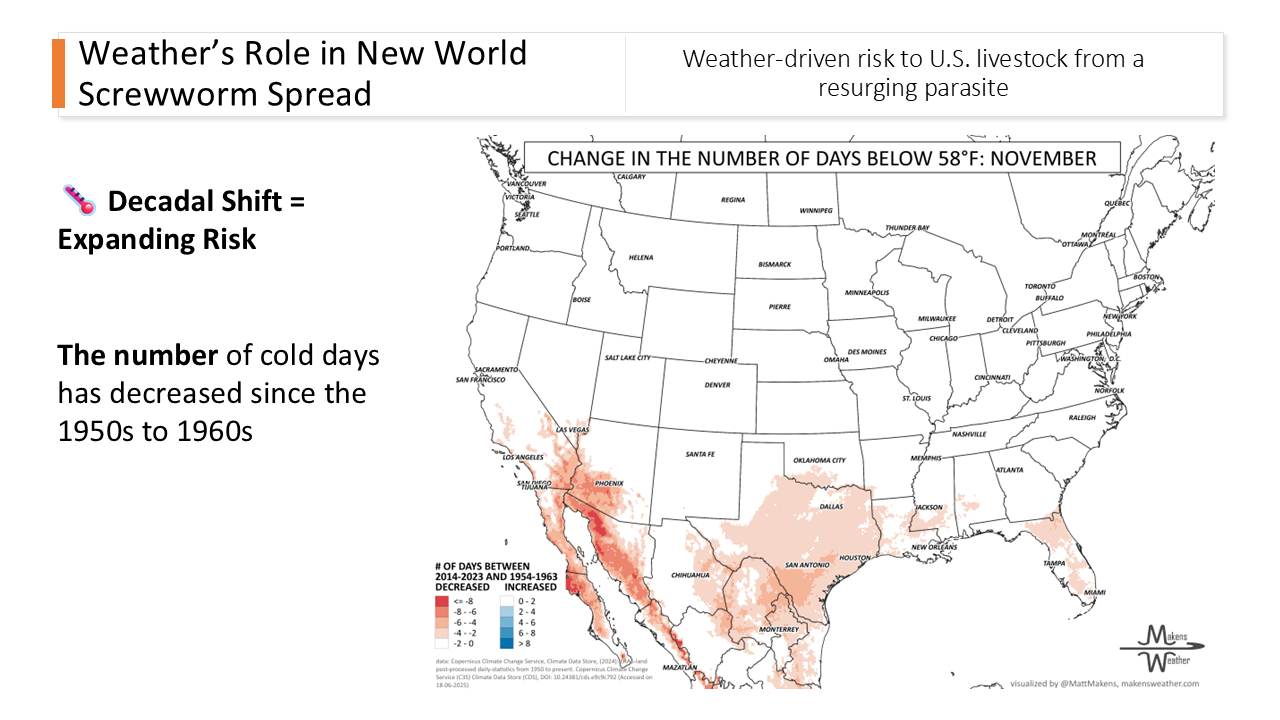
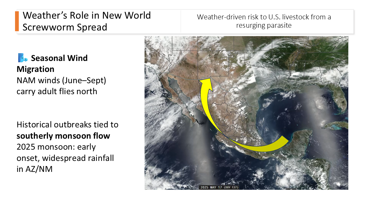
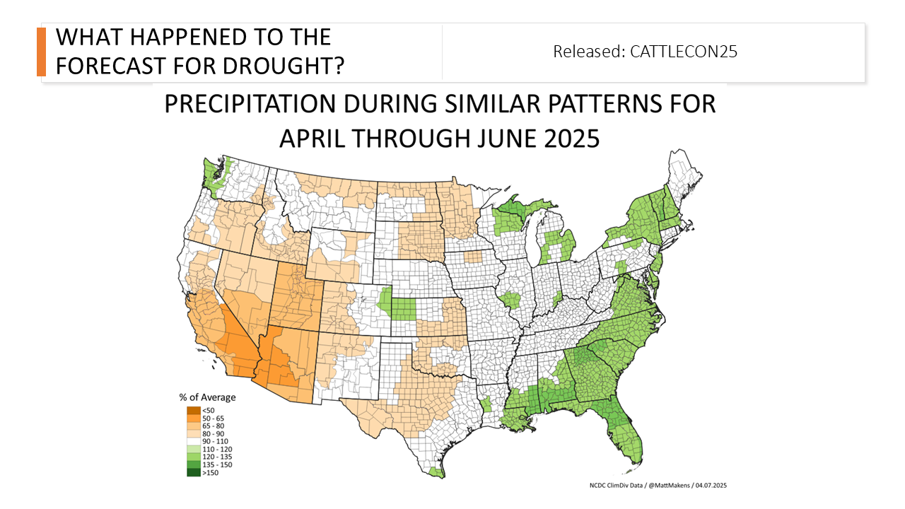

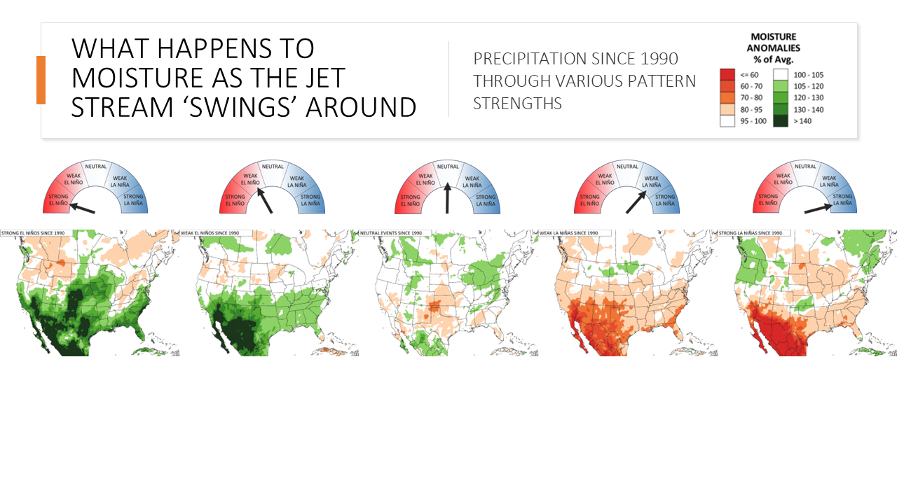

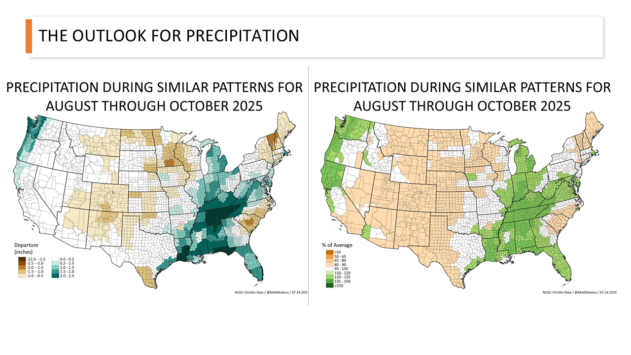

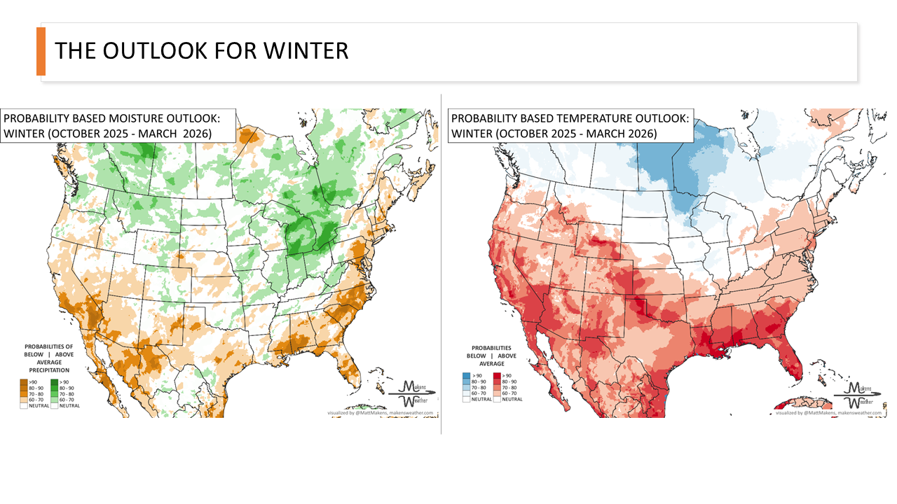

Expect another hot July across much of the country, with the best chance for beneficial rainfall in the interior West and the greatest uncertainty across the Midwest and eastern states.