





Weekly Weather Watch: Wednesday, December 11th, 2024
Santa Ana winds fuel critical fire weather conditions in Southern California. Record highs, then widespread heavy rain and severe thunderstorm threats, will impact the East Coast through New England into tonight. A surge of arctic air will hit Saskatchewan, Manitoba, Ontario, the Northern Plains and Midwest, producing lake-effect snow downwind of the Great Lakes and rain/snow for eastern Canada from today through Saturday. Here are other items to keep track of in this week’s Weather Watch.
Also, Members, you should have received your monthly forecast on the 1st. That subscriber content can be accessed here: December Outlook
HEADLINERS:
California’s fire situation: LA Times Article
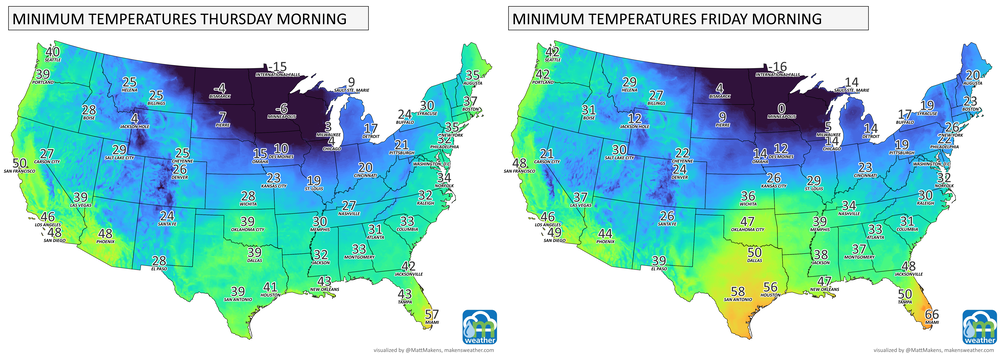
Arctic cold will spread across Central to Eastern Canada and Central to Eastern US.
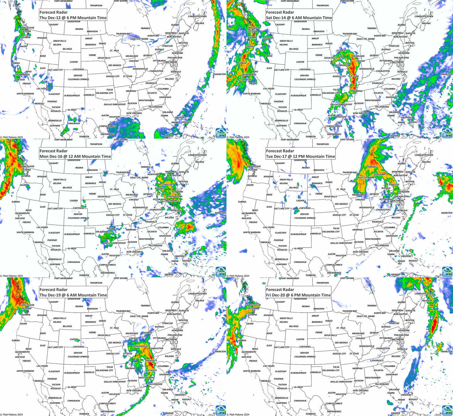
Wintry precipitation from ice to snow and rain along with that cold.
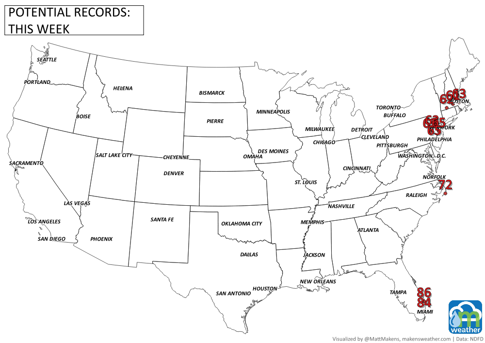
Some record highs possible Wednesday prior to a cool off with some areas of heavy precipitation for the East Coast.
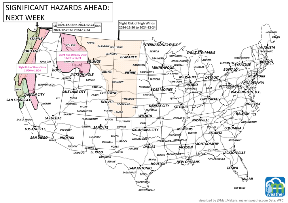
Moderate risk of episodic high winds across coastal portions of the Pacific Northwest and northern California, Wed-Sun, Dec 18-22.
Slight risk of episodic high winds across portions of the Pacific Northwest and northern California, Wed-Tue, Dec 18-24.
Slight risk of periodic heavy precipitation across parts of the Pacific Northwest and northern California, Fri-Tue, Dec 20-24.
Slight risk of periodic heavy snow for high elevation portions of the Northern Great Basin, Northern Rockies, Cascades, Sierra Nevada range, and Klamath Mountains, Fri-Tue, Dec 20-24.
Slight risk of episodic high winds across parts of the Northern and Central Plains, Fri-Tue, Dec 20-24.
Slight risk of episodic high winds across parts of south-central and southeastern Alaska, Wed-Sun, Dec 18-22.
ON THE RADAR:
EYE TO THE SKY:
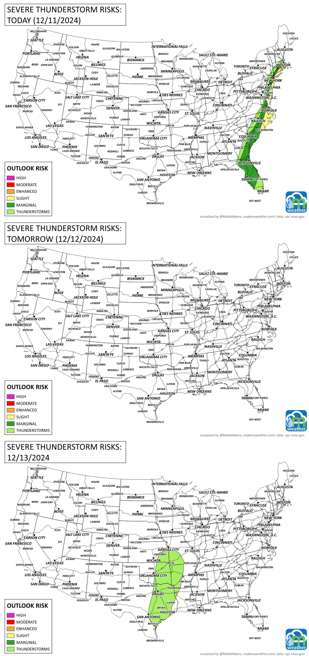
Severe thunderstorms possible along the East Coast today.
IN THE GAUGES:
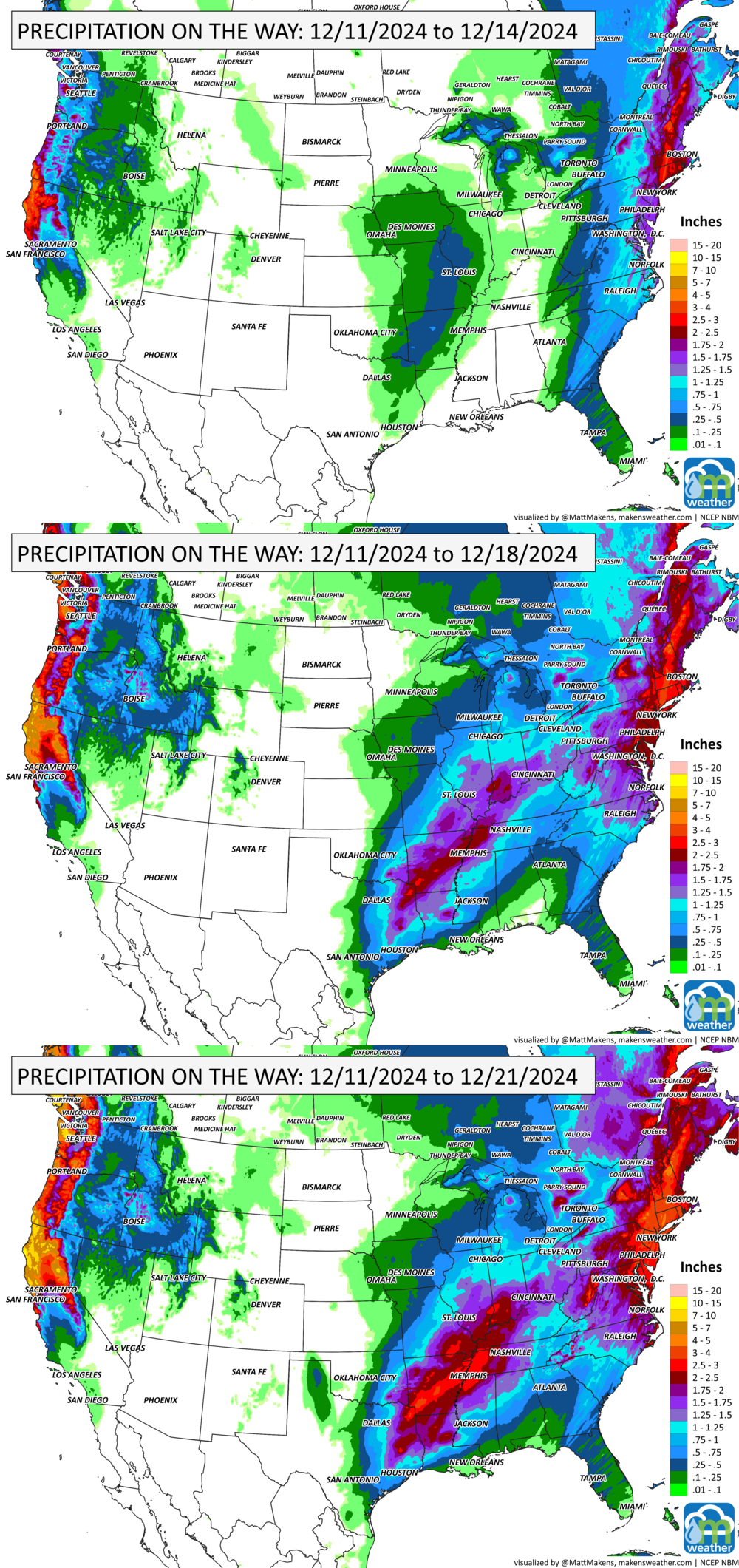
GRAB A RULER:
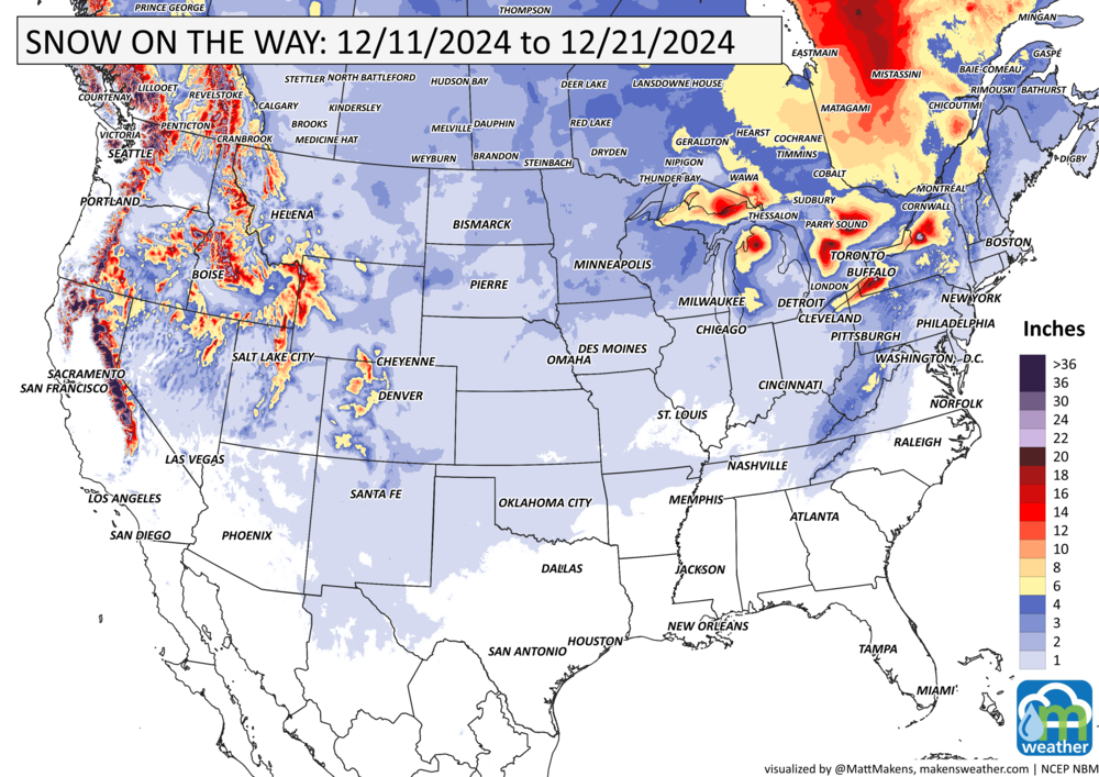
The heaviest snowfall will be stuck to the mountains and lake effect for the East. Across the Plains, just a hint of snowfall in areas, my map is misleading on the widespread nature of the snow…just pockets of it here and there.
RECORDS MADE TO BE BROKEN:
ARE YOU CIRRUS?!
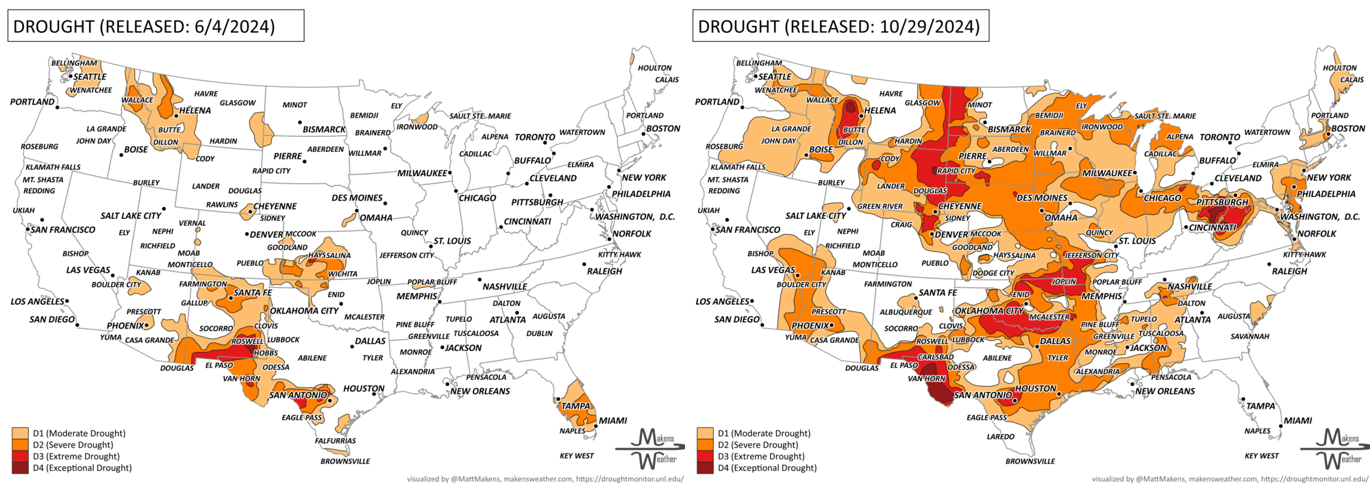
Drought: The Fastest Expansion in 25 Years
This past summer to fall saw one of the most rapid drought expansions in the U.S. in 25 years. In early June, drought covered just 12% of the country, but by late October, that number surged to 54%.
Between June 4th and October 29th, 2024, the U.S. experienced the fastest increase in drought severity/acreage during any 21-week period since 2000. (2000 starts this period of record)
( Data from droughtmonitor.unl.edu)
The weather pattern is about to make a pretty sharp turn across the country. California starts the week with unusual October heat, including highs well into the 90s and even lower 100s in the Central Valley. Meanwhile, much cooler fall air has reached the Great Lakes and Northeast. The Gulf Coast and Southeast stay unsettled, and there’s that record to watch: a tropical depression is likely to develop over the Gulf this week and could strengthen as it moves northeast. If it becomes a hurricane after the 8th, 2026 will have the latest-first hurricane in the Atlantic Basin record.