





Weekly Weather Watch: Monday, January 6th, 2025
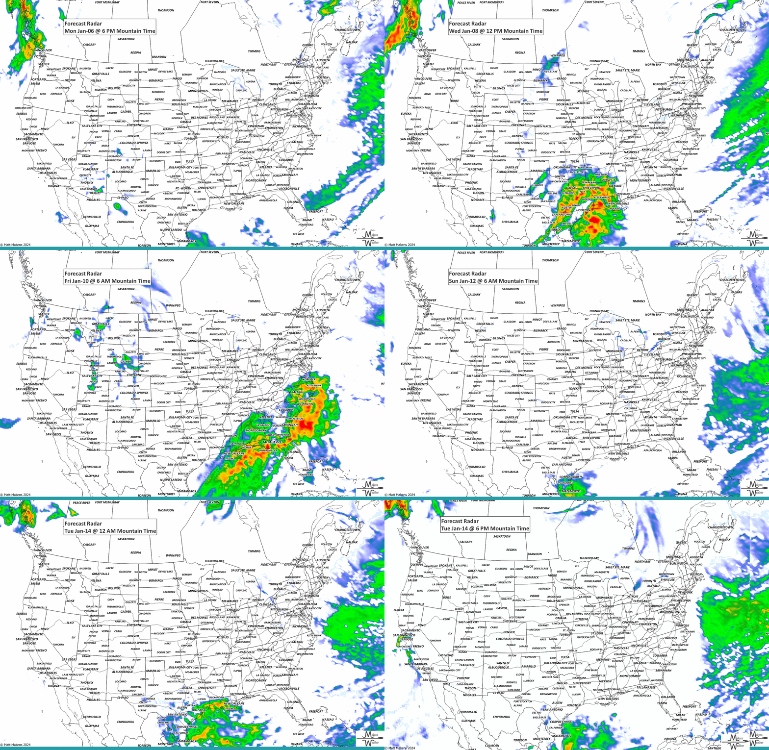
A major winter storm will move from the Ohio Valley to the Mid-Atlantic today, continuing severe travel delays, with major impacts due to areas of heavy snow and some icing for portions of West Virginia, Maryland, Virginia, Washington D.C., and Delaware. High winds will impact much of southern California Tuesday into Wednesday, possibly resulting in power outages and fire weather. Snow may reach as far south as Mexico and Texas.
Members, you should have received your monthly forecast on the 1st. That subscriber content can be accessed here: January Outlook
HEADLINERS:
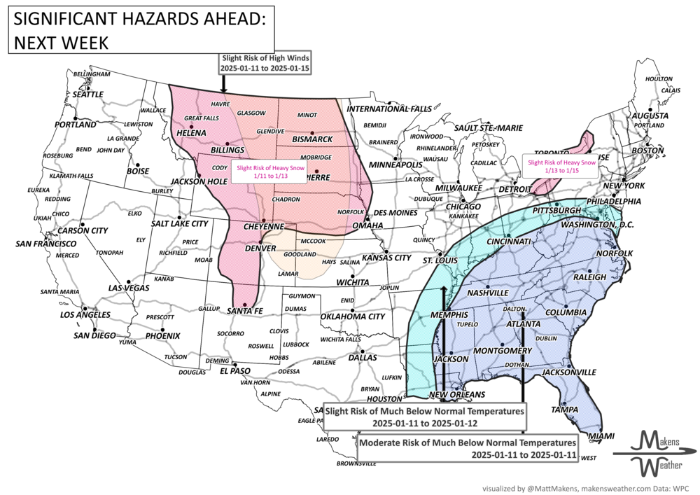
The cold weather in the East could stick around into the beginning of week-2. A mid-level trough moving into the eastern U.S. might bring some very chilly temperatures and lingering lake effect snow. High winds are also possible across parts of the Plains and Interior Mountain West throughout most of week-2. In Southern California, Santa Ana winds could persist into early week-2. As for Alaska, there’s still a chance for heavy precipitation, snow at higher elevations, and strong winds early on. For Canada, cold remains with areas of strong wind. The snow will favor the Mountains, Coastal Ranges, and the Maritimes.
ON THE RADAR:
EYE TO THE SKY:
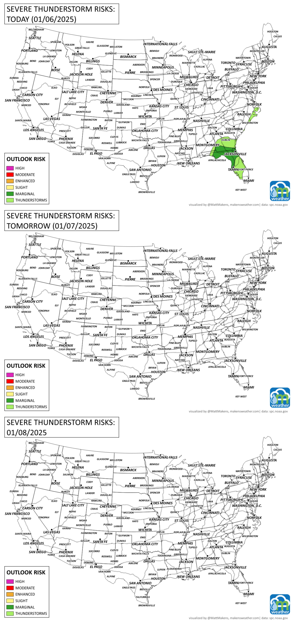
Severe thunderstorms are possible in the Southeast today.
IN THE GAUGES:
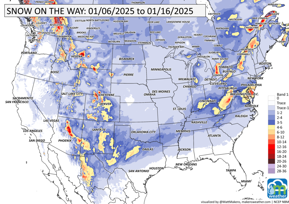
GRAB A RULER:
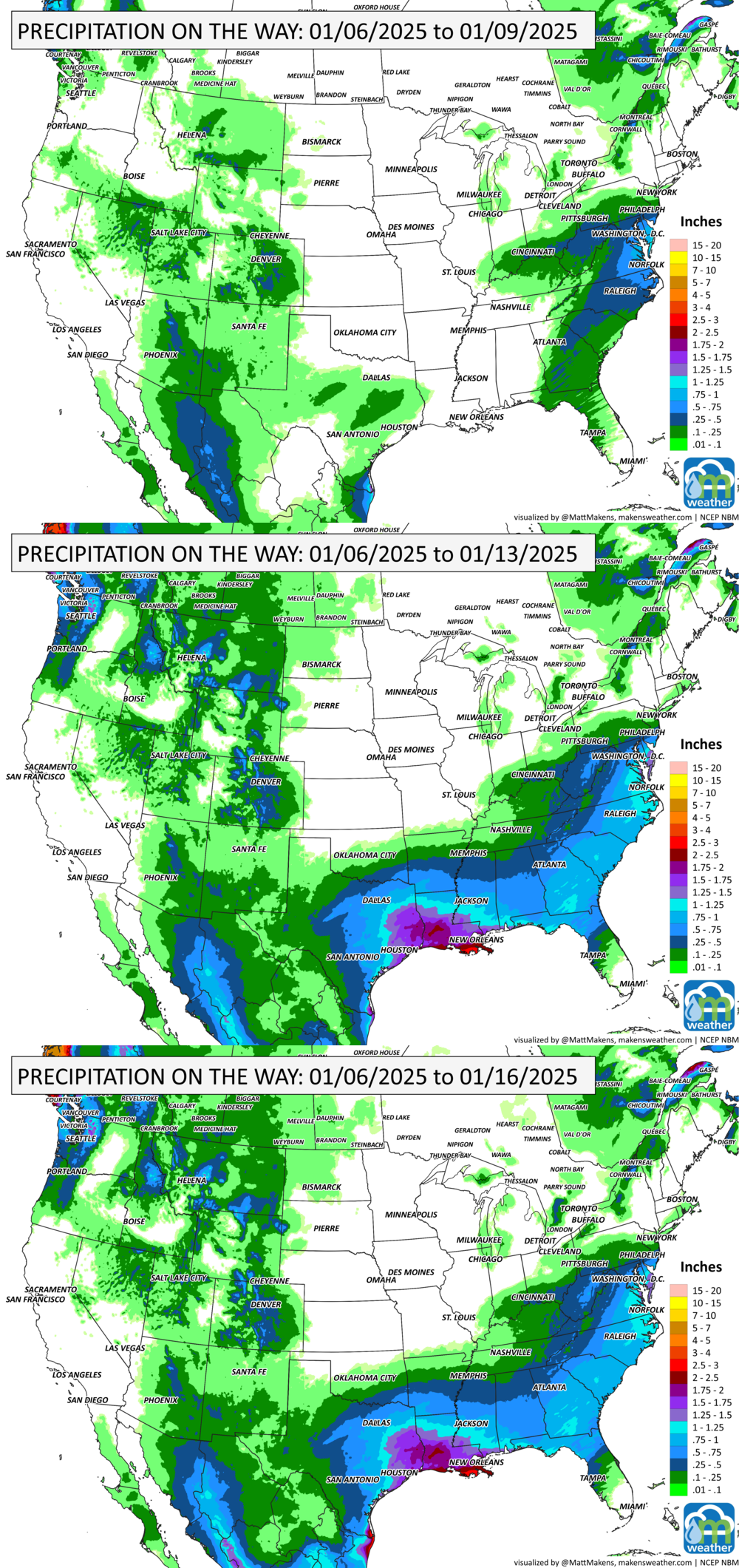
Pockets of heavy snow like a patchwork spread across the mountains ranges from Canada to Mexico and over the Appalachians with areas of heavy lake effect snow, too. Tuesday through Thursday will be producing most of this snow you see stretching south the Mexico and Texas.
RECORDS MADE TO BE BROKEN:
Yes, I know the map is blank. Significant cold across the Central & Eastern U.S. is largely not historic…
ARE YOU CIRRUS?!
On this day in history:
1996 The "Blizzard of 1996" dumped 20 inches of snow in New York City, giving Big Apple school kids their first snow day in 18 years. Up to three feet of snow fell on the Appalachians from Virginia to Pennsylvania.
The weather pattern is about to make a pretty sharp turn across the country. California starts the week with unusual October heat, including highs well into the 90s and even lower 100s in the Central Valley. Meanwhile, much cooler fall air has reached the Great Lakes and Northeast. The Gulf Coast and Southeast stay unsettled, and there’s that record to watch: a tropical depression is likely to develop over the Gulf this week and could strengthen as it moves northeast. If it becomes a hurricane after the 8th, 2026 will have the latest-first hurricane in the Atlantic Basin record.