





Weekly Weather Watch: Tuesday, January 14th, 2025
Critical to extremely critical fire weather conditions will continue for southern California - the strong Santa Ana wind continues, and there’s no moisture in sight. A blast of cold is gearing up for next week, sending many to the single digits and others to well below zero. Some areas of heavy snowfall are expected, but there is less moisture overall for the country compared to the last system that went through.
More on California: How Santa Ana winds fueled the deadly fires in Southern California
Members, you should have received your weekly breakouts via email yesterday.
HEADLINERS:
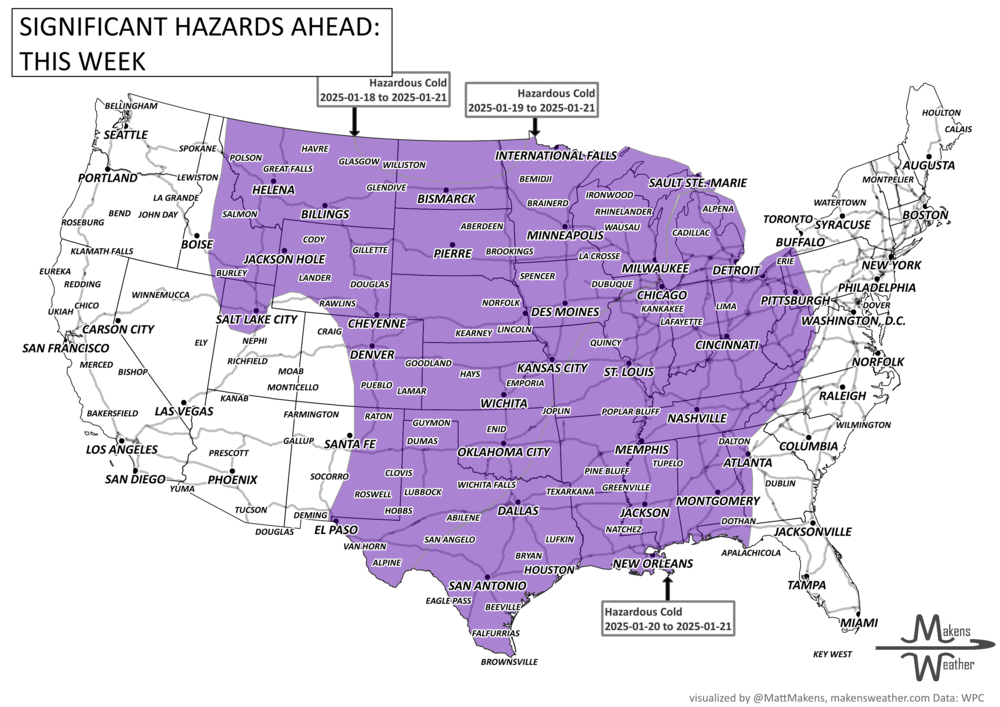
By this weekend, the weather patterns are shaping up to be pretty intense. We’re looking at a big shift with a deep trough stretching from Canada all the way down through the lower 48 states. As this happens, a blast of cold air will sweep into the U.S., with the coldest temperatures expected on Sunday and Monday for the Central to Northern Plains and nearby Rockies.
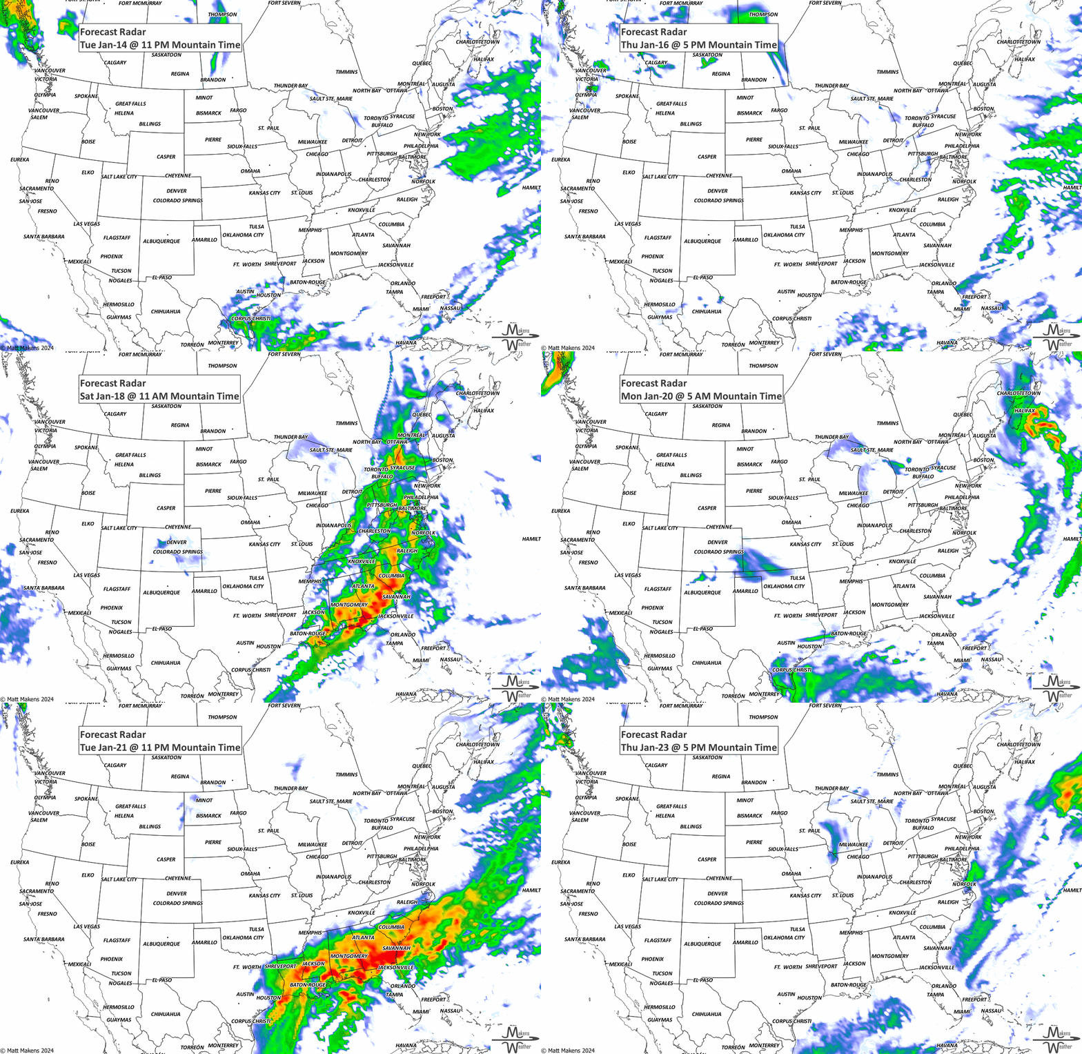
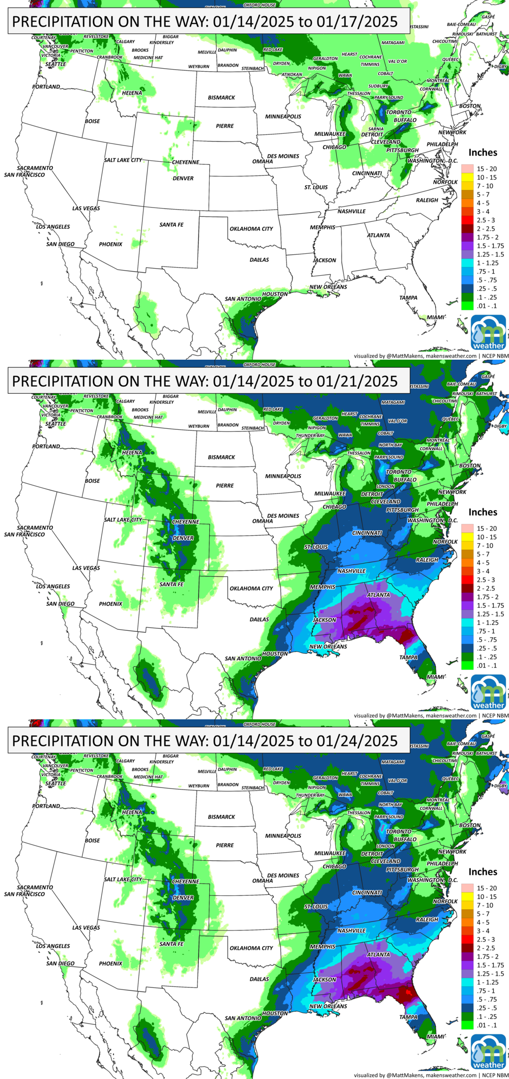
Regarding precipitation, expect snow to move through the Rockies and High Plains as the cold front moves through, tapering off next week. The arrival of cold air on the East Coast and western Atlantic might bring lighter precipitation. The Gulf Coast and Southeast may also be in for some moisture as the trough swings across the country.
ON THE RADAR:
IN THE GAUGES:
GRAB A RULER:
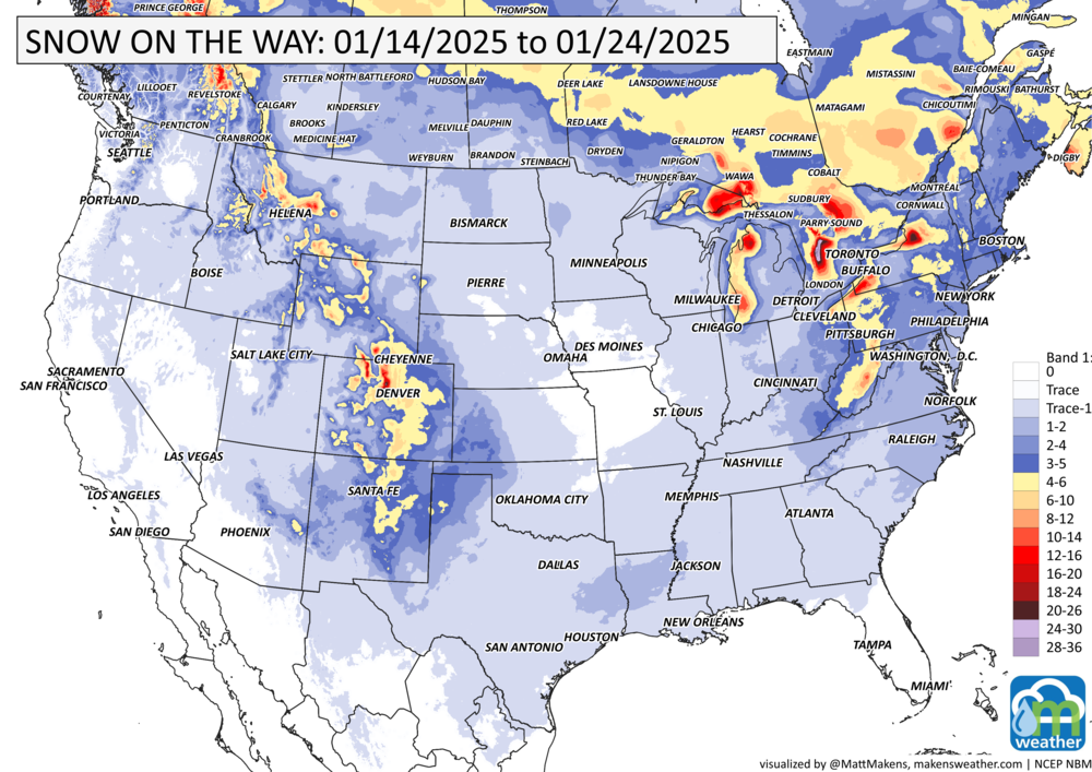
Pockets of heavy snow like a patchwork spread across the mountain ranges from Canada to New Mexico, over the Appalachians, and areas of heavy lake effect snow in the Great Lakes region, too.
RECORDS MADE TO BE BROKEN:
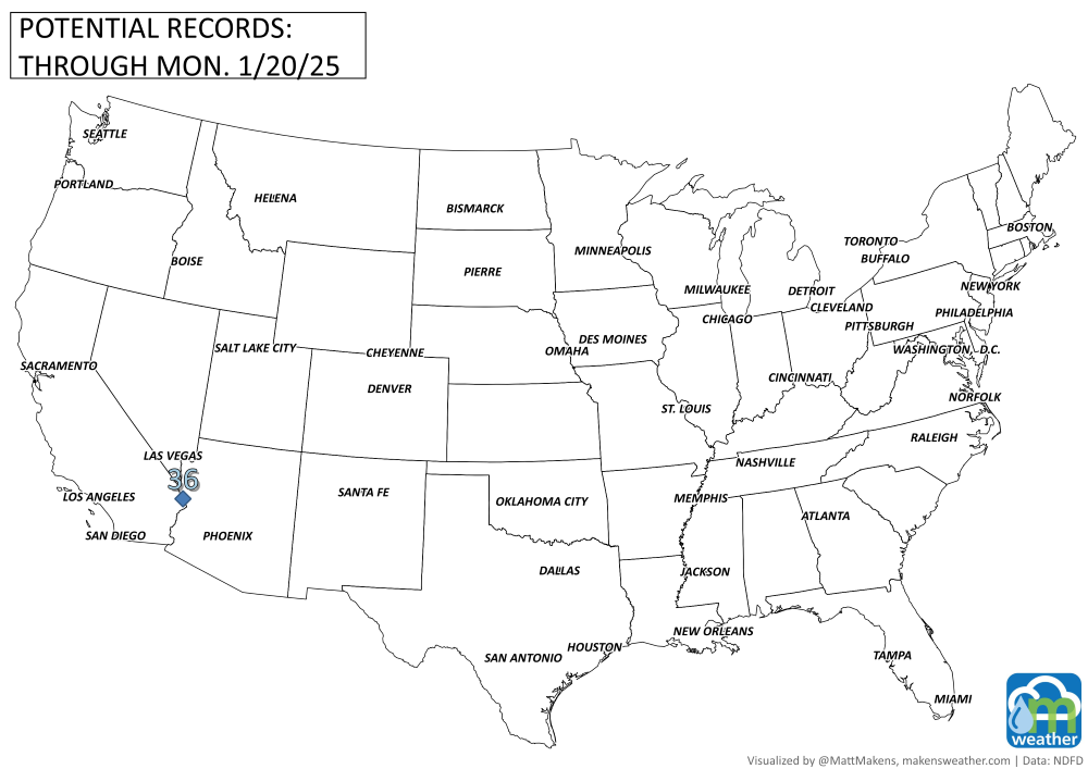
Yes, I know the map is blank. Significant cold across the Central & Eastern U.S. is largely not historic through Monday. I’ll update this map via social channels if needed.
ARE YOU CIRRUS?!
On this day in history:
1882 Southern California experienced its greatest snowfall ever. San Bernadino reported 15 inches of snow, while even San Diego reported a trace.
The weather pattern is about to make a pretty sharp turn across the country. California starts the week with unusual October heat, including highs well into the 90s and even lower 100s in the Central Valley. Meanwhile, much cooler fall air has reached the Great Lakes and Northeast. The Gulf Coast and Southeast stay unsettled, and there’s that record to watch: a tropical depression is likely to develop over the Gulf this week and could strengthen as it moves northeast. If it becomes a hurricane after the 8th, 2026 will have the latest-first hurricane in the Atlantic Basin record.