





Weekly Weather Watch: Monday, February 3rd, 2025
A long-lasting rainfall event will keep bringing moderate to heavy precipitation to northern and central California, with a risk of flooding. The Sierras, southern Cascades, and northern Rockies also see heavy mountain snow throughout the week. On top of that, high winds could cause issues across northern Nevada and the central Rockies. Cold air will be felt in Canada and across the Northern U.S. with heavy snowfall areas. Meanwhile, dozens of record-high temperatures are expected across the south. Here are the headlines this week.
Members, you should have received your monthly update yesterday. We discussed the ongoing potential for cold in the outlook for February - you can access that here.
HEADLINERS:
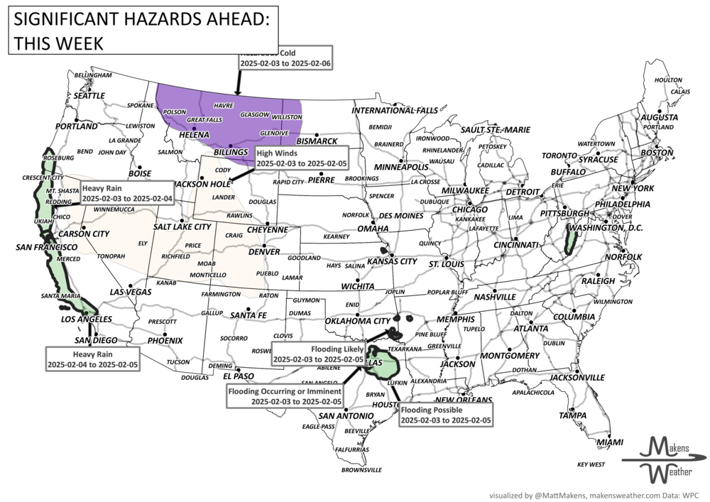
A mostly steady weather pattern through midweek.
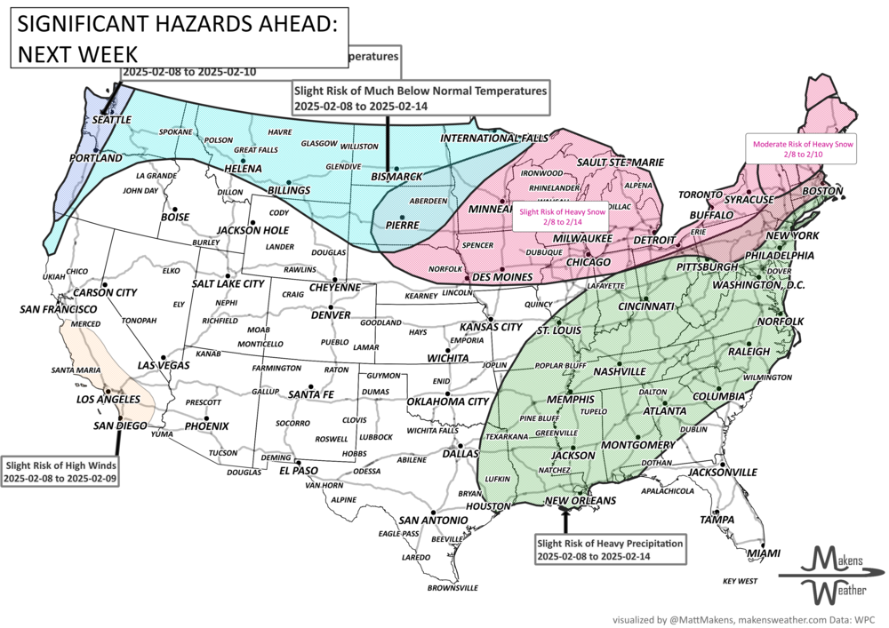
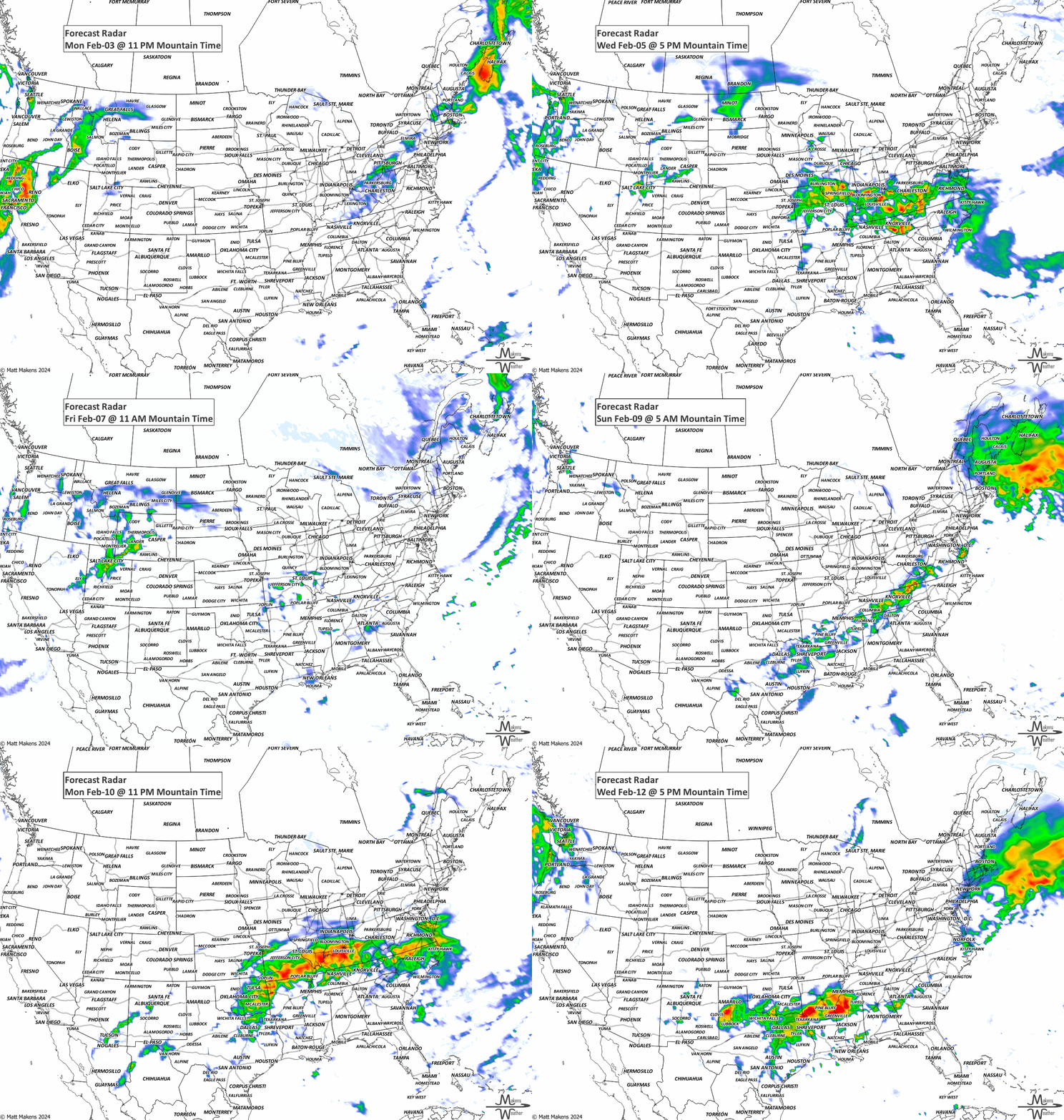
Later in the week and into the weekend, the atmosphere transitions a bit, and this should bring drier weather to California after a round of heavy rain and snow around Thursday.
The Great Basin and Rockies will see more precipitation, with higher elevations likely getting significant snow.
The eastern U.S. will experience two weather systems this week, each bringing a mix of rain, snow, or a wintry mix, depending on location.
The South will stay warm, while cooler air will push into the Northwest and northern Plains, with Montana possibly seeing the coldest temperatures.
Central to Eastern Canada will see the snowfall taper off and warmer temperatures move in, but it remains cold for western Canada with periods of snowfall - mostly light snowfall.
ON THE RADAR:
KEEP AN EYE TO THE SKY:
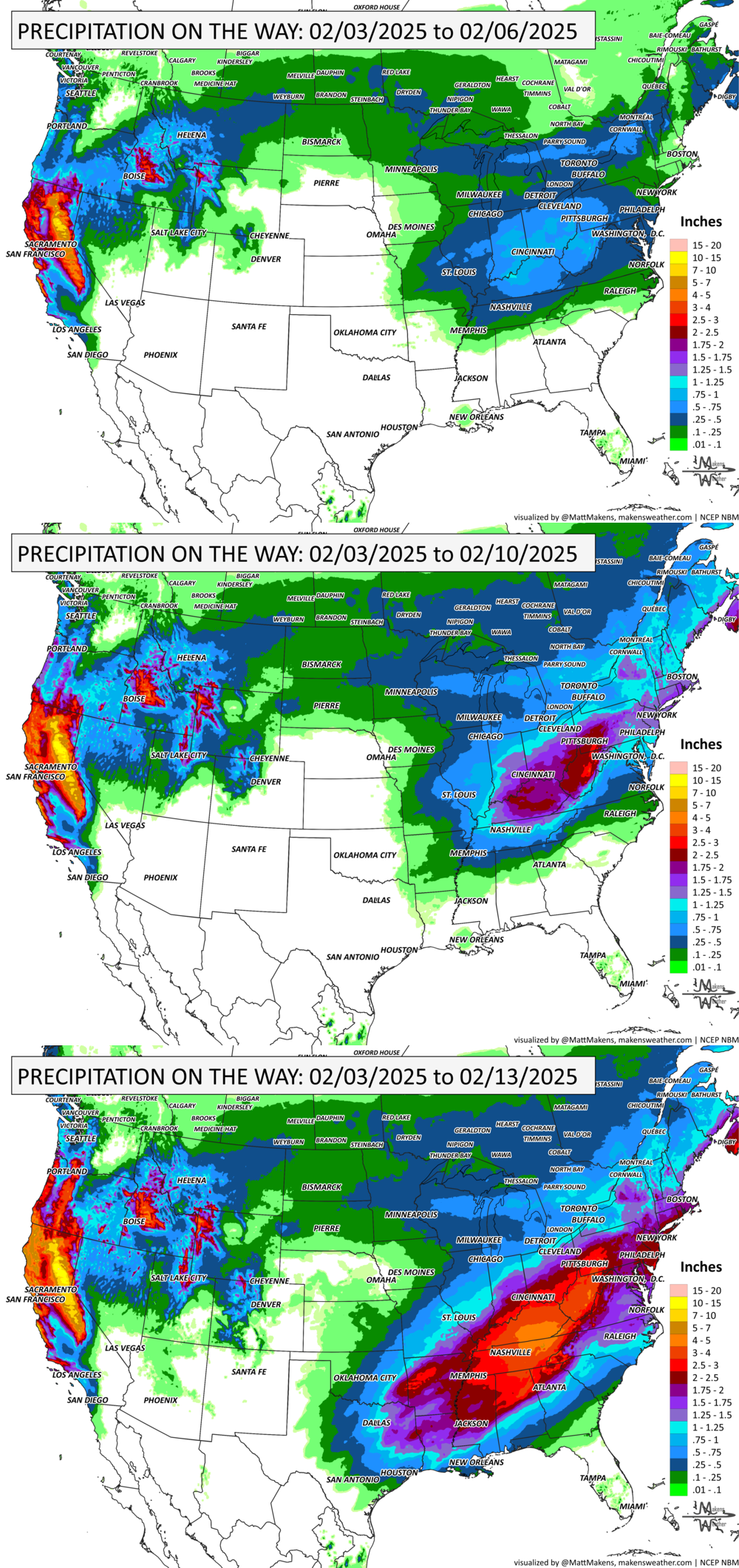
IN THE GAUGES:
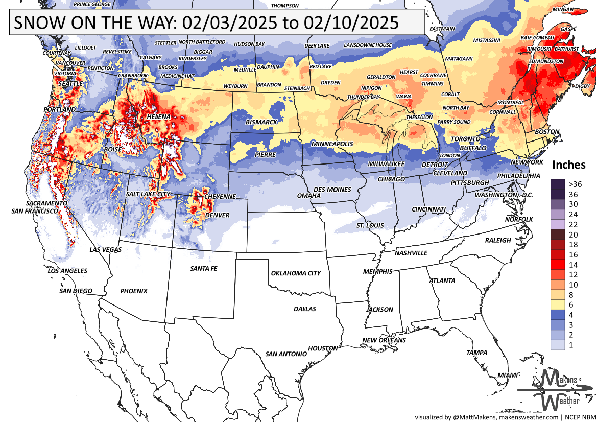
GRAB A RULER:
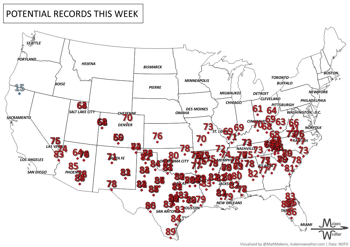
RECORDS MADE TO BE BROKEN:
ARE YOU CIRRUS?!
On this day in history:
1947 Snag, Yukon recorded North America's coldest temperature ever: -81.4 degrees.
1997 Thames River, England: portions of the river froze over for the first time since World War II.
The weather pattern is about to make a pretty sharp turn across the country. California starts the week with unusual October heat, including highs well into the 90s and even lower 100s in the Central Valley. Meanwhile, much cooler fall air has reached the Great Lakes and Northeast. The Gulf Coast and Southeast stay unsettled, and there’s that record to watch: a tropical depression is likely to develop over the Gulf this week and could strengthen as it moves northeast. If it becomes a hurricane after the 8th, 2026 will have the latest-first hurricane in the Atlantic Basin record.