





Weekly Weather Watch: Tuesday, February 25th, 2025
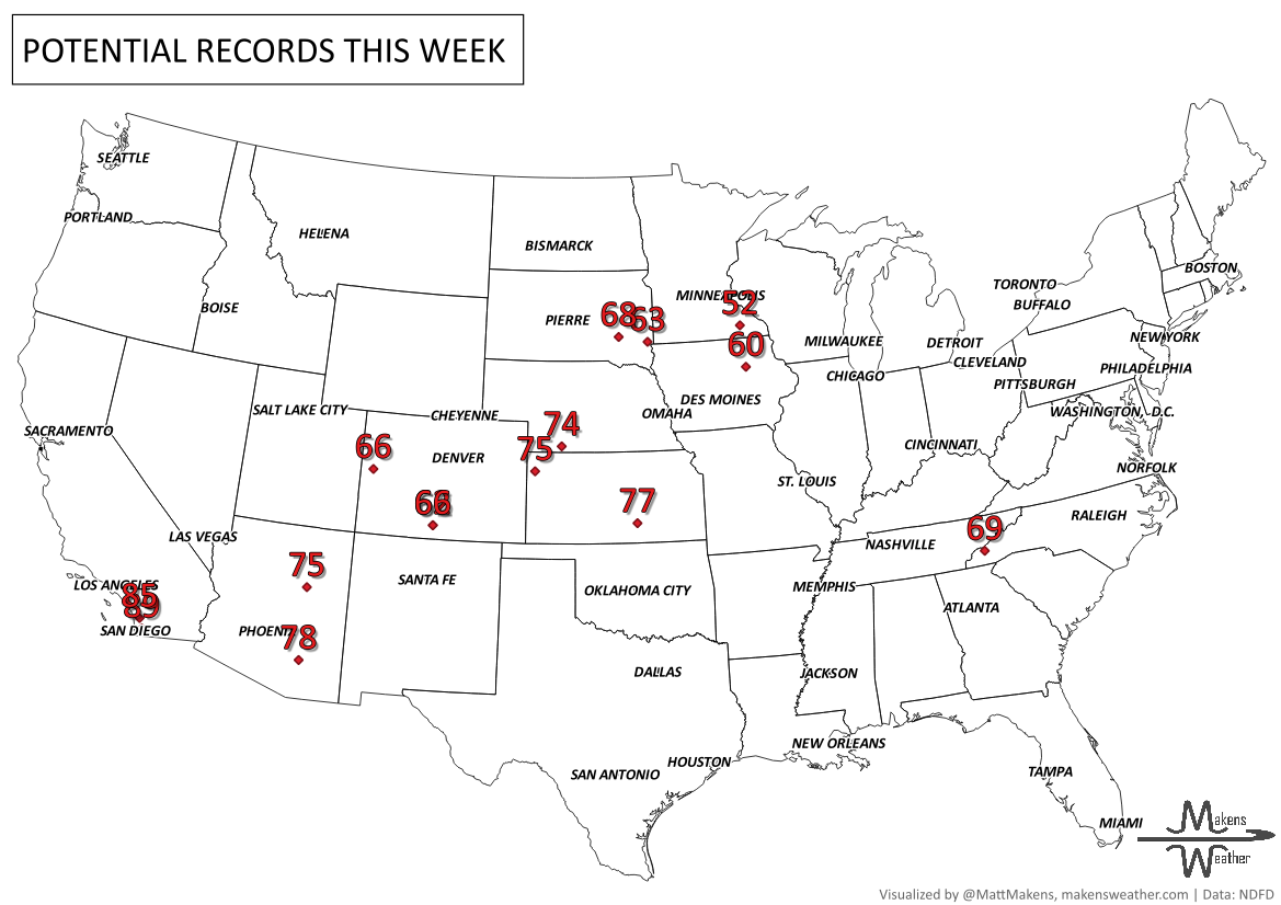
Last week’s cold has quickly retreated and most of us have quite a warm week on tap. The next potential change to the pattern will come March 4th and after.
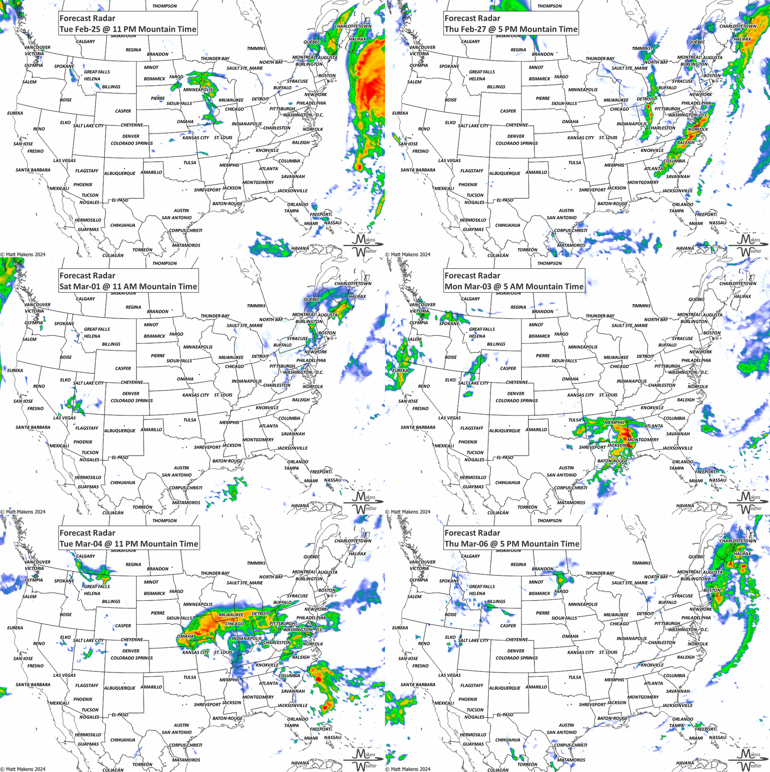
The atmospheric river event is starting to wind down today across the Pacific Northwest and Northern Rockies, but flooding remains a concern, along with some gusty winds. Those winds and drier conditions could also increase fire weather risks across parts of the Plains (more on range burning in a moment). If you're near the Gulf Coast, keep an eye out for dense fog tonight—it could make travel tricky!
Members, you should have received your weekly update yesterday, including your threshold probabilities for the week’s total precipitation. Give me a holler if you didn’t see that email.
HEADLINERS:
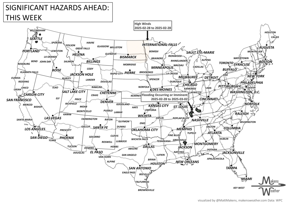
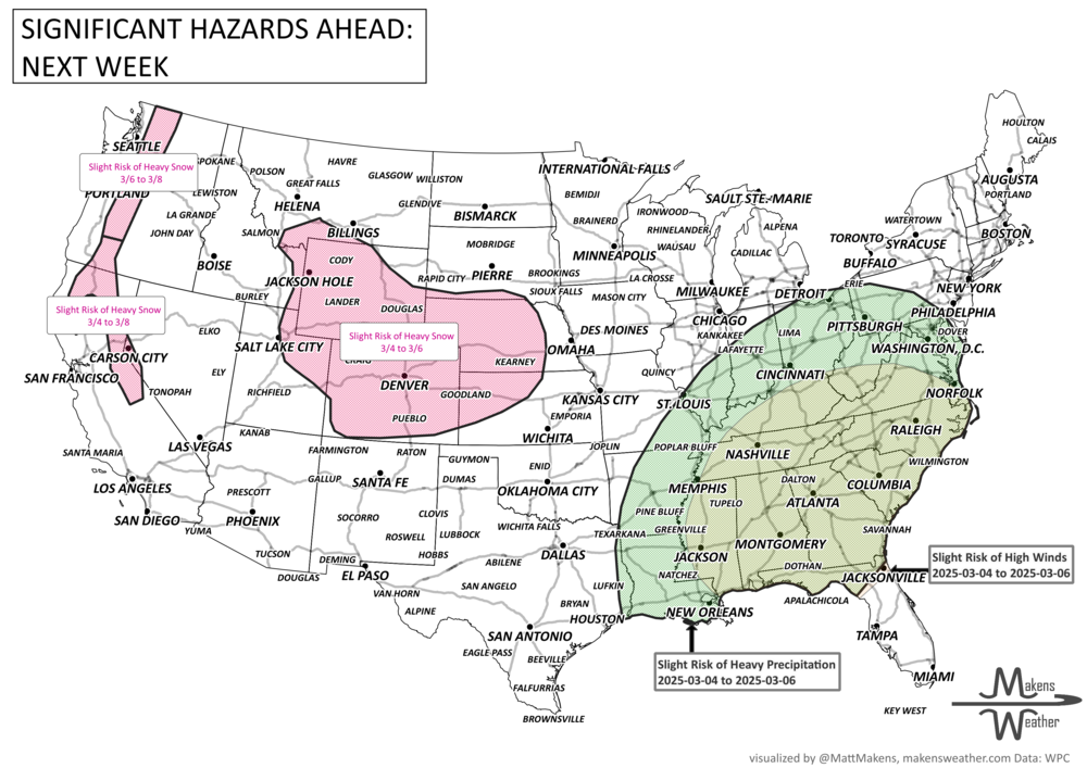
A couple systems will move into the West. The first will likely fizzle out. The second, however, may be a system to watch for later next week. Some of the hazards the pattern next week could bring include:
Slight risk of heavy precipitation for much of the southeastern CONUS, Tue-Thu, Mar 4-6.
Slight risk of high winds for portions of the Southeast, Mid-Atlantic, Ohio and Tennessee Valleys, Tue-Thu, Mar 4-6.
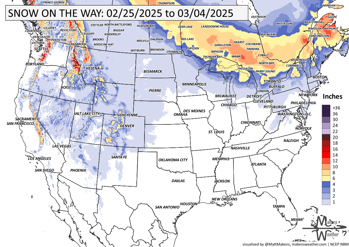
Slight risk of heavy snow for portions of the Rockies and Central Plains, Tue-Thu, Mar 4-6.
Slight risk of heavy snow for portions of the northern Sierra Nevada, Klamath, and southern Cascade Mountains, Tue-Sat, Mar 4-8.
Slight risk of heavy snow for the northern Cascade Mountains for Thu-Sat, Mar 6-8.
-Threats via WPC
ON THE RADAR:
KEEP AN EYE TO THE SKY:
IN THE GAUGES:
Big question marks on that moisture over Oklahoma and Texas…
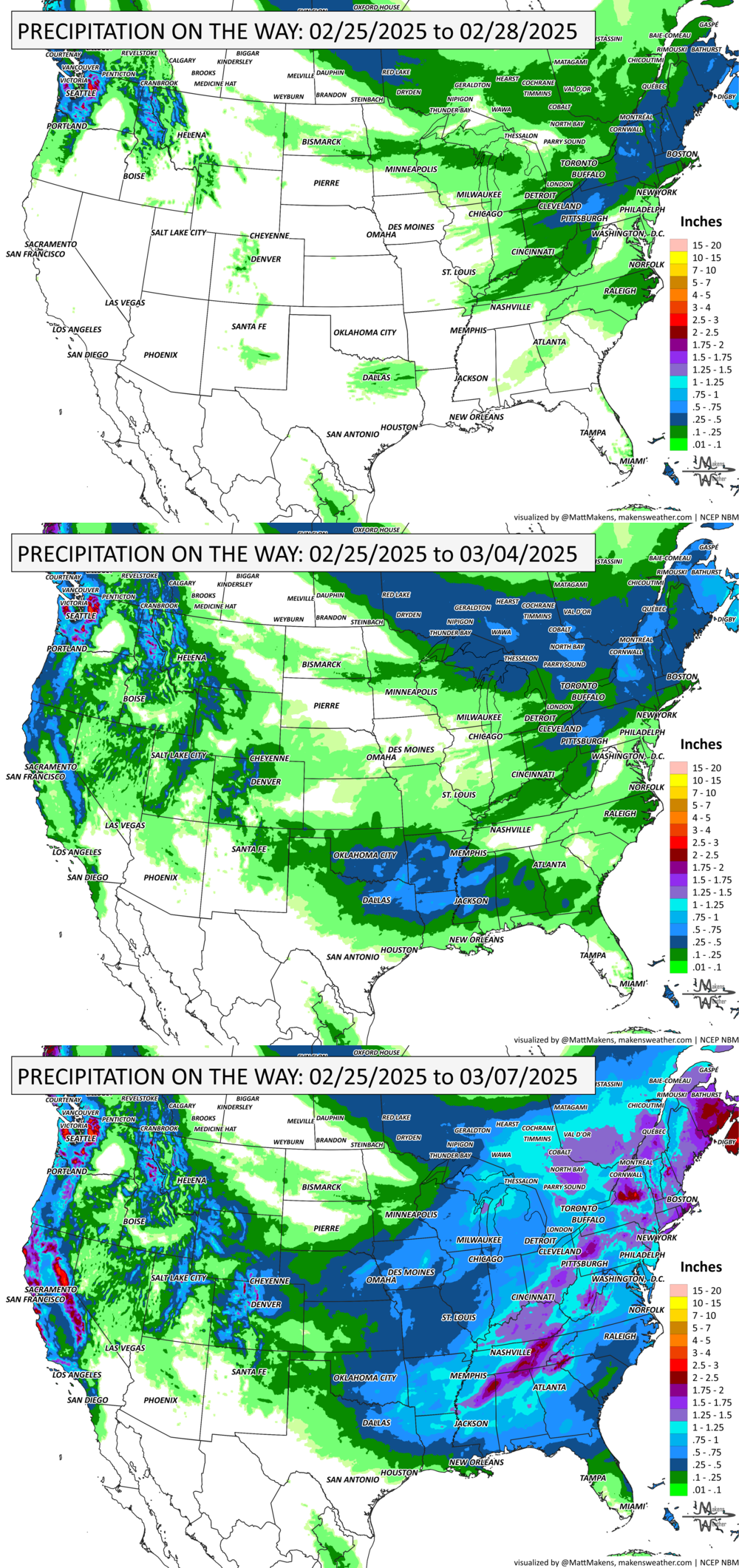
GRAB A RULER:
RECORDS MADE TO BE BROKEN:
ARE YOU CIRRUS?!
On this day in history:
1915 South Carolina observed its largest modern snowfall as 18 inches fell at Society Hill.
1987 Eighty-seven inches of snow fell at Alpine, AZ as a major storm struck the southwest United States.
1977 Dust from the Great Plains reduced visibility from Virginia to Florida. Winds in the Great Plains on the 22nd and 23rd gusted over 100 mph at Guadalupe Pass, TX, at White Sands NM, in Sherman County, KS, and in eastern Colorado.
BURNING QUESTIONS
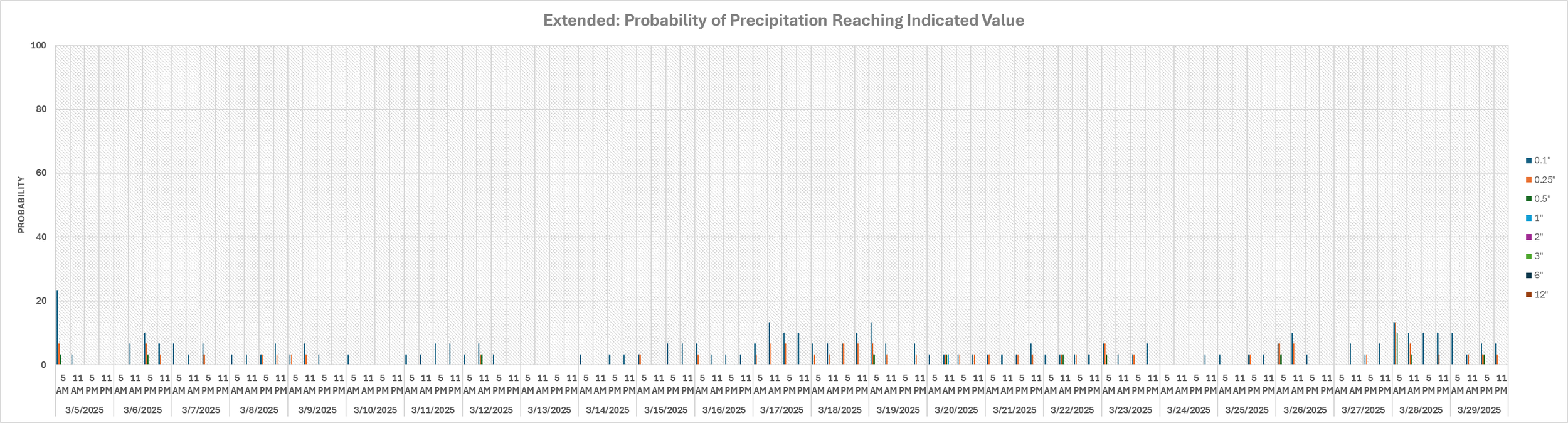
I have had several questions and data requests for weather conditions before controlled burns across the Plains. The problem is that you can’t rely on your phone or social media for accurate forecasts. The solution is to provide data interpretations so that you understand the probabilities of wind speeds, directions, precipitation, etc., to keep you better informed about when to burn your pastures. Here is an example of the precipitation probabilities for much of March for one such client. This is just an example of the data available when making critical decisions like this prescribed burn example.
The weather pattern is about to make a pretty sharp turn across the country. California starts the week with unusual October heat, including highs well into the 90s and even lower 100s in the Central Valley. Meanwhile, much cooler fall air has reached the Great Lakes and Northeast. The Gulf Coast and Southeast stay unsettled, and there’s that record to watch: a tropical depression is likely to develop over the Gulf this week and could strengthen as it moves northeast. If it becomes a hurricane after the 8th, 2026 will have the latest-first hurricane in the Atlantic Basin record.