





Weekly Weather Watch: Monday, March 3rd, 2025
In this Weekly Weather Watch, the headlines coming your way include: Strong winds and dry conditions will drive critical to extreme fire weather in the Southern Plains, especially in eastern New Mexico and western Texas. Meanwhile, heavy mountain snow will continue in the Sierra Nevada and Great Basin. A major winter storm moving into the Central U.S. will bring blizzard conditions, severe storms, and flash flooding concerns through midweek from Wyoming and Colorado to the East.
Members, you should have received your monthly update Saturday, where we discuss the potential cold for the month of March. Give me a holler if you didn’t see that email, but you can access that monthly forecast here.
HEADLINERS:
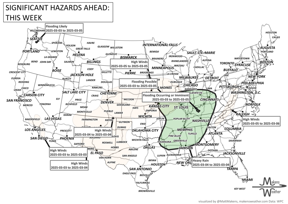
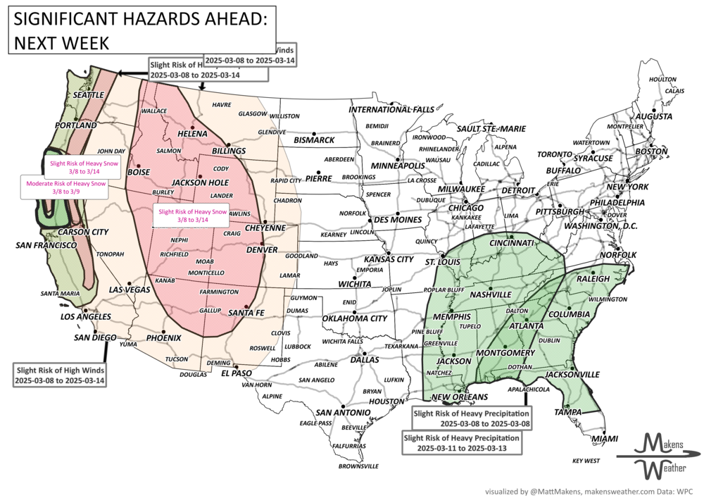
A number of low-pressure areas will cross North America this week and next. For now, extreme cold is limited to Eastern Canada but moisture will be widespread from Canada through the United States. This train of systems, if you will, continues into next week with the following highlights:
Moderate risk of heavy snow for portions of the northern Sierra Nevada, Klamath, and southern Cascade Mountains, Sat-Sun, Mar 8-9.
Moderate risk of heavy precipitation for portions of northern California and southwestern Oregon, Sat-Sun, Mar 8-9.
Slight risk of episodic heavy snow for the Cascades, Klamath, and Sierra Nevada Mountains for Sat-Fri, Mar 8-14.
Slight risk of episodic heavy precipitation for parts of western Oregon, western Washington, and much of California, Sat-Fri, Mar 8-14.
Slight risk of episodic high elevation snowfall over portions of the Great Basin, Intermountain West and the Rockies, Sat-Fri, Mar 8-14.
Slight risk of periodic high winds for much of the western CONUS, Sat-Fri, Mar 8-14.
Slight risk of heavy precipitation for portions of the Southeast, Sat, Mar 8.
Slight risk of episodic heavy precipitation for portions of the Ohio, Tennessee, Middle and Lower Mississippi Valleys, and the Southeast, Tue-Thu, Mar 11-13.
Possible Flooding for parts of southwestern Oregon and northern California.
List via NOAA’s WPC.
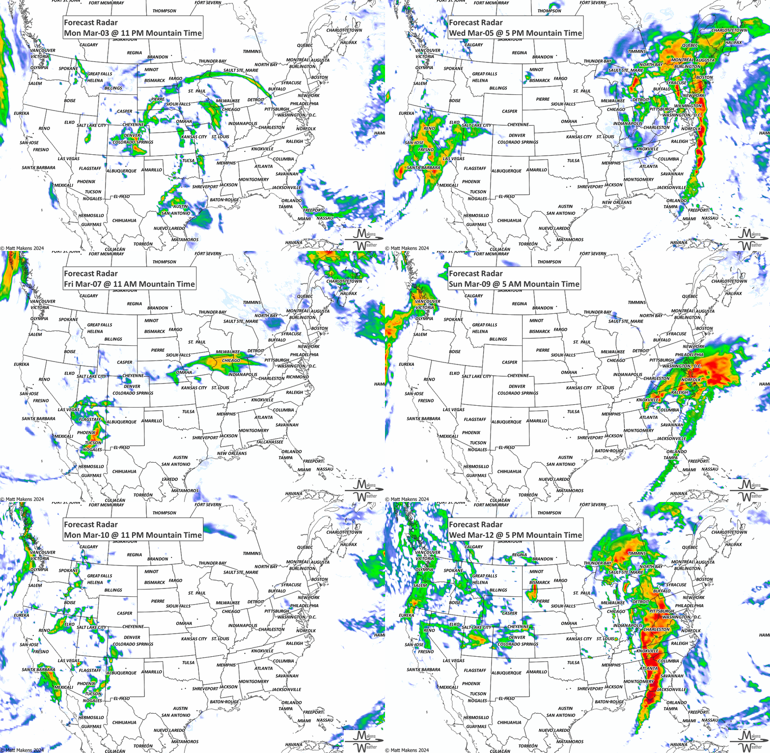
ON THE RADAR:
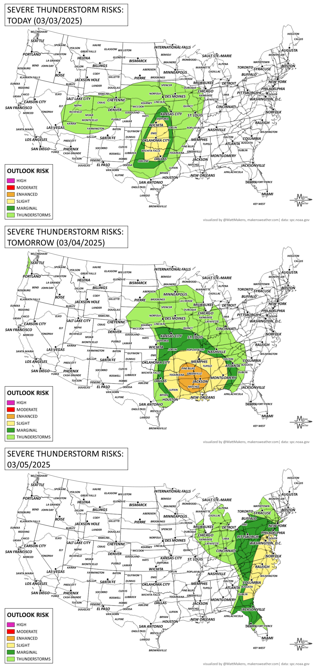
KEEP AN EYE TO THE SKY:
IN THE GAUGES:
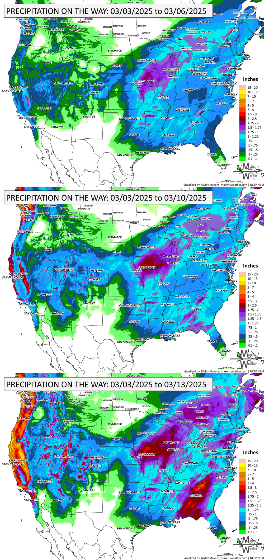
GRAB A RULER:
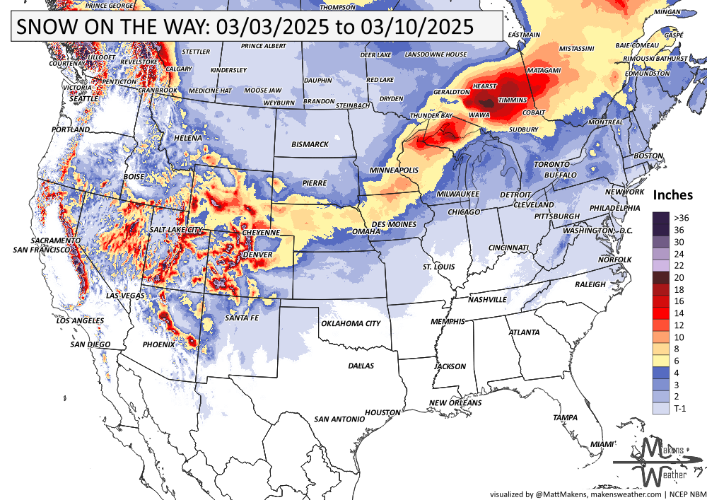
RECORDS MADE TO BE BROKEN:
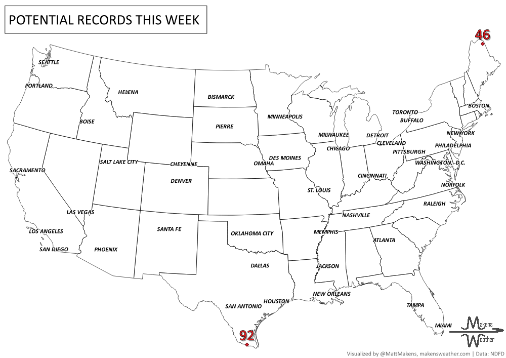
ARE YOU CIRRUS?!
On this day in history:
1989 A massive dust storm lowered visibility to zero along I-10 in Cochise County, AZ. Chain-reaction accidents involved 25 cars. Two motorists were killed.
1841 President William Henry Harrison delivered a 100-minute inaugural address in freezing temperatures, while refusing to wear a coat or hat. He came down with pneumonia and died on April 4th, only 32 days into his presidency.
1966 Jackson, MS was heavily damaged by a half-mile wide F5.
SO YOU ARE SAYING THERE IS A CHANCE:
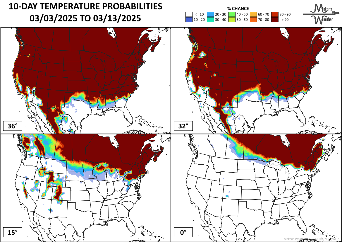
Every week my monthly subscribers get a breakdown of the weeks ahead. Part of that includes the probability of temperatures reaching certain thresholds, or the amount of precipitation or snow. Here’s an example for those cautiously watching temperatures. This shows the probability of reaching the four temperature thresholds indicated… eastern Canada and far northern New England have significant odds of hitting significant cold in the next 10 days (below 0°F).
The weather pattern is about to make a pretty sharp turn across the country. California starts the week with unusual October heat, including highs well into the 90s and even lower 100s in the Central Valley. Meanwhile, much cooler fall air has reached the Great Lakes and Northeast. The Gulf Coast and Southeast stay unsettled, and there’s that record to watch: a tropical depression is likely to develop over the Gulf this week and could strengthen as it moves northeast. If it becomes a hurricane after the 8th, 2026 will have the latest-first hurricane in the Atlantic Basin record.