





Weekly Weather Watch: Tuesday, March 11th, 2025
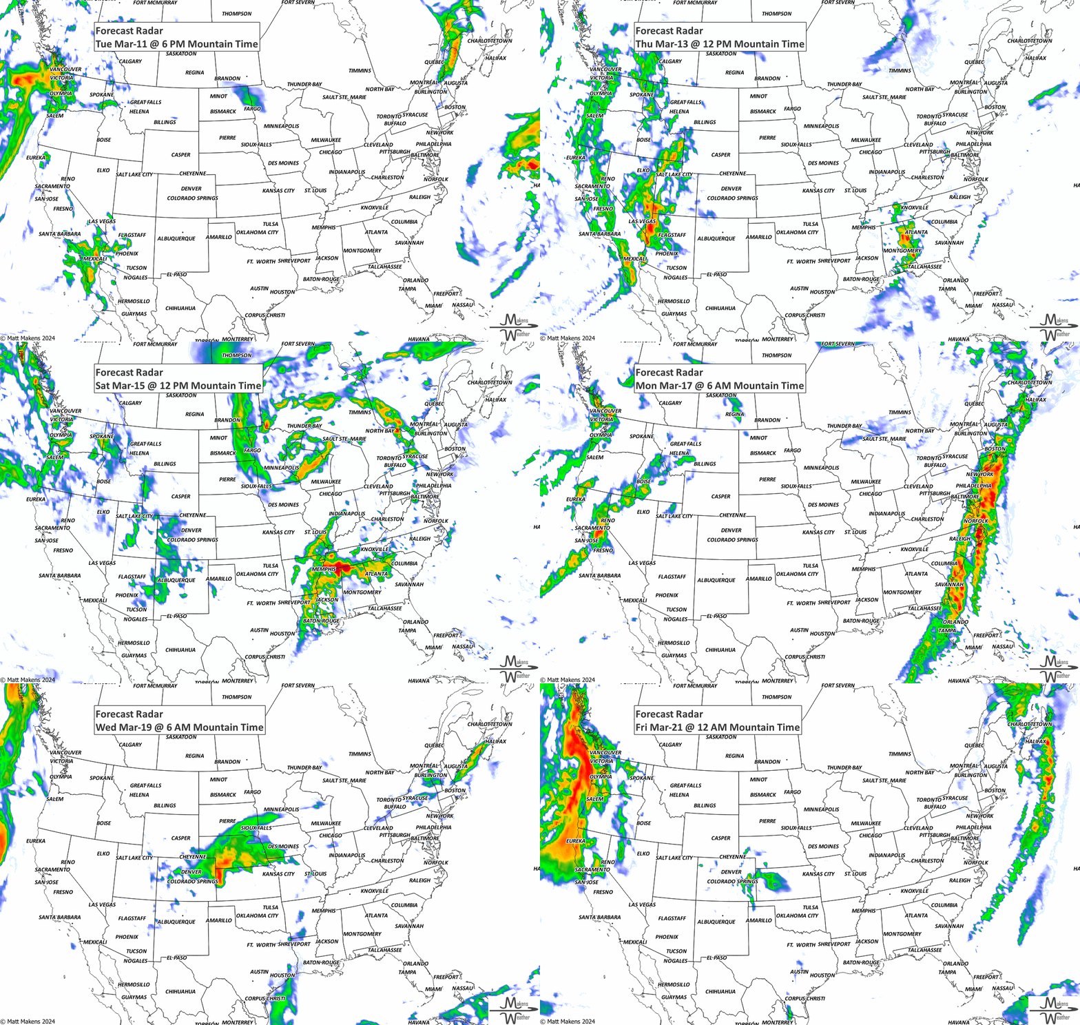
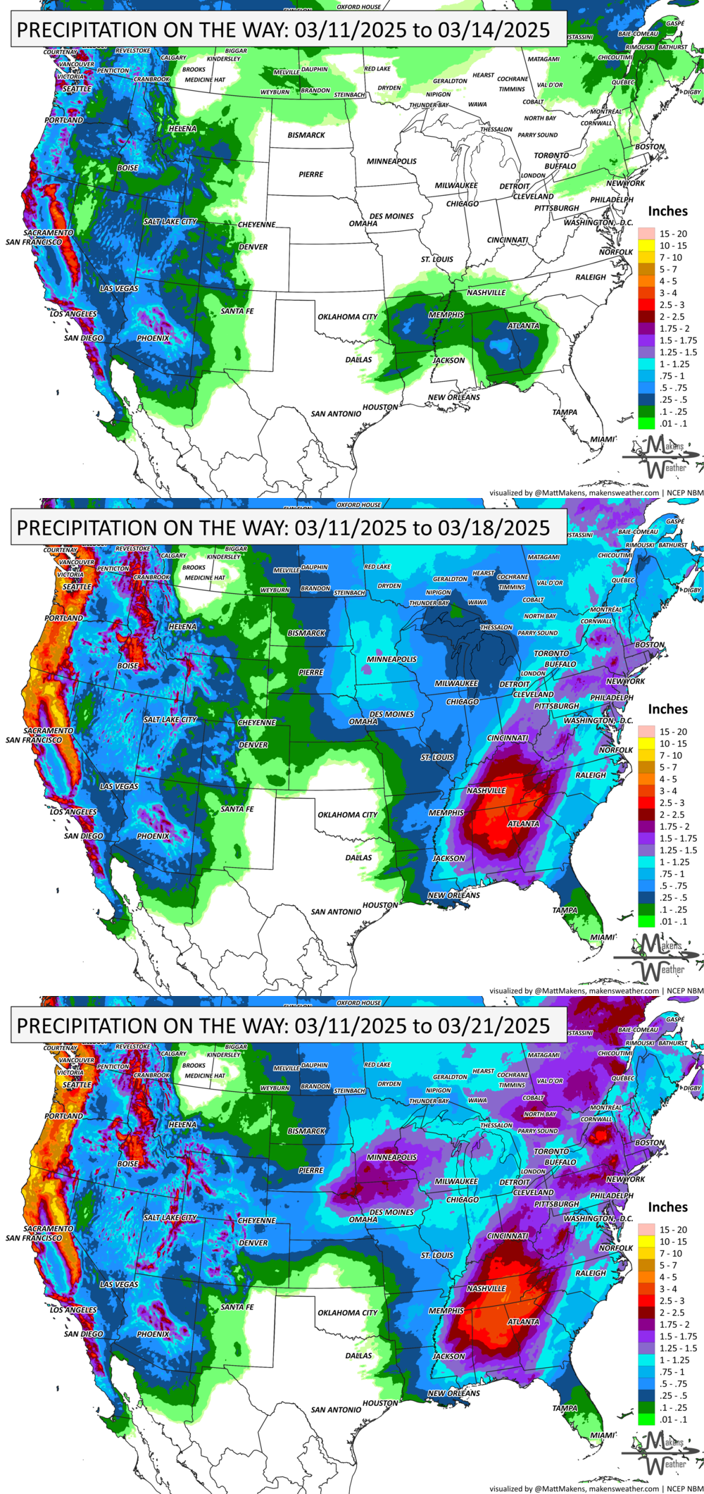
In this Weekly Weather Watch, the headlines coming your way include: An extended period of gusty winds and dry conditions will keep fire weather concerns high through Saturday from southern New Mexico into the southern Plains. Meanwhile, on the West Coast, a powerful Pacific storm will tap into an atmospheric river, bringing heavy snowfall and strong winds to the Sierra Nevada. This same system will also bring heavy rainfall to parts of coastal Southern California from Wednesday into Thursday, increasing the risk of flooding and travel disruptions. The heaviest snowfall remains over the mountainous west, and another area of heavy precipitation to hit the Midwest and Southeast. Significant cold and heavy snowfall will remain over much of Canada, except the southwestern regions.
Members, your weekly breakouts arrived to your emails yesterday. Holler at me if that didn’t arrive.
HEADLINERS:

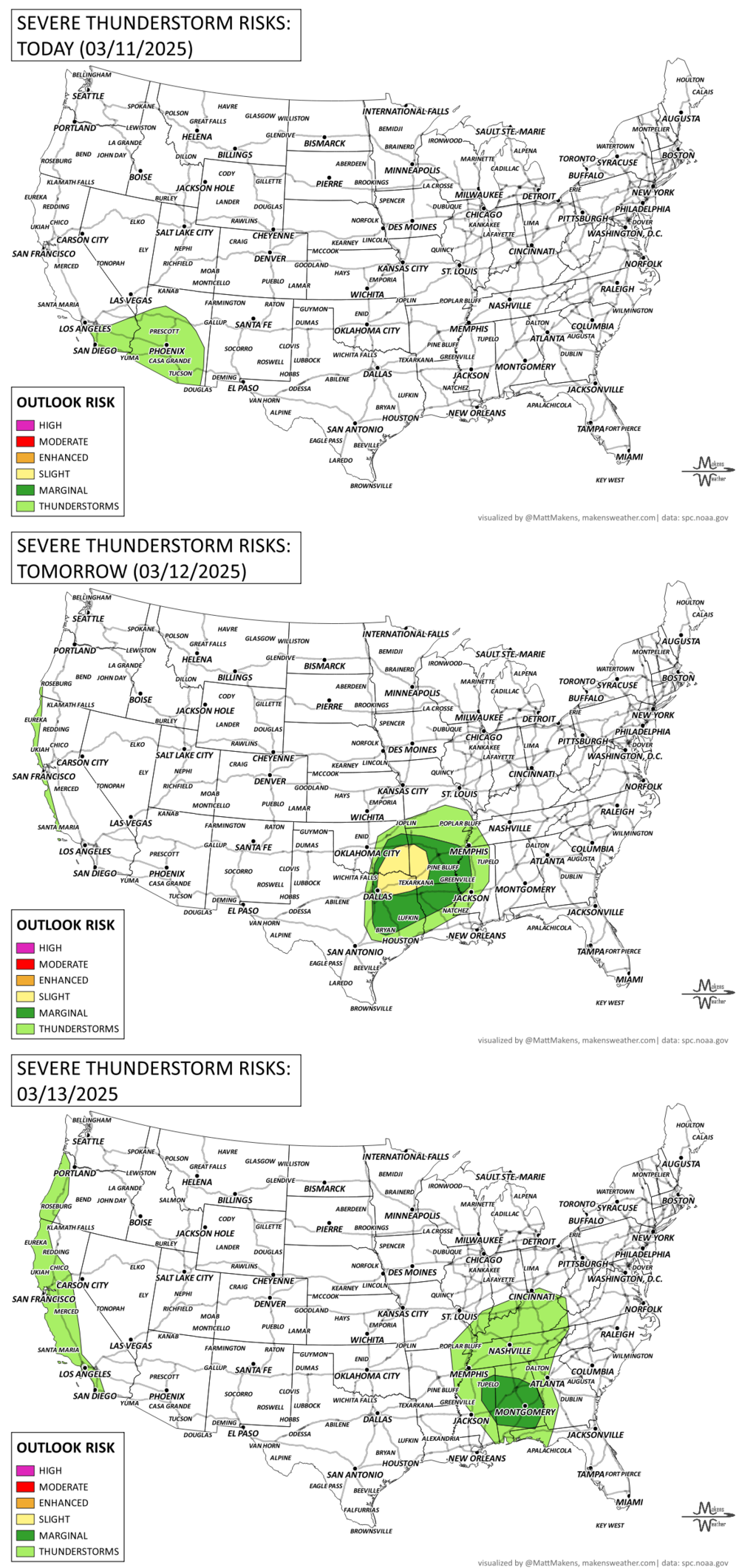
Heavy rain/flooding and severe weather possible for the Mississippi/Ohio/Tennessee Valleys and Southeast late week.
Widespread high winds cause fire danger in the southern Plains and localized blizzard conditions in the north-central CONUS.
Multiple rounds of precipitation likely in the West.
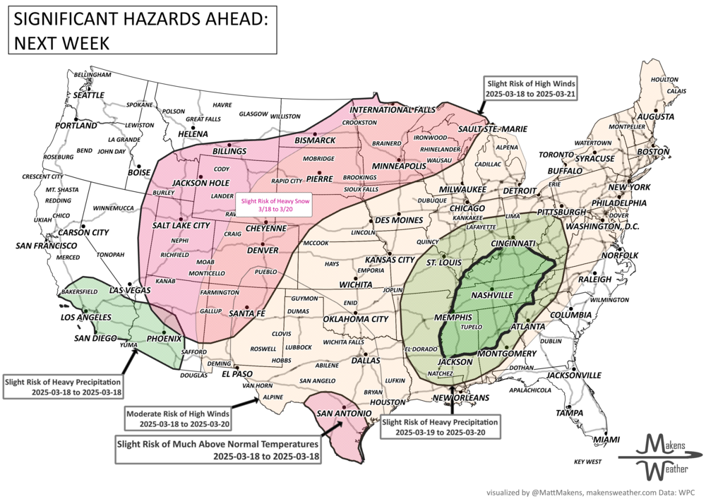
Moderate risk of high winds for the Central and Southern High Plains, and Rockies, Tue-Thu, Mar 18-20.
Slight risk of high winds for many portions of the central and eastern CONUS, Tue-Fri, Mar 18-21.
Slight risk of heavy precipitation for parts of southern California and the Desert Southwest, Tue, Mar 18.
Slight risk of heavy precipitation for parts of the Ohio, Tennessee, and Mississippi Valley, Appalachians and the Southeast, Wed-Thu, Mar 19-20.
Slight risk of high elevation heavy snow over portions of the Great Basin, Rockies, Central and Northern Plains, and the Upper Mississippi Valley, Tue-Thu, Mar 18-20.
Slight risk of heavy precipitation for Southeast Alaska, Wed-Thu, Mar 19-20.
Slight risk of much above normal temperatures for southern Texas, Tue, Mar 18.
Possible flooding for parts of the southern Ohio, Tennessee, and Lower Mississippi Valleys.
Rapid onset drought risk across portions of the Southern Plains.
List via NOAA’s WPC.
ON THE RADAR:
KEEP AN EYE TO THE SKY:
IN THE GAUGES:
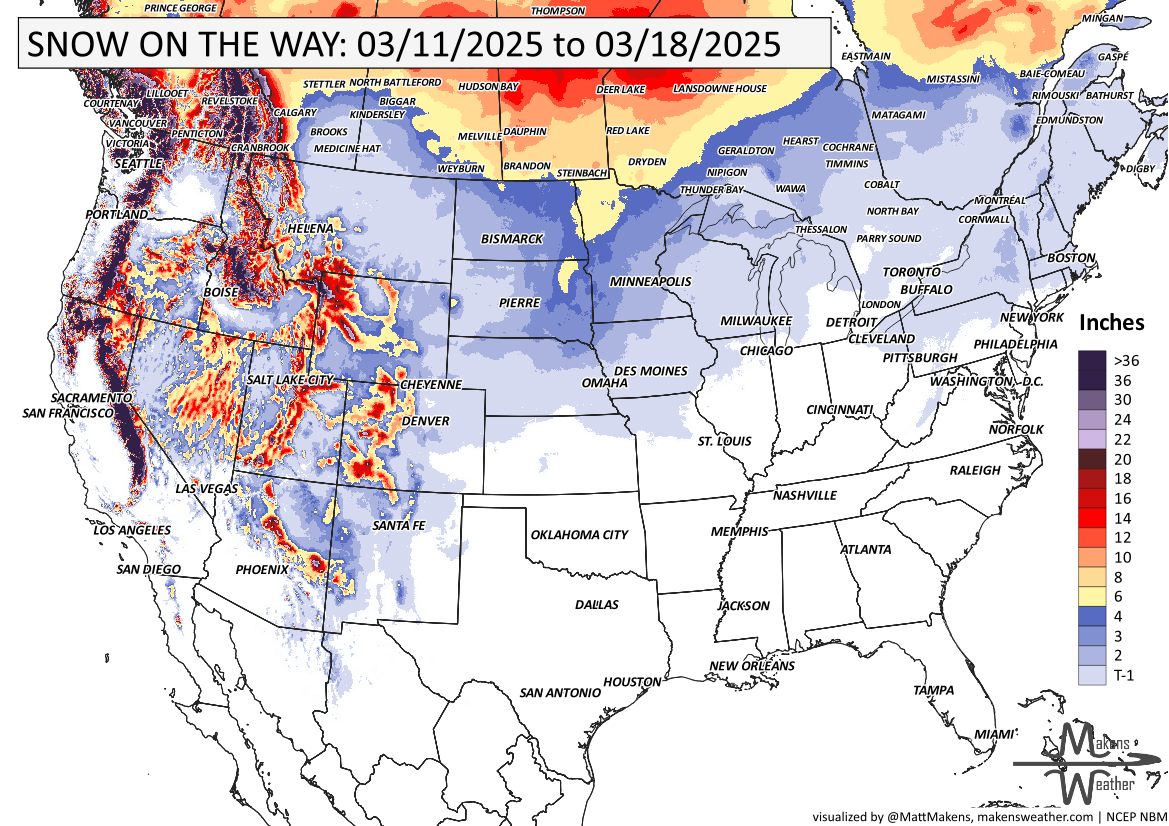
GRAB A RULER:
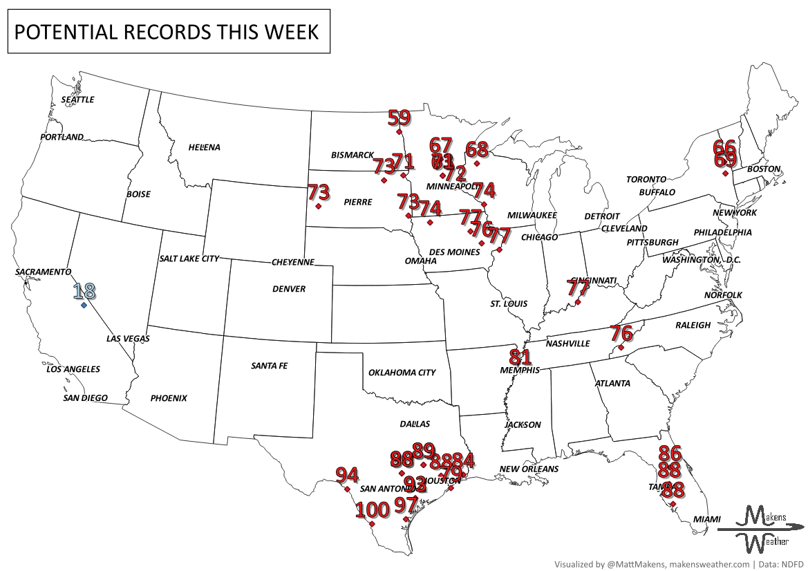
RECORDS MADE TO BE BROKEN:
ARE YOU CIRRUS?!
On this day in history:
1923 An F5 tornado struck a part of Pinson, TN, killing 20 people.
1888 An unexpected blizzard dumped 4 feet of snow from New York to New England, killing 400 people.
1911 The deepest snow cover measured in the U.S. was 451 inches in Tamarack, CA.
SO YOU ARE SAYING THERE IS A CHANCE:
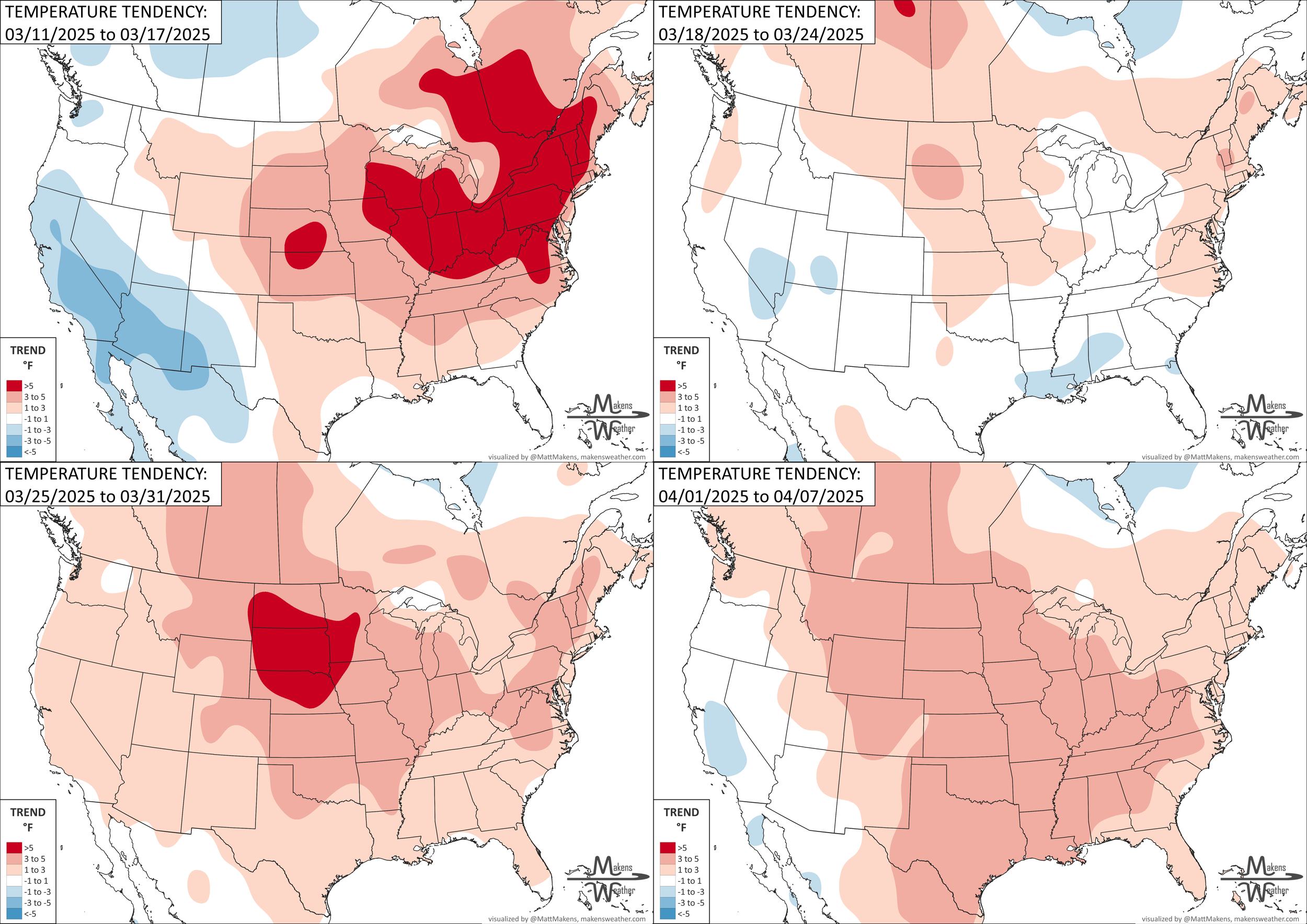
Every week, my monthly subscribers get a breakdown of the weeks ahead. Part of that includes the weekly temperature trends. Here’s an example for those cautiously watching temperatures. This shows the weekly temperatures above or below normal. Week #3 looks rather warm for the Northern Plains, where we have drought growth and fire bans.
The weather pattern is about to make a pretty sharp turn across the country. California starts the week with unusual October heat, including highs well into the 90s and even lower 100s in the Central Valley. Meanwhile, much cooler fall air has reached the Great Lakes and Northeast. The Gulf Coast and Southeast stay unsettled, and there’s that record to watch: a tropical depression is likely to develop over the Gulf this week and could strengthen as it moves northeast. If it becomes a hurricane after the 8th, 2026 will have the latest-first hurricane in the Atlantic Basin record.