





Weekly Weather Watch: Tuesday, April 15th, 2025
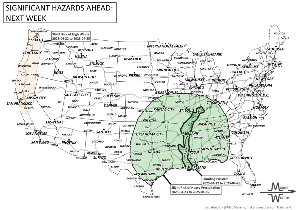
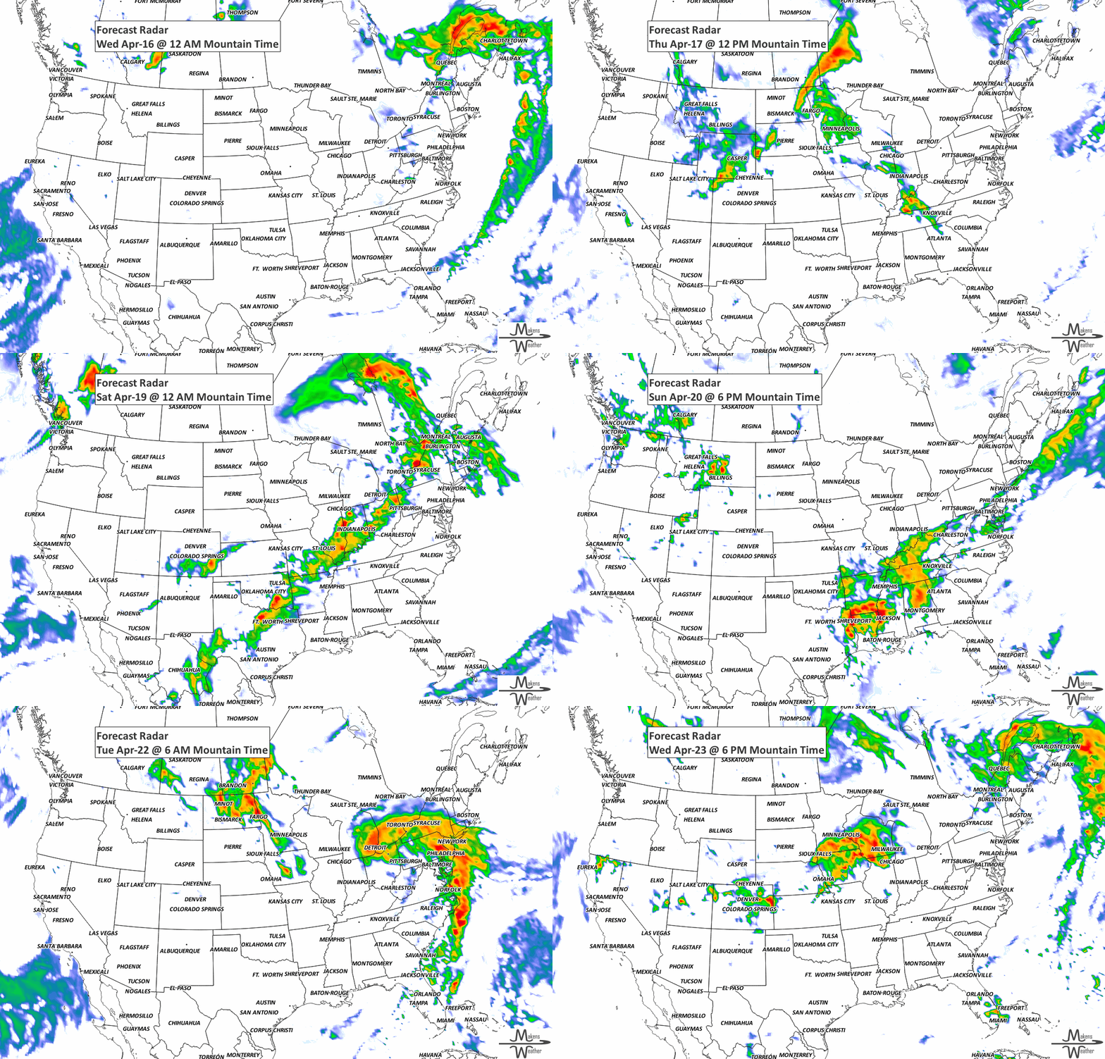
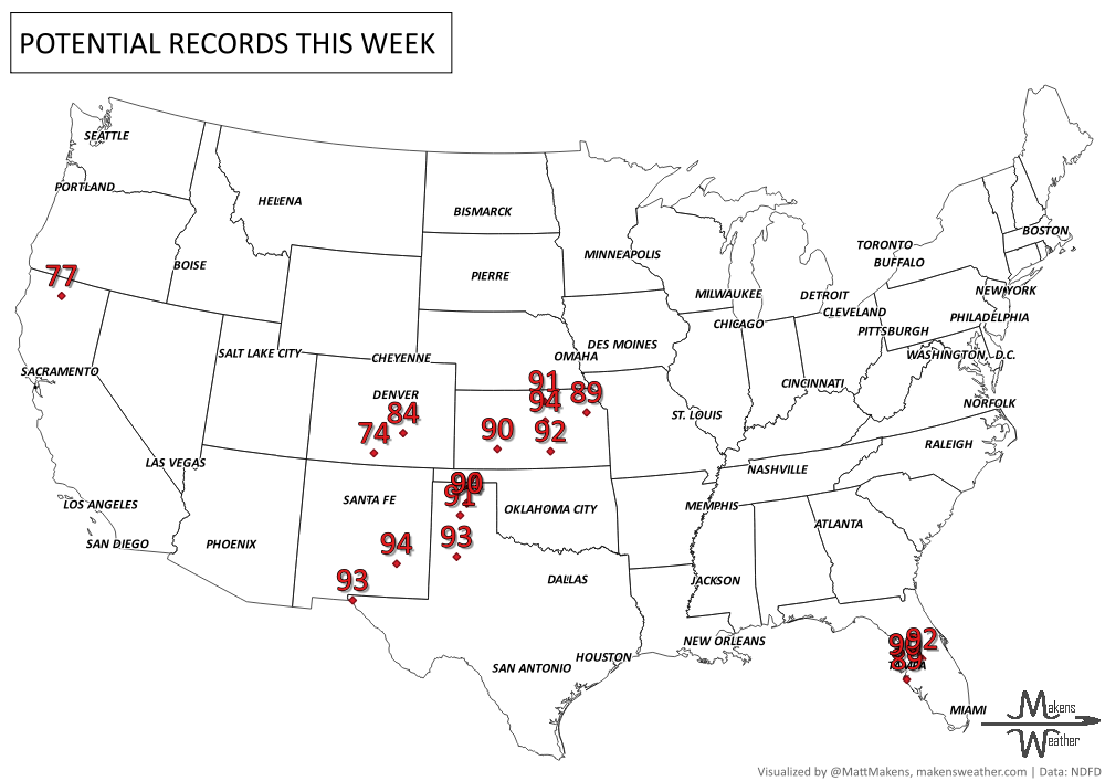
Hey weather watchers, here’s your briefing - The Weekly Weather Watch. A lot is happening across the U.S. & Canada this week. Lake effect snow is piling up around the Great Lakes, with gusty winds pushing into the Midwest and East Coast behind a cold front. It’s also shaping up to be a dangerous stretch for fire weather—conditions will be elevated in the Southwest today, and by Wednesday and Thursday, parts of the Southern Plains could face critical fire danger. Meanwhile, warm southerly flow is heating things up in the West and Central U.S., with highs soaring 15–25 degrees above normal in spots. Cooler air is sliding in behind that cold front tonight, especially across the East. By the weekend, storms are expected to roll through the Midwest and Mississippi Valley. Severe weather is on the table Friday, with the chance for heavy rain and even flooding, particularly in areas already dealing with high streamflows. Saturday brings an even greater risk for downpours from Texas through Missouri. Temps will swing wildly—below average in the West, but 10–20 degrees above normal from the southern Plains to the East Coast, especially on Friday and Saturday. Phew.
Members, your weekly outlooks arrived Monday.
HEADLINERS:
Gusty winds in Northeast/Mid-Atlantic today.
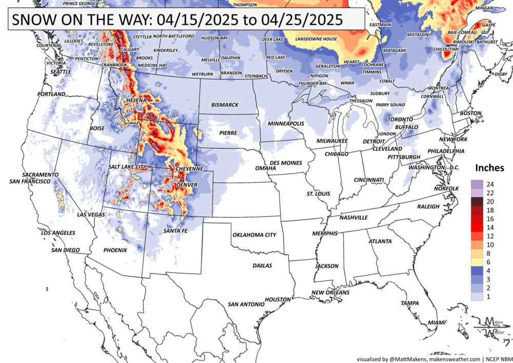
Snow across Lower Great Lakes today then Northern Rockies on Wednesday.
Critical Fire Weather Risk returns to Southern High Plains/Southwest beginning Wednesday.
Above average temperatures in the West and Central U.S.; cooler in the East.
Heavy snowfall in parts of Ontario and Maritimes.
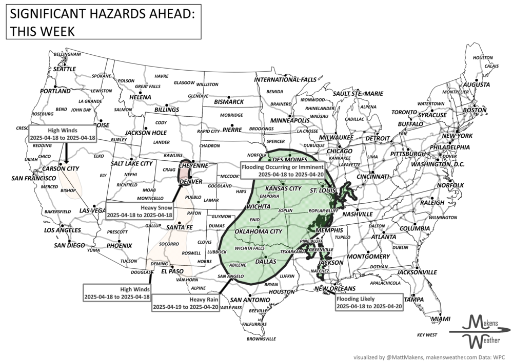
Slight risk of heavy precipitation for portions of the Central and Southern Plains and Middle and Lower Mississippi, Tennessee and Ohio Valleys, Southern Appalachians, and Southeast, Wed-Fri, Apr 23-25.
Slight risk of high winds over parts of California and the Pacific Northwest, Tue-Fri, Apr 22-25.
Flooding possible for the Middle and Lower Mississippi, and lower Ohio Rivers.
List via NOAA’s WPC.
ON THE RADAR:
KEEP AN EYE TO THE SKY:
IN THE GAUGES:
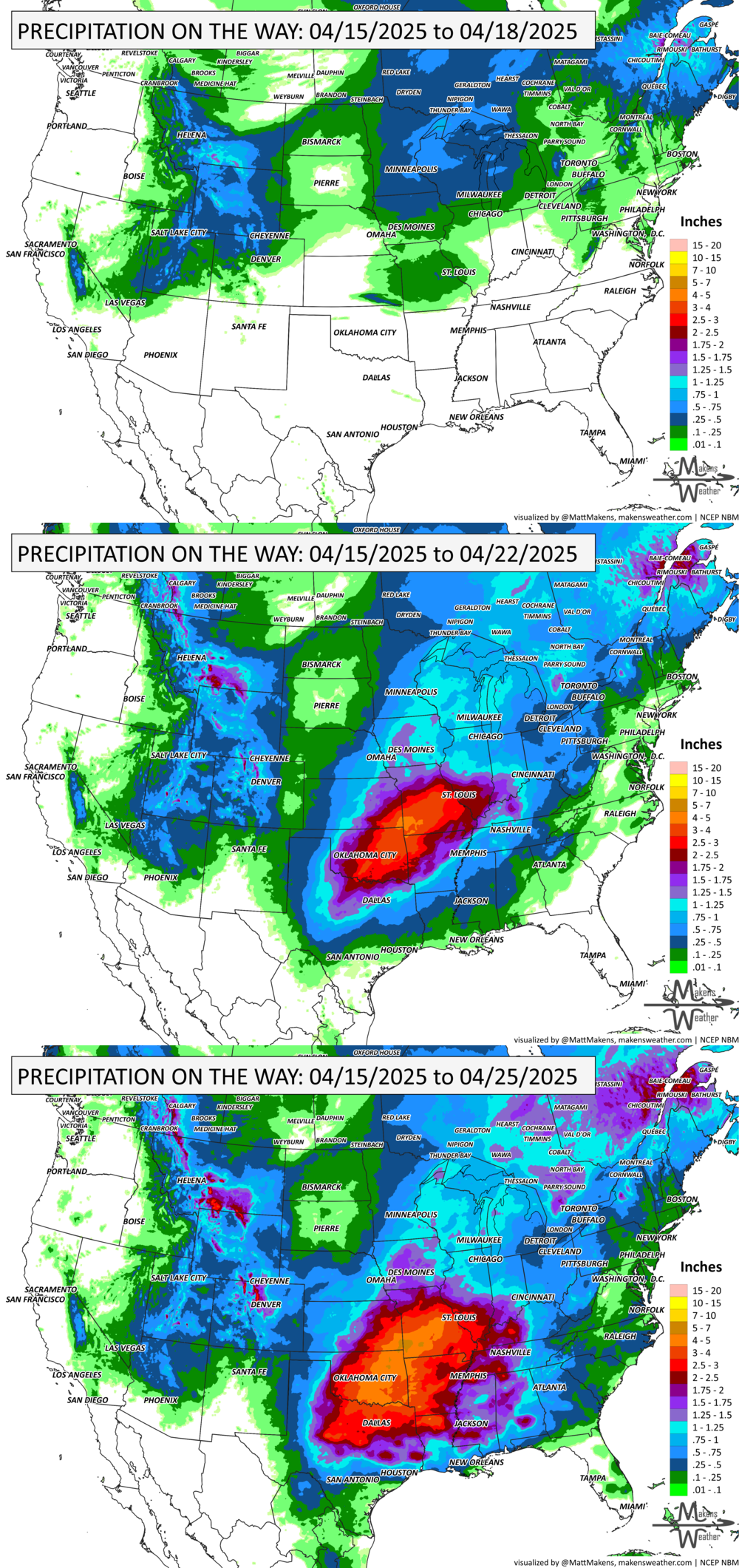
GRAB A RULER:
RECORDS MADE TO BE BROKEN:
ARE YOU CIRRUS?!
1984 In Terrace, British Columbia an intense wind storm capsized fishing vessels and sailboats, damaged power lines and buildings, and fanned forest fires. Wind gusts as high as 75 mph were reported. The storm caused several million dollars in damage.
SPRING SPORTS QUESTIONS:
It’s spring, the season of perpetual sports delays… at least around my house. Clients have the option of adding their own hourly planners to keep tabs on the days.

The weather pattern is about to make a pretty sharp turn across the country. California starts the week with unusual October heat, including highs well into the 90s and even lower 100s in the Central Valley. Meanwhile, much cooler fall air has reached the Great Lakes and Northeast. The Gulf Coast and Southeast stay unsettled, and there’s that record to watch: a tropical depression is likely to develop over the Gulf this week and could strengthen as it moves northeast. If it becomes a hurricane after the 8th, 2026 will have the latest-first hurricane in the Atlantic Basin record.