





Weekly Weather Watch: Monday, May 5th, 2025
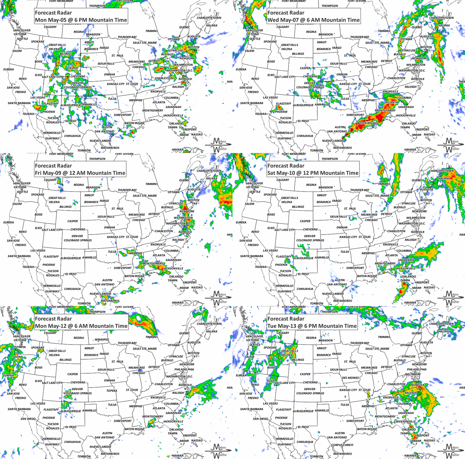
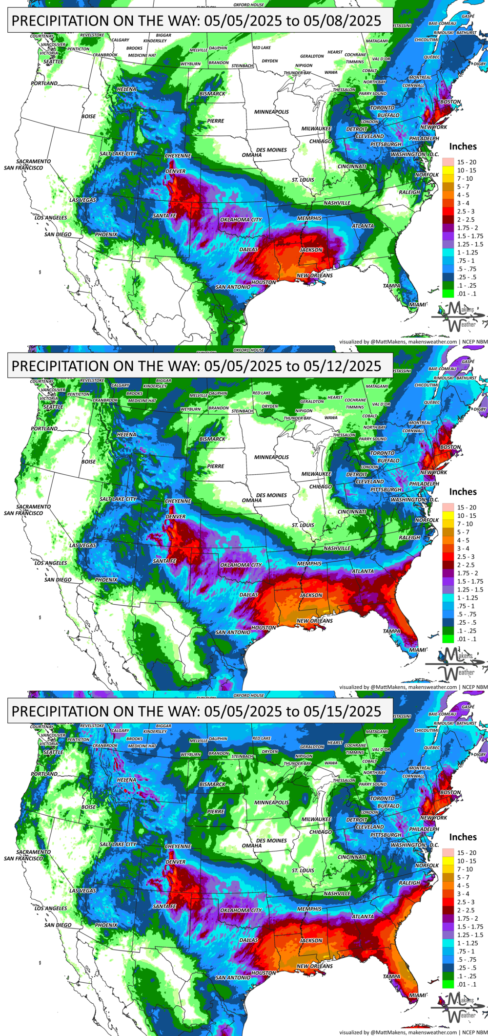
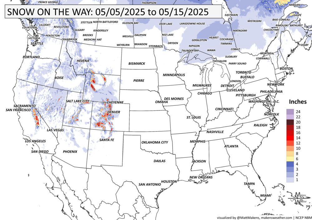
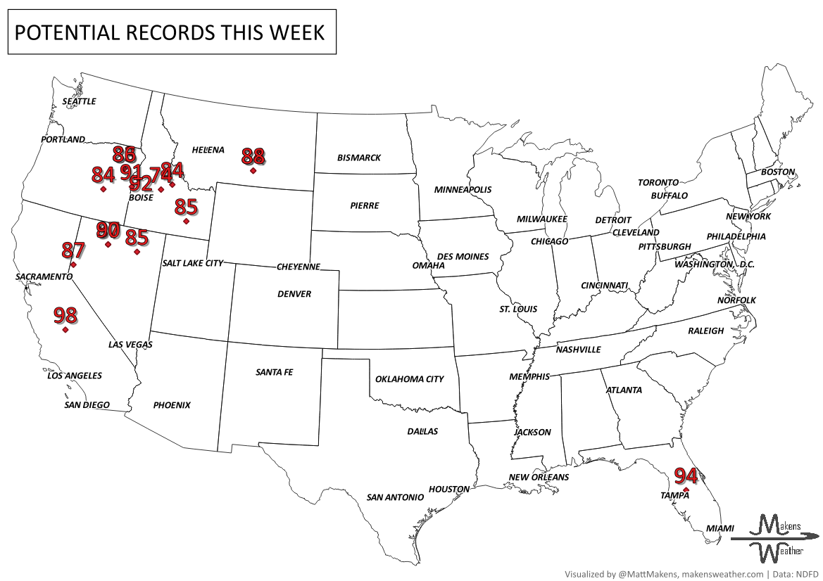
A pair of storm systems will bring unsettled weather through midweek, with severe thunderstorms and flash flooding possible in the southern High Plains, Ohio Valley, and parts of the Northeast, including the New York City area. Heavy snow may fall in the higher Rockies, while a slow-moving front lingers over the Southeast, supporting daily heavy rain chances. Temperatures will stay cooler than normal across the southern Plains and Northeast, but much of the West will heat up as the week progresses, with highs reaching into the 100s in the Desert Southwest. Heavy snow and rain for parts of Canada, mostly the mountainous west and high plains of Alberta, and heavy rainfall for parts of the Maritimes.
Interested in a membership that receives monthly outlooks, and/or custom weather information you can’t find elsewhere? Contact us today. Members, the monthly forecast you received remains on track as we focus on that heavy rainfall across the South in the near term, and the precipitation trends for the month ahead.
HEADLINERS:
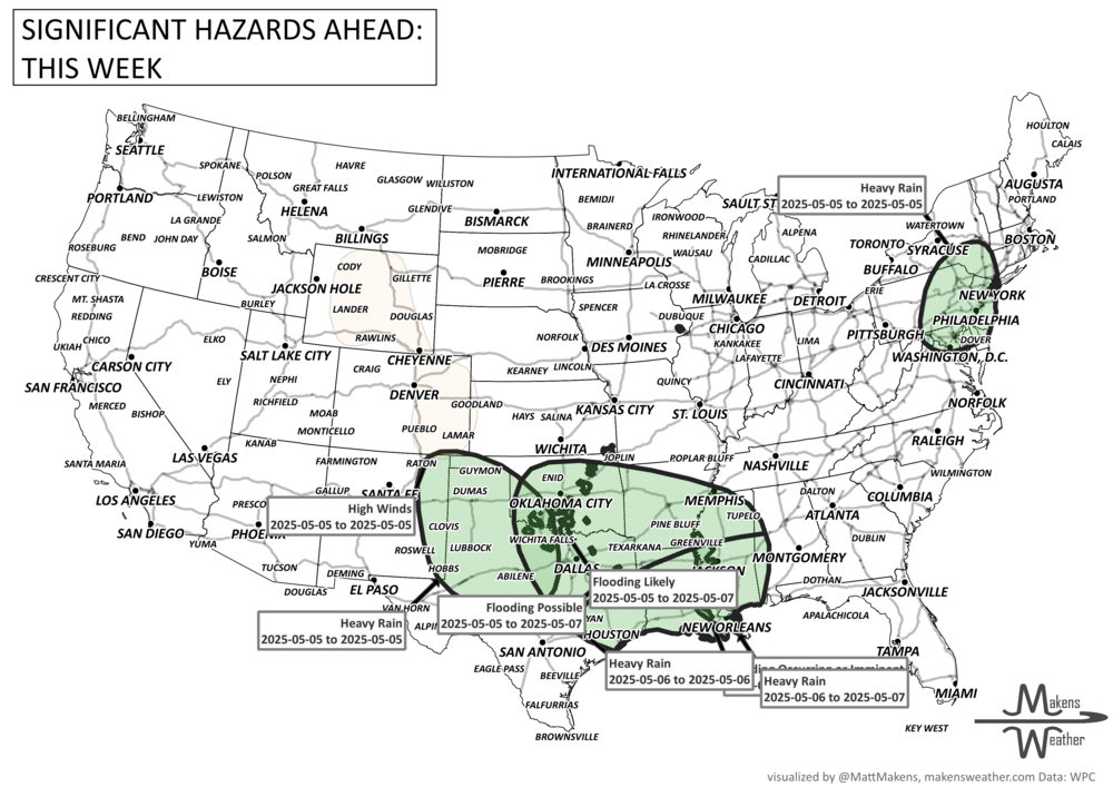
Increasing flash flood threat as well as severe weather expected for the southern Plains/Lower Mississippi Valley Monday into Tuesday.
Locally heavy rainfall with flash flooding possible for the Greater NYC area/southern New England Monday.
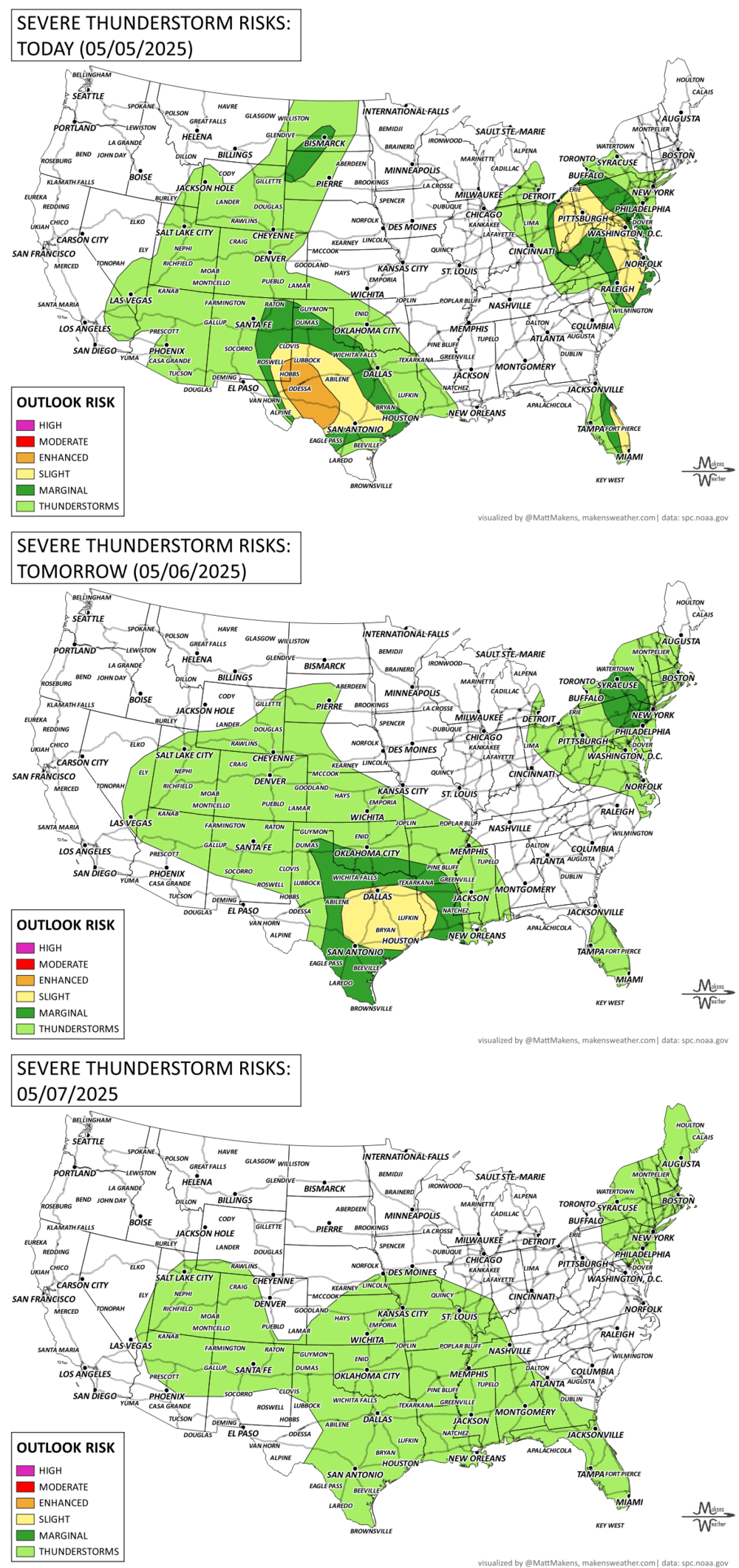
Severe thunderstorms are expected across southeast New Mexico into Texas this afternoon into tonight. Scattered large to very large hail and severe winds are the primary threats, though a few tornadoes are also possible. Additional strong to severe thunderstorms should occur across the upper Ohio Valley/Mid-Atlantic and the eastern Florida Peninsula this afternoon and evening.
Severe thunderstorms are possible from portions of the southern Plains into the lower Mississippi Valley on Tuesday. Severe winds, large to very large hail, and a few tornadoes are possible.
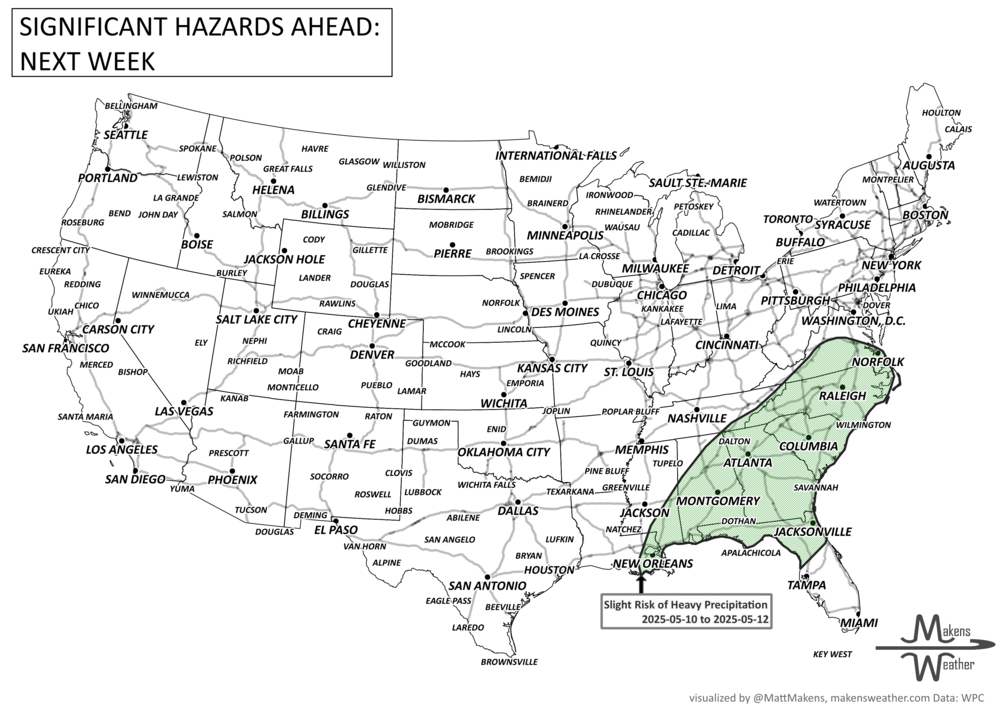
Slight risk of heavy precipitation for parts of the Southeast, Sat-Mon, May 10-12.
List via NOAA’s WPC & SPC.
ON THE RADAR:
KEEP AN EYE TO THE SKY:
IN THE GAUGES:
GRAB A RULER:
RECORDS MADE TO BE BROKEN:
ARE YOU CIRRUS?!
1964 An F5 tornado destroyed a dozen farms in Clay and Hamilton Counties, NE.
1960 Sapulpa, OK was visited by an F5 tornado along its 70-mile long path. Three hundred homes were damaged in town.
1989 Damage was in the millions as a tornado cut a swath across Cleveland, Lincoln, and Catawba counties in North Carolina. The F4 killed 4 and injured 52.
The weather pattern is about to make a pretty sharp turn across the country. California starts the week with unusual October heat, including highs well into the 90s and even lower 100s in the Central Valley. Meanwhile, much cooler fall air has reached the Great Lakes and Northeast. The Gulf Coast and Southeast stay unsettled, and there’s that record to watch: a tropical depression is likely to develop over the Gulf this week and could strengthen as it moves northeast. If it becomes a hurricane after the 8th, 2026 will have the latest-first hurricane in the Atlantic Basin record.