





Weekly Weather Watch: Tuesday, July 15th, 2025
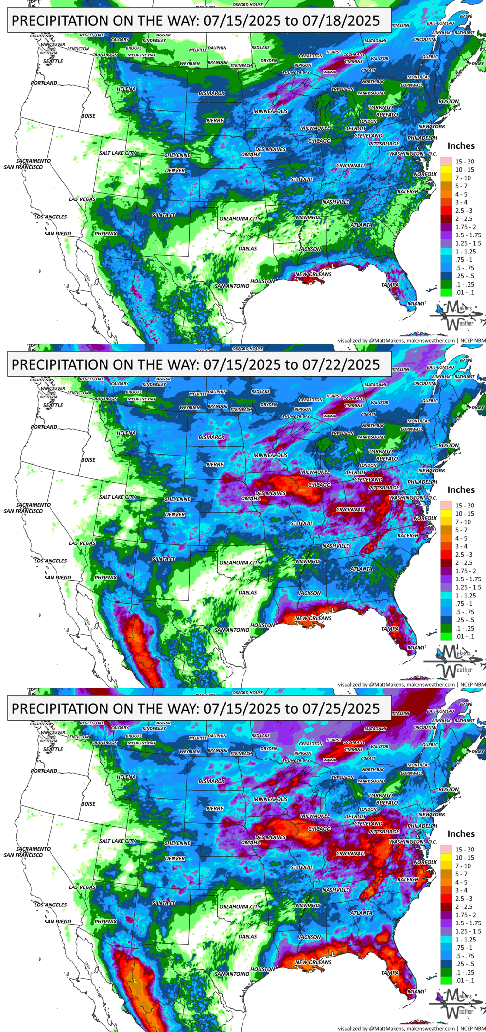
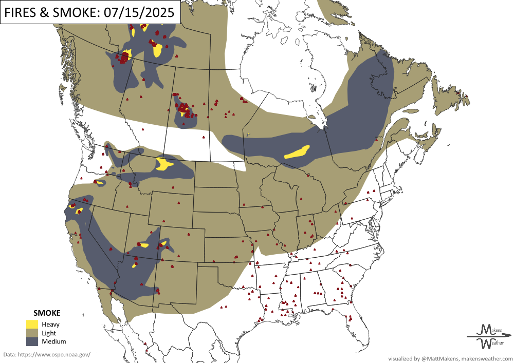
A busy stretch of summer weather is unfolding across the U.S., with dangerous thunderstorms, heavy rainfall, flash flooding, and heat all in the mix. Severe storms with damaging winds and large hail are expected across the Central and Northern Plains, while heavy downpours raise flash flood concerns from the Mid-Atlantic to Florida. A tropical disturbance is moving across Florida and into the northern Gulf Coast, adding to the flood threat. Meanwhile, heat builds across the East, and fire danger increases across the Great Basin. Severe thunderstorms are possible from Ontario to the Maritimes; meanwhile, air quality related to wildfire smoke impacts central and western Canada.
🌦️ members! New Interactive Forecast Dashboards Now Live!
Want a clearer picture of what’s coming? Our newly enhanced forecast dashboard puts all the essential weather information at your fingertips — precipitation totals, temperature trends, wind gusts, severe storm probabilities, and even an animated radar forecast showing when and where moisture arrives.
You can now:
Switch between regions with a click
View 7-day projections for temperature, heat index, and winds
Explore daily thunderstorm, tornado, hail, and wind risks
Watch radar animation with adjustable playback speed
It’s fast, visual, and built for those who need precision weather intelligence.
Check it out here: Members Portal
HEADLINERS:
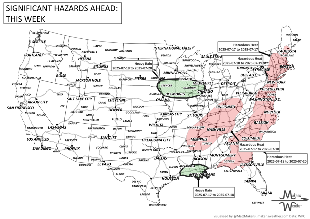
Key Weather Impacts – July 15–21
Tuesday–Wednesday:
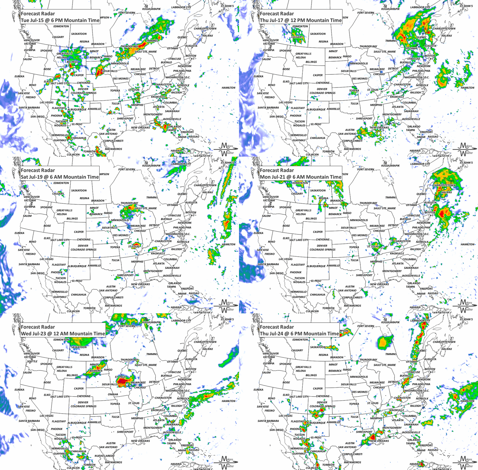
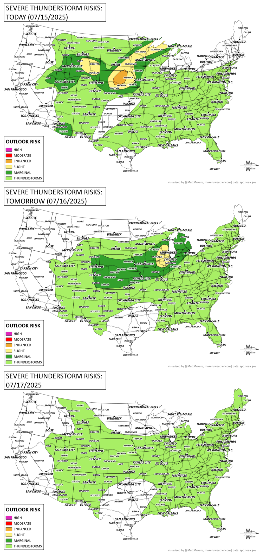
Severe storms likely across the Central Plains to Upper Midwest with damaging winds and hail.
Flash flooding risks across the Mid-Atlantic, Appalachians, and Florida Peninsula.
Critical fire weather across the Great Basin.
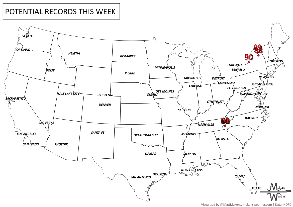
Major heat risk expands across the Northeast and Southeast.
Thursday–Saturday:
Heavy rain and flash flooding likely from a tropical disturbance along the central Gulf Coast, especially southern Louisiana.
Continued flash flood potential in the central Appalachians and Mississippi Valley.
Monsoonal storms with localized flooding risks in the Four Corners region.
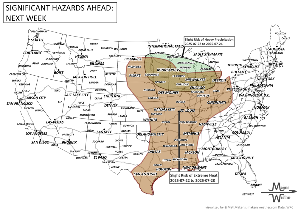
Sunday–Monday:
Moderate rain continues for parts of the central Gulf Coast, though uncertainty increases.
Persistent heat risk from the Southeast into the Mississippi Valley.
Cooler air settles over the northern Rockies and Plains.
ON THE RADAR:
KEEP AN EYE TO THE SKY:
IN THE GAUGES:
RECORDS MADE TO BE BROKEN:
fire!
ARE YOU CIRRUS?!
1995 An unusually strong cluster of thunderstorms raced at more than 70 mph through New York and New England during the early morning hours. Major wind damage occurred across the Adirondacks, where thousands of trees were toppled. Three fatalities occurred. Winds reached 92 mph in Otis, MA and small tornadoes occurred at Greenfield and Huntington.
1983 The Big Thompson Creek in Colorado flooded for the second time in 7 years, claiming 3 lives and filling the town of Estes Park with 8 to 10 feet of water.
The weather pattern is about to make a pretty sharp turn across the country. California starts the week with unusual October heat, including highs well into the 90s and even lower 100s in the Central Valley. Meanwhile, much cooler fall air has reached the Great Lakes and Northeast. The Gulf Coast and Southeast stay unsettled, and there’s that record to watch: a tropical depression is likely to develop over the Gulf this week and could strengthen as it moves northeast. If it becomes a hurricane after the 8th, 2026 will have the latest-first hurricane in the Atlantic Basin record.