





Weekly Weather Watch: Tuesday, July 29th, 2025
The last week of July and start of August brings no shortage of impactful weather across North America. Severe thunderstorms, flash flooding, and prolonged dangerous heat are the major concerns through the first few days of August. The Plains and Midwest face several rounds of thunderstorms, while the Southwest continues to battle flash flood threats from monsoonal rains. A late-week cold front shifts the storm focus to the Carolinas and Southeast, and finally begins to erode the long-standing heat wave gripping the central and eastern U.S.
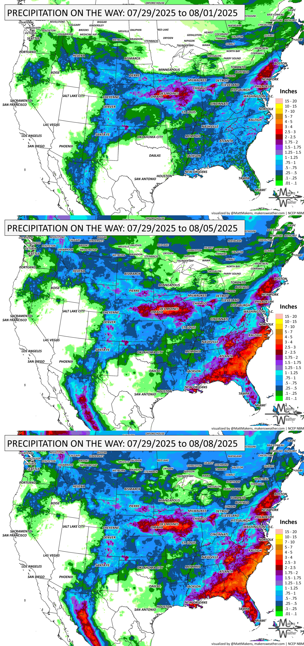
💧 How Much Rain Is Really On The Way?
Get Instant Answers with Our Precipitation Dashboard:
Tired of vague forecasts? Our Precipitation Dashboard gives you a clear, color-coded look at how much rain is expected—down to your region, for the next day, next 3 days, or next 7 days. Whether you're in the Plains bracing for storms, the Southeast watching flood risks, or just planning your week—this tool delivers the detail you need.
Members get full access to:
Easy-to-read maps showing total rainfall amounts
Region-specific breakdowns (Plains, Canada, Eastern U.S., and more)
Daily updates with blended-model accuracy
📈 Track it 👉 Join Now to Access the Dashboard
HEADLINERS:
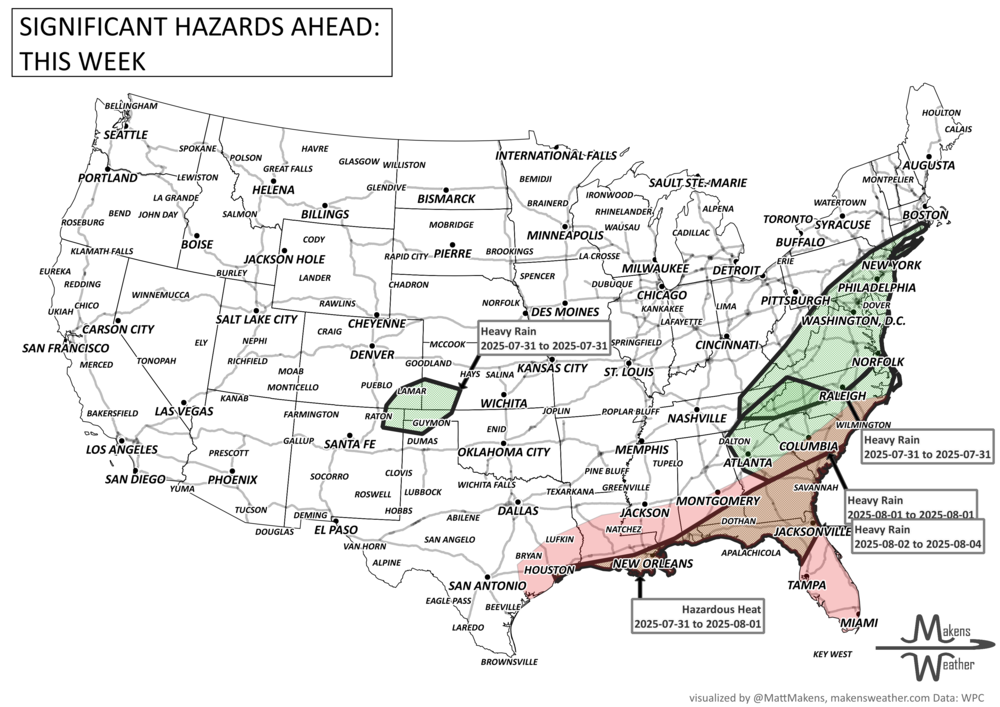
Notable Weather Highlights:
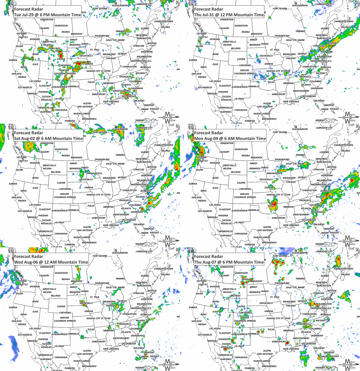
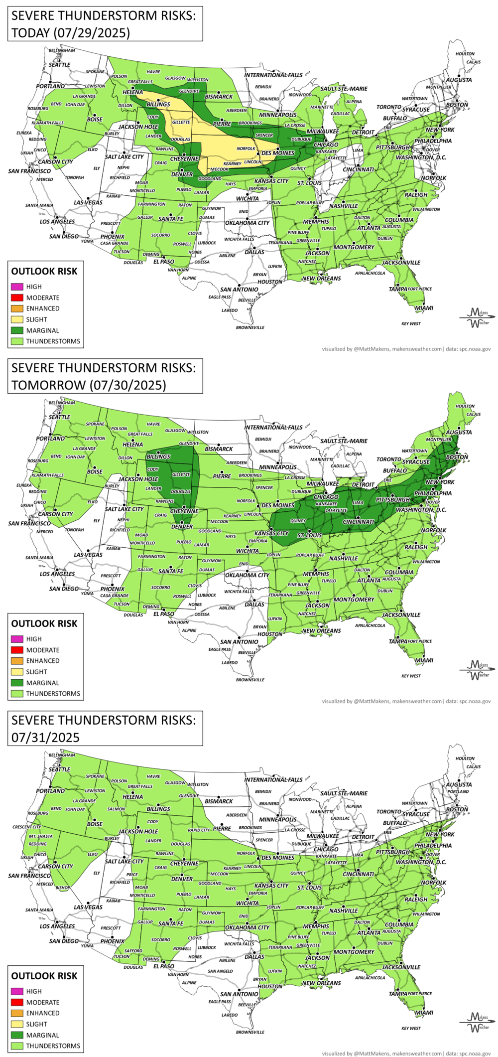
Tuesday–Wednesday: Severe storms with damaging winds, hail, and heavy rain likely across eastern Montana, the Dakotas, Nebraska, Iowa, and parts of Wyoming.
Wednesday: Flash flooding risk expands into the Midwest, including Iowa, Missouri, Illinois, and western Indiana.
Tuesday–Wednesday: Monsoon thunderstorms bring flash flooding potential to New Mexico and parts of the Southern/Central High Plains.
Late Week (Friday–Saturday): Heavy rain and localized flash flooding likely in the Carolinas and southern Appalachians, especially South Carolina and Georgia.
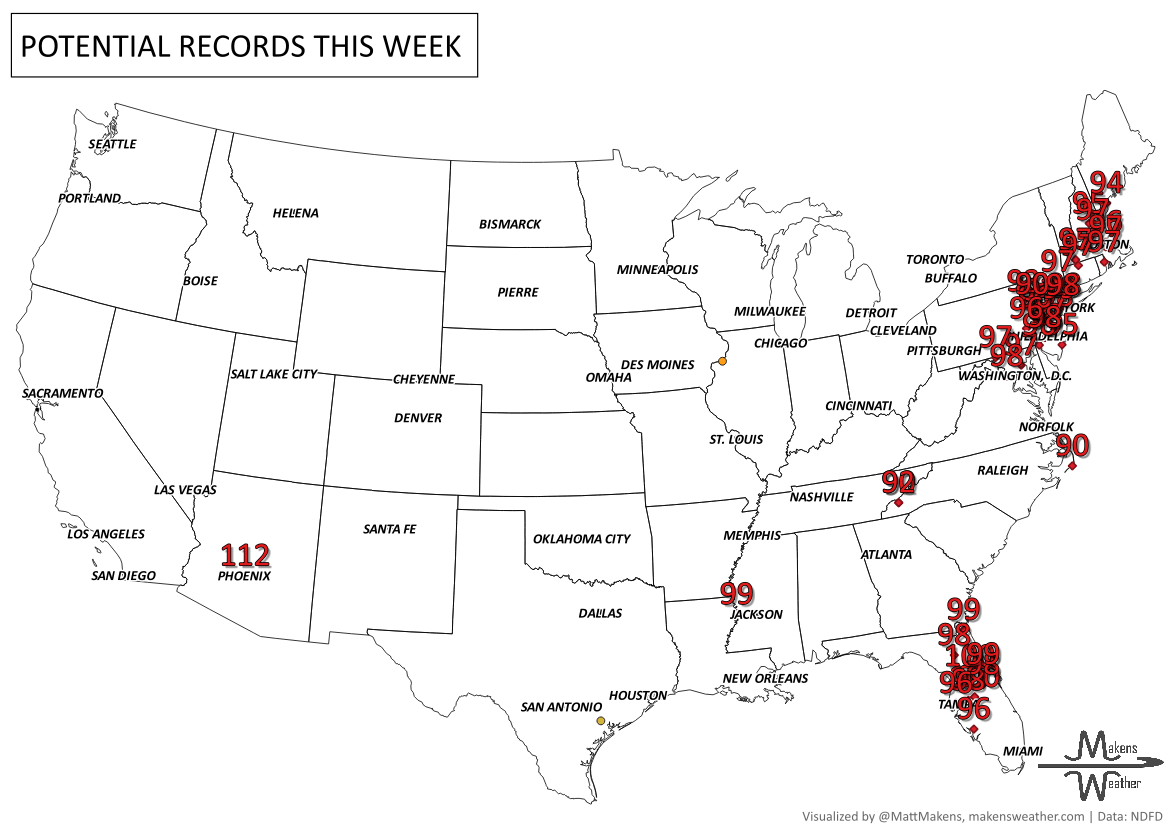
Friday into the weekend: Dangerous heat peaks in Florida and southern Georgia, with heat index values near 110°F. Cooler air moves into the Plains and East behind a cold front.
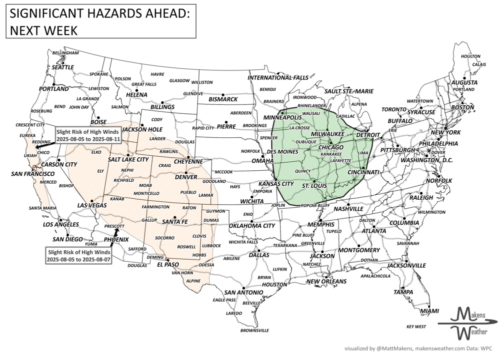
Weekend into early next week: Repeated rounds of rain possible in the central U.S. as storm clusters track along a stalled front.
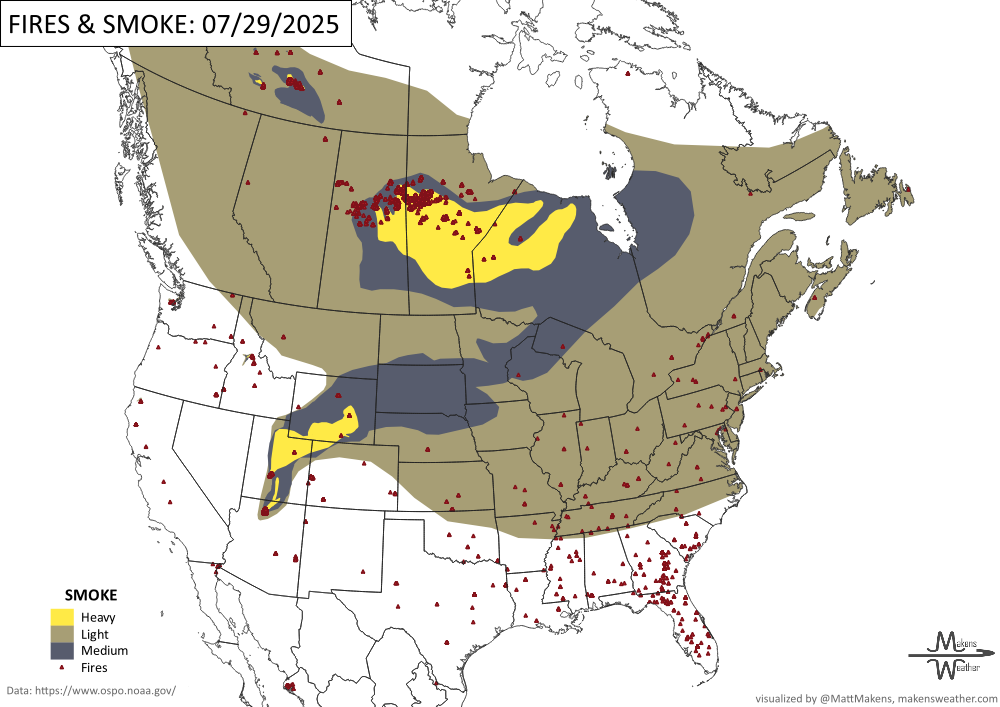
Ongoing: Smoke-related air quality alerts across Saskatchewan, Manitoba, and Ontario. Heat warnings remain in effect for British Columbia and parts of the Maritimes.
ON THE RADAR:
KEEP AN EYE TO THE SKY:
IN THE GAUGES:
RECORDS MADE TO BE BROKEN:
fire!
ARE YOU CIRRUS?!
2005 A hike up Mount Whitney in California turned deadly when the tarp belonging to camping Boy Scouts was struck by lightning. A boy scout and the scout leader were killed.
1981 Lightning struck a tree then spread across the ground near Vance, NC. The lightning strike killed 50 bovine weighing around 800 pounds each.
1916 Lightning ignited a forest fire that burned down the towns of Cochrane and Matheson, Ontario killing 233 people.
The weather pattern is about to make a pretty sharp turn across the country. California starts the week with unusual October heat, including highs well into the 90s and even lower 100s in the Central Valley. Meanwhile, much cooler fall air has reached the Great Lakes and Northeast. The Gulf Coast and Southeast stay unsettled, and there’s that record to watch: a tropical depression is likely to develop over the Gulf this week and could strengthen as it moves northeast. If it becomes a hurricane after the 8th, 2026 will have the latest-first hurricane in the Atlantic Basin record.