





Weekly Weather Watch: Tuesday, August 5th, 2025
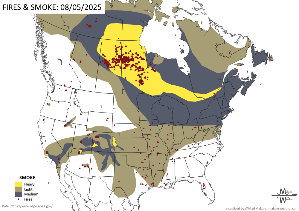
Wildfire smoke continues impacting air quality from the Upper Midwest to the Northeast this week. Hot, dry, and windy weather brings increased fire risk to the Four Corners region, Great Basin, and the Rockies. Meanwhile, severe storms threaten parts of the Northern Plains, and heavy rain raises flood concerns in the Southeast. Heat and smoke hazards are across central Canada, mainly in Saskatchewan and Manitoba.
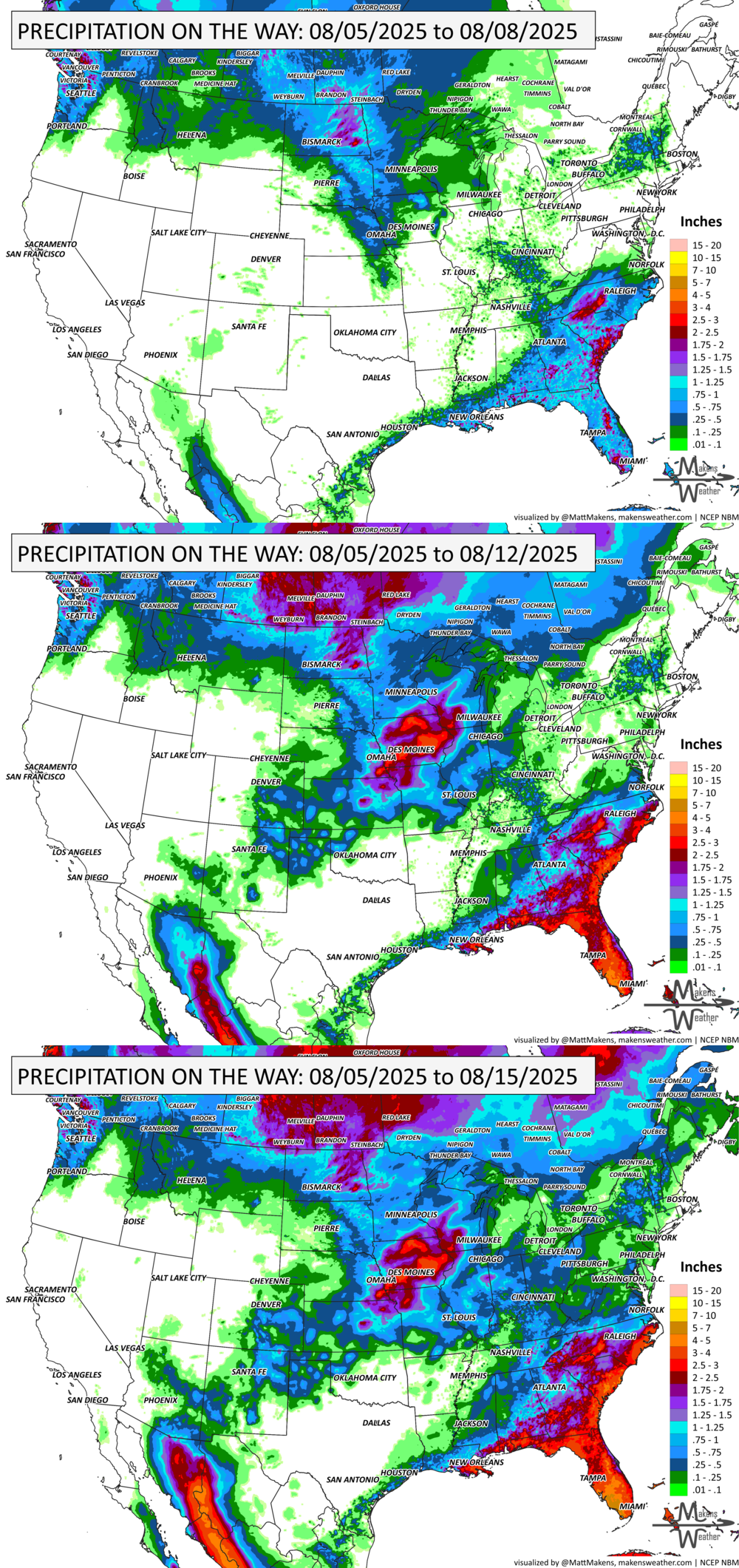
💧 How Much Rain Is Really On The Way?
Get Instant Answers with Our Precipitation Dashboard:
Tired of vague forecasts? Our Precipitation Dashboard gives you a clear, color-coded look at how much rain is expected—down to your region, for the next day, next 3 days, or next 7 days. Whether you're in the Plains bracing for storms, the Southeast watching flood risks, or just planning your week—this tool delivers the detail you need.
Members get full access to:
Easy-to-read maps showing total rainfall amounts
Region-specific breakdowns (Plains, Canada, Eastern U.S., and more)
Daily updates with blended-model accuracy
📈 Track it 👉 Join Now to Access the Dashboard
HEADLINERS:
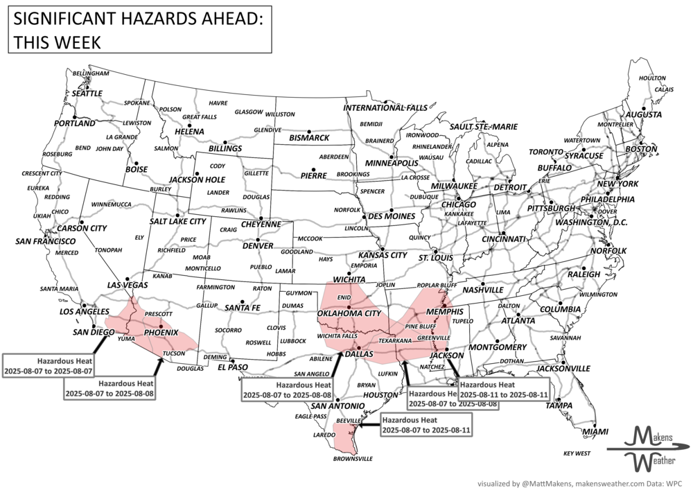
Key Weather Impacts:
Tuesday to Thursday:
Wildfire smoke continues to cause poor air quality from the Upper Midwest into the Northeast.
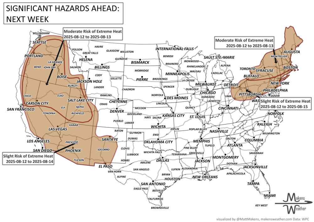
Severe thunderstorms, with a risk of damaging winds, hail, and isolated tornadoes, impact the Northern Plains.
Heavy rainfall leading to flash flooding persists across the Southeast and southern Mid-Atlantic.
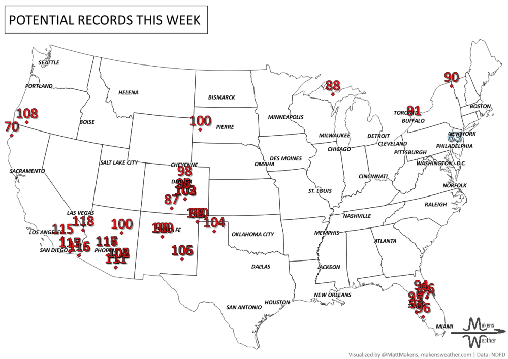
Extreme heat warnings in effect across Southeastern California, Arizona, and Southern New Mexico, with temperatures climbing dangerously above 110°F.
Friday to Tuesday (Aug 8-12):
Significant heat continues for the Southwest and South-Central Plains, potentially spreading into the Midwest and Great Lakes by the weekend.
Heavy rains and thunderstorms likely in the Upper Midwest, Northern Plains, and along the Southeast Coast.
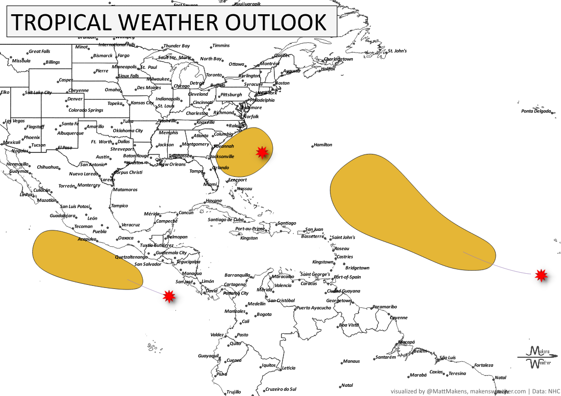
Two tropical disturbances under watch:
One system off the Southeastern United States coast has a medium (40%) chance of becoming a tropical depression by late week or the weekend.
Another in the Central Tropical Atlantic has a medium (50%) chance of developing into a tropical depression by this weekend.
ON THE RADAR:
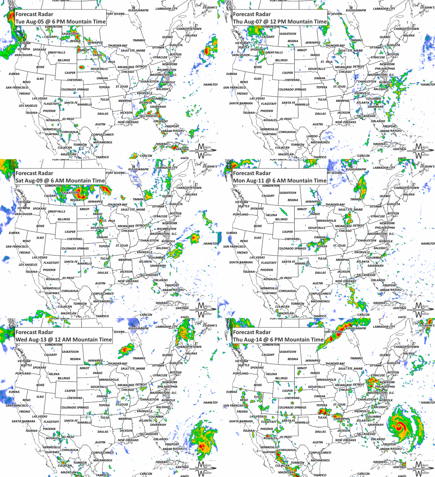
KEEP AN EYE TO THE SKY:
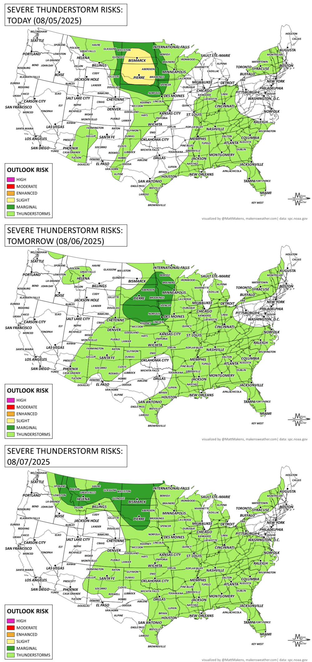
IN THE GAUGES:
RECORDS MADE TO BE BROKEN:
TROPICAL TIDINGS:
Two tropical disturbances under watch for mainland U.S.:
One system off the Southeastern United States coast has a medium (40%) chance of becoming a tropical depression by late week or the weekend.
Another in the Central Tropical Atlantic has a medium (50%) chance of developing into a tropical depression by this weekend.
fire!
ARE YOU CIRRUS?!
1987 Severe thunderstorms raked eastern South Dakota where a dozen tornadoes were reported along with softball size hail at Bowdle and wind gusts to 90 mph at Watertown.
1980 Hurricane Allen reached Category Five status for the first of three times during its long path across the Atlantic with a pressure of 911 millibars while south of Puerto Rico.
The weather pattern is about to make a pretty sharp turn across the country. California starts the week with unusual October heat, including highs well into the 90s and even lower 100s in the Central Valley. Meanwhile, much cooler fall air has reached the Great Lakes and Northeast. The Gulf Coast and Southeast stay unsettled, and there’s that record to watch: a tropical depression is likely to develop over the Gulf this week and could strengthen as it moves northeast. If it becomes a hurricane after the 8th, 2026 will have the latest-first hurricane in the Atlantic Basin record.