





Weekly Weather Watch: Tuesday, December 9th, 2025
The weather story this week centers around two major events. In the Pacific Northwest, a powerful atmospheric river is flooding the region with several days of heavy rain, gusty winds, and mountain snow. Meanwhile, a series of clipper systems are spreading snow and biting cold from the Northern Plains into the Great Lakes and Northeast. Arctic air follows behind, dropping temperatures sharply and triggering hazardous flash freeze conditions. In contrast, the Southwest and Deep South stay mild and dry.
Unlock the Makens Weather Advantage ☀️📊
Your membership includes:
✔️ Real-time dashboard with the latest weather observations and long-range projections
✔️ Monthly-lead forecasts to plan weeks ahead
✔️ Discounts on personalized consultations for ag, energy, or risk planning
All built for decision-makers who need weather insight, not just data.
🎯 Join now and put the forecast to work for you.
📈 The latest outlooks and conditions - track it 👉 Join Now to Access the Dashboard
HEADLINERS:
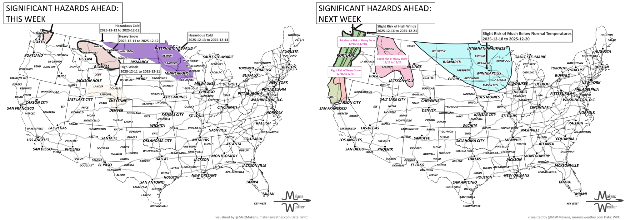
Key Weather Impacts
Tuesday, Dec 9:
Flash freeze risk in Southwestern Saskatchewan as temperatures plunge below freezing
Heavy snow spreads into southeastern Saskatchewan and southwest Manitoba (10–20 cm)
Snow squalls possible across parts of Ontario with near-zero visibility
Wednesday, Dec 10:
Atmospheric river continues flooding rain in western Washington and northwestern Oregon
Snow and wind spread through the Great Lakes, tapering in the Northern Plains
Thursday, Dec 11:
Rain moves into the Ohio Valley and Mid-Atlantic
Drying begins in the Pacific Northwest, but rivers may remain high
Friday–Sunday (Dec 12–14):
Bitter arctic cold invades the Upper Midwest and Great Lakes
Hazardous wind chills below -20°F expected
Lake-effect snow bands may develop in the Great Lakes region
Monday–Tuesday (Dec 15–16):
Milder air returns to the Northern Plains
Light snow pushes east toward the Appalachians and Northeast
Rain lingers along the Gulf Coast and Florida
ON THE RADAR:
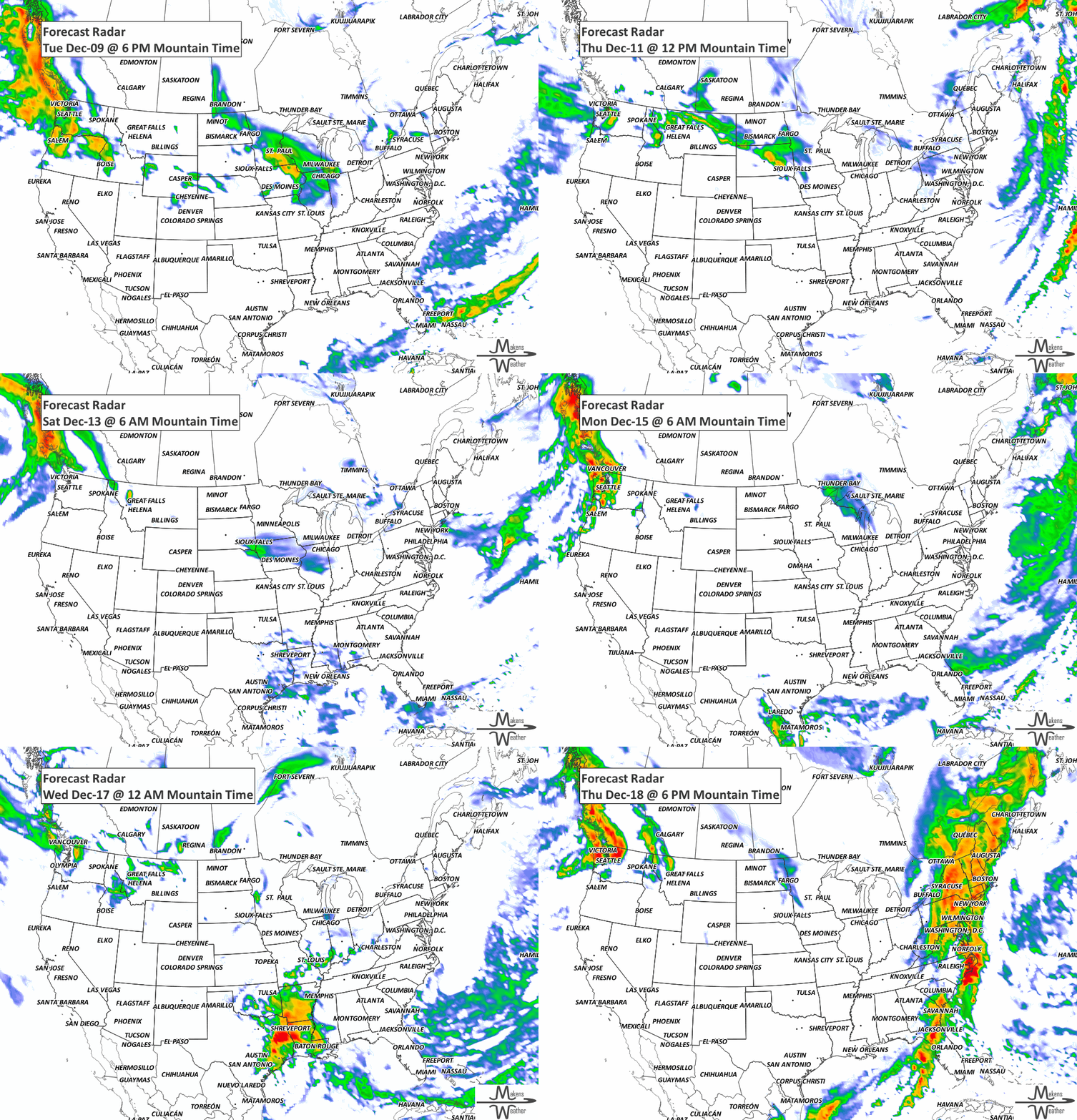
KEEP AN EYE TO THE SKY:
Thunderstorms are not expected to be significant in the next three days.
IN THE GAUGES:
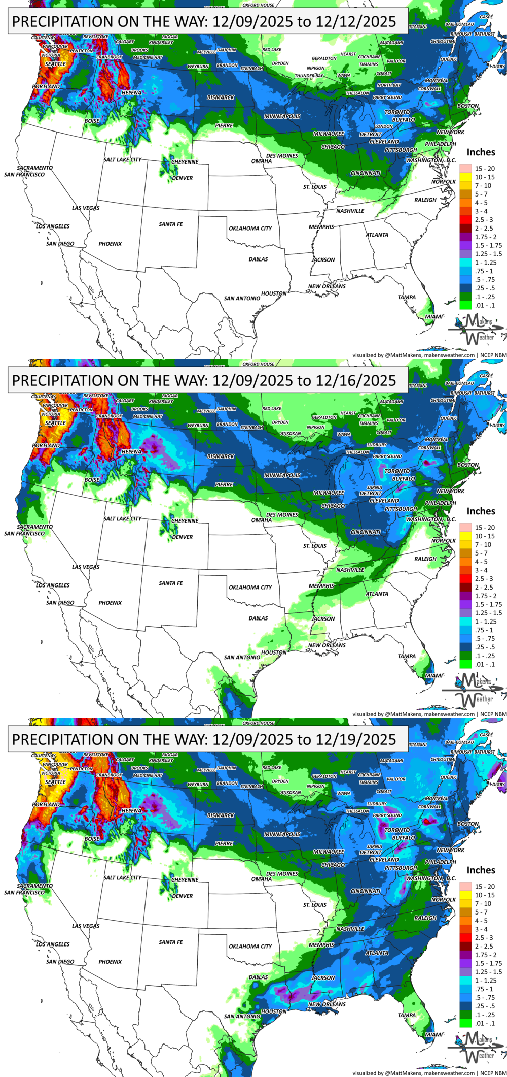
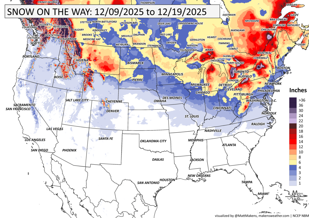
GRAB A RULER:
RECORDS MADE TO BE BROKEN:
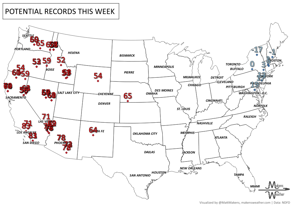
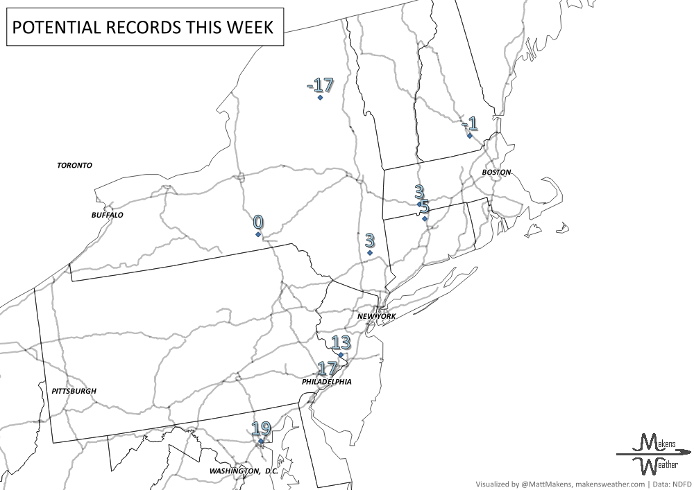
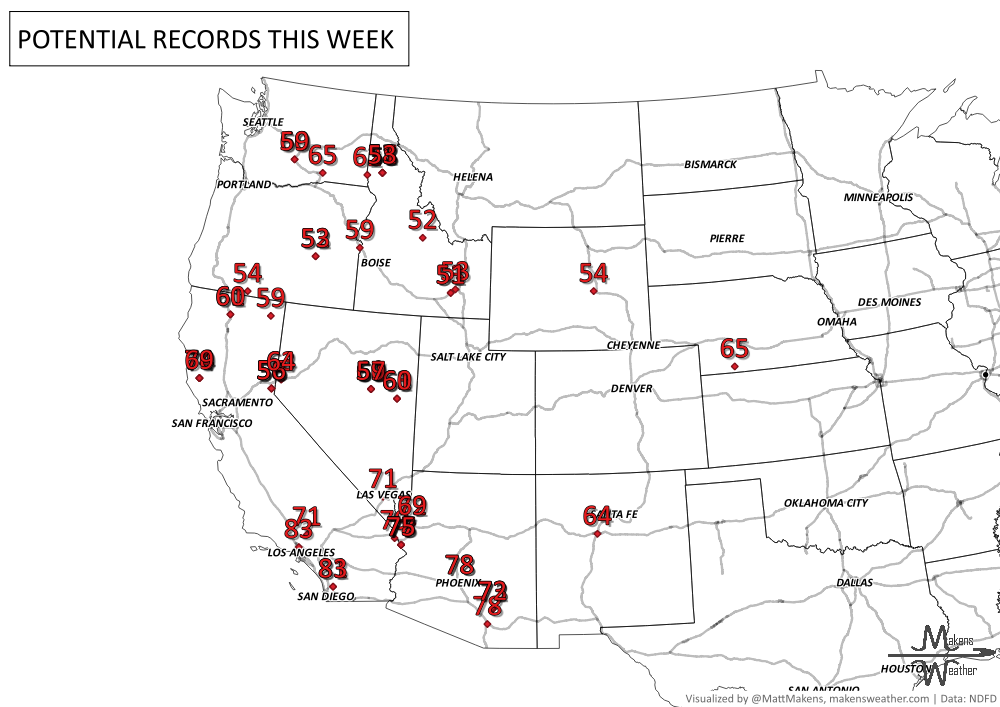
UN-DROUGHTABLY DRY:
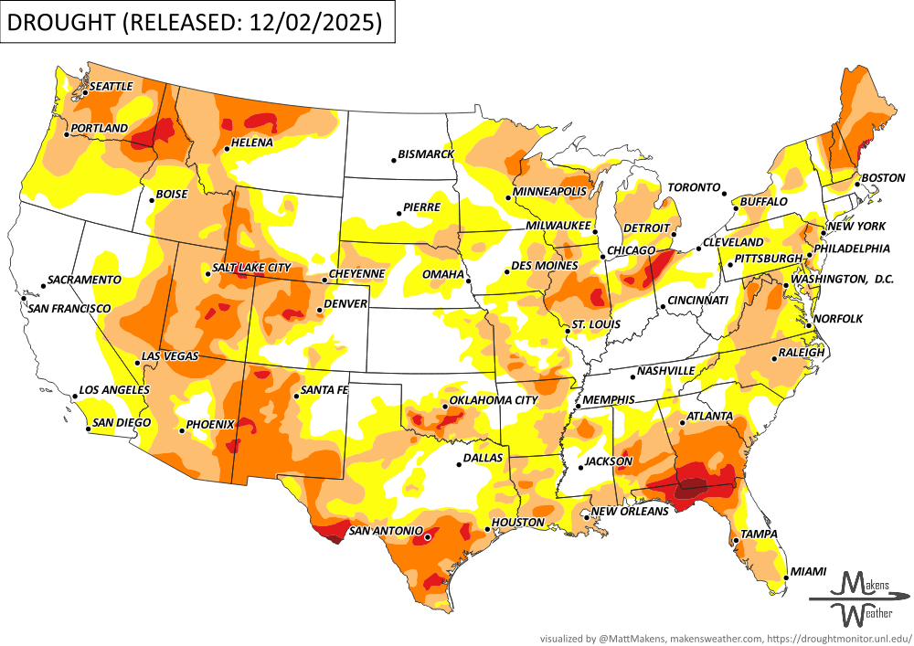
Drought conditions have improved across many parts of the West, Plains, Midwest, and Northeast, thanks to recent rain and snow. However, some areas still face challenges:
In California and parts of the West, recent moisture helped ease drought, but mountain snowpack remains well below normal in most regions.
Southern Rockies and parts of the Southwest have seen above-normal snowpack after recent storms.
Central and Northeast Texas saw continued improvement from recent rains.
In the Southeast, drought has worsened in areas like southern Georgia and the Florida Panhandle due to low soil moisture and streamflow.
Northern Plains, Midwest, and Northeast received helpful snow, bringing minor drought relief.
Snowpack levels are still lagging in much of the western U.S., with California’s snowpack only 39% of normal as of early December. -U.S. Department of Agriculture
ARE YOU CIRRUS?!
1917 Vevay, IN, on the Ohio River, reported 26 inches of snow in 24 hours with 14-foot drifts. By the 16th, people could walk across the river from Vevay to Kentucky.
1989 A strong storm produced wind gusts of 40 to 65 mph from the Alaska Peninsula to the North Gulf Coast of Alaska. Southeasterly winds gusted to 75 mph in the Anchorage area. Gusty winds associated with the same cold front caused a power outage across much of the island of Hawaii.
The weather pattern is about to make a pretty sharp turn across the country. California starts the week with unusual October heat, including highs well into the 90s and even lower 100s in the Central Valley. Meanwhile, much cooler fall air has reached the Great Lakes and Northeast. The Gulf Coast and Southeast stay unsettled, and there’s that record to watch: a tropical depression is likely to develop over the Gulf this week and could strengthen as it moves northeast. If it becomes a hurricane after the 8th, 2026 will have the latest-first hurricane in the Atlantic Basin record.