





Weekly Weather Watch: Tuesday, April 14th, 2026
A very active weather pattern is unfolding across North America this week, featuring severe thunderstorms, heavy rainfall, and flooding risks from the Plains to the Great Lakes, while record-breaking heat expands across the East Coast. Meanwhile, winter-like conditions return to the Northwest and Rockies, and critical fire weather concerns develop in the High Plains. A wintry system with strong wind and areas of heavy snow will trek from Alberta to Quebec, the biggest impact likely in Ontario.
BRAND NEW PRODUCT☀️📊
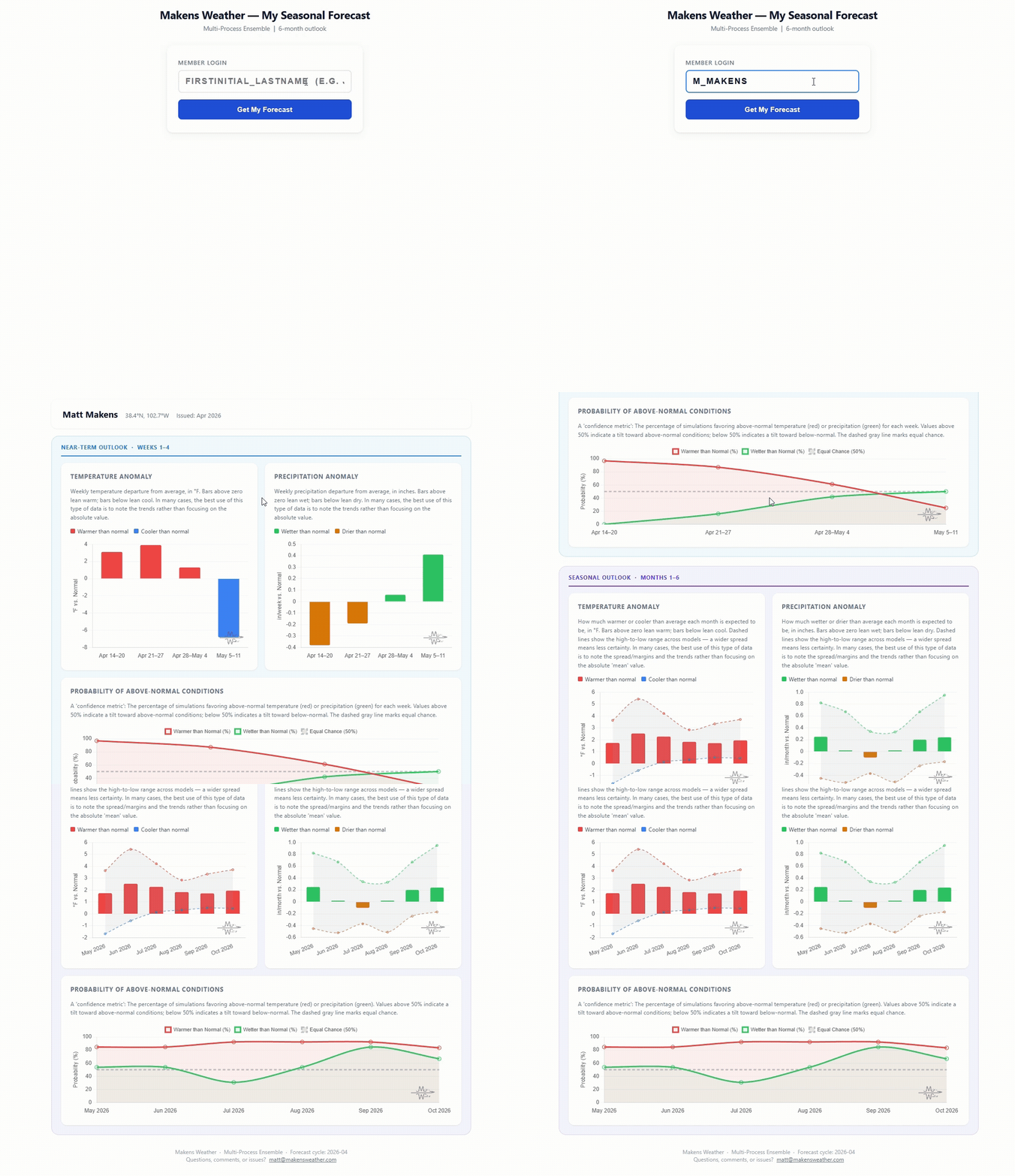
📈 The latest weekly and monthly outlooks 👉 Join Now to Access
HEADLINERS:
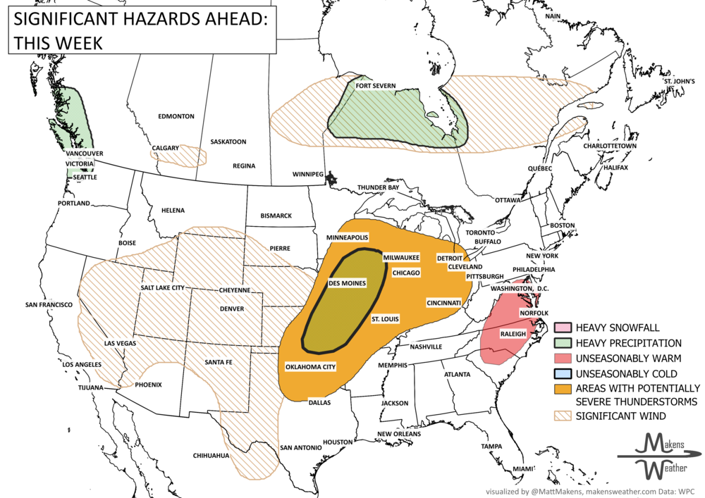
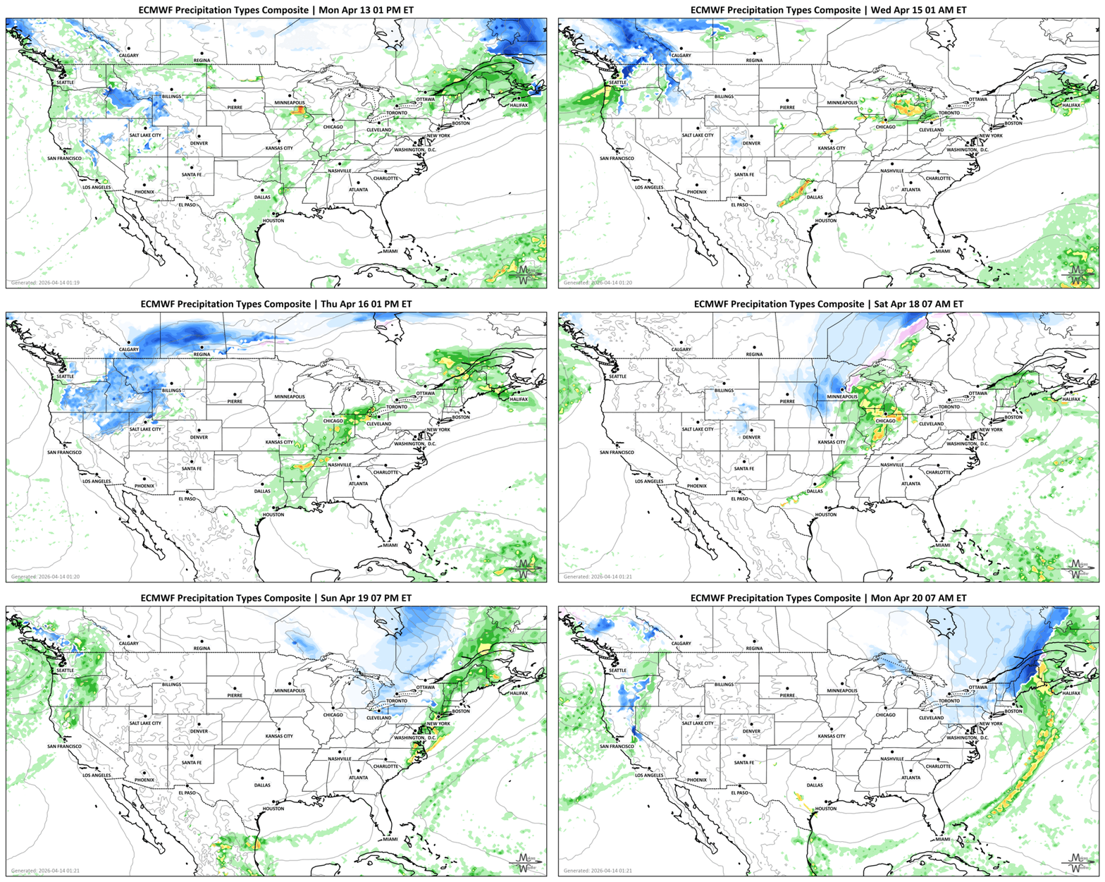
Next 7 Days: Key Timing and Impacts
Tuesday – Wednesday:
Southern Plains to Great Lakes – Rounds of strong to severe thunderstorms with heavy rain and localized flooding
Upper Midwest & Great Lakes – Repeated storm activity, especially late day into nighttime
Interior Northeast – Periods of showers and thunderstorms
Marianas Islands (CNMI & Guam) – Typhoon and tropical storm conditions with destructive winds and flooding rain
Alberta - Strong winds across the south
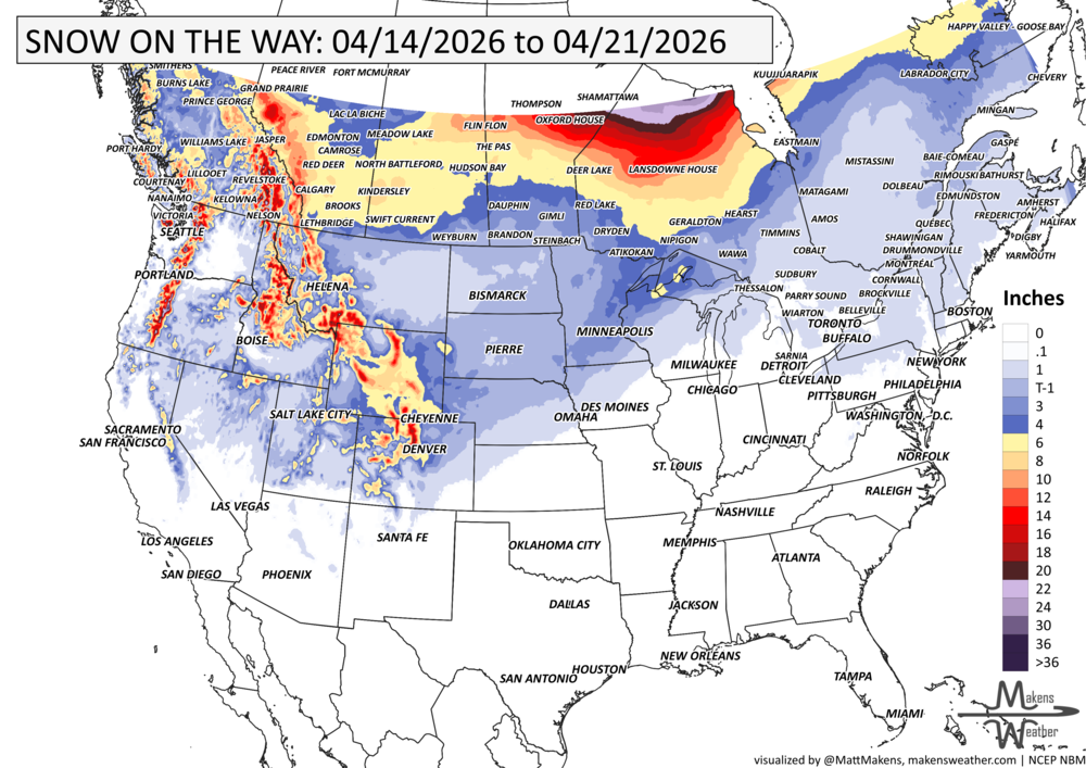
Alberta to Saskatchewan - Heavy snows
Wednesday – Thursday:
Pacific Northwest – Heavy mountain snow, strong winds, and sharply colder temperatures arrive
Northern Rockies & Great Basin – Snow spreads inland by Thursday morning
Central & Southern High Plains – Critical fire weather risk due to dry air and gusty winds
Alberta to Manitoba - Heavy snows
Thursday – Saturday:
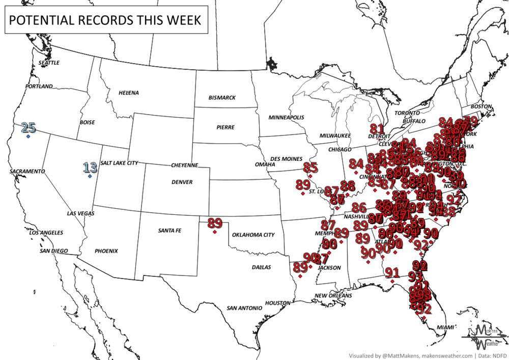
Mid-Atlantic & East Coast – Record heat expands, with temperatures well into the 80s and 90s
Carolinas to Virginia – Peak heat Friday into Saturday with potential daily records
Ohio Valley to Mid-South – Scattered showers and storms, generally weaker Thursday
Manitoba to Quebec - Heavy snows
Friday:
Eastern Kansas to Chicago Metro – Increasing risk for heavy rain and stronger thunderstorms
Northern Missouri to Southwest Wisconsin – Higher potential for repeated storms and localized flooding
Saturday:
South-Central U.S. – Additional thunderstorms developing ahead of a cold front
Mid-Atlantic (north) – Slight cooling trend begins
Ontario and Ontario - Heavy snows
Sunday – Monday:
East Coast – Strong cold front ends the heatwave with cooler, more typical April conditions
Plains & Midwest – Continued storm chances along the front
Quebec and The Maritimes - Strong wind
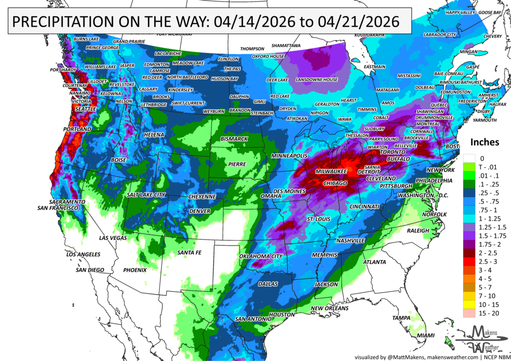
IN THE GAUGES, PRECIPITATION THROUGH THE 21ST:
NOTE: FOR THE SOUTHERN TO MIDWESTERN US, THESE PROJECTED TOTALS ARE LIKELY TO BE OVERDONE FOR MANY AREAS BECAUSE THUNDERSTORMS WILL BE THE SOURCE OF RAINFALL, AND WE KNOW THAT THUNDERSTORMS MAY BE FAR APART, ESPECIALLY OVER OKLAHOMA AND TEXAS. SO, THESE TYPES OF PROJECTIONS FOR THUNDERSTORM AREAS REFLECT A POTENTIAL RAINFALL TOTAL, IF YOU GET THE STORMS TO PASS OVER YOU. THE ACTUAL OBSERVATIONS WILL BE MORE ISOLATED TOTALS TO THESE MAGNITUDES SOUTH OF I-70 OR SO.
GRAB A RULER, SNOWFALL THROUGH THE 21ST:
RECORDS MADE TO BE BROKEN, DAILY HIGHS (RED) | DAILY LOWS (BLUE):
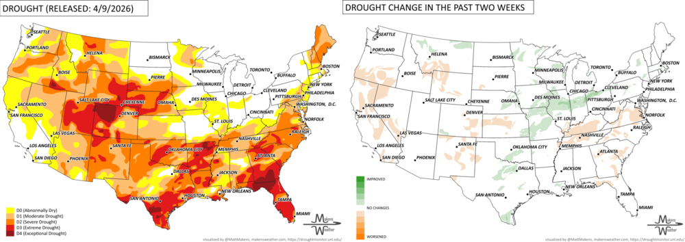
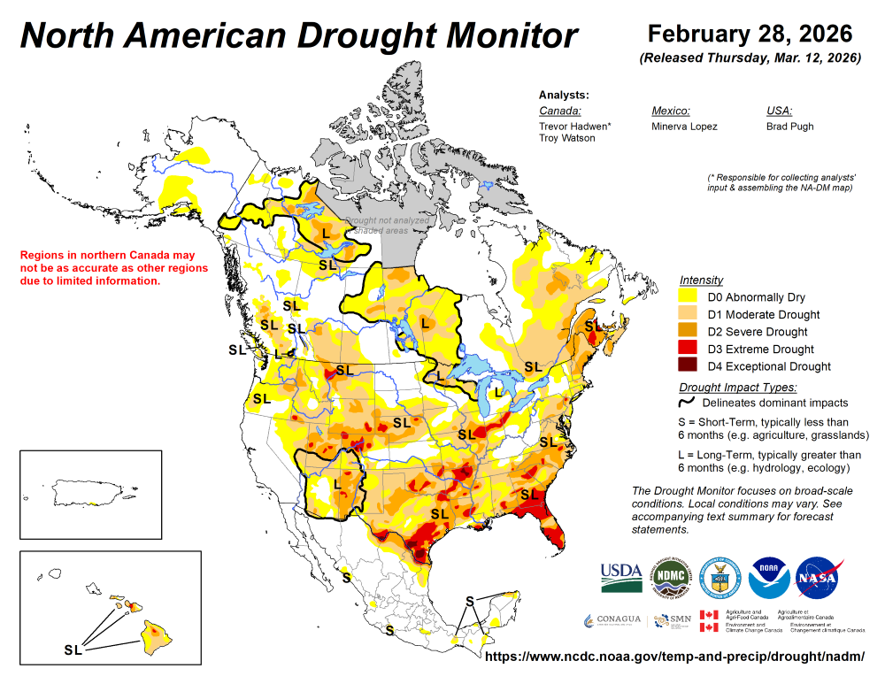
UN-DROUGHTABLY DRY:
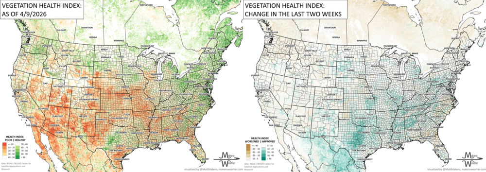
ARE YOU CIRRUS?!
Today in weather history:
1939 A family of tornadoes caused up to F5 damage along an 80-mile-long path in northwest Oklahoma. A freight train arrived in Capron, OK at the same time as the tornado. Eight cars of the train were blown off the tracks.
1921 The world's greatest 24-hour snowfall occurred in Silver Lake, CO, with 76 inches.
1886 A massive tornado struck Rice, MN. The tornado killed 11 members of a bridal party, including the bride and groom. The tornado, 800 yards wide at times, cut a 20-mile path through Saint Cloud, MN, killing 74 people. The bottom of the Mississippi River was said to have been seen during the tornado's crossing.
The weather pattern is about to make a pretty sharp turn across the country. California starts the week with unusual October heat, including highs well into the 90s and even lower 100s in the Central Valley. Meanwhile, much cooler fall air has reached the Great Lakes and Northeast. The Gulf Coast and Southeast stay unsettled, and there’s that record to watch: a tropical depression is likely to develop over the Gulf this week and could strengthen as it moves northeast. If it becomes a hurricane after the 8th, 2026 will have the latest-first hurricane in the Atlantic Basin record.