





Weekly Weather Watch: Tuesday, September 15th, 2026
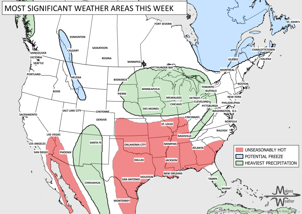
Late-summer weather is hanging on across the south-central U.S., where another stretch of hot, humid days will continue through much of the week. Farther north and west, heavy rain will be the bigger concern. Several rounds of thunderstorms could produce flooding from the Central Plains into the Upper Midwest, while monsoon moisture keeps showers and storms active across the Southwest and Southern Rockies. The pattern begins to change later this week, allowing the southern heat to ease while the focus for heavier rain shifts east toward the Great Lakes and Northeast. A frost possible across Canada, with a first freeze more likely for Quebec and the Maritimes.
Some new videos have dropped to YouTube that may be of interest (I’ll post my winter outlook in a day or two). Here are those new links:

📈 The latest weekly and monthly outlooks 👉 Join Now to Access
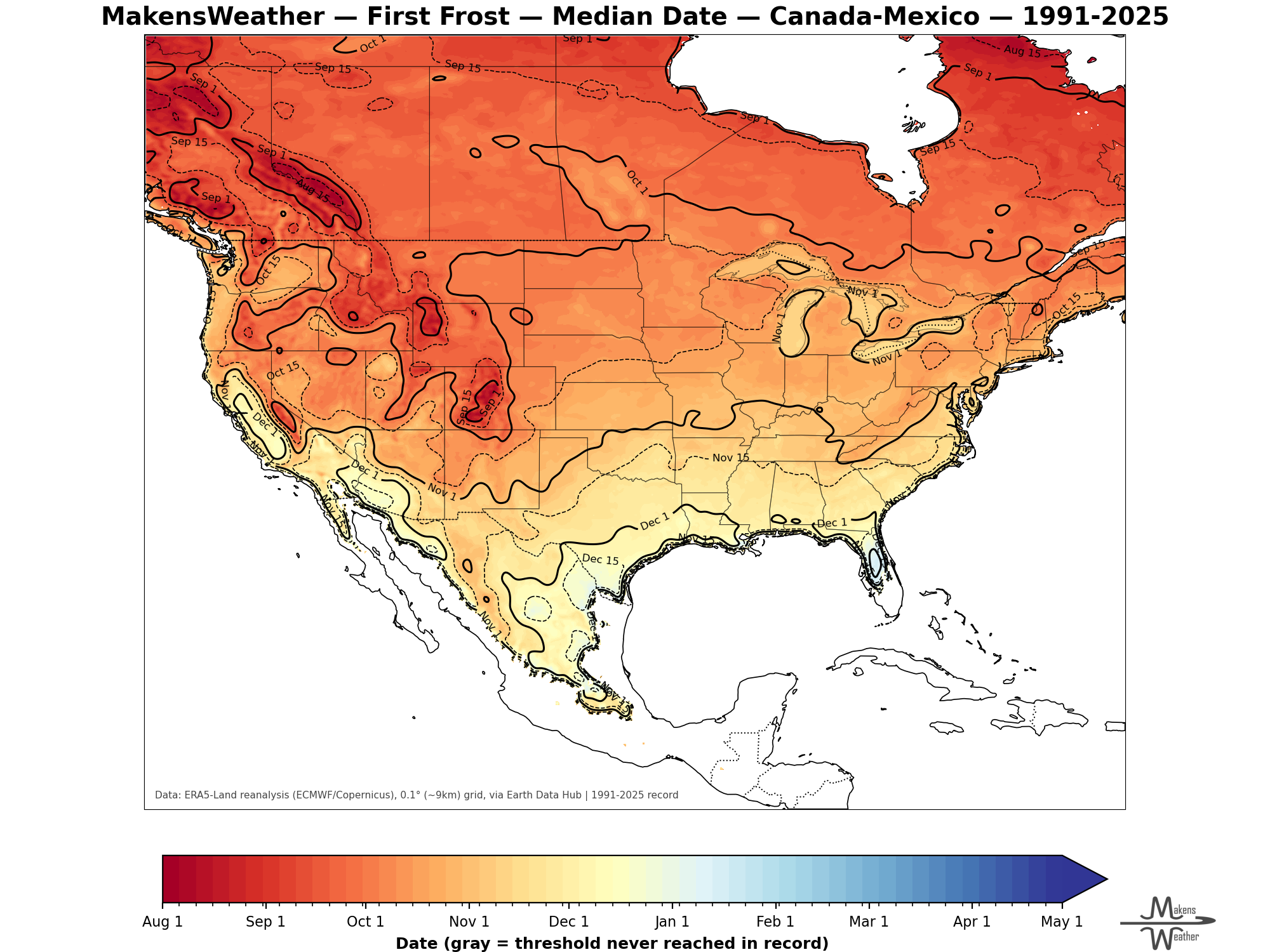
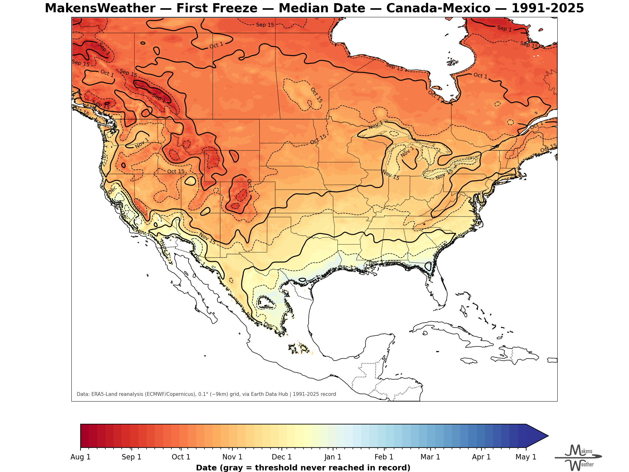
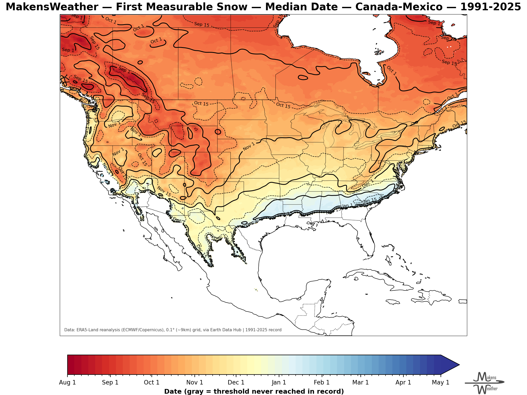
AVERAGE FIRST FROST, FREEZE AND SNOW DATES:
HEADLINERS:
What to watch:
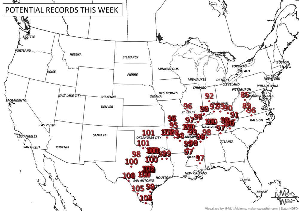
Tuesday, Sept. 15: Hot and humid conditions continue from Texas into the Lower and Mid-Mississippi Valley, with some daily record highs potentially challenged. Meanwhile, thunderstorms capable of heavy rain continue across the Central Plains and Missouri Valley. A few stronger storms could also produce damaging wind gusts. Strong wind from Manitoba to the Great Lakes.
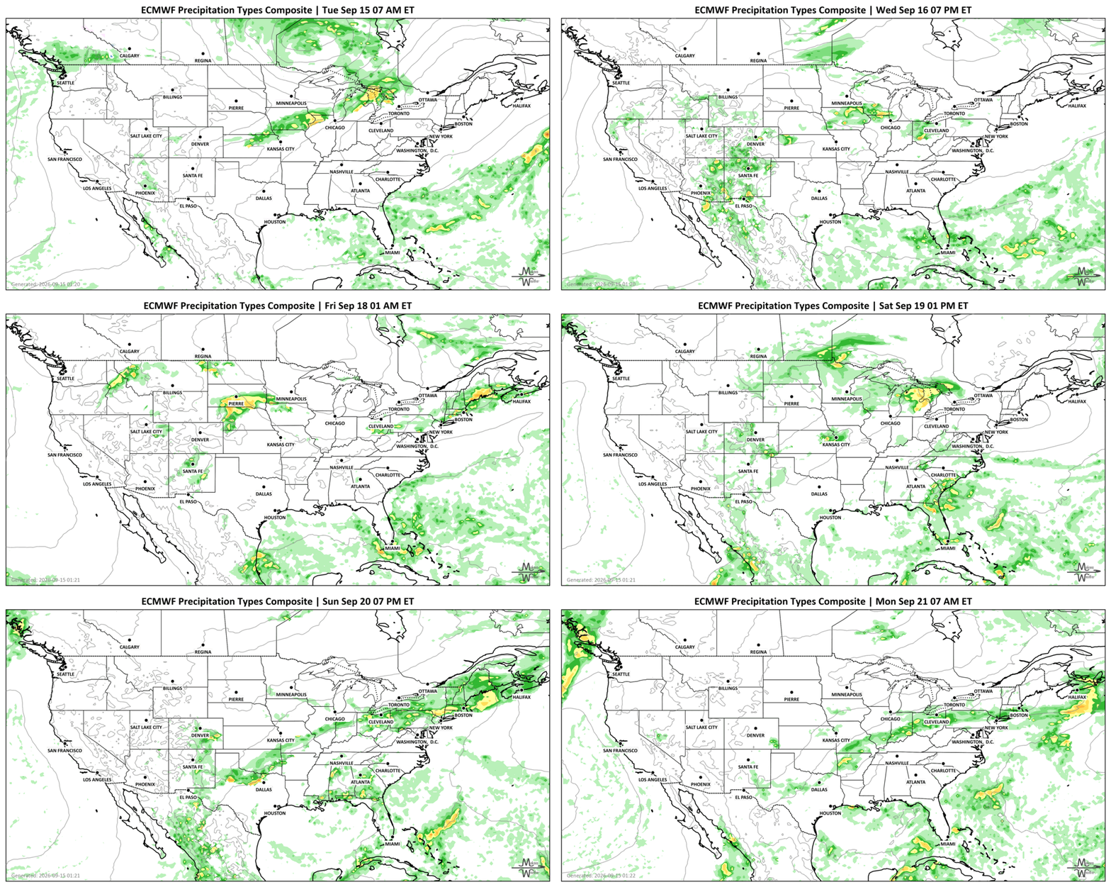
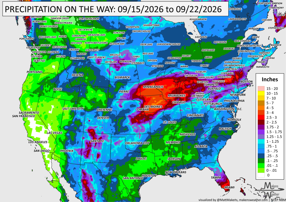
Tuesday into Wednesday: Repeated thunderstorms increase the flooding concern from northeast Kansas into Iowa and surrounding portions of the Central Plains and Upper Midwest. Some locations could receive heavy rain more than once.
Tuesday through Thursday: Monsoon moisture keeps thunderstorms going across the Southwest and Southern Rockies, including New Mexico and the Four Corners. Heavy downpours could quickly cause problems around normally dry washes and slot canyons.
Through late week: The heat remains stubborn across east Texas, the Southern Plains and Mississippi Valley. High humidity will add to the discomfort before temperatures gradually begin to moderate. Frosty temperatures move east across Canada.
Friday: Another round of thunderstorms and heavy rain is expected across parts of the Upper Midwest, where there is a renewed risk of excessive rainfall. First freeze possible from Quebec to the Maritimes.
This weekend: The storm system shifts east, spreading showers and thunderstorms toward the Great Lakes, Ohio Valley and eventually the Northeast. At the same time, the persistent heat across the South-Central U.S. should finally begin easing. Freezing temperatures in the Maritimes.
Early next week: Rain and thunderstorms may move farther south into the Mid-Atlantic, while another surge of monsoon moisture could bring renewed storms to New Mexico and the Southwest.
SET YOUR WATCHES - WHEN THE MOISTURE ARRIVES:
IN THE GAUGES, PRECIPITATION THROUGH THE 22ND:
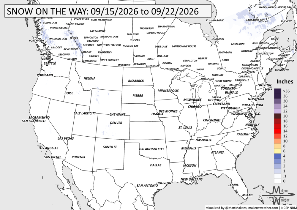
GRAB A RULER, SNOWFALL THROUGH THE 22ND:
RECORDS MADE TO BE BROKEN, DAILY HIGHS (RED) | DAILY LOWS (BLUE):
UN-DROUGHTABLY DRY:
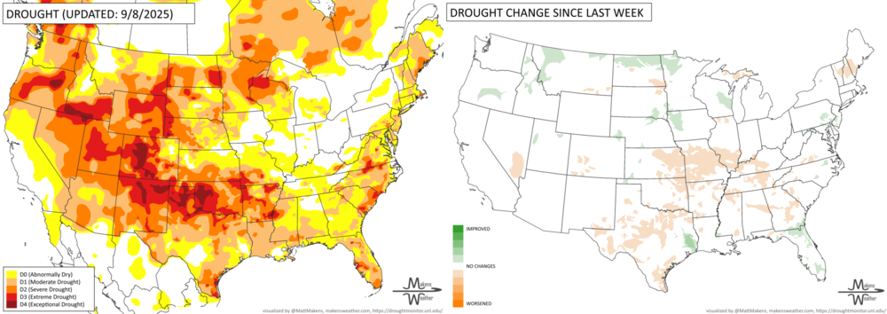
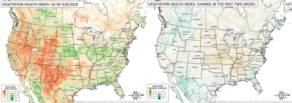
Drought conditions continued to worsen across parts of the central and south-central U.S. this week, with flash drought expanding from much of Texas northeast into the middle and lower Mississippi Valley. Unusually warm temperatures combined with limited rainfall also contributed to worsening conditions across parts of the Great Plains, Corn Belt and Missouri.
There were some notable exceptions. Heavy rain brought relief to portions of the Upper Midwest, northern Rockies and western Oregon, while Tropical Storm Edouard soaked a narrow corridor of southeast Texas with locally 10 to 15 inches or more. Recent tropical rainfall also improved dryness in parts of Hawaii and Puerto Rico.
FIRE!
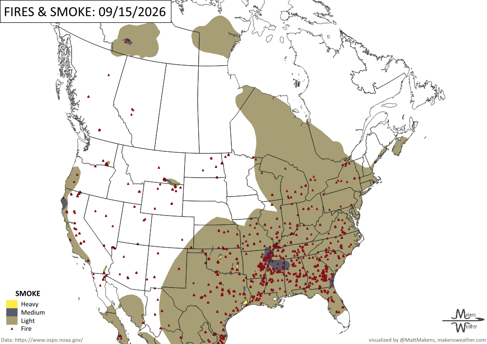
So far this year, 54,407 fires have burned more than 8.4 million acres across the United States, 123% of the 10-year average number of fires and 149% of the 10-year average acres burned for this date. -NIFC
TRACKING THE TROPICS
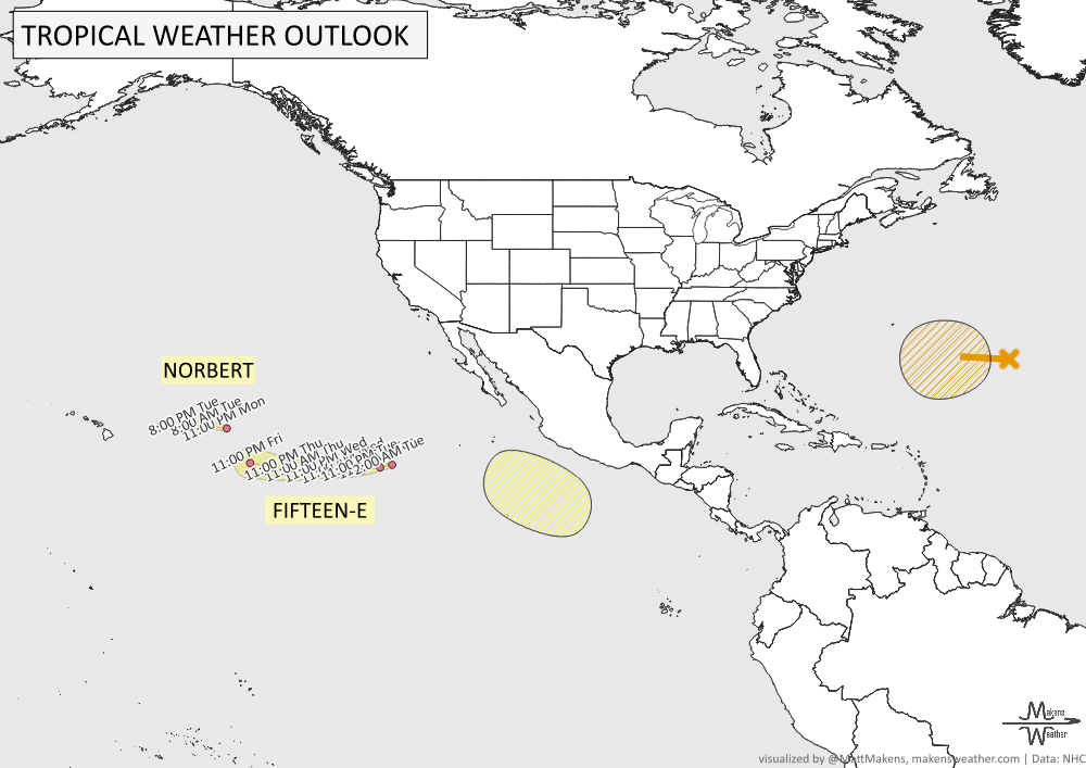
The central Atlantic is the main area to watch, where a tropical depression could form later this week as disturbed weather moves west-northwest. Elsewhere, thunderstorms and rough seas will affect parts of the Caribbean, Gulf, and western Atlantic, with conditions generally improving late this week. Tropical Depression Fifteen-E is moving west across the eastern Pacific and is not expected to become a tropical storm due to dry air and unfavorable winds. Tropical Depression Norbert is also moving west, away from the region. Elsewhere, strong winds and rough seas are expected near the Gulf of Tehuantepec, where gale conditions are forecast Wednesday night. -NHC
ARE YOU CIRRUS?!
In weather history:
1747: Historical accounts describe a hurricane that caused flooding along the Rappahannock River in Virginia. A slave ship overturned during the storm, with several fatalities reported.
1945: A powerful hurricane made landfall near Homestead, Florida, before tracking north through the state and exiting near Jacksonville Beach. Wind gusts reached 170 mph. The storm caused extensive damage at Homestead Army Air Field, destroying housing, the nurses’ dormitory, Base Exchange, laundry and fire station. Aircraft were also heavily damaged.
2010: A hailstone measuring 7.75 inches in diameter was found in southwest Wichita, Kansas, setting the record for the largest hailstone documented in the state.
2011: An EF0 waterspout moved ashore in Ocean City, Maryland.
The weather pattern is about to make a pretty sharp turn across the country. California starts the week with unusual October heat, including highs well into the 90s and even lower 100s in the Central Valley. Meanwhile, much cooler fall air has reached the Great Lakes and Northeast. The Gulf Coast and Southeast stay unsettled, and there’s that record to watch: a tropical depression is likely to develop over the Gulf this week and could strengthen as it moves northeast. If it becomes a hurricane after the 8th, 2026 will have the latest-first hurricane in the Atlantic Basin record.