





Weekly Weather Watch: Wednesday, May 28th, 2025
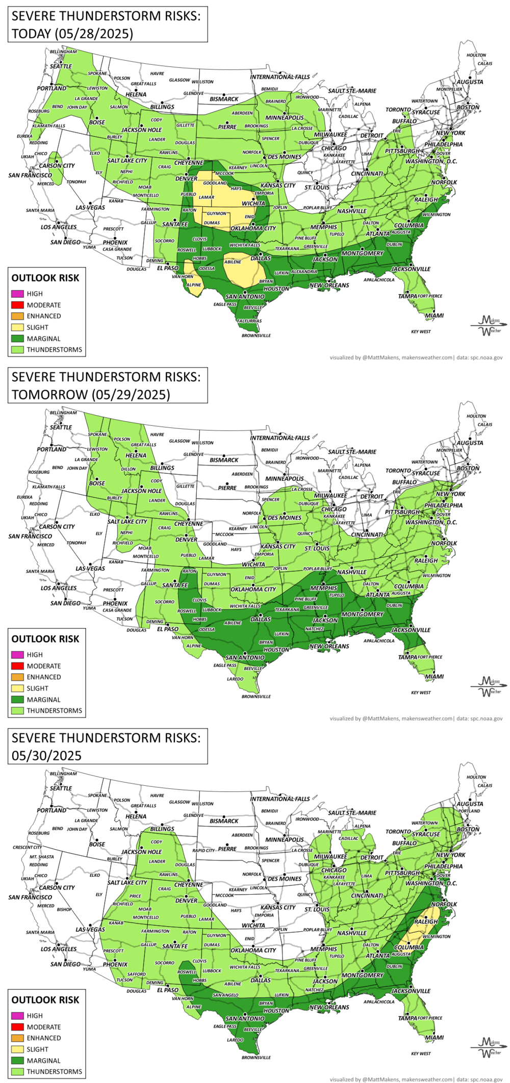
Transitioning Weather Pattern to Bring Western Heat, Eastern Rain, and Rocky Mountain Snow Risk: Severe weather threat today across the central and southern Plains. Expect very large hail, damaging winds, and a few tornadoes. Heavy rain in Texas could lead to flash flooding, while storms in the Southeast may bring isolated wind damage.
A shifting upper-level pattern will drive major weather changes across the U.S. and Canada this weekend and into next week. Expect record heat in the West, heavy rain in the East, and a growing chance for mountain snow across the Rocky Mountains from the northern U.S. through Alberta.
HEADLINERS:
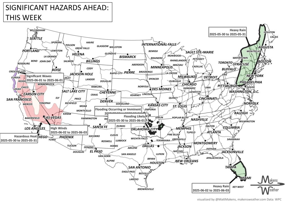
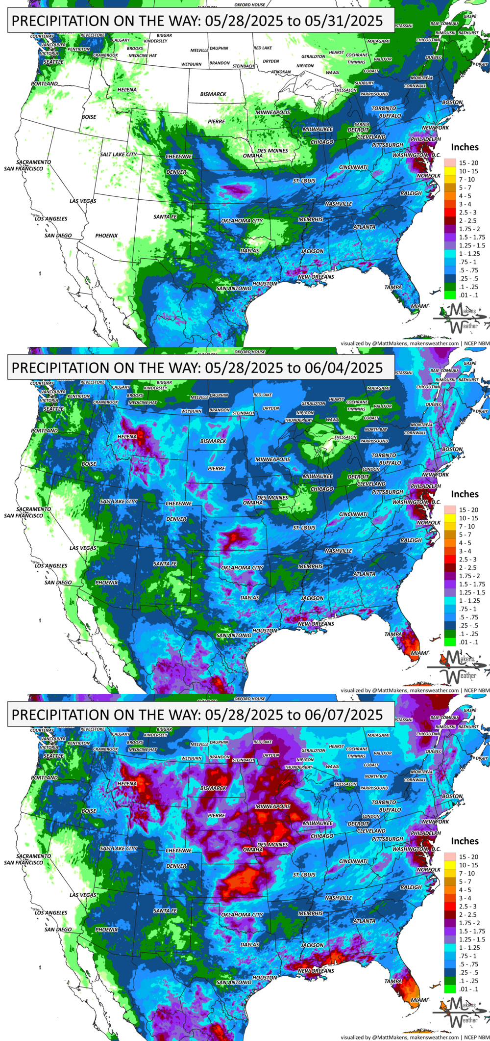
East Coast & Gulf: Rainy into early week, especially Florida.
New England: Rain risk continues Saturday, especially northern areas.
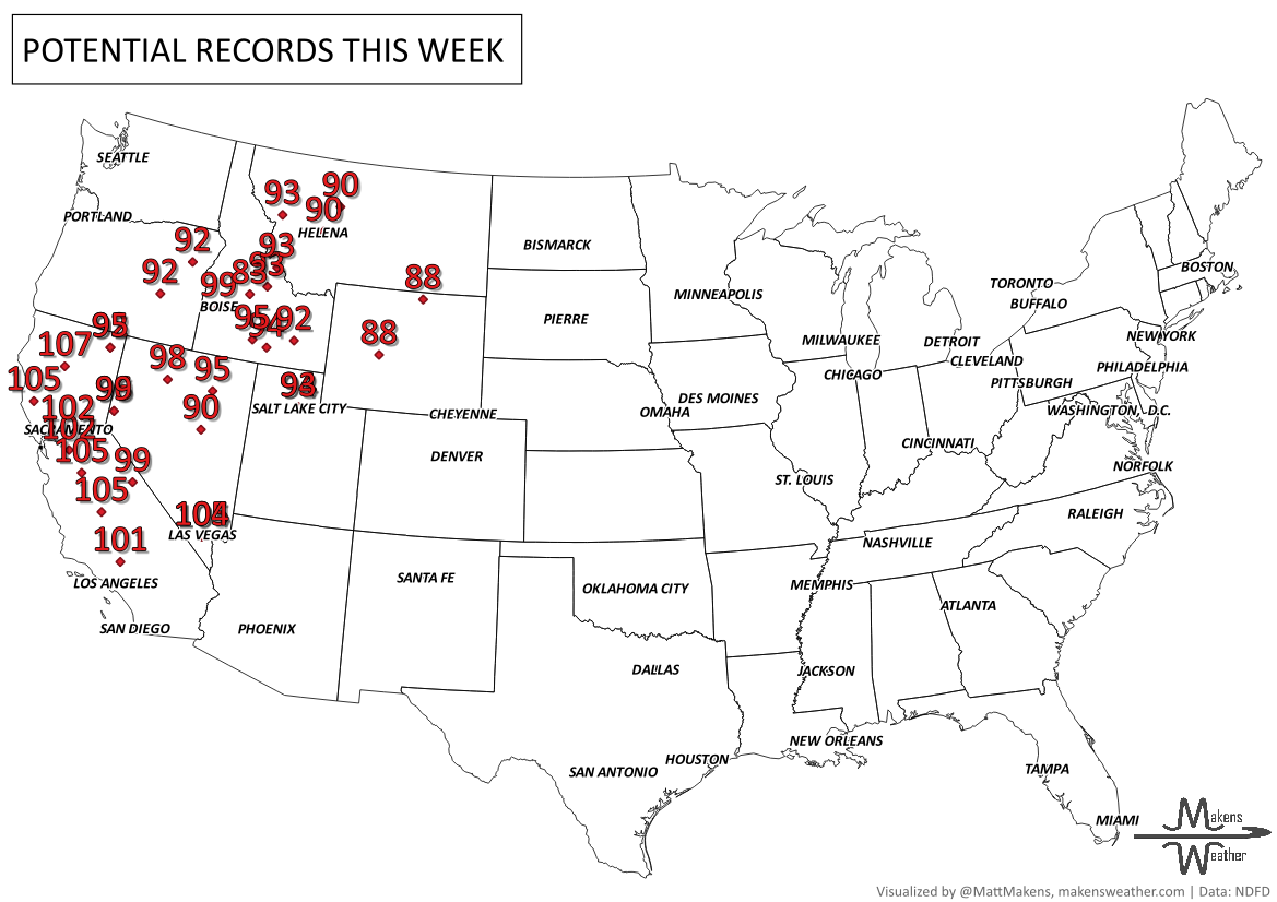
West: Extreme heat through the weekend, followed by cooling and increasing rain/snow into next week.
Canada: Heavy precipitation for higher terrain in B.C. and AB. Heavy rainfall from QC to NS. Strong chinook in AB. Unseasonably warm temperatures cross the country progressively this week into next.
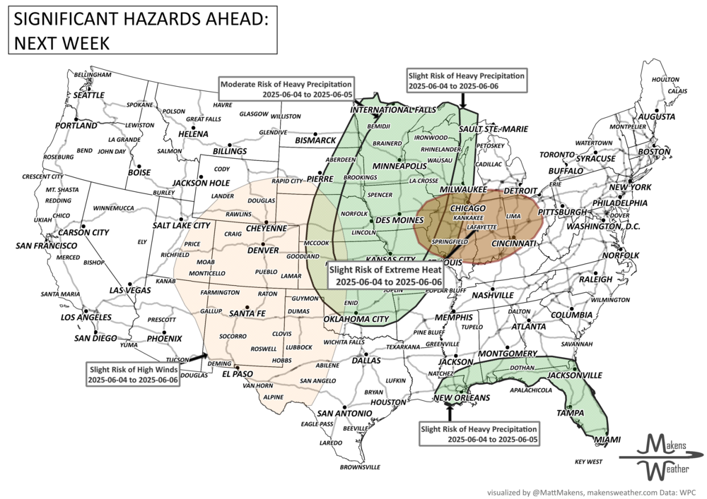
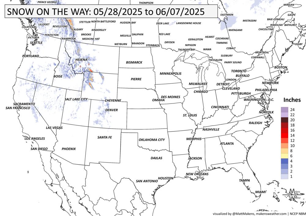
Northern U.S. & Canadian Rockies: Midweek snow potential in the higher elevations.
Eastern U.S.: Hotter weather builds June 4–6, especially across the Ohio Valley and southern Great Lakes. First significant heat wave of the season could reach near 90°F.
Central U.S.: Heavy rain and thunderstorms likely midweek (June 4–6) from the Central Plains through the Mississippi Valley into the western Great Lakes.
Florida & Gulf Coast: Rounds of heavy rain possible late this week into early next week, with tropical moisture pooling across Florida and the central Gulf Coast.
Western U.S.: Windy conditions and fire weather concerns June 4–6 across the High Plains, Four Corners, and Southwest. Heat backs off as a trough develops.
Northern Rockies: Increased rain and possible high-elevation snow midweek as cooler, wetter flow spreads inland.
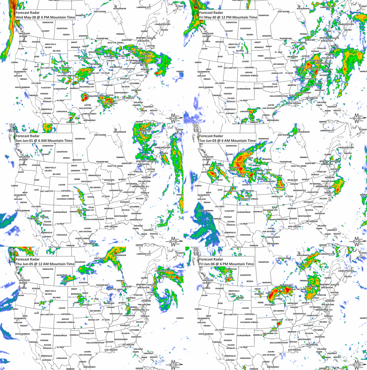
ON THE RADAR:
KEEP AN EYE TO THE SKY:
IN THE GAUGES:
GRAB A RULER:
RECORDS MADE TO BE BROKEN:
ARE YOU CIRRUS?!
1963 A tropical cyclone struck Bangladesh killing 11,500 people.
The weather pattern is about to make a pretty sharp turn across the country. California starts the week with unusual October heat, including highs well into the 90s and even lower 100s in the Central Valley. Meanwhile, much cooler fall air has reached the Great Lakes and Northeast. The Gulf Coast and Southeast stay unsettled, and there’s that record to watch: a tropical depression is likely to develop over the Gulf this week and could strengthen as it moves northeast. If it becomes a hurricane after the 8th, 2026 will have the latest-first hurricane in the Atlantic Basin record.