Weekly Weather Watch: Tuesday, July 1st, 2025
Midweek brings flash flooding and severe storm risks from the Mid-Atlantic to Texas, followed by building heat across the central and eastern U.S. heading into the holiday weekend. Florida and the Upper Midwest also face stormy, soggy days ahead. Air quality is an issue throughout central Canada related to the wildfires, plus heat warnings are issued for parts of Alberta this week.
🌦️ members! New Interactive Forecast Dashboards Now Live!
Want a clearer picture of what’s coming? Our newly enhanced forecast dashboard puts all the essential weather information at your fingertips — precipitation totals, temperature trends, wind gusts, severe storm probabilities, and even an animated radar forecast showing when and where moisture arrives.
You can now:
Switch between regions with a click
View 7-day projections for temperature, heat index, and winds
Explore daily thunderstorm, tornado, hail, and wind risks
Watch radar animation with adjustable playback speed
It’s fast, visual, and built for those who need precision weather intelligence.
Check it out here: Members Portal
HEADLINERS:
Key Weather Impacts:
Tuesday:
Mid-Atlantic: Flash flooding likely from heavy thunderstorms; risk of severe storms with gusty winds and isolated tornadoes.
Southern High Plains & Western Gulf Coast: Localized flash flooding from intense thunderstorms.
Northern California & Oregon: Scattered showers and storms; Washington, Oregon, and Idaho remain under heat advisories.
Southwest: Extreme heat warnings continue under strong upper-level ridging.
Wednesday:
Southern Mid-Atlantic: Ongoing heavy rain with continued risk of flash flooding, especially in urban and low-lying areas.
Northern Rockies & Northern Intermountain Region: Showers and strong storms with a new frontal system.
Great Lakes/Upper Mississippi Valley: Showers and possible severe thunderstorms with a southward-moving front.
Friday into Saturday:
Florida Peninsula: Multi-day tropical moisture surge brings rounds of heavy rain; localized flooding possible.
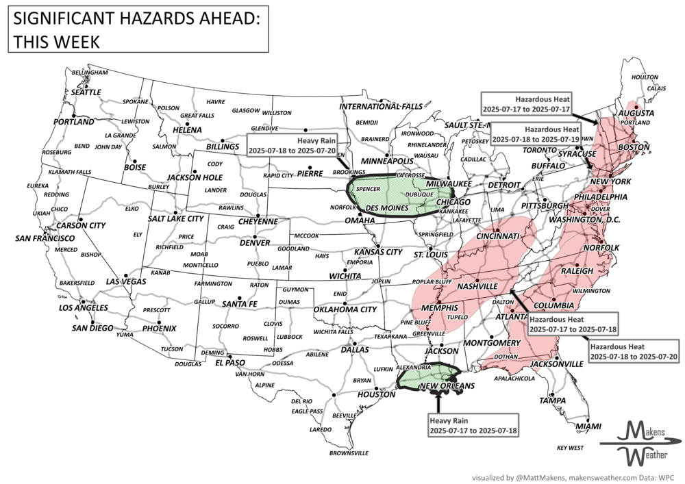
North-Central Plains/Upper Midwest: Repeated thunderstorms and storm complexes may lead to flash flooding.
Holiday Weekend:
Central and Eastern U.S.: Widespread hazardous heat expands under a strong ridge; stay cool and hydrated.
Upper Midwest to Northeast: Storm systems continue tracking east, keeping rain and storm chances elevated.
ON THE RADAR:
KEEP AN EYE TO THE SKY:
IN THE GAUGES:
RECORDS MADE TO BE BROKEN:
ARE YOU CIRRUS?!
1988 Mount Washington, NH reported 4 inches of snow.
1931 The summer flood along the Yangtze River in July and August 1931 was the most severe in history, affecting over 51 million Chinese. 3.7 million people perished from this greatest disaster of the century due to disease, starvation or drowning. This flood was preceded by a prolonged drought in China during the 1928-1930 period.
1825 Kentucky's first official weather observation was taken in Newport. The day was calm with sunny skies in the morning and increasing clouds in the afternoon. The temperature peaked around 80 degrees.


