

Weekly Weather Watch: Monday, June 23rd, 2025
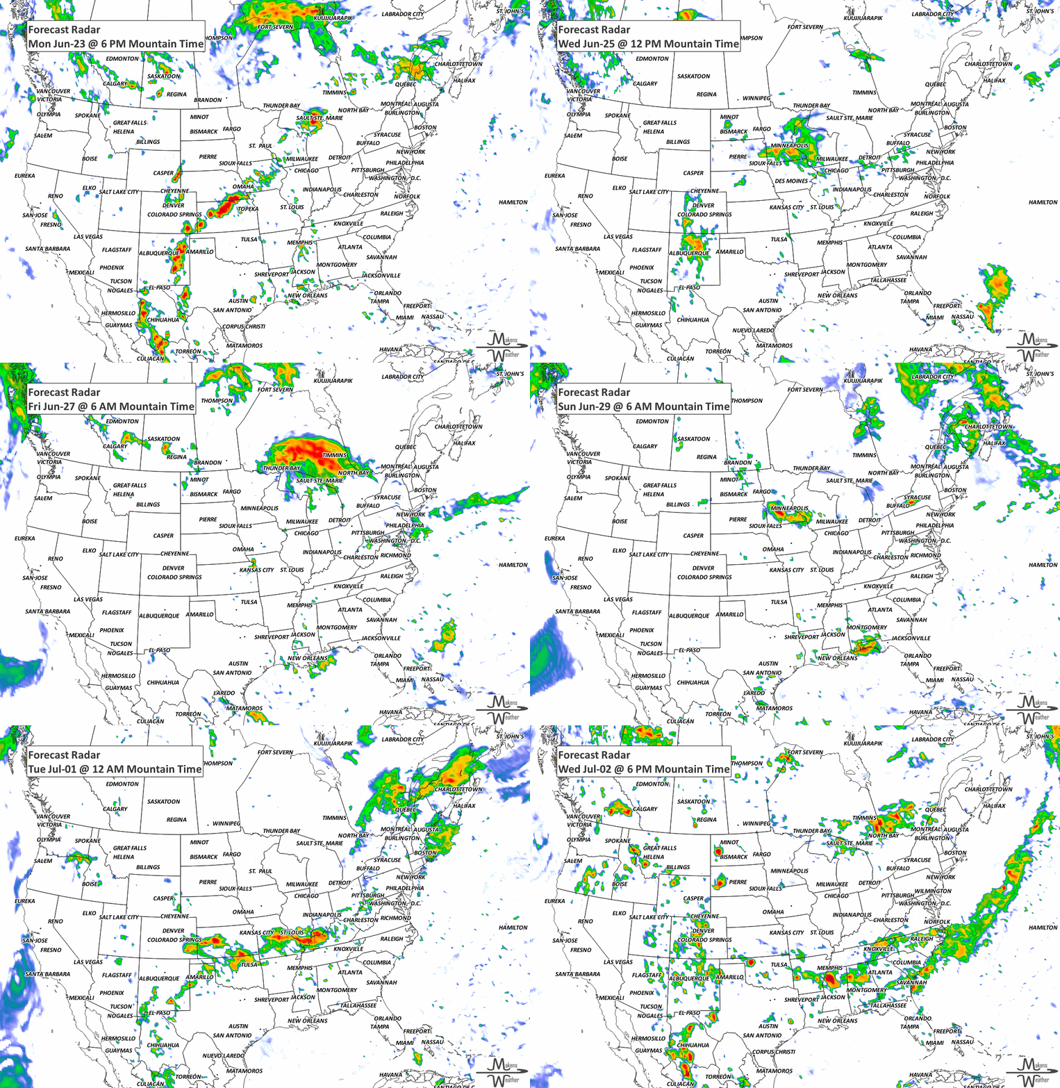
Extreme heat will persist from the Midwest into the Mid-Atlantic, Northeast, Ontario and Quebec this week, posing significant health risks, especially to individuals lacking adequate cooling or hydration. The heatwave, though slightly easing later this week, will continue to impact much of the central and eastern U.S. Additionally, the Southwest and Upper Midwest will experience notable heavy rainfall, increasing flood risks in localized areas. Areas of wildfire smoke will be notable across the western U.S. and much of western to central Canada.
Get personalized weather data straight to your inbox—stay informed and prepared with a monthly membership. Members: New dashboards with your requested custom weather information are being developed and will be distributed to you in the coming weeks. Please look for these emails.
HEADLINERS:

Key Weather Impacts:
Monday-Wednesday: Extreme heat expands from the Midwest to the Northeast, bringing dangerous temperatures and minimal overnight relief. Severe thunderstorms with extreme heat possible for parts of Ontatio and Quebec.
Tuesday: Heavy rainfall expected in the Southwest, especially across New Mexico.
Thursday-Friday: Heavy rainfall and flash flooding potential for the Upper Midwest, particularly in Wisconsin and the Upper Peninsula of Michigan.
Late week/weekend: Additional rounds of thunderstorms from the Midwest to the Eastern Seaboard, with scattered heavy rain possible.
Throughout the week: Continued extreme heat with Major to Extreme Heat Risk in the Midwest, Ohio Valley, and eastern states, with heat indices frequently above 100°F.
Weekend and beyond: Slight risk of extreme heat continues in the eastern U.S. (Saturday-Sunday, June 28-29). Episodic high winds are expected along coastal regions of central and northern California and southwestern Oregon (June 28-July 1).

ON THE RADAR:
KEEP AN EYE TO THE SKY:

IN THE GAUGES:

RECORDS MADE TO BE BROKEN:

ARE YOU CIRRUS?!
1982 At the South Pole Weather Station, Antarctica, the temperature fell to an all-time record low of -117 degrees.
1944 Four tornadoes killed 153 people and caused five million dollars in damage in Pennsylvania, West Virginia, and Maryland. The tornadoes moved southeast along parallel paths, flattening everything in their way. The town of Shinnston, WV, was leveled and left with the majority of the casualties.
The weather pattern is about to make a pretty sharp turn across the country. California starts the week with unusual October heat, including highs well into the 90s and even lower 100s in the Central Valley. Meanwhile, much cooler fall air has reached the Great Lakes and Northeast. The Gulf Coast and Southeast stay unsettled, and there’s that record to watch: a tropical depression is likely to develop over the Gulf this week and could strengthen as it moves northeast. If it becomes a hurricane after the 8th, 2026 will have the latest-first hurricane in the Atlantic Basin record.