Weekly Weather Watch: Monday, December 11th, 2023
The stars at night are big and bright, deep in the heart of Texas….unless a significant precipitation event comes through, which will be the top of the headlines for this Weekly Weather Watch. Generally speaking, we continue to see moisture favor the Northwest and Eastern Seaboard, but a system will develop this week over the Southwest and Southern Plains to douse the area in heavy rain and some snow. For my monthly members, the discussion I showed with scenario two - the lower probability outcome - is becoming more likely with this system. This one has the “feelings” of El Niño…
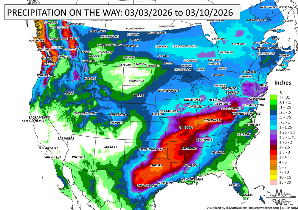
Total precipitation this week is shown, and a zoomed-in image of the Southern Plains.
A widespread one to three-inch water event looks likely during the next few days. Those two images show total precipitation, meaning rain, snow, ice, or a mix. So, just in terms of snowfall, there is heavy, wet snow on the way to New Mexico into the Panhandles.
That’s nice and all, but we have things to do…So, when does it hit? Here’s an animation to show the progression of precipitation this week.
That animation shows the development of heavy showers mid-to-late week before the system combines with some tropical energy and moves along the Eastern Seaboard into next week. There is also occasional moisture to hit the Northwest, but not quite to the extent we have seen recently.
A shift occurs along the West Coast due to the atmospheric pattern over Russia, Asia, and the Pacific Ocean. A strong jetstream flow will begin to look more like what we see during El Niño events: a screaming jet from the tropical Pacific toward the West Coast and across the southern states. This will take some time to form fully, but it is looking likely and will impact us later this month into January. This fits with the “textbook” timing of El Niño impacts.
So, with that said, we are more likely than not tipping our scales toward the moisture aspects of El Niño as we close out 2023 and get into 2024. This week’s system over the South feels very El Niño to me, although attributing any one storm to a single climate-driver is foolish and I’ll criticize myself for doing so. In next week’s Weather Watch, we have a glimpse at Christmas Week and how this pattern shift, and more active jetstream, may impact us.

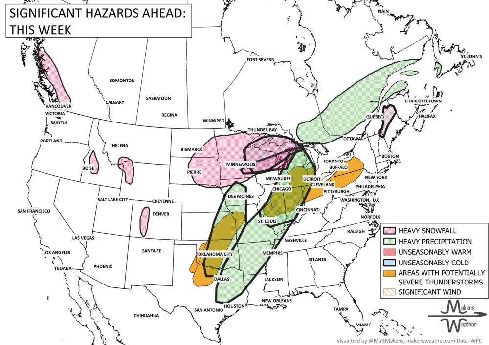
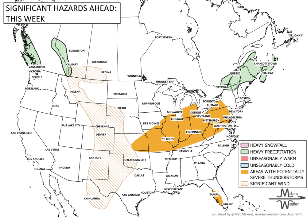
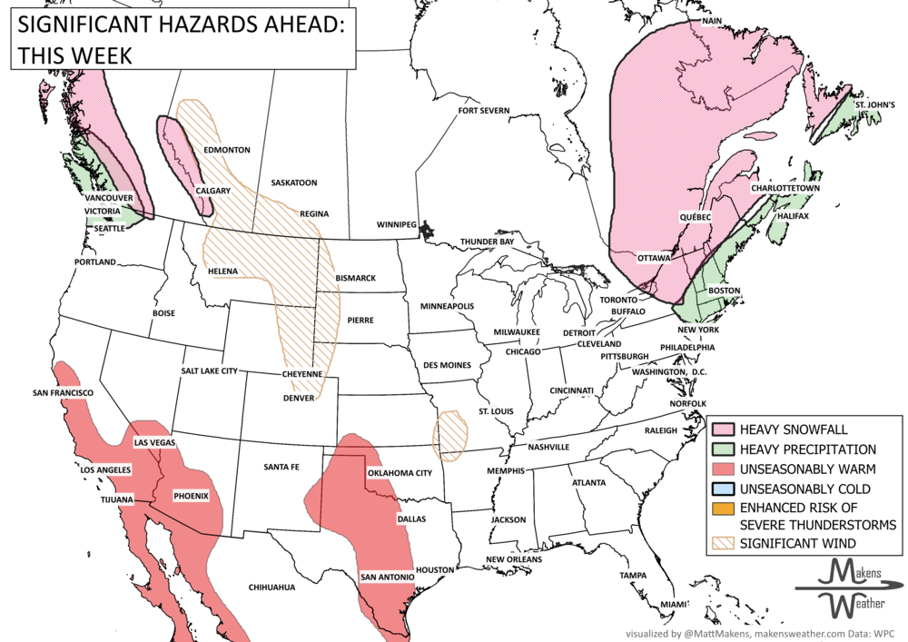
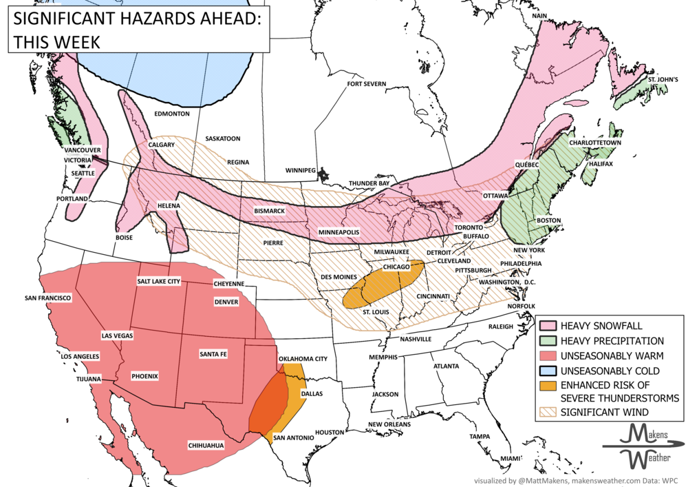


A drawn-out storm pattern will keep much of the country active through the first week of April. A slow-moving front stretching from the Great Lakes into the Plains will separate late-season snow and ice to the north from heavy rain and severe thunderstorms to the south. The setup brings the greatest impacts to parts of the Midwest, Ohio Valley, Southern Plains, Mississippi Valley, and eventually the East Coast, while the West sees mountain snow and then a warming trend heading into the weekend.