


Weekly Weather Watch: Monday, January 15th, 2024
Good morning. I know you are probably still in this deep freeze, depending on where you are exactly, but milder days are ahead… you’ll have to be patient. Later this week a little push of cold comes through many regions, but by the weekend into next week warmer temperatures will return to most of us. This week’s focus is primarily on the cold, then a moisture surge for the West before the Southern Plains catch more precipitation. Here is this week’s Weather Watch, a brief look at the general weather pattern and headlines for the next week to ten days.
The cold remains top of mind for the majority of the country, it’ll take several days to loose the flow of cold.
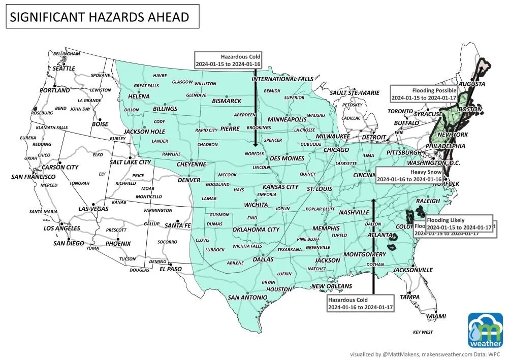
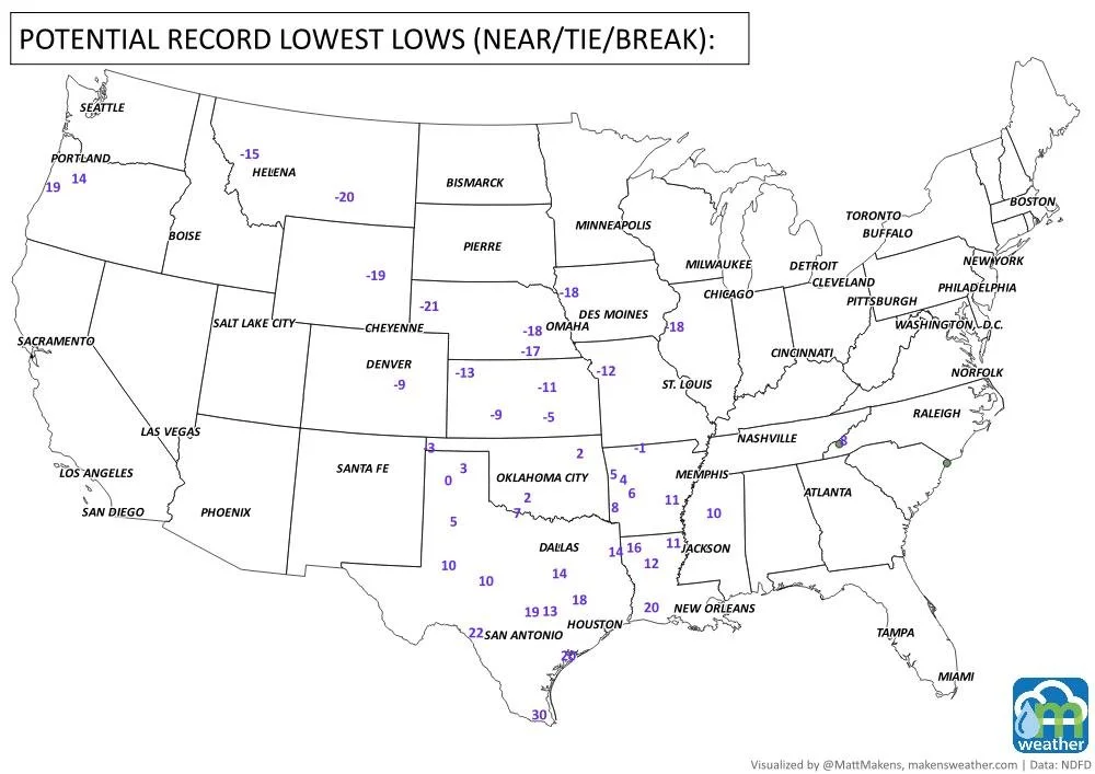
Potential record lows to be set this week: Notice record cold from the Northern Rockies to Mexico. Kansas and Nebraska have some mighty cold records to be set.
After the 20th-22nd, analogs and modeling have warmer temperatures returning for a time. Let’s move on, and get moving, with this storm animation: The West will catch your attention, then from the South to the East later in the period.
Of that storm flow, here is the total estimated precipitation: South TX and LA have some heavy moisture on the way. Take that, drought!

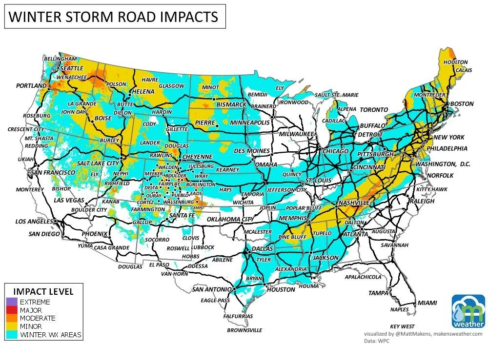
Out of the total precipitation, some of that will be snowfall. The Rockies are continuing to improve the snowpack, and the lake-effect snows to the east have been impressive.

There are several areas of lake-effect snow along the Great Lakes. You perhaps heard about that regarding NFL playoff games this past weekend. Well, that potential continues and will contribute to travel issues for folks, in addition to the significant travel delays expected in the next three days.
Phew, that’s quite a lot of winter. As discussed with the Monthly Members, it is these two middle weeks of the month that had been forecast to be the most active; we have another week or so to go… Be well. Be safe. Blessings, -Matt.
A prolonged and dangerous heat wave will dominate the weather story this week as much of the central and eastern United States experiences some of the hottest weather of the year. Heat index values above 100 degrees will become widespread, with some communities seeing readings between 105 and 115 degrees and little relief at night. At the same time, several rounds of severe thunderstorms are expected from the High Plains through the Upper Midwest and Northeast, bringing the threat of damaging winds, large hail, and localized flash flooding. Out West, cooler-than-normal temperatures will continue while dry conditions keep wildfire concerns elevated across parts of the Four Corners and Great Basin. Air quality is an issue across Alberta to Quebec due to wildfire smoke. Heavy precipitation is possible from far eastern Saskatchewan to far western Manitoba.