


Weekly Weather Watch: Monday, September 15th, 2025
The U.S. weather pattern is shifting into a classic early fall setup. A nor’easter-like coastal storm is spinning up off the Southeast, set to hit the Mid-Atlantic coast midweek with rain, wind, and rough surf. At the same time, stubborn late-summer heat grips the Mississippi Valley and Northeast, while storm chances reload across the Central and Northern Plains. A soggy pattern also lingers over California, South Florida, and the Southwest into the weekend. Meanwhile, fog and air quality issues continue across British Columbia, Alberta, and Saskatchewan.
💧 THE MONTH’S UPDATE
So far, September is tracking closely with the trends outlined in our monthly outlook, shared with members at the start of the month and updated weekly. In addition, members get full access to the week’s forecast conditions with the interactive dashboard:
📈 Track it 👉 Join Now to Access the Dashboard
HEADLINERS:
Key Weather Impacts:
Monday–Wednesday:
Mid-Atlantic coast faces rain, gusty winds, and minor coastal flooding as a coastal low tracks inland.
Northern Plains to Upper Midwest: Scattered thunderstorms continue early week.
Tuesday–Thursday:
Central Rockies and High Plains: Increasing storm coverage, especially overnight Tuesday into Wednesday.
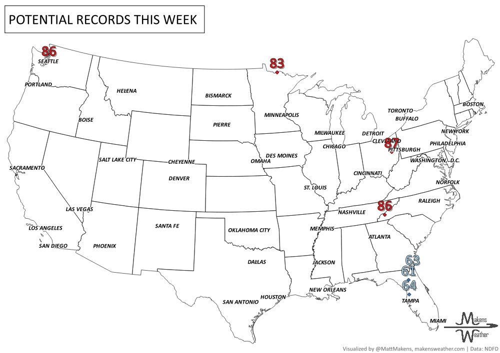
Great Lakes and Northeast: Staying unseasonably warm, especially Midwest and Mississippi Valley, where highs may approach daily records.
Thursday–Saturday:
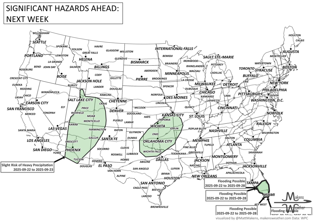
North-Central Plains to Upper Midwest: Slow-moving low brings rounds of rain; localized flooding possible from Kansas City to St. Louis.
California and Great Basin: Surge of Pacific moisture brings increased rain chances.
South Florida: Heavy rain risk continues for the Miami–Palm Beach corridor.
Weekend:
A strong cold front ushers cooler air down the Eastern Seaboard with cool air damming possible in the Carolinas.
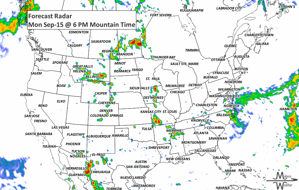
ON THE RADAR:
KEEP AN EYE TO THE SKY:

IN THE GAUGES:

RECORDS MADE TO BE BROKEN:
UN-DROUGHTABLY DRY:

TROPICAL TIDINGS:
Tropical Storm Mario (East Pacific):
Location: ~19.4°N, 112.3°W
Winds: 50 kt (60 mph)
Movement: West-northwest at ~10 kt
Impacts: Peak seas near 12 ft; expected to weaken into a remnant low by Wednesday, dissipating by Friday well off the Baja coast.
Outlook: No direct threat to land, but mariners should monitor for rough seas near southern Baja California.
Tropical Development Outlooks:
Eastern Pacific (Off Southern Mexico):
A broad trough has a medium chance (next 7 days) of tropical development as it moves west-northwestward.
Environmental conditions are favorable, and a tropical depression may form mid-to-late week.
Atlantic Basin:
Near 36W (Central Tropical Atlantic):
A tropical wave with a low-pressure center is producing strong convection.
High chance of developing into a tropical depression later this week as it tracks west-northwest.
At 50W (Another tropical wave):
Less organized but still monitored.
In the Caribbean (~70W):
Typical wave with scattered showers.
No immediate signs of development.

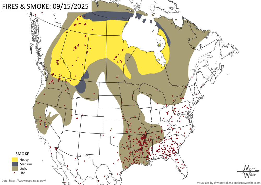
WHERE THERE’S SMOKE, THERE’S …
ARE YOU CIRRUS?!
1989 "Princess", the Hurricane Hunter reconnaissance plane, was nearly lost when it went into the eye of Hurricane Hugo. It apparently hit a tornado-like vortex and lost two of the four engines. Fortunately, the crew found a weaker spot in the eyewall and escaped.
1988 A tornado tracked a 25-mile path from Rietspruit to Bethesda, South Africa.
A soggy pattern stretches across the U.S. this week, with heavy rain and flash flood risks in the Ohio Valley, New Mexico, and possible Nor’easter development near the Mid-Atlantic. Warmth hangs on in the East before a sharp cooldown.