


Weekly Weather Watch: Tuesday, September 23rd, 2025
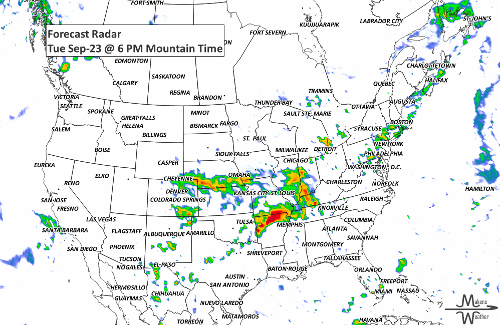
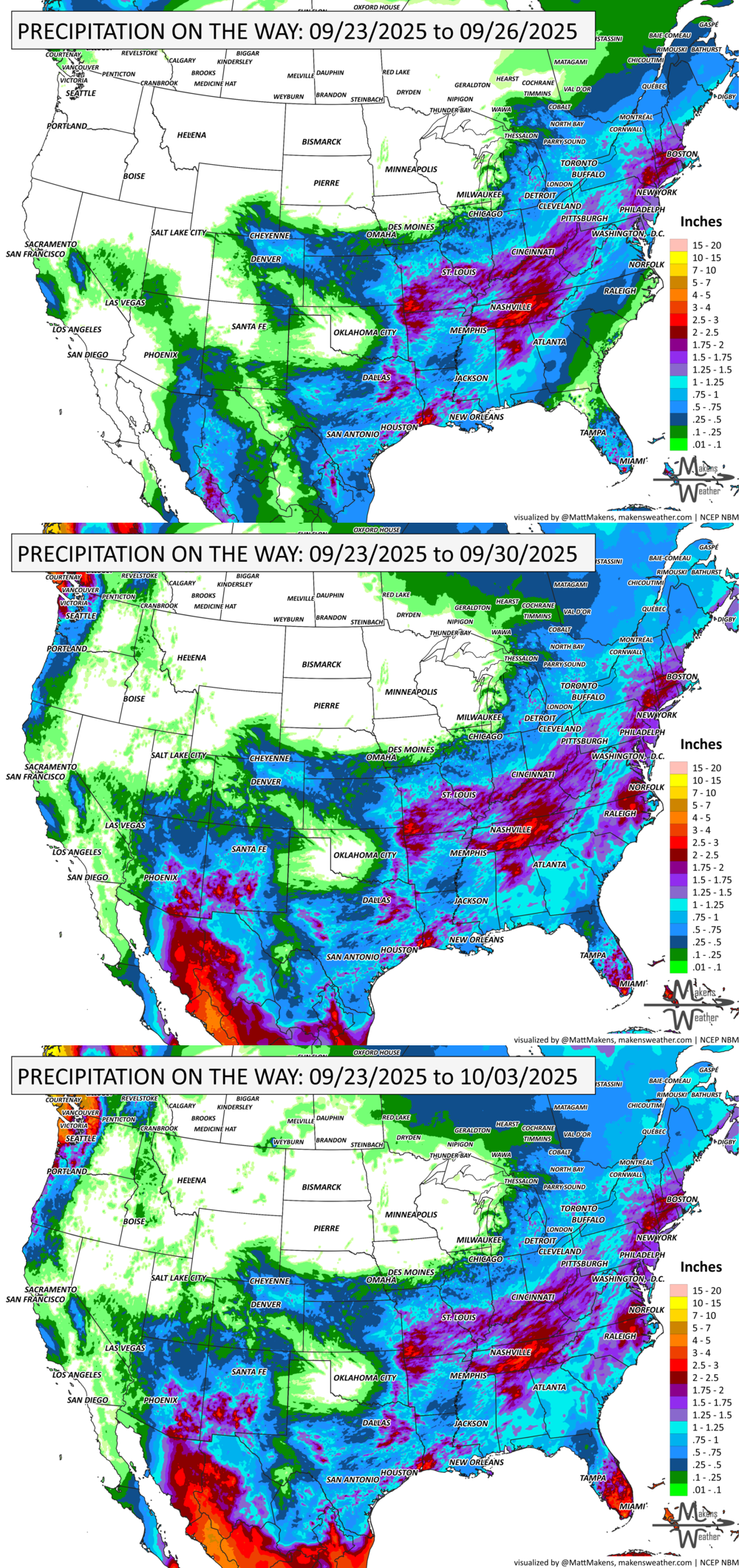
A stormy stretch continues across the central and southern Plains early this week, with widespread thunderstorms and a risk of flash flooding and severe weather, including hail and isolated tornadoes. As a cold front advances, the rain shifts eastward, soaking the Ohio Valley, Mid-South, and Gulf Coast midweek before spreading into the Southeast and Mid-Atlantic by Friday. The Southwest also turns wetter later this week as tropical moisture feeds daily downpours. Cooler temperatures will follow the front into the central U.S., while the Northeast and West remain seasonably warm. Across Canada, heavy precipitation is expected to fall on Coastal British Columbia and from the Peace Region to the Southern Rockies. Elsewhere, gusty wind will impact provinces stretching from Alberta to the Maritimes later this week.
💧 THE MONTH’S UPDATE
September is certainly shaping up to be the transitional month of fall weather, as outlined in our monthly outlook, shared with members at the start of the month and updated weekly. There are developing signs that October will be quite active mid-month, which we will discuss in the next monthly update. In addition, members get full access to the week’s forecast conditions with the interactive dashboard:
📈 Track it 👉 Join Now to Access the Dashboard
HEADLINERS:
Key Weather Impacts:
Tuesday–Wednesday:
Widespread thunderstorms from the Great Lakes to Texas with flash flooding and severe weather likely.
Flood Watches in place, especially across the ArkLaTex, Ozarks, and Ohio/Tennessee Valleys.
Some damaging winds, large hail, and a few tornadoes possible.
Wednesday–Friday:
Cooler air slides into the central and southern Plains, pushing highs into the 60s and 70s.
Thunderstorm focus shifts east toward the Ohio Valley, Mid-South, and Gulf Coast.
Isolated flash flooding possible in West Texas and southern New Mexico.
Friday–Weekend:
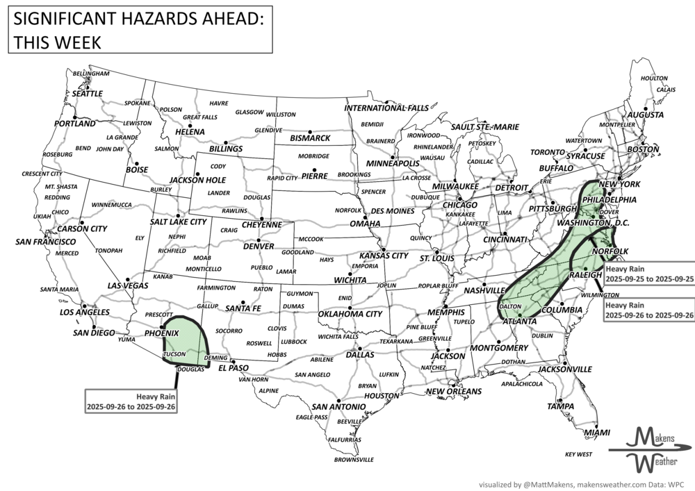
Heavy rain expands along a slow-moving cold front in the Southeast and Mid-Atlantic.
Locally heavy rain for southeast Arizona and southwest New Mexico as tropical moisture surges into the Southwest.
Marginal flood risk across both regions with isolated flash flooding concerns.
Temperatures:
Warmth dominates the Northeast, West Coast, and Northern Plains, with highs in the 70s to 90s.
Cooler-than-normal in the central Rockies and adjacent Plains, with some mountain snow possible at high elevations.
ON THE RADAR:
KEEP AN EYE TO THE SKY:

IN THE GAUGES:
GRAB A RULER:

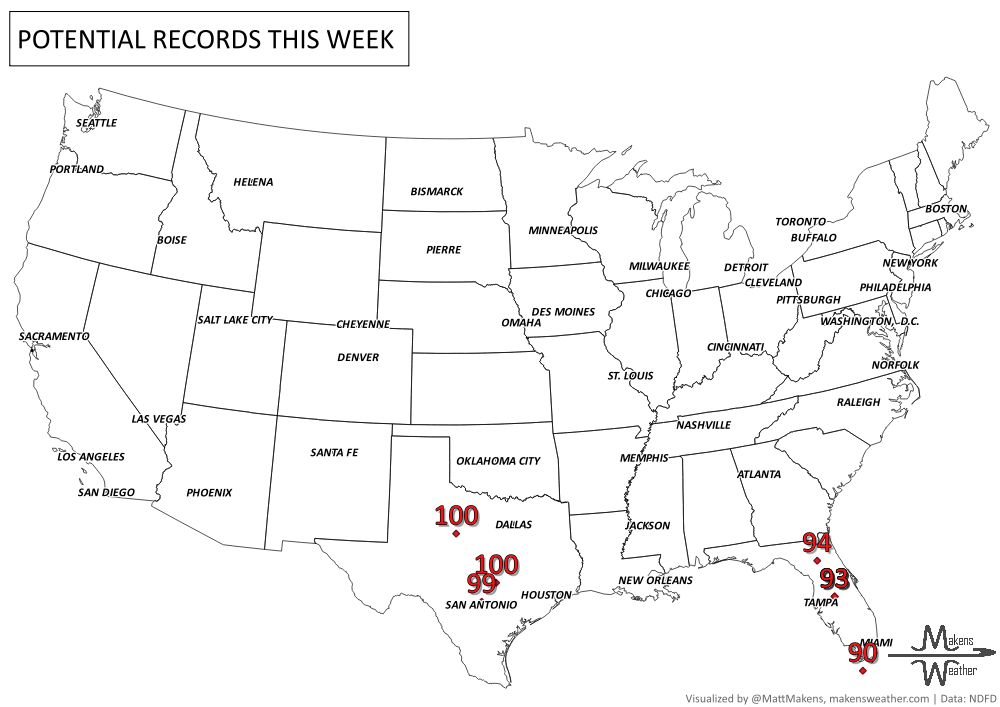
RECORDS MADE TO BE BROKEN:
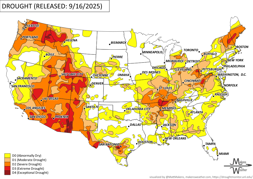
UN-DROUGHTABLY DRY:
TROPICAL TIDINGS:
Hurricane Gabrielle remains well offshore in the Atlantic but is generating large swells, resulting in life-threatening rip currents and rough surf along much of the U.S. East Coast through midweek. Farther east in the Atlantic, two tropical waves are being monitored closely by the National Hurricane Center:
Invest 93L, located near 46°W, shows signs of slow organization and could develop further as it moves west toward the Caribbean.
Invest 94L, located near 60°W, is a stronger tropical wave already producing widespread thunderstorms. It is expected to bring heavy rainfall and gusty winds to the Leeward Islands, Puerto Rico, and the Virgin Islands by mid-to-late week.
In the Pacific, Tropical Storm Narda is strengthening and forecast to become a hurricane as it tracks westward off the Mexican coast. While it poses no immediate threat to land, it is producing dangerous seas in the region.
Although none of these systems currently pose a direct threat to the U.S., the tropics are clearly becoming more active, and conditions warrant close monitoring over the next 5–7 days.

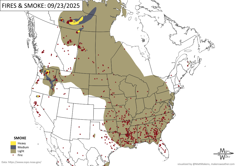
WHERE THERE’S SMOKE, THERE’S …
ARE YOU CIRRUS?!
1815 The poem "The September Gale" written by Oliver Wendell Holmes was written about a hurricane that struck New England on this date. Holmes was just six years old at the time.
1983 Super Typhoon Forrest underwent the most rapid intensification of any tropical cyclone. Its central pressure crashed 100mb in 24 hours.
1551 The Grand Harbour, located in Valeeta, Malta, was hit by a waterspout which moved inland and caused extensive damage. A shipping armada in the harbour about to go into battle was destroyed by the waterspout killing at least 600 people.
A soggy pattern stretches across the U.S. this week, with heavy rain and flash flood risks in the Ohio Valley, New Mexico, and possible Nor’easter development near the Mid-Atlantic. Warmth hangs on in the East before a sharp cooldown.