


Weekly Weather Watch: Tuesday, October 14th, 2025
A potent Pacific storm is bringing a wet and wintry start to the week for the western U.S., with Southern California and the Southern Rockies facing the risk of flash flooding. Heavy snow is piling up in the Sierra Nevada and will shift to the Northern Rockies by Wednesday. As the week continues, the storm moves east, bringing widespread rain to the Plains, Mid-South, and eventually the East Coast. Meanwhile, another storm system is set to push into the Pacific Northwest by late weekend, keeping the unsettled weather going into next week. Tropical Storm Lorenzo remains out in the Atlantic with no expected U.S. impact. Across Canada, heavy western moisture, including snow in the mountains. Elsewhere, semi-heavy moisture will move across the central and eastern Prairies toward Ontario. Also, widespread frost and freezing temperatures are possible for all provinces.
💧 OCTOBER’S UPDATE
Members, October’s outlook is on track, and yesterday you saw the outlook into mid-November. In addition, members get full access to the week’s forecast conditions with the interactive dashboard:
📈 Track it 👉 Join Now to Access the Dashboard
HEADLINERS:
Key Weather Impacts:
Tuesday (Oct 14):
Heavy rain and flash flooding risk in Southern California and the Southern Rockies
Snowstorm in the Sierra Nevada Mountains
Wednesday (Oct 15):
Snow expands into the Northern Rockies
Rain and storms spread into the Great Basin, Central Rockies, and Southern High Plains
Thursday (Oct 16):
Showers linger in the Rockies and Northern Plains
Rain reaches the Great Lakes
Friday (Oct 17):
A new system brings increasing rain to the Mid-Mississippi Valley
Mild temps surge ahead of the front, especially in the Central U.S.
Saturday (Oct 18):
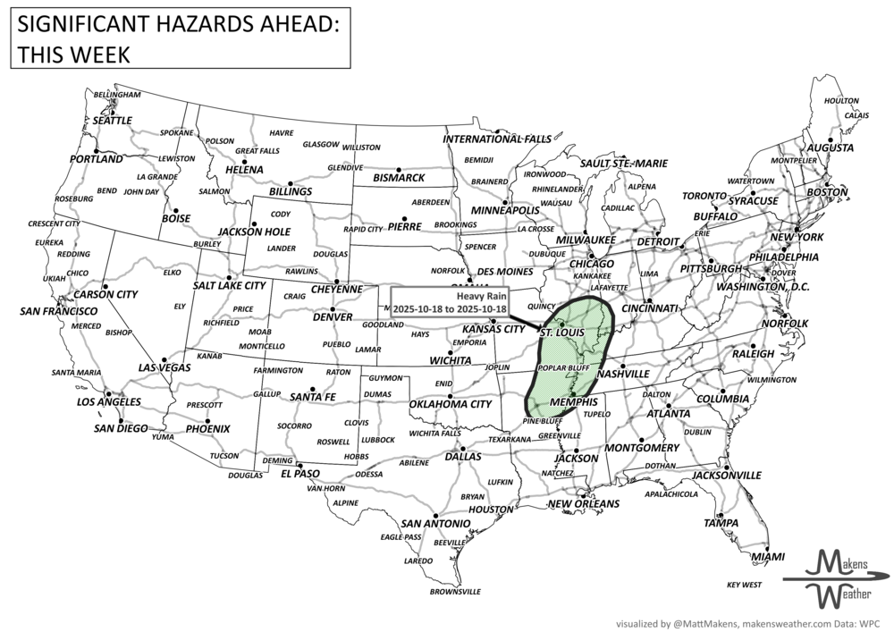
Marginal risk of heavy rain across the Mid-South
Breezy and wet across parts of the Northern Plains
Sunday–Monday (Oct 19–20):
Rain moves into the Northeast and Southeast
Another Pacific system enters the Pacific Northwest with valley rain and mountain snow
Tuesday (Oct 21):
Wet pattern shifts across the West again with potential for renewed mountain snow
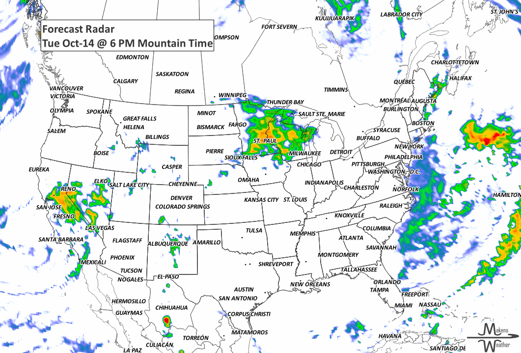
ON THE RADAR:
KEEP AN EYE TO THE SKY:

IN THE GAUGES:
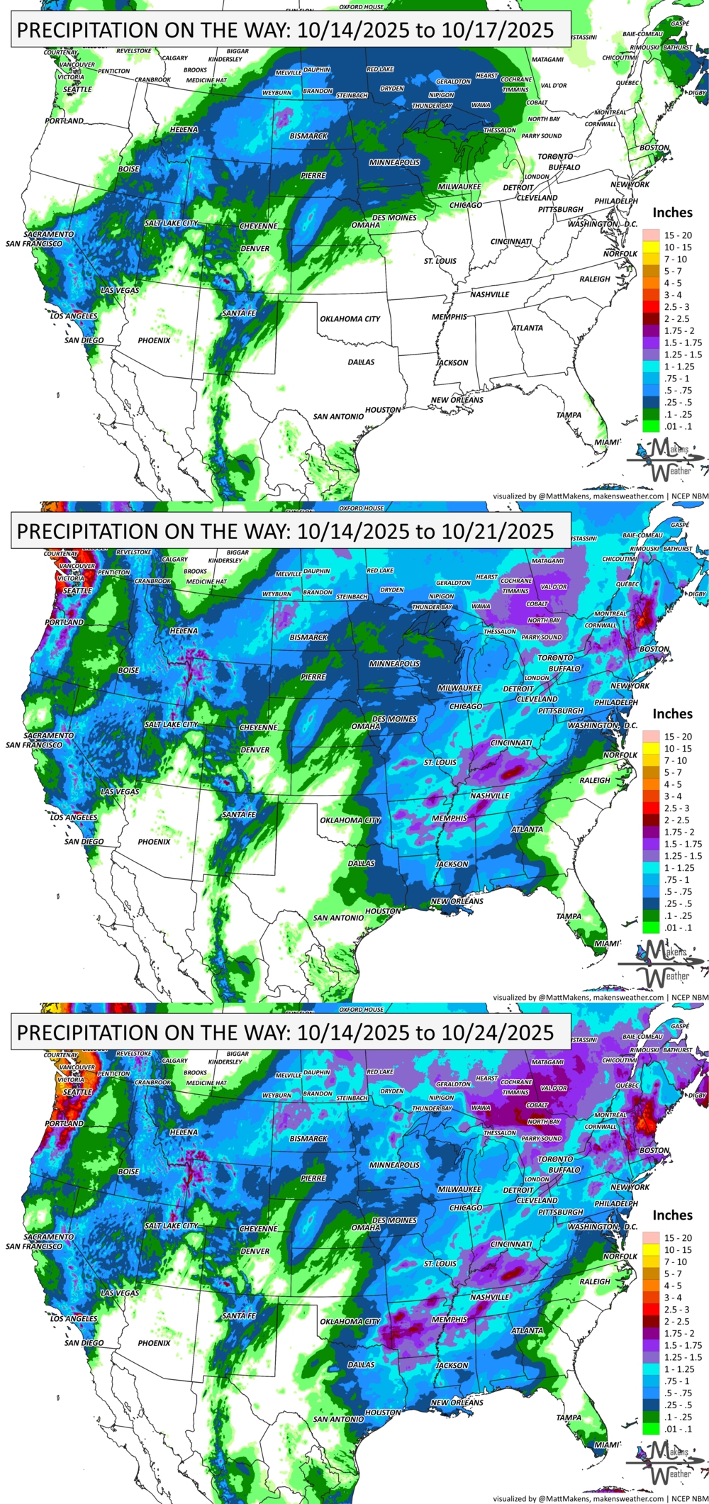
GRAB A RULER:

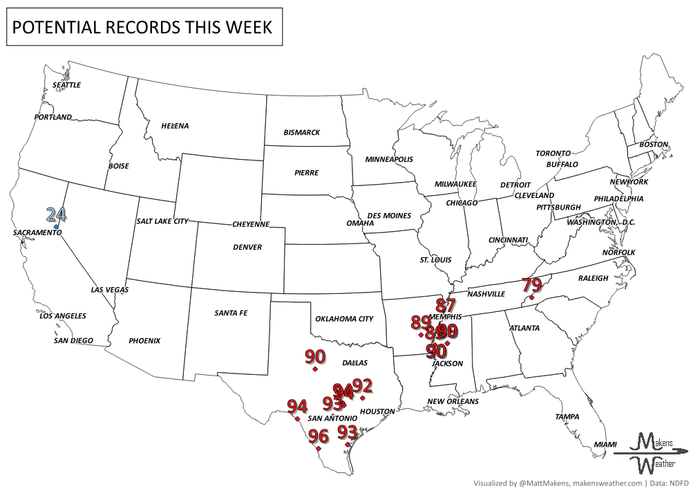
RECORDS MADE TO BE BROKEN:
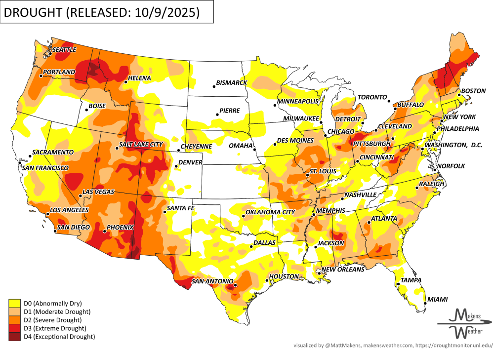
UN-DROUGHTABLY DRY:
Drought conditions worsened this week across parts of the Northeast, Midwest, and Southeast, especially in areas like Missouri, Illinois, Indiana, and Georgia. In contrast, southeast Missouri, the Ohio River Valley, and parts of Louisiana saw welcome rainfall, with some spots receiving over 5 inches—leading to significant drought improvement.
Dry weather also triggered new drought development in northeast Montana, west Texas, and western Louisiana. Meanwhile, recent heavy rains brought widespread improvement in the Las Vegas area, northern Nevada, Utah, Oregon, and southwest Idaho. -U.S. Department of Agriculture
TROPICAL TIDINGS:
Tropical Storm Lorenzo is currently spinning in the central Atlantic, about 1,000 miles west of the Cabo Verde Islands. The storm is poorly organized, with most of the stronger thunderstorms located east of the center.
Lorenzo’s Movement: The storm is drifting northwestward and is expected to turn north, then northeast by midweek.
No U.S. Threat: At this time, Lorenzo poses no direct threat to North America. No coastal watches or warnings are in effect.
Forecast Outlook: Little change in strength is expected, and Lorenzo should remain over open waters.
Elsewhere in the tropics, a weak tropical wave near 96W in the eastern Pacific is producing scattered showers and storms. No immediate development is expected, but it will be monitored as it moves west. -NOAA’s NHC

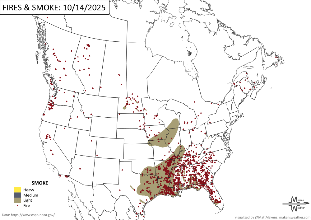
WHERE THERE’S SMOKE, THERE’S …
ARE YOU CIRRUS?!
1965 24.28 inches of rain fell on Fort Lauderdale, Florida. Two weeks later, another 18.15 inches fell.
1942 Midnapore Cyclone struck India and was accompanied by wind speeds of 140 mph.
1966 A half mile wide F5 tornado struck Belmond, IA during a homecoming parade. Fortunately the threatening skies caused the crowd to seek safe shelter indoors.
A drawn-out storm pattern will keep much of the country active through the first week of April. A slow-moving front stretching from the Great Lakes into the Plains will separate late-season snow and ice to the north from heavy rain and severe thunderstorms to the south. The setup brings the greatest impacts to parts of the Midwest, Ohio Valley, Southern Plains, Mississippi Valley, and eventually the East Coast, while the West sees mountain snow and then a warming trend heading into the weekend.