


Weekly Weather Watch: Tuesday, October 21st, 2025
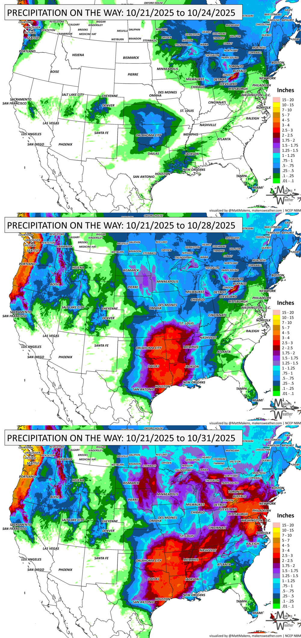
A dynamic weather pattern will dominate the U.S. this week. Scattered showers and lake-effect thunderstorms will linger across the Great Lakes, while breezy, cooler air spreads into the Northeast. The Southern Plains face a growing flood risk by Friday as heavy rain and storms roll in from Oklahoma to Louisiana. Meanwhile, Tropical Storm Melissa has formed in the Caribbean, with potential impacts for Haiti and Jamaica by late week—though the track remains highly uncertain. Out West, a shift toward colder weather will bring rain to the Pacific Northwest and snow to the Rockies by the weekend. And in southern Texas, unseasonable heat continues with record highs and heightened fire weather concerns. Across Canada, areas of strong wind for the West along with heavy precitation from British Columbia to the mountainous areas of Alberta. Pockets of heavy moisture will hit sections of Ontario and Quebec.
💧PRF INSURANCE
For those in agriculture, PRF insurance isn’t due until December, but I’m already processing many requests for 2026 rainfall grid outlooks. Members receive discounts on custom PRF grid analyses.
📈 The latest outlooks and conditions - track it 👉 Join Now to Access the Dashboard
HEADLINERS:
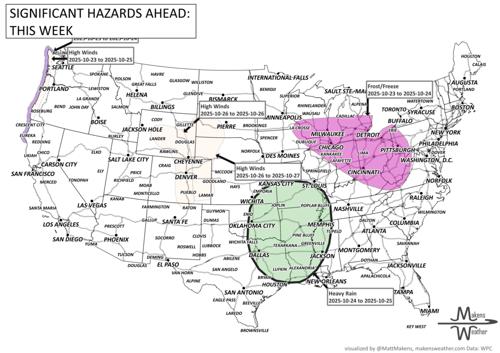
Key Weather Impacts:
Tuesday–Wednesday
Great Lakes: Chilly, with rain and possible lake-effect thunderstorms near Lake Erie.
Mid-Atlantic & Northeast: Scattered showers and gusty winds reaching New England by Wednesday.
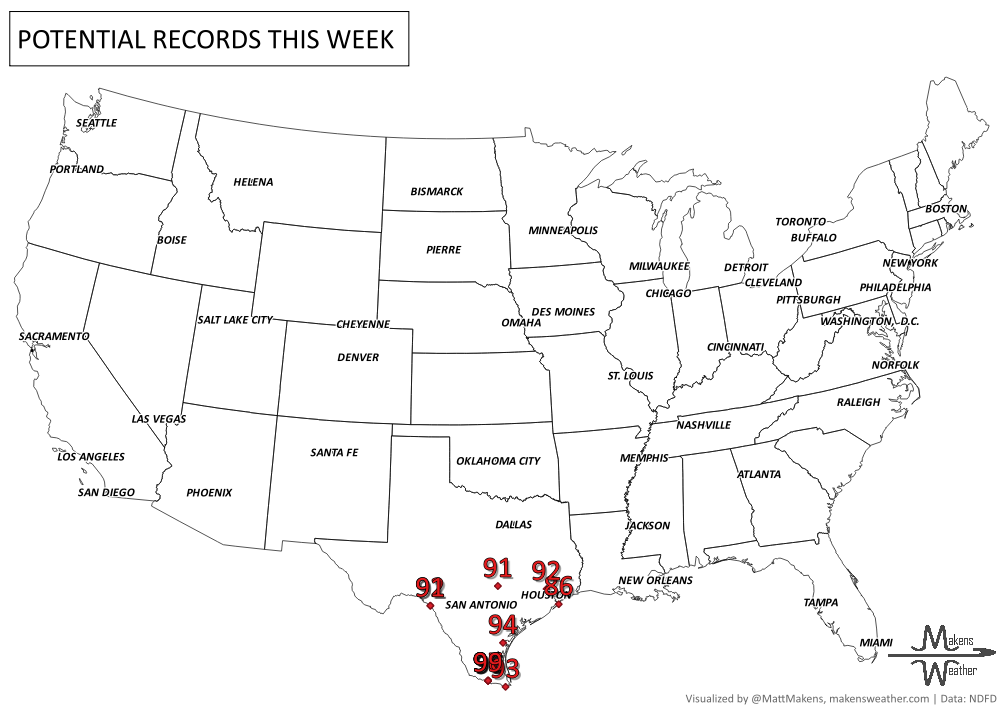
Southern Texas: Near-record heat (90s) and fire weather concerns in north-central Texas.
Florida: Showers taper off as a weakening front slides across the Sunshine State.
Thursday–Saturday
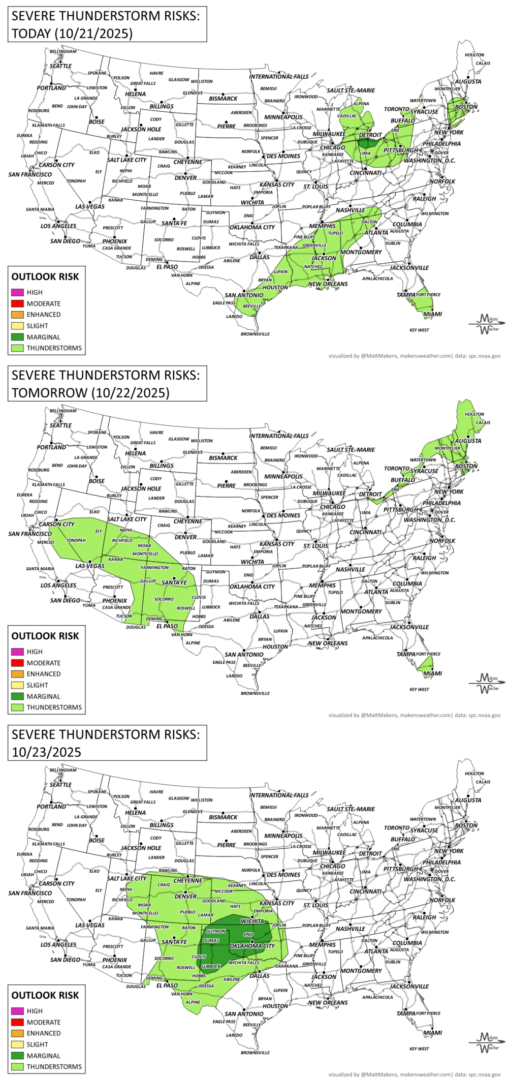
Southern Plains: Heavy rain and storms from central Oklahoma to Louisiana; flash flooding possible.
Pacific Northwest: Incoming system brings rain and mountain snow, especially in northern California and Washington.
Tropical Storm Melissa: Nearing Haiti and Jamaica with heavy rain and flooding potential by late week.
Sunday–Tuesday
Rockies & Intermountain West: Widespread snow with over a foot possible at higher elevations.
Upper Midwest to Missouri: Gusty winds, scattered showers, and developing low pressure.
Caribbean: Monitoring Tropical Storm Melissa, with interests in Cuba and Hispaniola urged to stay alert.
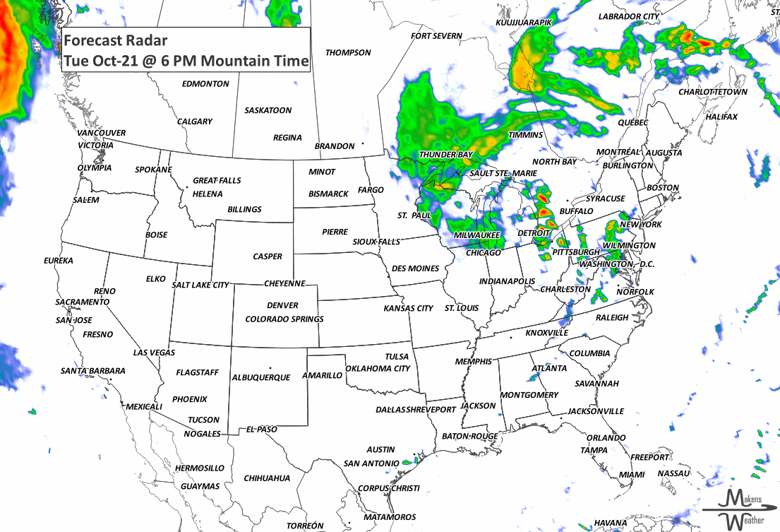
ON THE RADAR:
KEEP AN EYE TO THE SKY:
IN THE GAUGES:
GRAB A RULER:

RECORDS MADE TO BE BROKEN:
UN-DROUGHTABLY DRY:
Recent heavy rains brought meaningful drought improvement to parts of the Four Corners, southern Colorado, and eastern South Carolina, where some areas saw 4 to 6 inches of rain or more. The wet conditions also helped ease dryness across the Ohio Valley and stretches of the Atlantic Coast from South Florida to southern New England. However, drought conditions worsened in parts of the Deep South, central Gulf Coast, and the Lower Mississippi Valley, where rainfall was limited. Dryness also held firm across portions of the Great Plains, Great Lakes, and northern New England. While recent rains helped, many areas still need sustained moisture to erase long-term deficits. -U.S. Department of Agriculture

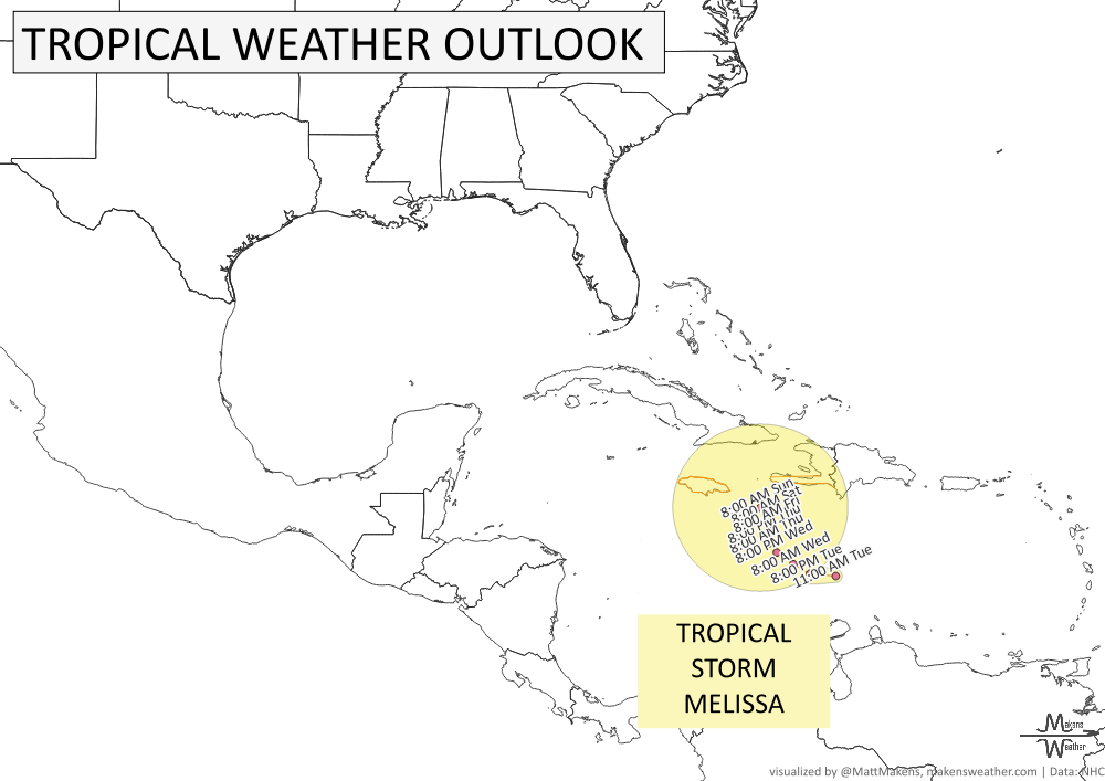
TROPICAL TIDINGS:
Tropical Storm Melissa has developed over the central Caribbean Sea, and while it’s still disorganized, it poses a growing threat to parts of the Greater Antilles. The storm is forecast to slowly move northwest, potentially nearing Haiti and Jamaica by Thursday or Friday. However, there is still significant uncertainty in Melissa’s exact track and intensity. Some models suggest it may stall or drift west, remaining in the Caribbean into the weekend.
Key Messages:
Melissa could bring heavy rainfall and dangerous flash flooding to Haiti and the Dominican Republic through the weekend, with a risk of landslides in mountainous areas.
A Hurricane Watch is in effect for the southern coast of Haiti, and a Tropical Storm Watch is in effect for Jamaica. Residents should finish storm preparations by Thursday.
There is high uncertainty in Melissa’s future path. Interests in Cuba, Hispaniola, and nearby regions should monitor forecasts closely through the week. -NOAA’s NHC
ARE YOU CIRRUS?!
1934 A severe windstorm lashed the Pacific Northwest coast. In Washington, 22 deaths were reported and $1.7 million in damage was done, mainly to timber. Winds reached 87 mph at North Head, and waves reached 20 feet high on the inland waters of Puget Sound and Lake Washington.
1975 Carlton Fisk made history on this day because of a walk-off home run in the 1975 World Series, after it had been postponed by rain for three days.
A drawn-out storm pattern will keep much of the country active through the first week of April. A slow-moving front stretching from the Great Lakes into the Plains will separate late-season snow and ice to the north from heavy rain and severe thunderstorms to the south. The setup brings the greatest impacts to parts of the Midwest, Ohio Valley, Southern Plains, Mississippi Valley, and eventually the East Coast, while the West sees mountain snow and then a warming trend heading into the weekend.