
Weekly Weather Watch: Tuesday, November 10th, 2026
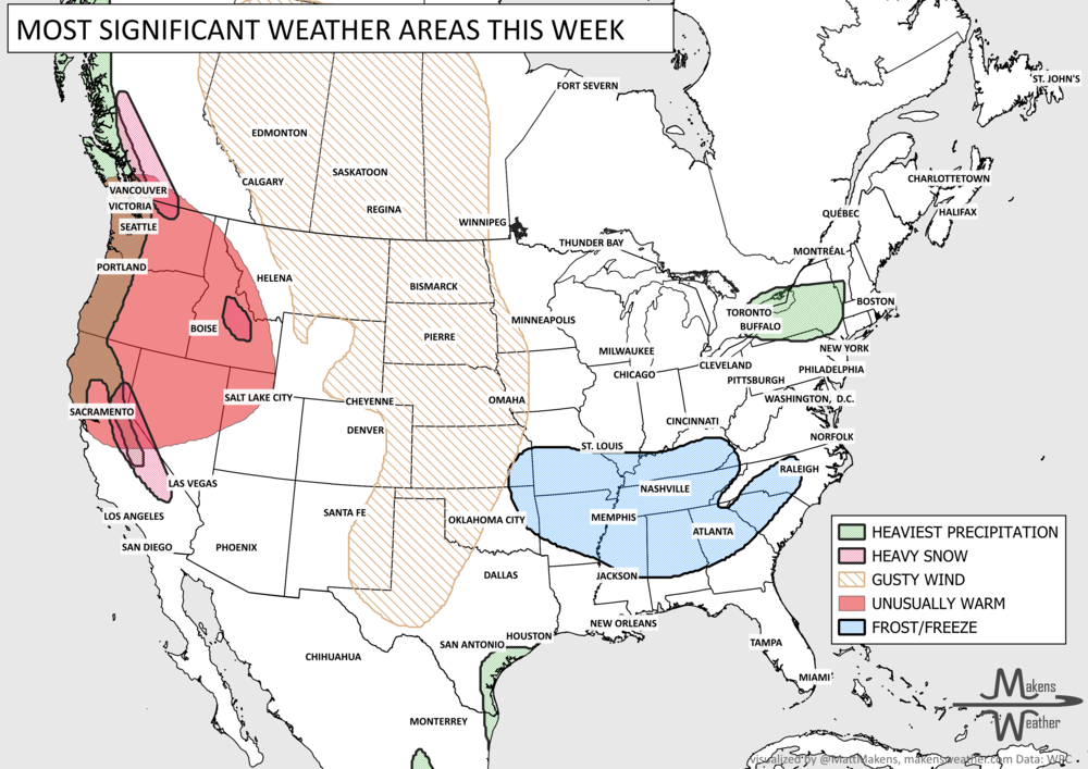
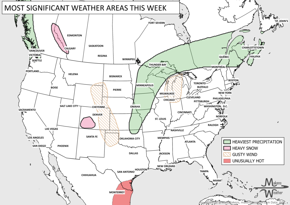
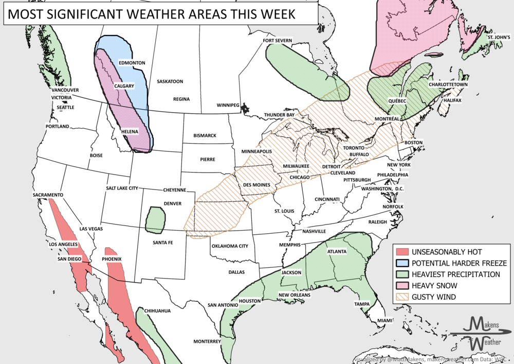
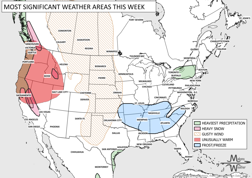
An active stretch of weather is ahead for both coasts, while much of the middle stays relatively mild. A series of Pacific storms will bring rounds of rain, mountain snow, and gusty winds from British Columbia and Washington to northern California, with heavier precipitation developing late this week and into the weekend. Meanwhile, a strong storm system will move across the Midwest and eastern U.S./eastern Canada, bringing gusty winds, scattered thunderstorms, and a sharp drop in temperatures. By Friday and Saturday, parts of the Southeast, Ohio Valley, and Appalachians could feel more like December, with the first widespread frost and freeze of the season in some areas. We discuss the snow chances on SnowBros.
📈 The latest weekly and monthly outlooks 👉 Join Now to Access
HEADLINERS:
What to watch:
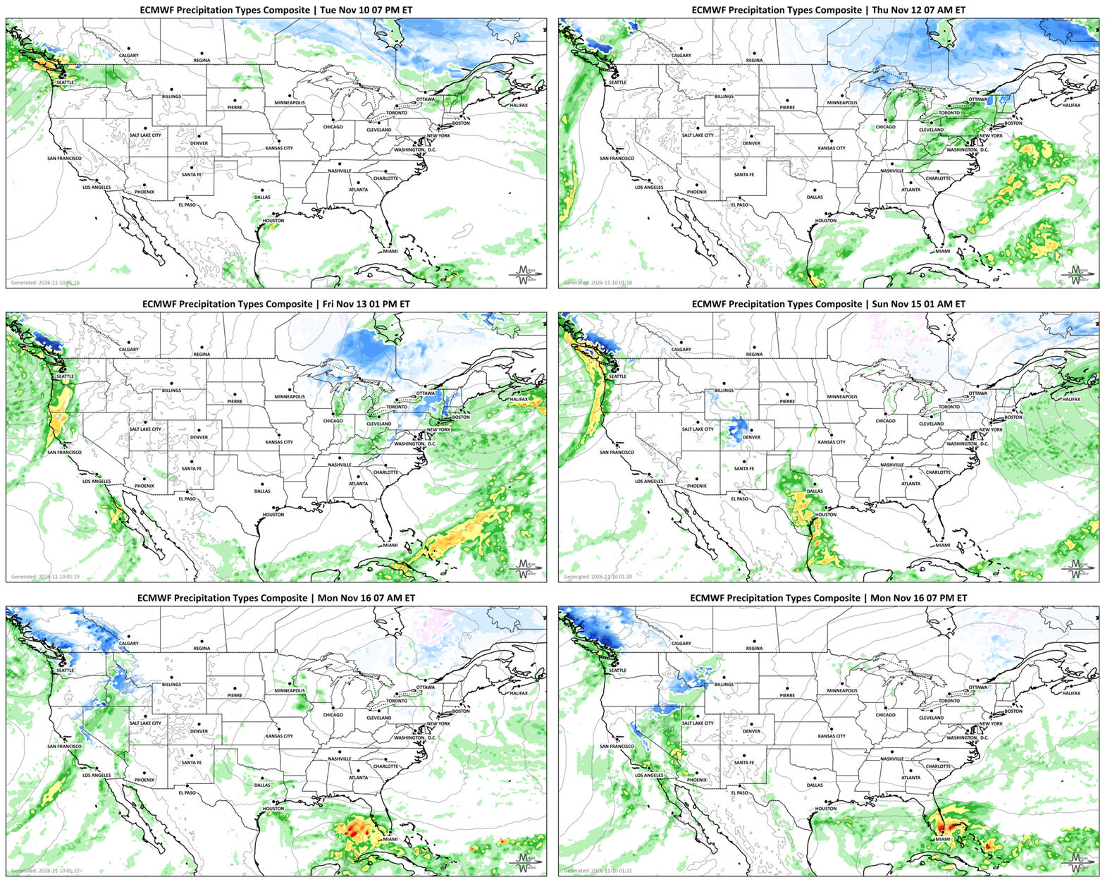
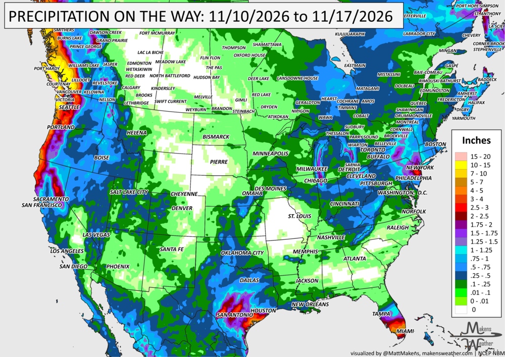
Tuesday-Wednesday: Periods of moderate rain and mountain snow continue across the Pacific Northwest, with the heaviest precipitation focused on the Olympic Peninsula. Scattered showers affect the Great Lakes and Northeast to eastern Canada, while thunderstorms and gusty winds develop across the Midwest and Ohio Valley on Wednesday.
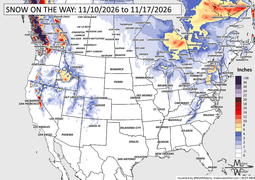
Wednesday-Thursday: A strong cold front pushes across the eastern half, bringing increasing winds and falling temperatures. Wet snow becomes possible around the Upper Great Lakes, Ontario and Quebec, while rain and thunderstorms move through parts of the Ohio and Tennessee Valleys.
Friday-Saturday: Much colder air settles across the Southeast, Mid-Atlantic, and Appalachians, with temperatures running 5 to 15 degrees below normal. Frost and freezing temperatures become widespread in parts of the Deep South, Tennessee Valley, and Ohio Valley. Rain and higher-elevation snow linger across the Northeast/Eastern Canada, with lake-effect precipitation around the Great Lakes.
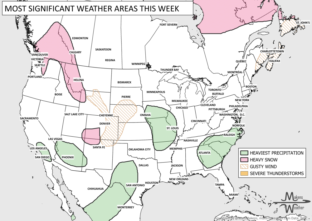
Friday-Weekend: Another round of Pacific moisture brings widespread rain to northern California, Oregon, Washington, and British Columbia, with 1 to 2 inches possible in lower elevations. Colder air lowers snow levels across the Sierra Nevada and northern California mountains, where moderate snowfall is possible.
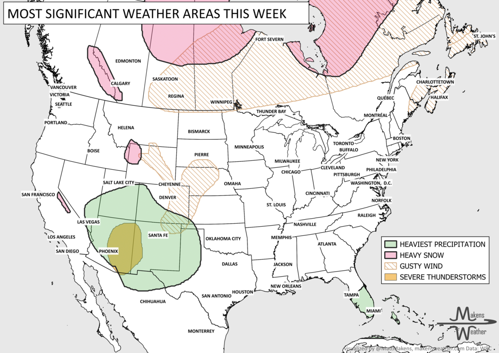
Weekend-Monday: Additional rain and thunderstorms are possible across southern Texas, while Pacific moisture spreads inland toward the Intermountain West. Temperatures begin to recover across the East, while the Plains remain relatively mild.
SET YOUR WATCHES - WHEN THE MOISTURE ARRIVES:
IN THE GAUGES, PRECIPITATION THROUGH THE 17TH:
GRAB A RULER, SNOWFALL THROUGH THE 17TH:
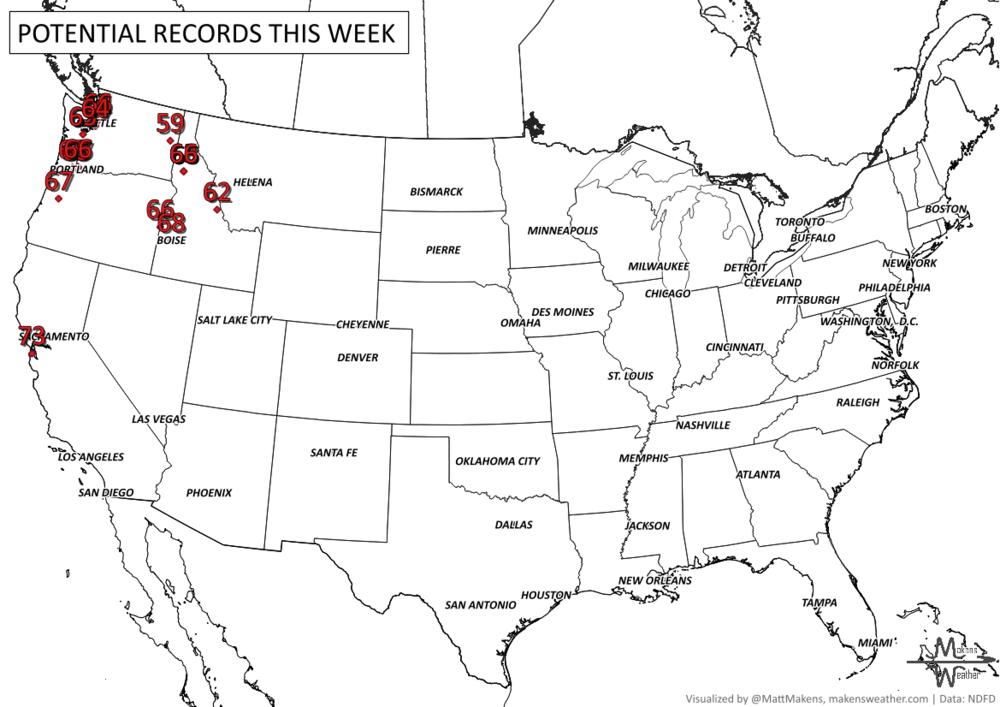
RECORDS MADE TO BE BROKEN, DAILY HIGHS (RED) | DAILY LOWS (BLUE):
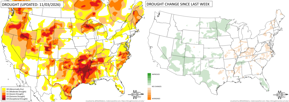
UN-DROUGHTABLY DRY:
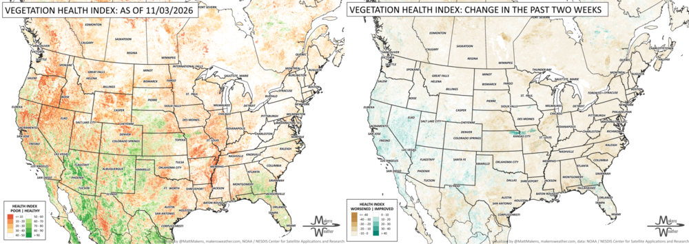
A wet fall continues to bring drought relief across the Southwest and Great Basin, where widespread improvements were made following another round of heavy precipitation. Rainfall from the remnants of Hurricane Vance also helped ease drought across western and central Texas, while wetter conditions brought improvements to the Great Plains and Upper Mississippi Valley. Drought continues to shrink across Florida, but conditions worsened in parts of the Mississippi and Ohio Valleys, Mid-Atlantic, and New England. Some long-term drought remains in the West despite recent rainfall. Alaska and Hawaii remain drought-free.
TRACKING THE TROPICS
ARE YOU CIRRUS?!
In weather history:
1975: The SS Edmund Fitzgerald sank during a powerful storm on Lake Superior, about 17 miles northwest of Whitefish Point, Michigan. Strong winds and large waves likely contributed to the sinking, which claimed the lives of all 29 crew members.
2002: One of the largest November tornado outbreaks in U.S. history struck during Veterans Day weekend (November 9-11). A total of 76 tornadoes touched down across 17 states in the eastern U.S., killing 36 people. It remains the second-largest November tornado outbreak on record at the time of the event.
An active stretch of weather is ahead for both coasts, while much of the middle of the country stays relatively mild. A series of Pacific storms will bring rounds of rain, mountain snow, and gusty winds from Washington to northern California, with heavier precipitation developing late this week and into the weekend. Meanwhile, a strong storm system will move across the Midwest and eastern U.S., bringing gusty winds, scattered thunderstorms, and a sharp drop in temperatures. By Friday and Saturday, parts of the Southeast, Ohio Valley, and Appalachians could feel more like December, with the first widespread frost and freeze of the season in some areas.