

Weekly Weather Watch: Tuesday, September 29th, 2026
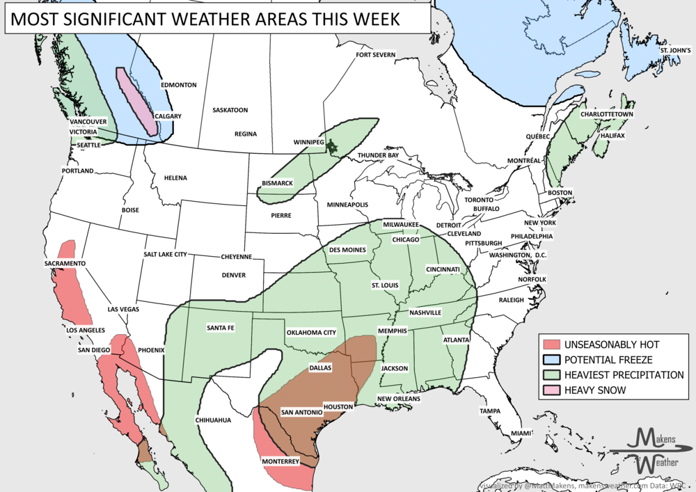
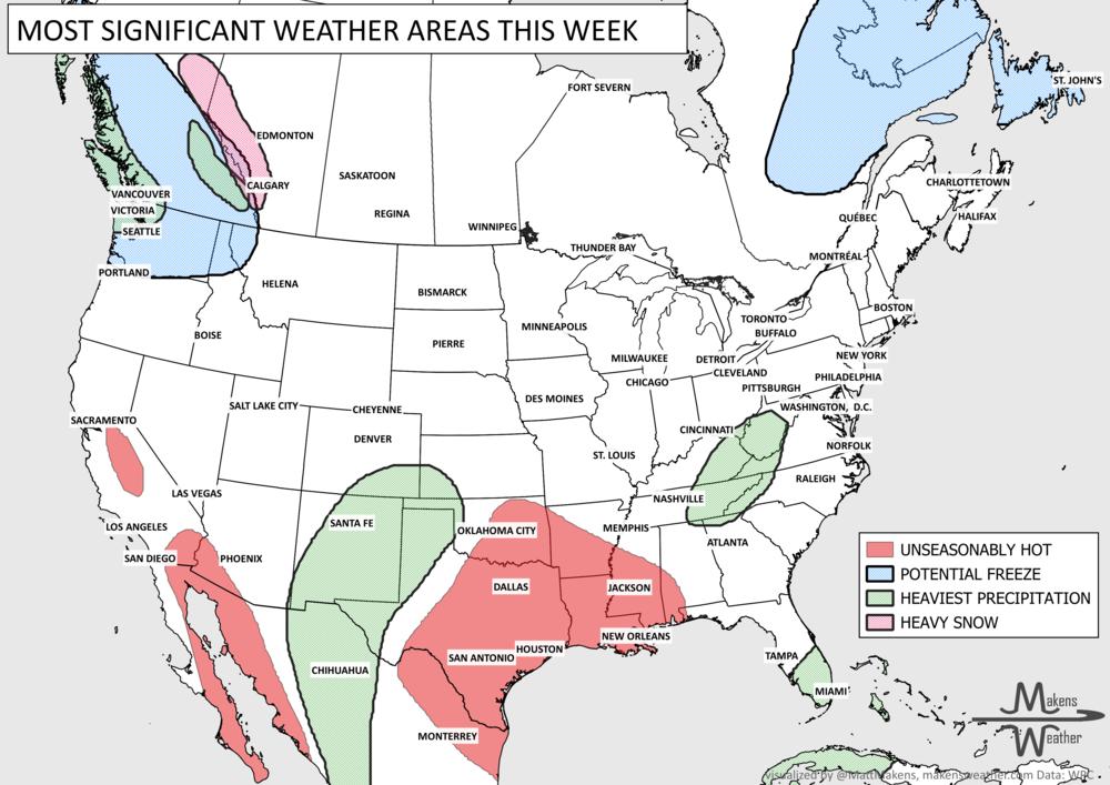
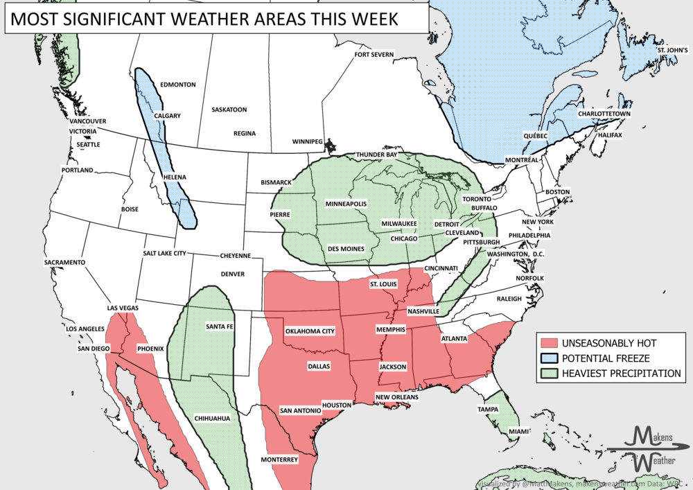
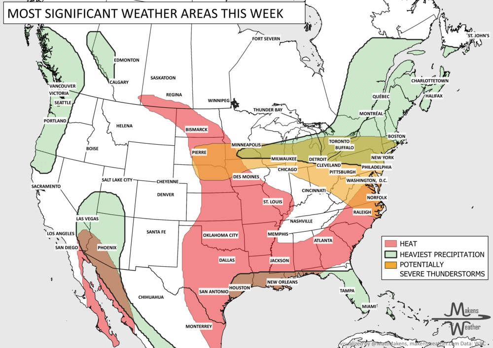
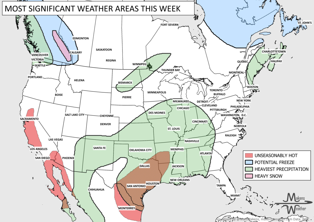
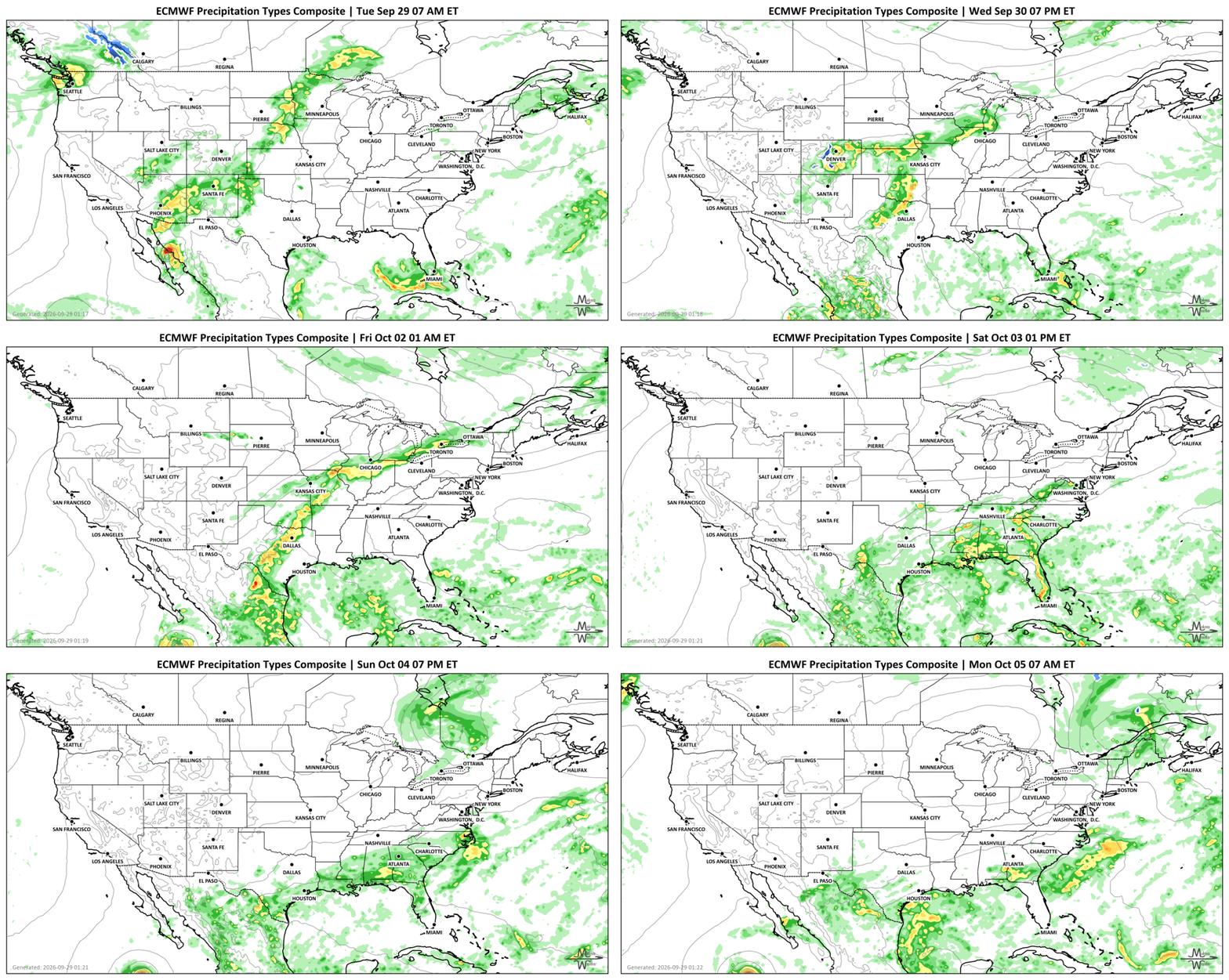
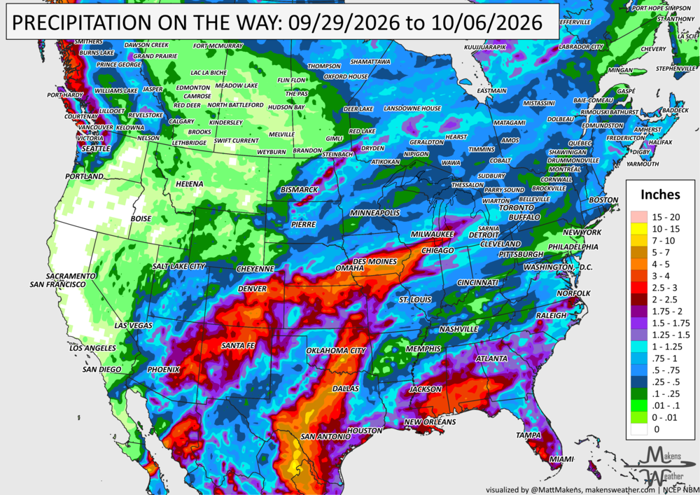
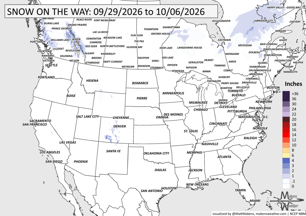
Pacific tropical moisture will drive one of the bigger weather stories this week as it gets pulled north into a slow-moving storm over the Southwest. New Mexico and western Texas face the greatest flash-flood threat early in the week, before heavy rain expands across the Southern Plains, Central Plains and Midwest. Some areas could pick up 3 to 6 inches of rain, with locally higher totals. The wet pattern won’t end quickly either, with the threat gradually shifting east toward the Mississippi and Tennessee Valleys later this week and into the weekend. Meanwhile, the Nor’easter affecting New England is winding down, while late-season heat hangs on across southern Texas and eventually builds across parts of the West. Heavy precipitation for British Columbia (snow on the Rockies), southern Manitoba, western Ontario.
Some new videos have dropped to YouTube that may be of interest:

📈 The latest weekly and monthly outlooks 👉 Join Now to Access
HEADLINERS:
What to watch:
Tuesday: Tropical moisture from Hurricane Polo surges into the Southwest and Southern Rockies. New Mexico and western Texas face a significant flash-flood threat, including areas near recent burn scars. Heavy rain also reaches parts of the Central Plains and Midwest. The Nor’easter continues to weaken near New England. Heavy snow continues on the Canadian Rockies.
Wednesday: The heavy-rain focus expands into the Southern Plains, Central Rockies and Central High Plains. Flooding concerns also continue from eastern Nebraska into western Iowa. Severe thunderstorms become possible across parts of the Southern Plains, with damaging winds, hail and a few tornadoes possible. Heavy snow continues on the Canadian Rockies. Freeze possible for the western half of Canada.
Thursday: The flood threat continues across the Southern Plains, where repeated rainfall could begin causing problems beyond smaller streams and urban areas. Some rivers may also respond. Rain and thunderstorms remain scattered elsewhere from the Great Lakes to the Gulf Coast. Freezing temperatures spread eastward across Canada.
Friday into Saturday: The storm moves only slowly east. Heavy-rain and flooding concerns spread from the Southern Plains and Lower Mississippi Valley toward the Tennessee Valley and central Gulf Coast. Areas of heavy snow from Quebec to Labrador.
Weekend into early next week: The main rain corridor gradually shifts farther east toward the Southeast, Appalachians and possibly the Mid-Atlantic. Cooler fall air follows northern cold fronts, while warmer and drier weather builds across much of the West.
SET YOUR WATCHES - WHEN THE MOISTURE ARRIVES:
IN THE GAUGES, PRECIPITATION THROUGH THE 6TH:
GRAB A RULER, SNOWFALL THROUGH THE 6TH:
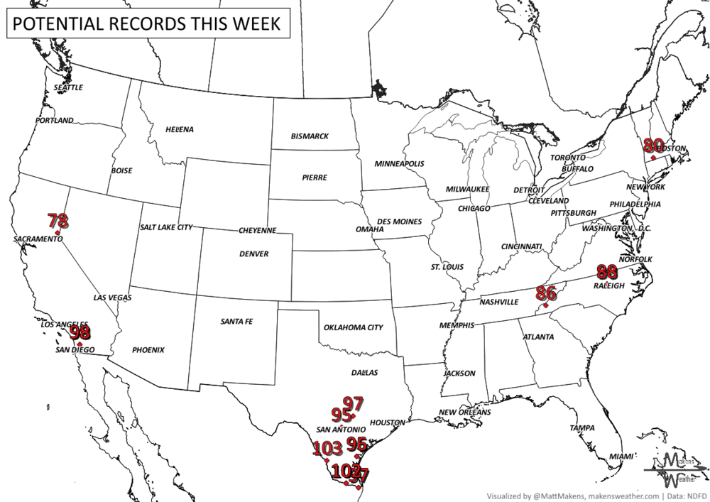
RECORDS MADE TO BE BROKEN, DAILY HIGHS (RED) | DAILY LOWS (BLUE):
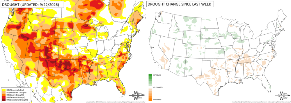
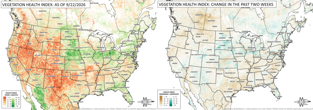
UN-DROUGHTABLY DRY:
Hot and dry weather continued across much of the South, while repeated rounds of heavy rain tracked along the northern edge of the heat. The wettest corridor stretched from Iowa and Minnesota through Wisconsin, Illinois and into Ohio and West Virginia, where localized totals reached 6 to 8 inches. Parts of Kansas and Missouri received 3 to 5 inches, with additional beneficial rain across portions of the central and northern High Plains and Southwest.
Rain remained spotty and generally light from Texas and Oklahoma into the lower Mississippi and Tennessee Valleys, while much of the West Coast stayed dry. Temperatures across the South were again generally 5 to 10°F above normal, with some areas more than 15°F above normal as the unusually persistent late-season warmth continued.
TRACKING THE TROPICS
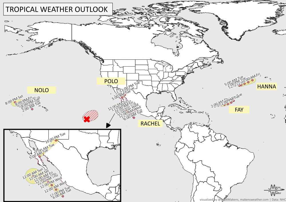
The eastern and central Pacific remain busy with three named systems. Hurricane Polo is near the Baja California Peninsula, Hurricane Nolo is several hundred miles west of Hawaii, and Tropical Storm Rachel is south-southwest of Lázaro Cárdenas, Mexico.
Another system, EP91, is being watched well east-southeast of Hawaii. It has a 90% chance of becoming a tropical depression within the next day or two as it moves slowly east-northeast. Conditions are expected to become less favorable for further development later this week.
ARE YOU CIRRUS?!
In weather history:
1927: A deadly tornado outbreak swept from Oklahoma to Indiana, killing 81 people and causing an estimated $25 million in damage. The worst destruction occurred from St. Louis, Missouri, to Granite City, Illinois, where one or possibly two tornadoes carved an eight-mile path and killed 79 people.
Pacific tropical moisture will drive one of the bigger weather stories this week as it gets pulled north into a slow-moving storm over the Southwest. New Mexico and western Texas face the greatest flash-flood threat early in the week, before heavy rain expands across the Southern Plains, Central Plains and Midwest. Some areas could pick up 3 to 6 inches of rain, with locally higher totals. The wet pattern won’t end quickly either, with the threat gradually shifting east toward the Mississippi and Tennessee Valleys later this week and into the weekend. Meanwhile, the Nor’easter affecting New England is winding down, while late-season heat hangs on across southern Texas and eventually builds across parts of the West.