

Weekly Weather Watch: Tuesday, September 22nd, 2026
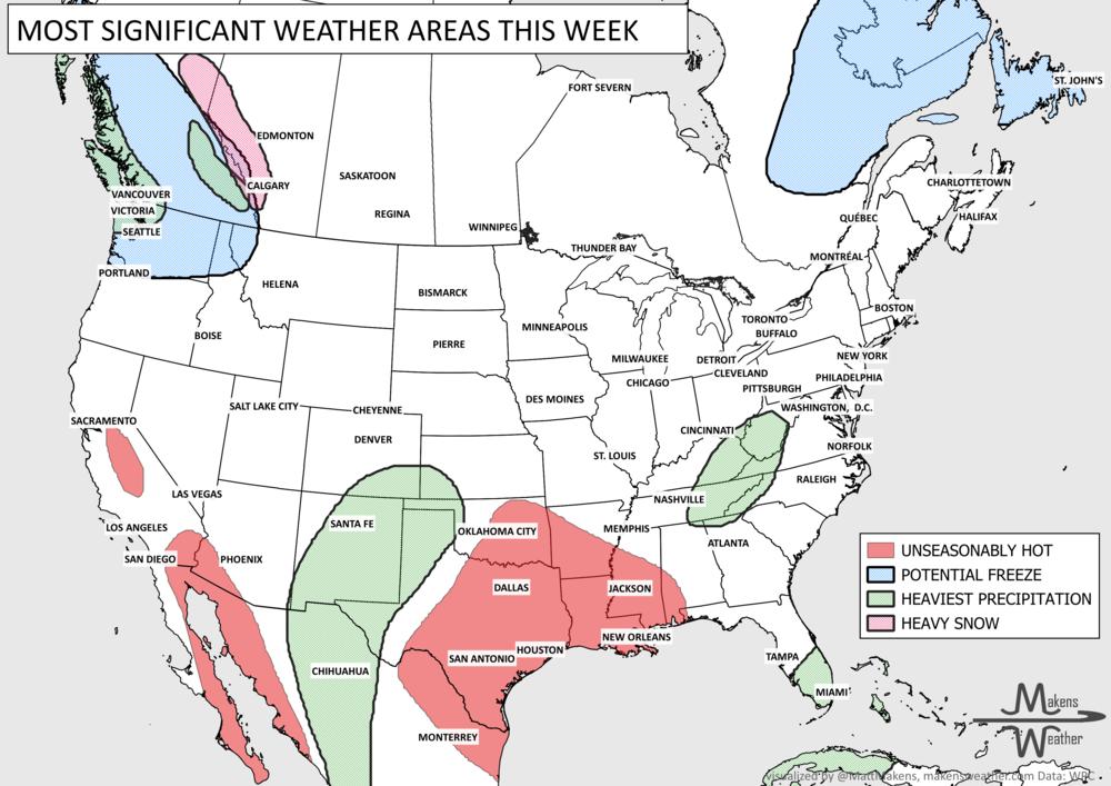
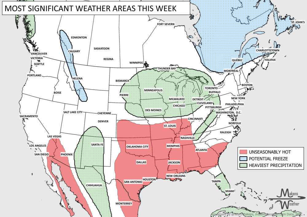
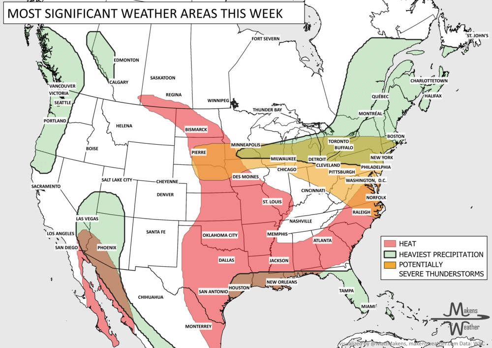
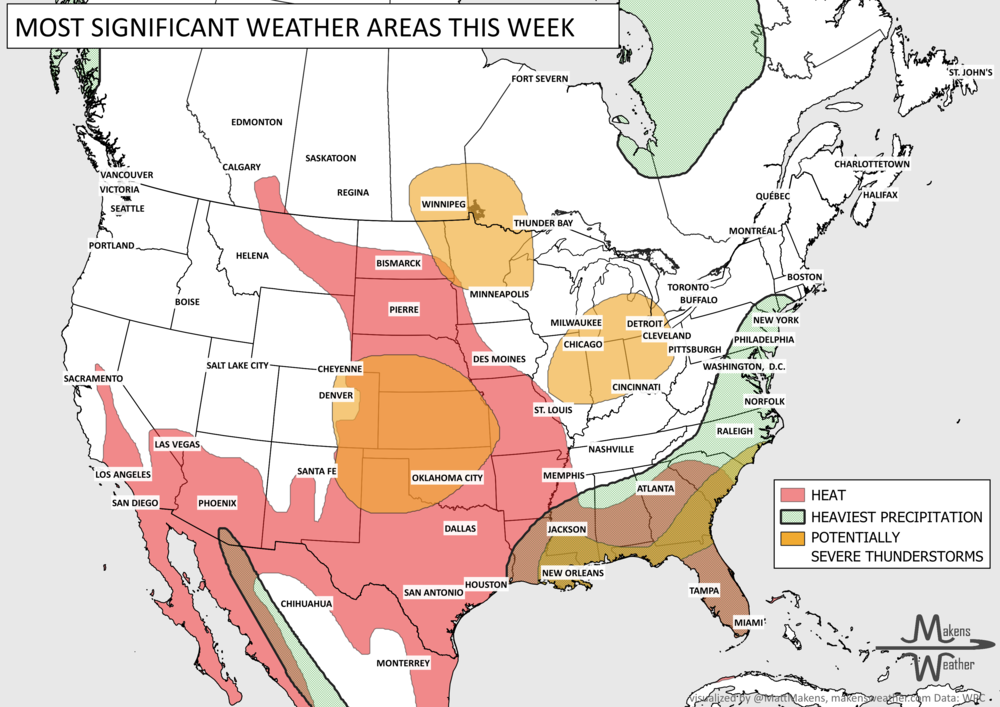
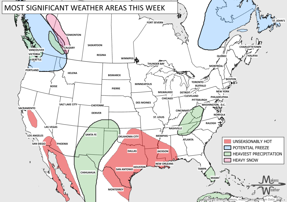
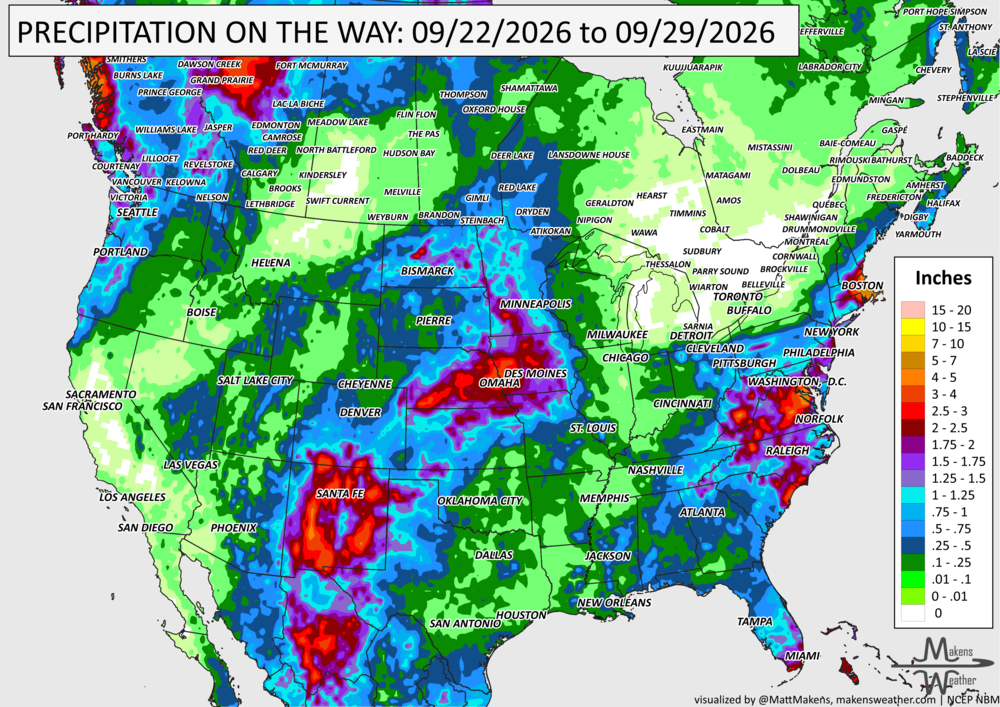
A busy weather pattern will bring several areas of concern through the next week. New Mexico and west Texas face the first significant threat as tropical moisture fuels rounds of heavy rain Tuesday and Wednesday, raising the risk of flash flooding and debris flows near recent burn scars. Farther east, showers and thunderstorms will produce pockets of heavy rain from the Ohio Valley and Southeast into the Mid-Atlantic. By late week, attention shifts to a slow-moving coastal storm near the Mid-Atlantic and Northeast, where several days of onshore winds could bring heavy rain, coastal flooding, high surf and beach erosion. Meanwhile, cooler weather settles into much of the northern and eastern U.S., while summerlike warmth hangs on across the southern Plains and Lower Mississippi Valley. Heavy snow will fall on some of the Canadian Rockies by the weekend.
Some new videos have dropped to YouTube that may be of interest:

📈 The latest weekly and monthly outlooks 👉 Join Now to Access
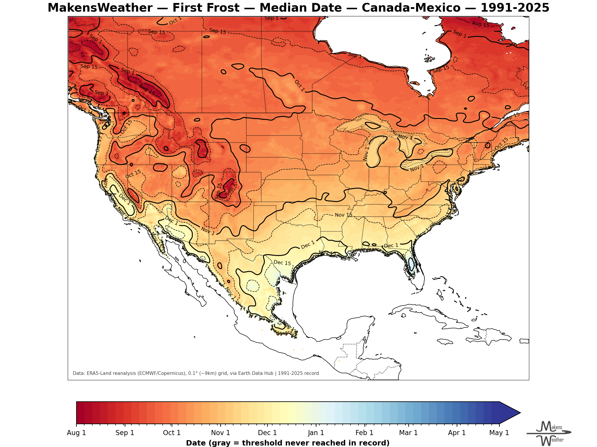
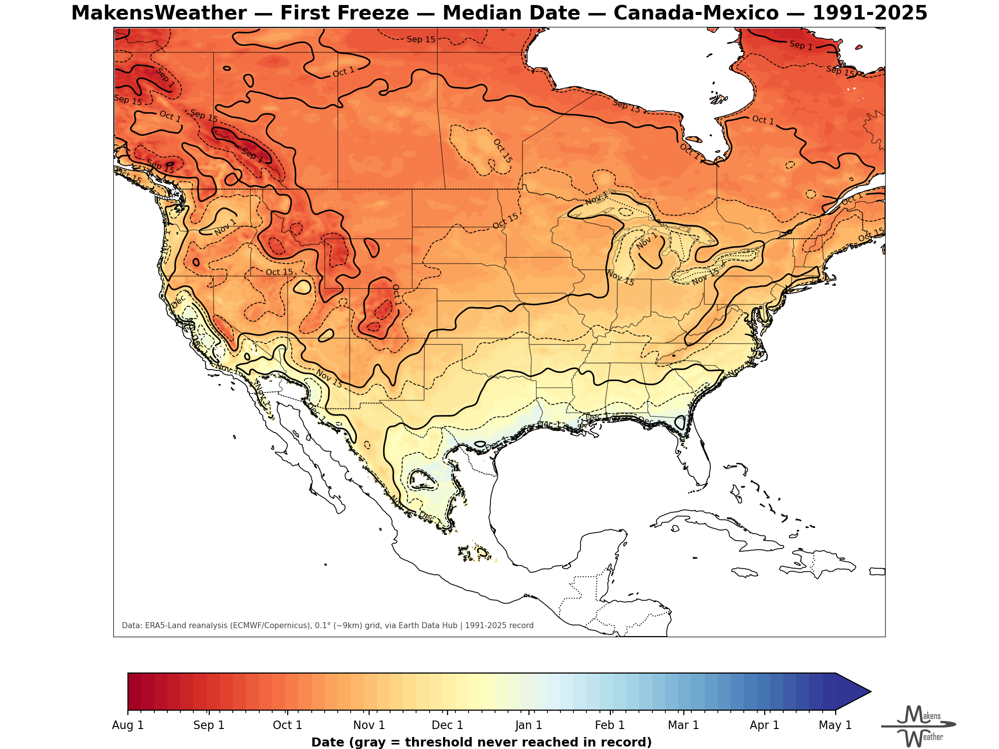
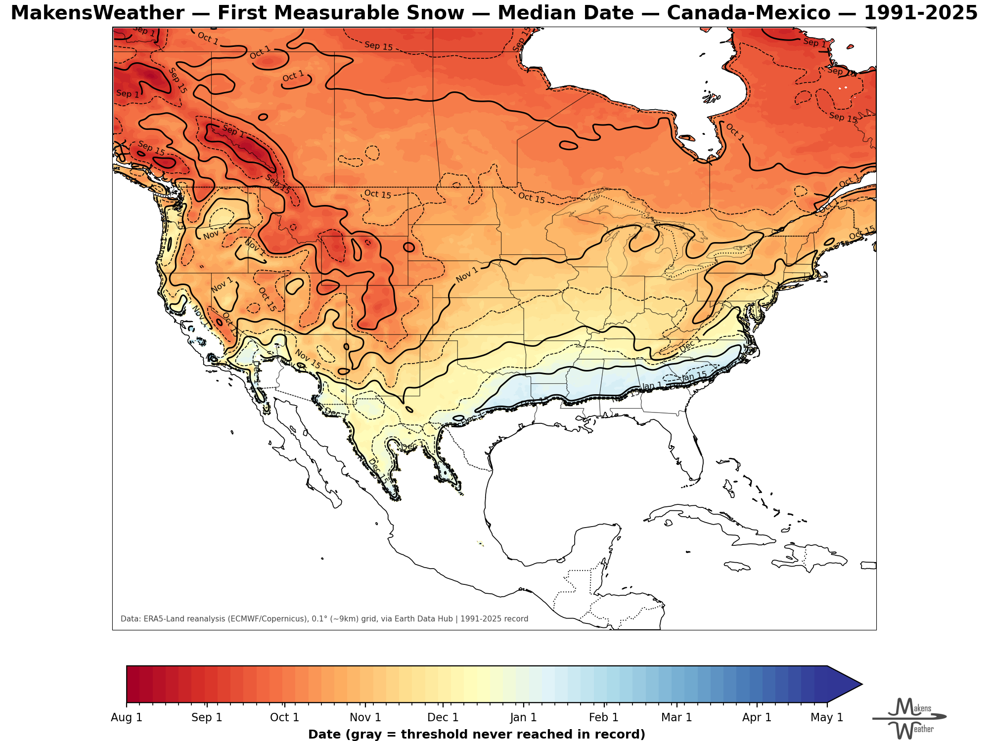
AVERAGE FIRST FROST, FREEZE AND SNOW DATES:
HEADLINERS:
What to watch:
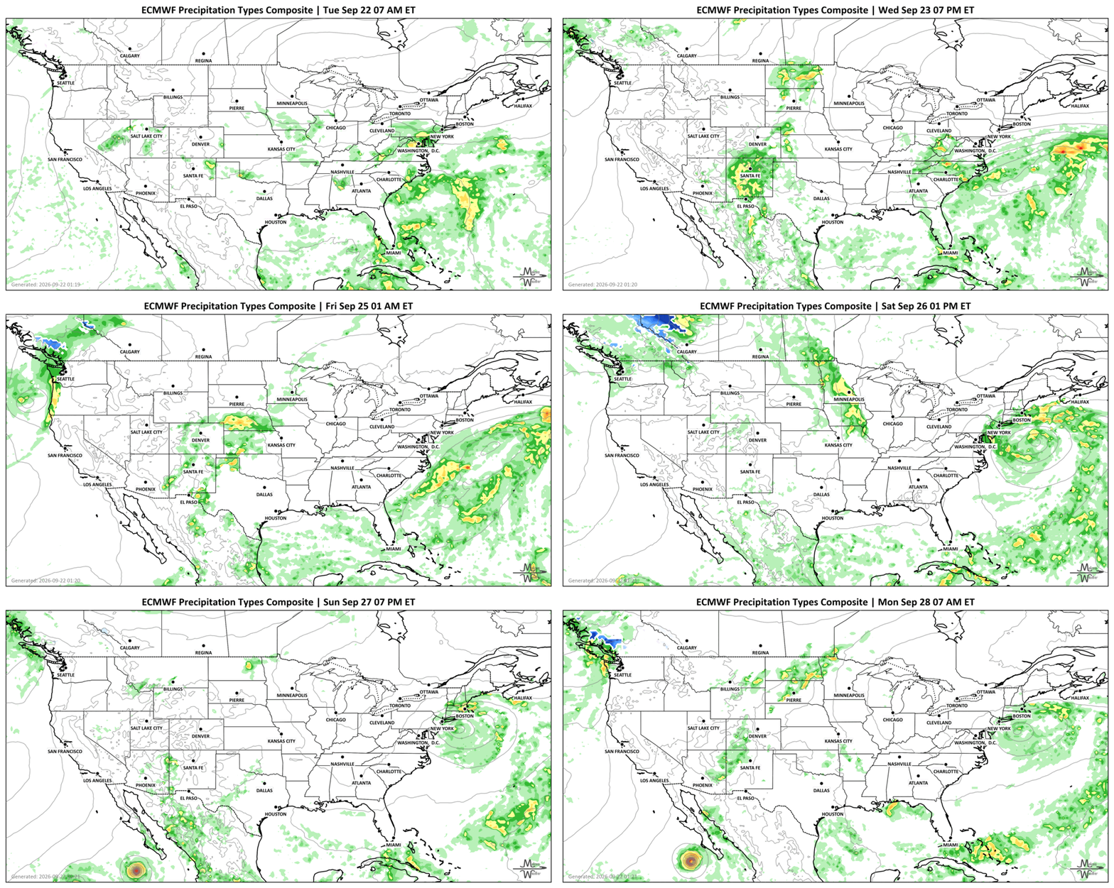
Tuesday: Heavy rain becomes the main concern across New Mexico and west Texas, with flash flooding possible. Burn scar areas will be particularly sensitive to heavy downpours. Additional strong thunderstorms and locally heavy rain are possible across the Southeast, Ohio Valley and Mid-Atlantic.
Wednesday: The flooding threat increases across New Mexico, particularly eastern portions of the state, as another round of heavy rain develops. Additional downpours could aggravate flooding concerns across the Ohio Valley and Mid-Atlantic, especially where the ground is already saturated.
Thursday: Rain associated with the eastern system increasingly focuses toward the Mid-Atlantic and East Coast. Scattered heavy thunderstorms remain possible across Florida.
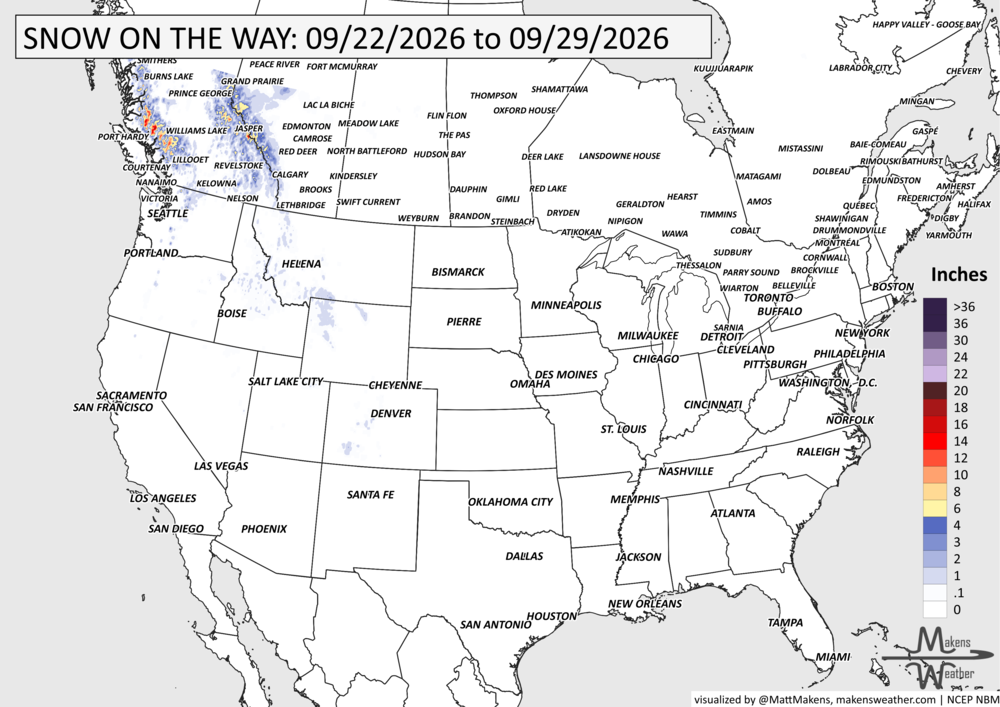
Friday: A coastal storm becomes the primary concern near the Mid-Atlantic and Northeast. Persistent onshore winds could begin producing coastal flooding, high surf, rip currents and beach erosion. Heavy rain may also affect parts of coastal New England, although the exact placement remains uncertain. Heavy snow forms in the Canadian Rockies with heavy rainfall in higher elevations of British Columbia.
Saturday-Sunday: The coastal storm may linger near the Northeast, prolonging rough surf, gusty winds and coastal flooding concerns. How much rain reaches land will depend heavily on the storm's exact track. Rain and higher-elevation snow are also possible across the Pacific Northwest and northern Rockies. Heavy snow continues in the Canadian Rockies.
Monday-Tuesday: Attention begins shifting back toward the central U.S., where moisture from the Pacific and Gulf could combine to produce a broader area of rain and thunderstorms. Some heavier rainfall may develop as the next western system moves east. Heavy rainfall in parts of Southern Manitoba.
SET YOUR WATCHES - WHEN THE MOISTURE ARRIVES:
IN THE GAUGES, PRECIPITATION THROUGH THE 29TH:
GRAB A RULER, SNOWFALL THROUGH THE 29TH:
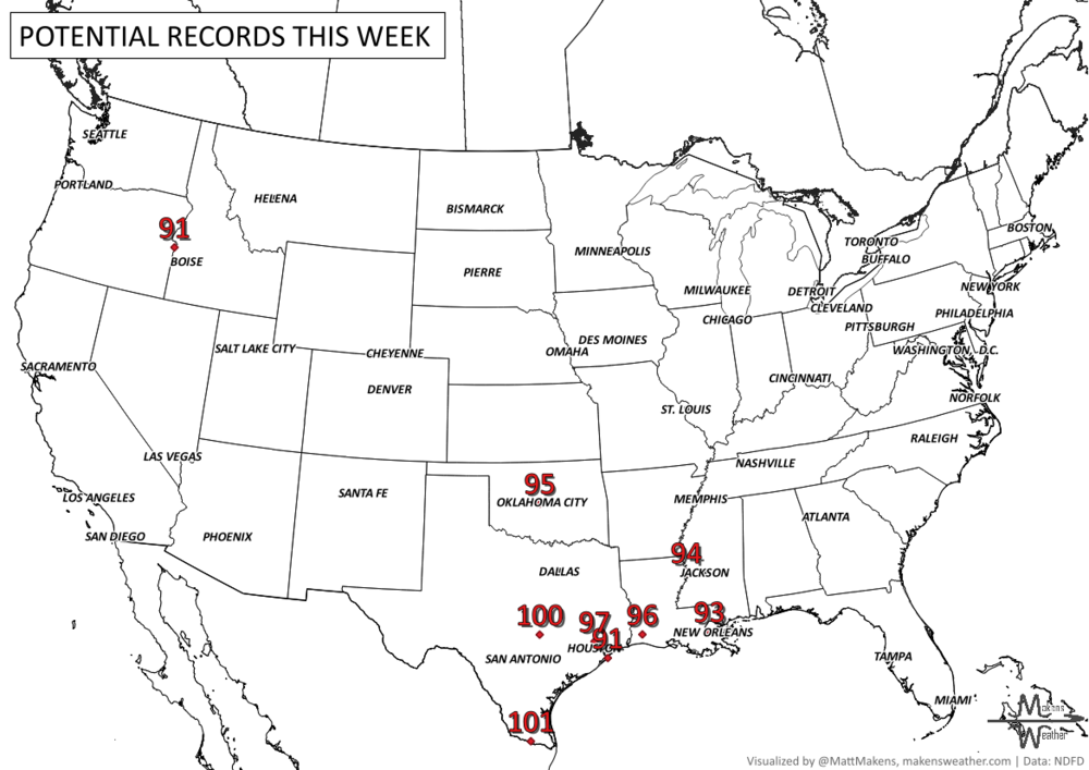
RECORDS MADE TO BE BROKEN, DAILY HIGHS (RED) | DAILY LOWS (BLUE):
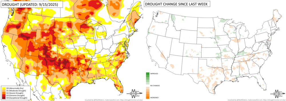
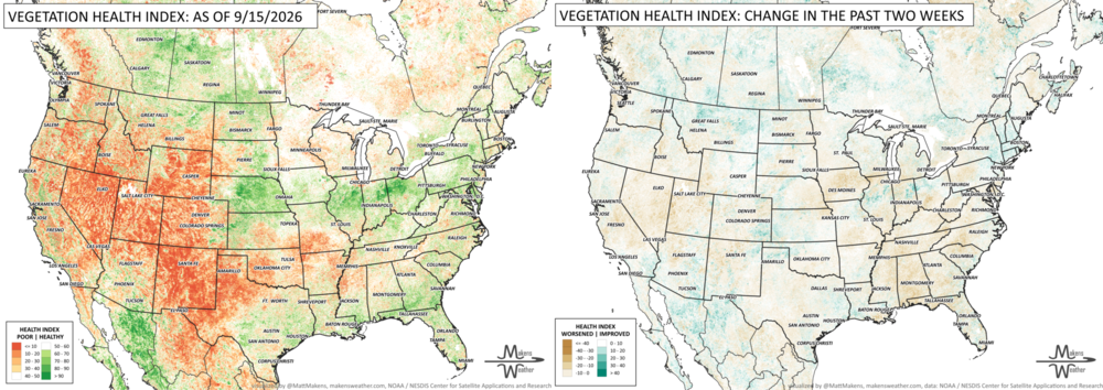
UN-DROUGHTABLY DRY:
Recent rainfall brought some welcome moisture to parts of the central U.S., including Iowa, eastern Nebraska, Kansas and northwest Missouri, where a few areas picked up more than 4 inches. Heavy rain also soaked an already-wet area from Ohio and West Virginia into western Pennsylvania, while much of Florida and the Gulf Coast received 2 to 4 inches.
Dryness remained the bigger story across the Southwest, Texas, Oklahoma and western Great Plains, aside from scattered monsoon rainfall near the New Mexico-Arizona border. Meanwhile, unusually warm conditions continued across the southern Great Plains and lower Mississippi Valley, with temperatures in some locations running more than 10 degrees above normal.
TRACKING THE TROPICS
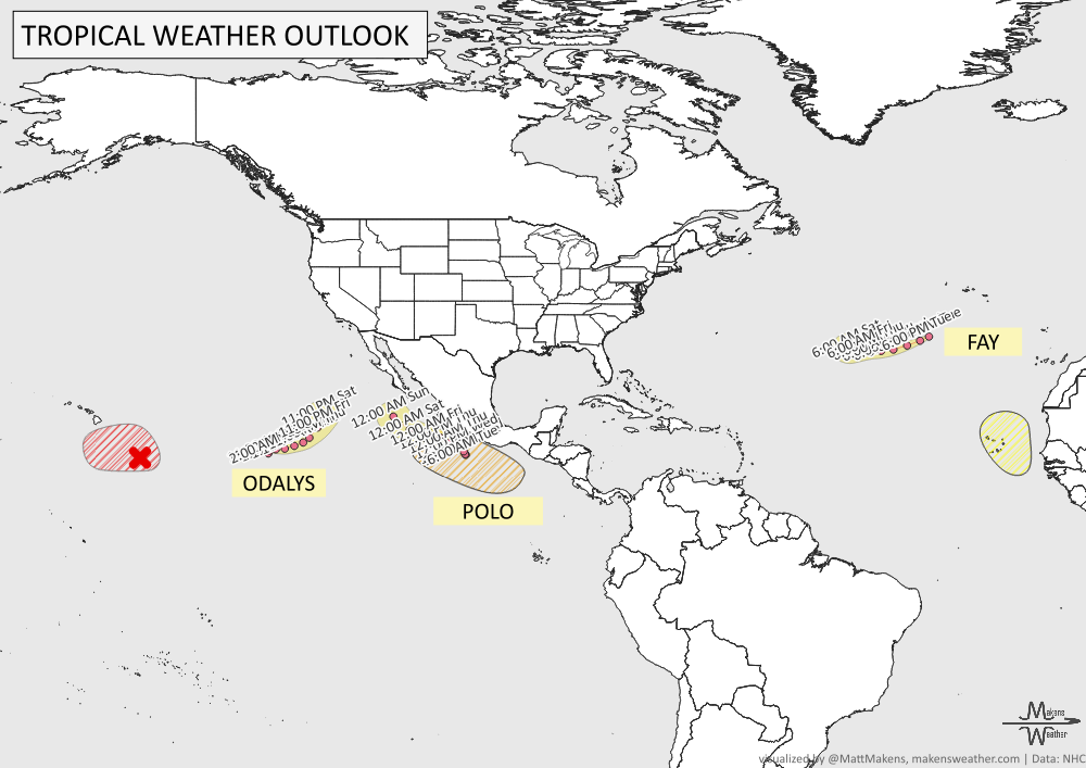
The tropics remain active in both the Atlantic and eastern Pacific. Tropical Storm Fay continues over the open Atlantic southwest of the Azores, while a new tropical wave moving off western Africa has a low chance of development. Regardless of development, the Cabo Verde Islands could see gusty winds and heavy rain later this week.
Activity is busier in the eastern Pacific, where Tropical Storm Odalys and Hurricane Polo are ongoing. Farther west, the remnants of Tropical Depression Fifteen-E have a high chance of redeveloping southeast of Hawaii, with a tropical depression likely during the next day or two. Another system could gradually organize south of the Gulf of Tehuantepec later this week or weekend while remaining generally parallel to the coast of southern and southwestern Mexico. -NHC
ARE YOU CIRRUS?!
In weather history:
1810 A tornado struck Fernhill Heath, England with a reported path width of between a half-mile and one mile, making it the widest known tornado path in Britain.
1890 A severe hailstorm struck Strawberry, Arizona, leaving an extraordinary accumulation of hail. Five days after the storm, hail reportedly remained in drifts 12 to 18 inches deep.
2006 A major September tornado outbreak struck portions of Missouri, Illinois and Kentucky. One supercell produced a long-track F4 tornado that traveled 27.5 miles from southeastern Missouri into southwestern Illinois.
A busy weather pattern will bring several areas of concern through the next week. New Mexico and west Texas face the first significant threat as tropical moisture fuels rounds of heavy rain Tuesday and Wednesday, raising the risk of flash flooding and debris flows near recent burn scars. Farther east, showers and thunderstorms will produce pockets of heavy rain from the Ohio Valley and Southeast into the Mid-Atlantic. By late week, attention shifts to a slow-moving coastal storm near the Mid-Atlantic and Northeast, where several days of onshore winds could bring heavy rain, coastal flooding, high surf and beach erosion. Meanwhile, cooler weather settles into much of the northern and eastern U.S., while summerlike warmth hangs on across the southern Plains and Lower Mississippi Valley.