
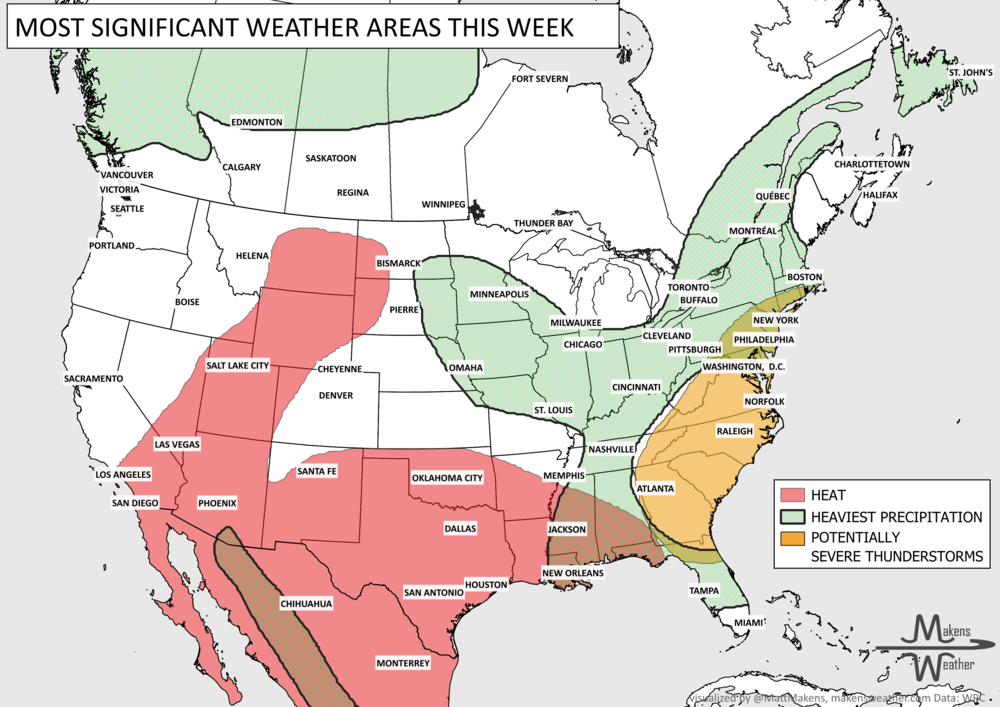
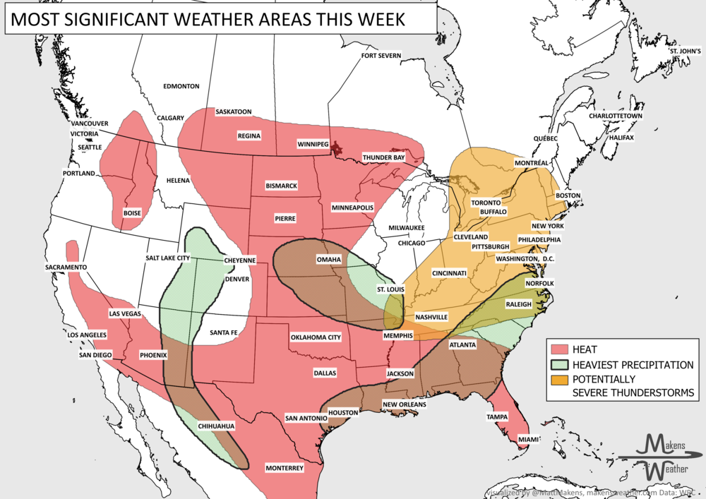
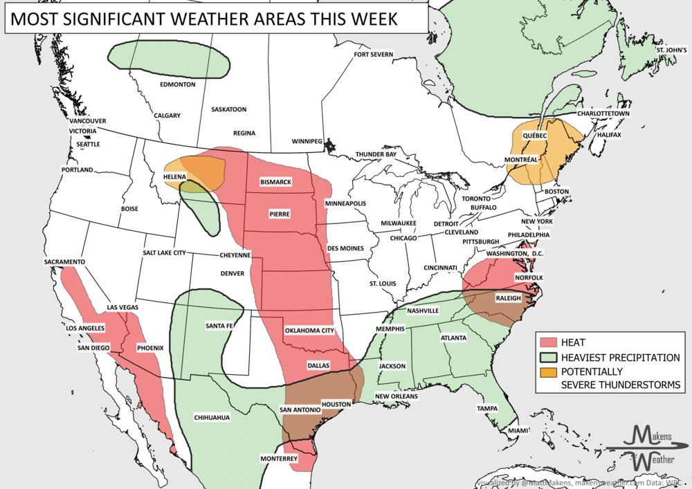
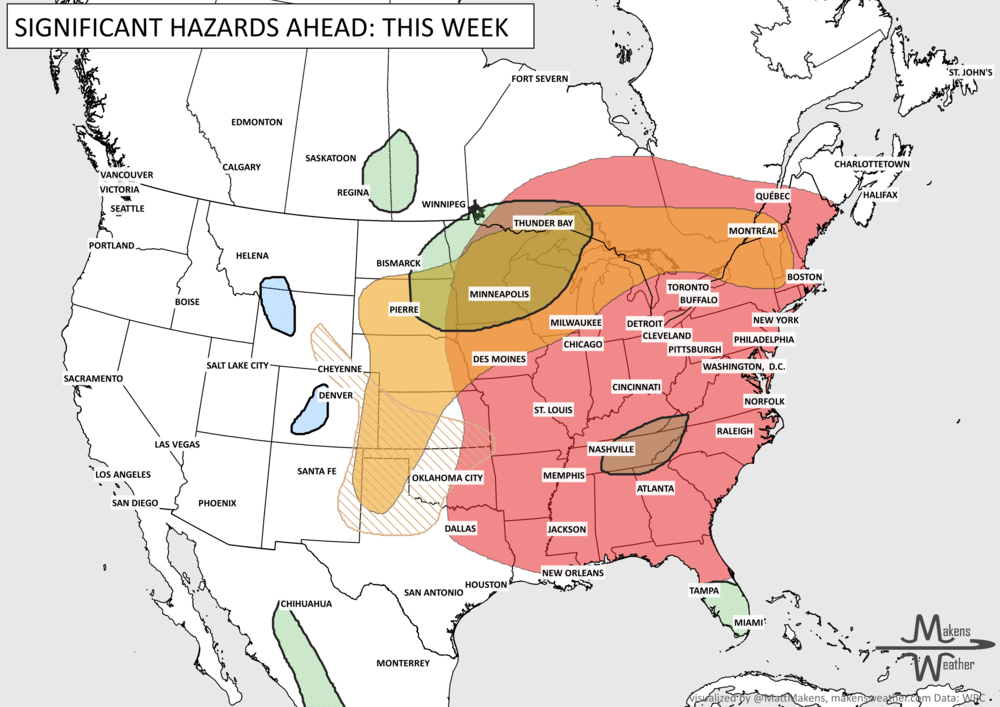
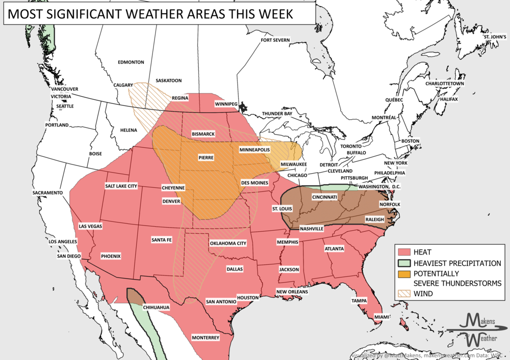
A busy stretch of summer weather is underway. The greatest concern through midweek will be severe thunderstorms capable of damaging winds, large hail, isolated tornadoes, and flash flooding from the Dakotas into Minnesota and later the Upper Midwest. At the same time, dangerous heat continues across the Southeast, while a strengthening ridge will send temperatures soaring across the Northern Plains and Central U.S. heading into the weekend. Meanwhile, the Southwest monsoon will gradually become more active, bringing increasing rounds of afternoon and evening thunderstorms. In British Columbia and Quebec, smoke is causing or expected to cause poor air quality and reduced visibility.
Read More
The weather pattern across the United States and Canada remains highly active this week, with two major stories dominating the forecast. Dangerous, long-lasting heat continues across much of the South before expanding into the western United States by the weekend. At the same time, repeated rounds of thunderstorms will bring the threat of flash flooding and severe weather from the Mid-Atlantic and Northeast to parts of the Midwest and Gulf Coast. Residents across these regions should stay weather-aware as heavy rain, damaging winds, and dangerous heat create multiple hazards over the coming week.