


The weather pattern is about to make a pretty sharp turn across the country. California starts the week with unusual October heat, including highs well into the 90s and even lower 100s in the Central Valley. Meanwhile, much cooler fall air has reached the Great Lakes and Northeast. The Gulf Coast and Southeast stay unsettled, and there’s that record to watch: a tropical depression is likely to develop over the Gulf this week and could strengthen as it moves northeast. If it becomes a hurricane after the 8th, 2026 will have the latest-first hurricane in the Atlantic Basin record.
Read MoreWeekly Weather Watch
THE LATEST UPDATE:
The weather pattern is getting more active as we head into November. Several storm systems will bring rain to much of the country over the next week, with mountain snow in the West and the possibility of some snow reaching the High Plains early next week. Texas faces a more immediate concern, with heavy thunderstorms and localized flooding possible through Thursday. Meanwhile, much of the central and eastern United States will stay unusually warm for late October, with temperatures running 10 to 20 degrees above average in some areas. The biggest forecast question involves a developing Pacific storm that could bring widespread precipitation to California and eventually strengthen over the central Plains.
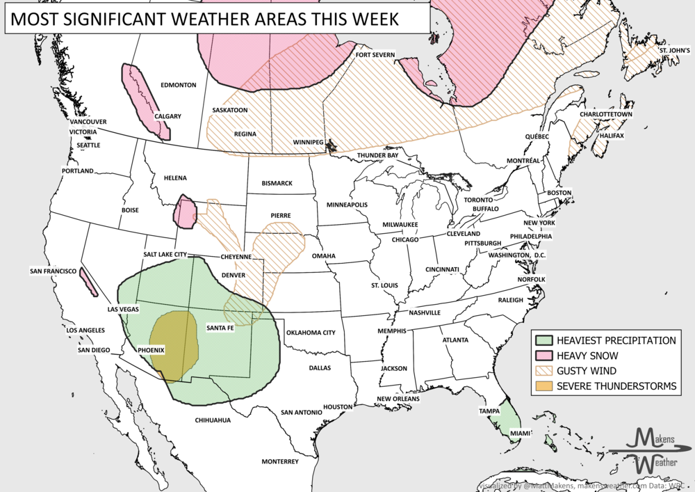
A nor'easter will continue to cause problems along the Mid-Atlantic coast through midweek, with coastal flooding, beach erosion and dangerous marine conditions. Meanwhile, a storm moving into the West will pull unusually high amounts of moisture into the Southwest and Four Corners, increasing the risk of flash flooding Wednesday and Thursday. That storm will eventually spread rain and thunderstorms into the Plains this weekend, with some locally heavy rainfall possible. Snow is also likely in the higher elevations of the Sierra Nevada and Rockies. Temperatures will run cooler than normal across much of the West, while the Central U.S. stays unusually warm for late October. Another Pacific system will bring precipitation into the Northwest this weekend, and parts of Florida could see repeated rounds of heavy rain.
The weather pattern is about to make a pretty sharp turn across the country. California starts the week with unusual October heat, including highs well into the 90s and even lower 100s in the Central Valley. Meanwhile, much cooler fall air has reached the Great Lakes and Northeast. The Gulf Coast and Southeast stay unsettled, and there’s that record to watch: a tropical depression is likely to develop over the Gulf this week and could strengthen as it moves northeast. If it becomes a hurricane after the 8th, 2026 will have the latest-first hurricane in the Atlantic Basin record.
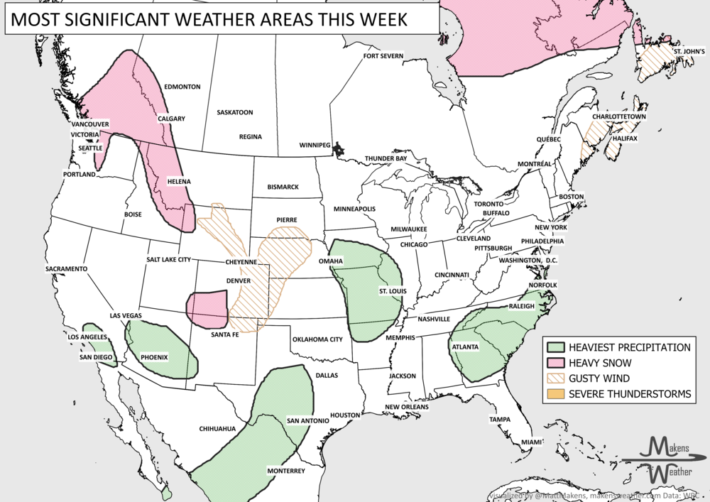
Pacific tropical moisture will drive one of the bigger weather stories this week as it gets pulled north into a slow-moving storm over the Southwest. New Mexico and western Texas face the greatest flash-flood threat early in the week, before heavy rain expands across the Southern Plains, Central Plains and Midwest. Some areas could pick up 3 to 6 inches of rain, with locally higher totals. The wet pattern won’t end quickly either, with the threat gradually shifting east toward the Mississippi and Tennessee Valleys later this week and into the weekend. Meanwhile, the Nor’easter affecting New England is winding down, while late-season heat hangs on across southern Texas and eventually builds across parts of the West.
A busy weather pattern will bring several areas of concern through the next week. New Mexico and west Texas face the first significant threat as tropical moisture fuels rounds of heavy rain Tuesday and Wednesday, raising the risk of flash flooding and debris flows near recent burn scars. Farther east, showers and thunderstorms will produce pockets of heavy rain from the Ohio Valley and Southeast into the Mid-Atlantic. By late week, attention shifts to a slow-moving coastal storm near the Mid-Atlantic and Northeast, where several days of onshore winds could bring heavy rain, coastal flooding, high surf and beach erosion. Meanwhile, cooler weather settles into much of the northern and eastern U.S., while summerlike warmth hangs on across the southern Plains and Lower Mississippi Valley.
The weather pattern is getting more active as we head into November. Several storm systems will bring rain to much of the country over the next week, with mountain snow in the West and the possibility of some snow reaching the High Plains early next week. Texas faces a more immediate concern, with heavy thunderstorms and localized flooding possible through Thursday. Meanwhile, much of the central and eastern United States will stay unusually warm for late October, with temperatures running 10 to 20 degrees above average in some areas. The biggest forecast question involves a developing Pacific storm that could bring widespread precipitation to California and eventually strengthen over the central Plains.