


Weekly Weather Watch: Tuesday, September 2nd, 2025
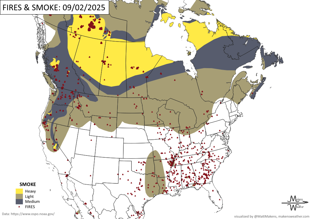
As we step into September, weather contrasts are on full display across the U.S. Record-breaking heat grips the Pacific Northwest, while monsoonal rains soak the Southwest and parts of the Gulf Coast, raising flash flood concerns. Meanwhile, a strong cold front sweeping through the Midwest and Great Lakes will usher in early-fall-like chill with highs 15–25 degrees below normal midweek. A more unsettled pattern continues late in the week from the Central Plains to the East Coast, while another round of moisture may arrive in the West from the remnants of Tropical Depression Twelve-E. Air quality is the most immediate issue for parts of western Canada, particularly Alberta, due to wildfire smoke.
💧 How Much Rain Is Really On The Way?
Get Instant Answers with Our Precipitation Dashboard:
Tired of vague forecasts? Our Precipitation Dashboard gives you a clear, color-coded look at how much rain is expected—down to your region, for the next day, next 3 days, or next 7 days. Whether you're in the Plains bracing for storms, the Southeast watching flood risks, or just planning your week—this tool delivers the detail you need.
Members get full access to:
Easy-to-read maps showing total rainfall amounts
Region-specific breakdowns (Plains, Canada, Eastern U.S., and more)
Daily updates with blended-model accuracy
📈 Track it 👉 Join Now to Access the Dashboard
HEADLINERS:

Key Weather Impacts:
Tuesday–Thursday:
Extreme heat continues in the Pacific Northwest (temps over 100°F possible, record-potential)
Heavy rain and flash flooding in the Southwest U.S., especially near the Four Corners
Localized flash floods possible from Florida to Texas and the Tennessee Valley
Sharp cold front plunges through the Northern Plains, reaching the Great Lakes by Thursday with highs only in the 50s–60s
Friday–Saturday:
Widespread cool-down across the Midwest, Great Lakes, and Ohio Valley
Showers and storms stretch from the Plains to the Northeast
Localized flood risk continues in South Florida and the Keys
Sunday–Tuesday (Sep 7–9):
Monsoonal/tropical moisture may bring heavy showers to the Southwest and Southern Plains, depending on the track of T.D. Twelve-E
Lake-effect rain possible across parts of the Great Lakes
Warming trend for the West, but cool and unsettled weather persists east of the Rockies

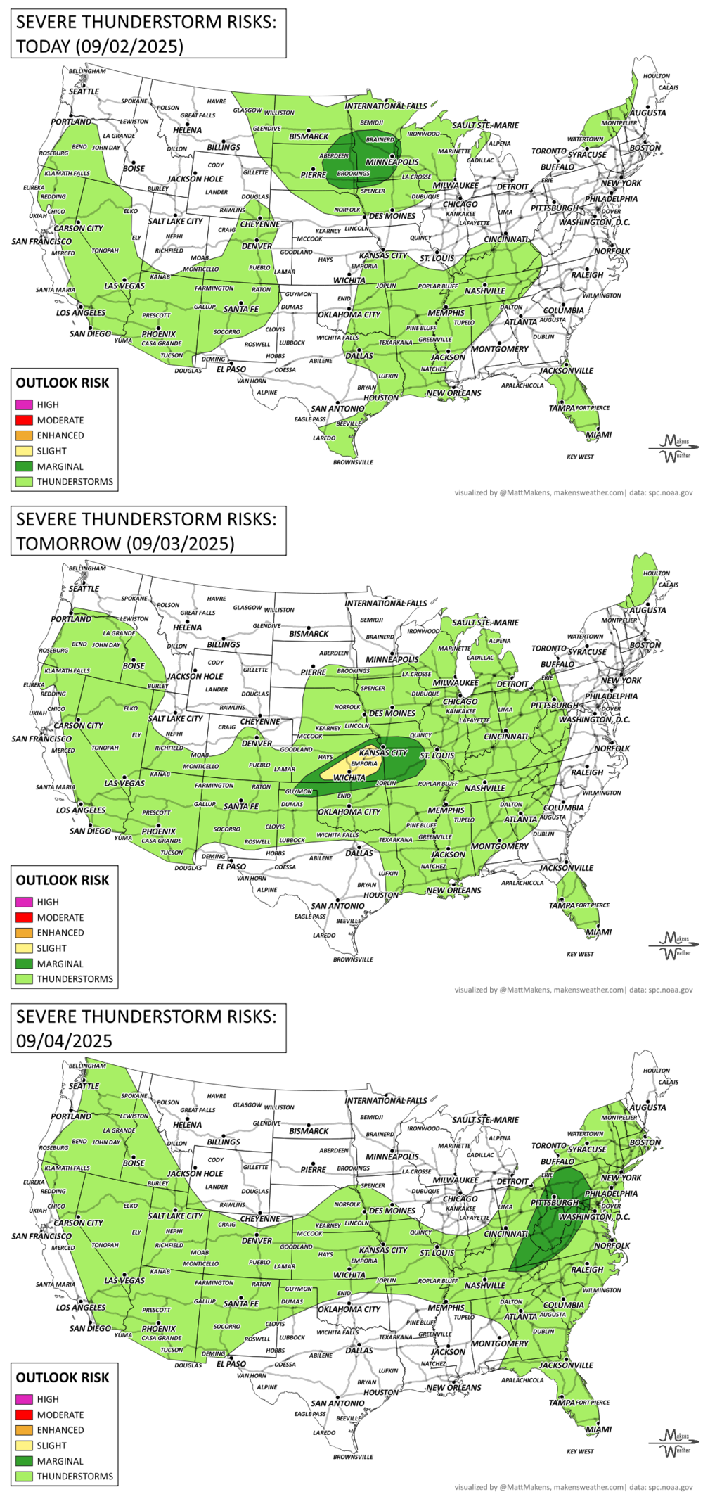
ON THE RADAR:
KEEP AN EYE TO THE SKY:
IN THE GAUGES:

RECORDS MADE TO BE BROKEN:

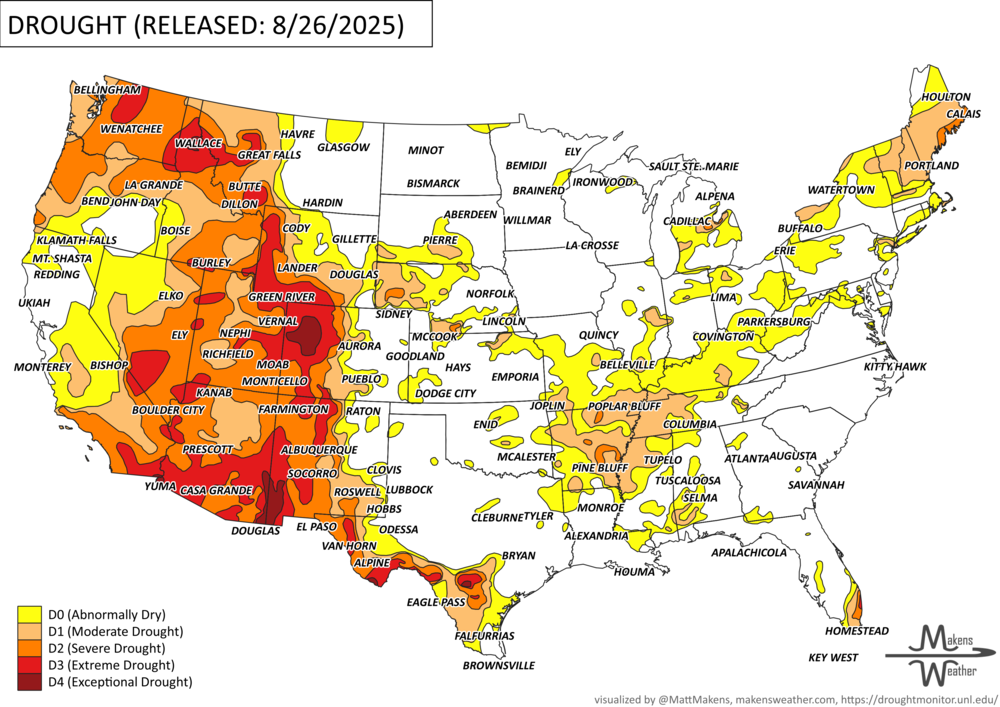
UN-DROUGHTABLY DRY:
TROPICAL TIDINGS:
Tropical activity is ramping up in both the Eastern Pacific and Atlantic, with one named system already influencing the forecast for parts of the Southwest U.S. and Mexico, and another disturbance being monitored in the Atlantic Basin.
T.D. Twelve-E (Eastern Pacific):
Status: Currently a tropical depression
Location: Off the coast of Baja California
Forecast Track: Uncertain—models are split. Some show a turn northeast into northern Mexico and possibly the southern Plains, while others keep it lingering offshore or turn it westward.
Impacts:
Southwest U.S.: Increasing tropical moisture late this week into the weekend
Flash flood potential in Arizona, southern Utah, and New Mexico, depending on track
Cloud cover and showers will keep temperatures closer to normal in these areas
Atlantic Tropical Wave (Eastern Atlantic):
Status: Disorganized cluster of storms near the Cabo Verde Islands
Movement: West-northwest at ~15 mph
Formation Odds:
Next 48 hours: Low (30%)
Next 7 days: High (70%)
Outlook:
Gradual development expected later this week or weekend
Still well out at sea with no immediate threat to land
Should be watched closely by late next week for possible implications in the Caribbean or Atlantic seaboard

WHERE THERE’S SMOKE, THERE’S …
ARE YOU CIRRUS?!
2002 In Ladysmith, WI businesses were closed because of Labor Day. An F3 tornado touched down and damaged the area. Fortunately, no one was killed.
1935 One of the most intense hurricanes to ever hit the U.S. struck the Florida Keys, packing 200 mph winds and killing 400 people. The hurricane produced a 15-foot tide and storm surge waves 30 feet high. The barometric pressure at Matecumbe Bay, FL hit a United States record low of 26.35 inches.
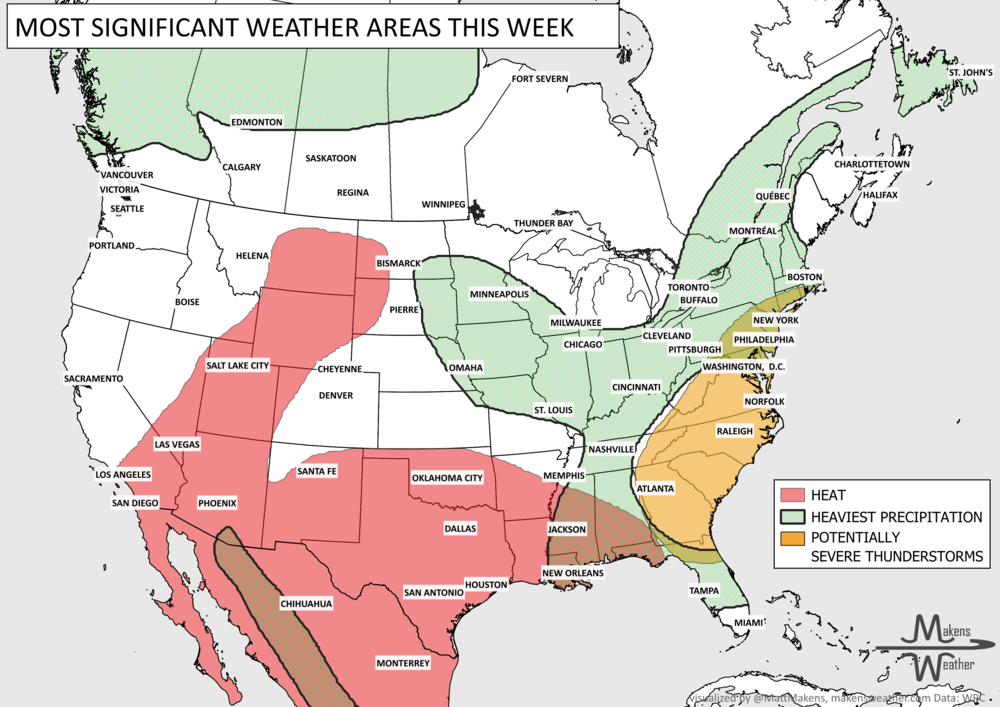
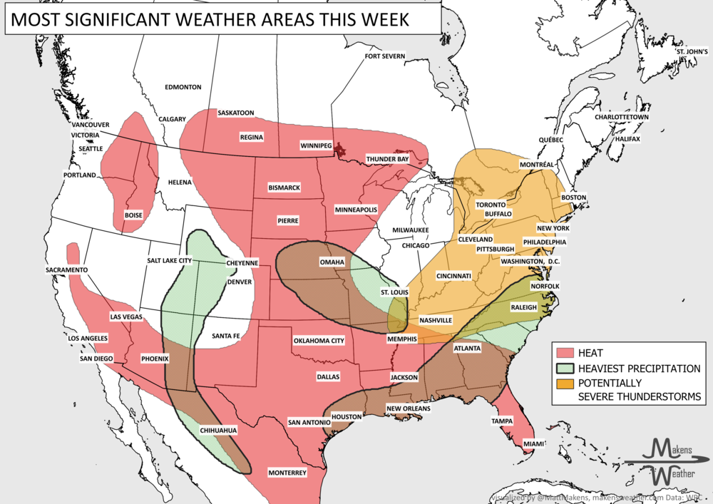
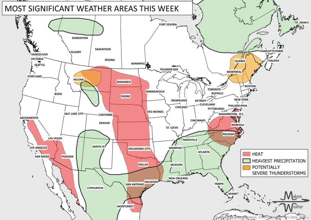
The weather pattern across the United States and Canada remains highly active this week, with two major stories dominating the forecast. Dangerous, long-lasting heat continues across much of the South before expanding into the western United States by the weekend. At the same time, repeated rounds of thunderstorms will bring the threat of flash flooding and severe weather from the Mid-Atlantic and Northeast to parts of the Midwest and Gulf Coast. Residents across these regions should stay weather-aware as heavy rain, damaging winds, and dangerous heat create multiple hazards over the coming week.