


Weekly Weather Watch: Monday, December 1st, 2025
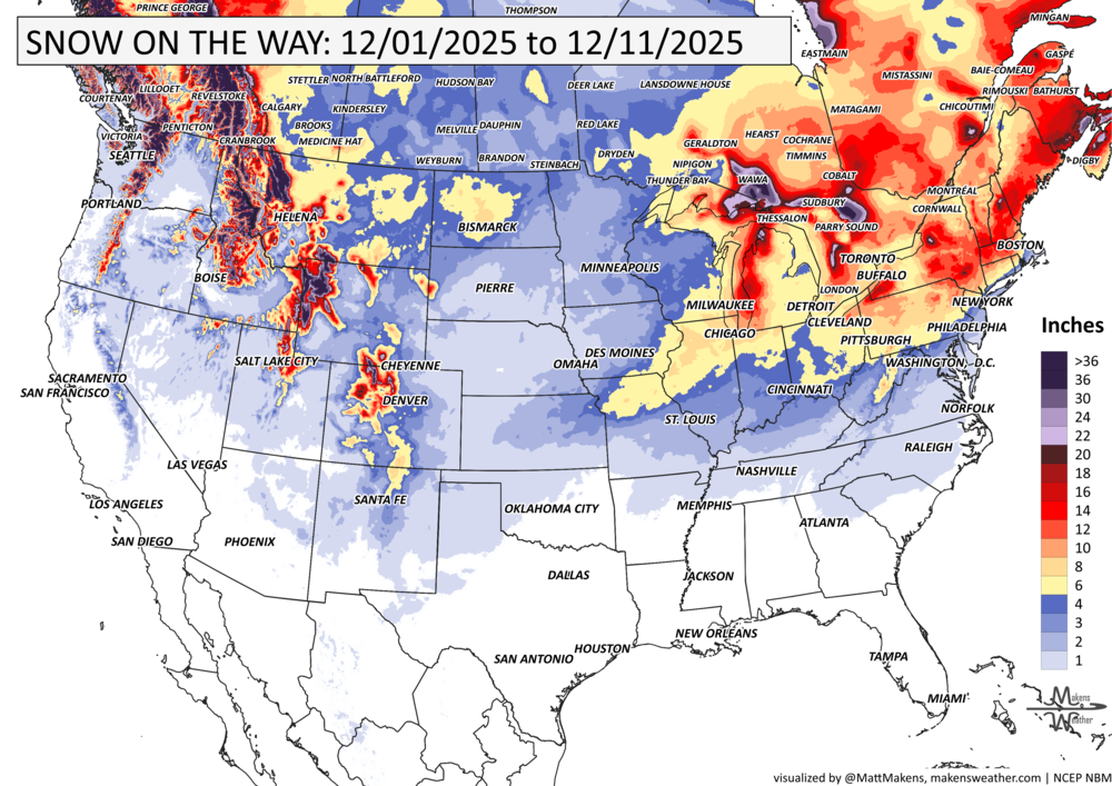
A potent early-winter storm system is set to make headlines across the central and eastern U.S. this week. Expect a mix of soaking rains, thunderstorms, icy roads, and accumulating snow from the Gulf Coast to New England, followed by more storm potential late in the week. Freezing rain hits parts of British Columbia, meanwhile, snow squalls and lake effect snows for parts of Ontario and Quebec. Colder-than-normal air will grip much of North America, giving this week a distinctly winter-like feel.
Unlock the Makens Weather Advantage ☀️📊
Your membership includes:
✔️ Real-time dashboard with the latest weather observations and long-range projections
✔️ Monthly-lead forecasts to plan weeks ahead
✔️ Discounts on personalized consultations for ag, energy, or risk planning
All built for decision-makers who need weather insight, not just data.
🎯 Join now and put the forecast to work for you.
📈 The latest outlooks and conditions - track it 👉 Join Now to Access the Dashboard
HEADLINERS:
Key Weather Impacts
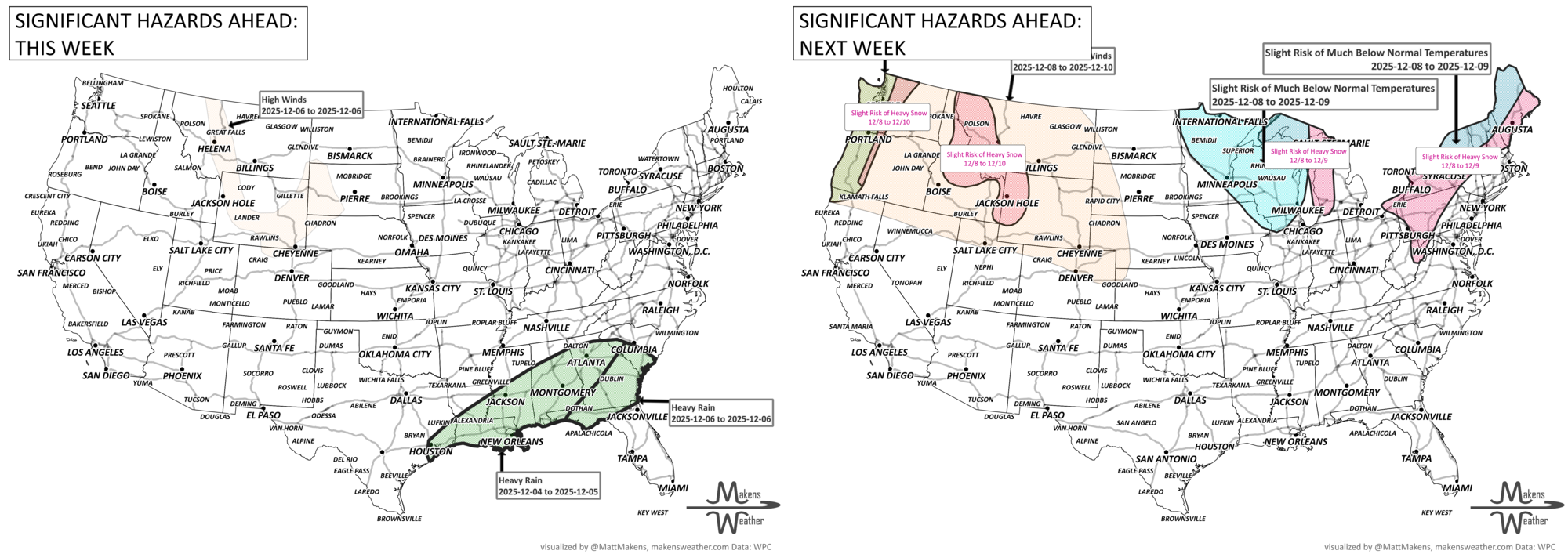
Monday–Wednesday:
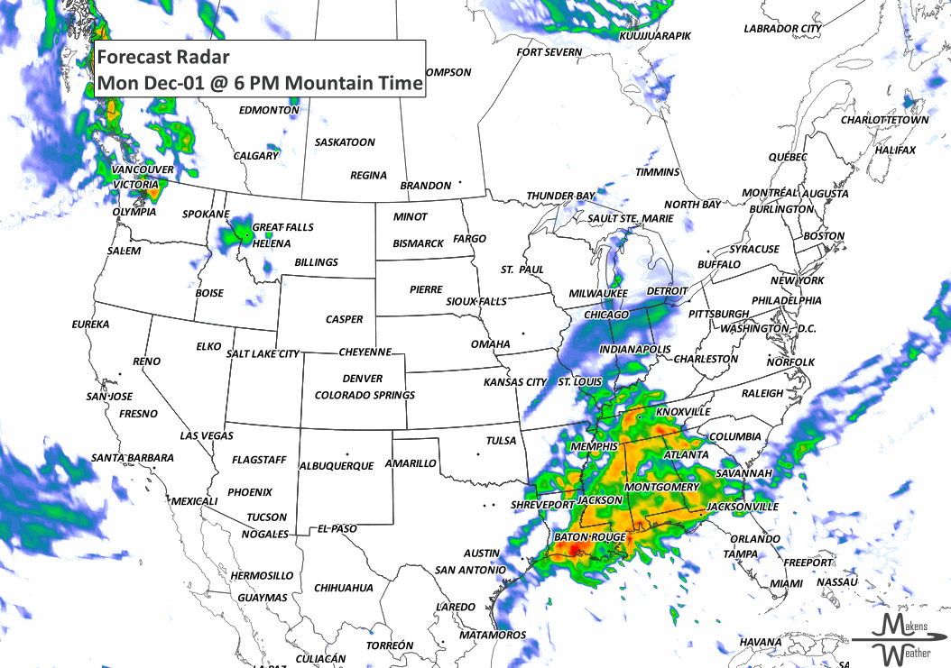
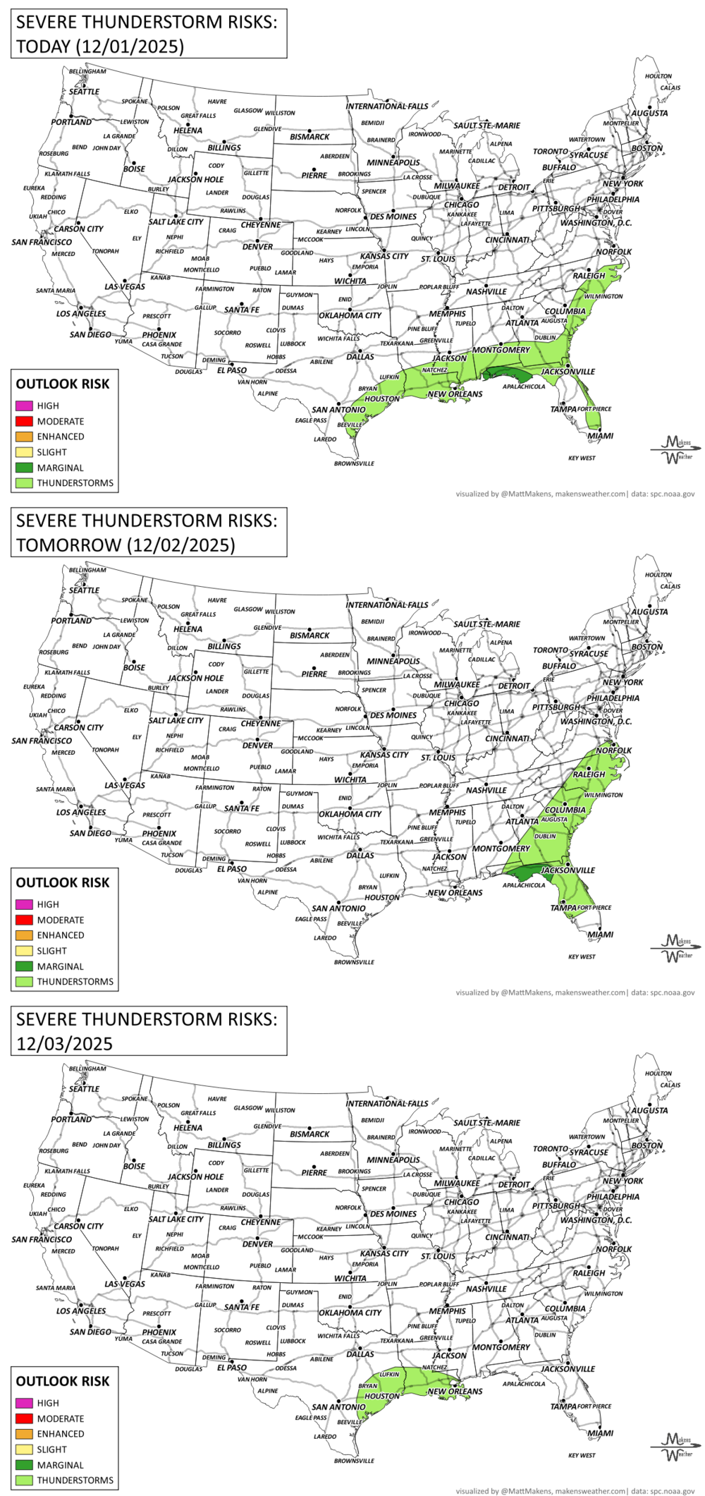
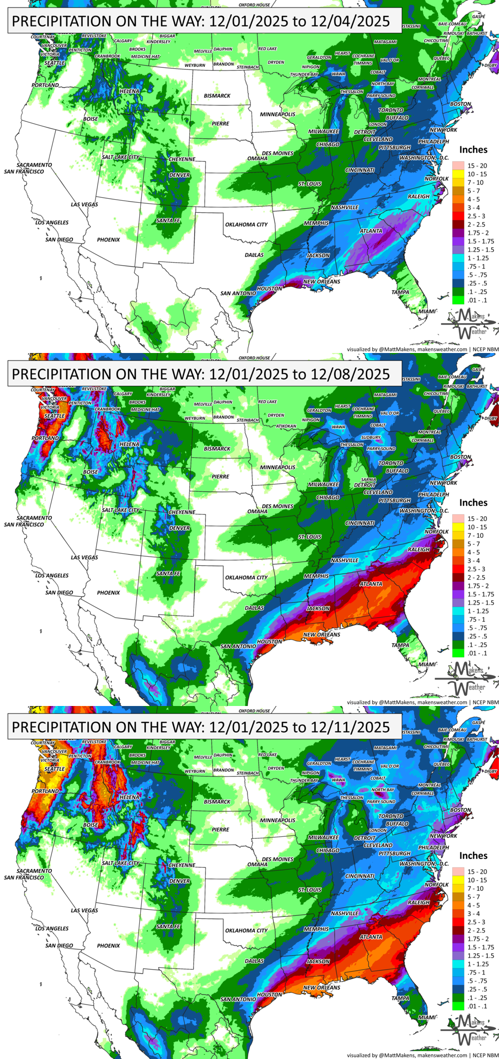
Gulf Coast & Southeast: Scattered thunderstorms and heavy rain, with isolated flash flood potential.
Ozarks to Ohio Valley: Messy wintry mix with ice glaze possible; hazardous travel conditions.
Plains to Lower Great Lakes: Light to moderate snow accumulations.
New England & Inland Mid-Atlantic: Season’s first major winter storm Monday night into Tuesday. Expect heavy snow (6”+ in spots) and ice, mainly north and west of I-95.
Freezing rain for British Columbia, and snow squalls near the Great Lakes in Ontario and Quebec.
Thursday–Saturday:
Gulf Coast to Southeast: A new round of heavy rain spreads in, possibly training over the same areas and leading to localized flooding.
Northern Plains & Upper Midwest: Cold surge with wind chills -20 to -30°F Thursday morning.
Northeast: Watching for another possible Nor’easter this weekend—stay tuned as confidence builds.
Temperature Outlook:
Central/Eastern U.S.: Temperatures remain well below average with widespread chill.
West Coast & Southwest: A flip to milder and above-average conditions later in the week.
ON THE RADAR:
KEEP AN EYE TO THE SKY:
IN THE GAUGES:
GRAB A RULER:
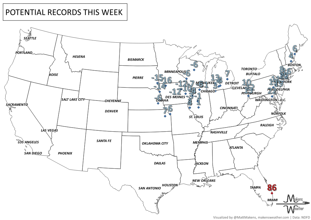
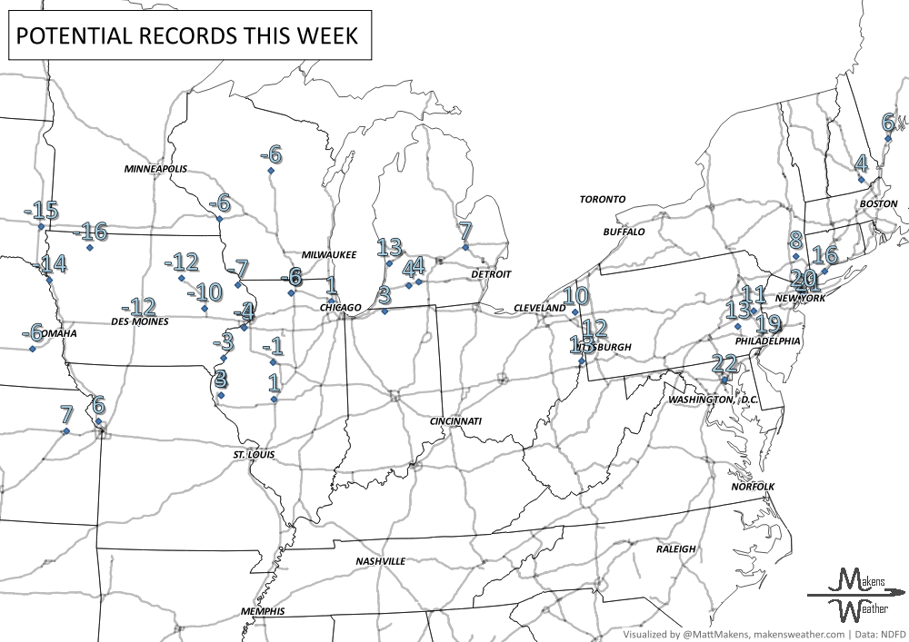
RECORDS MADE TO BE BROKEN:
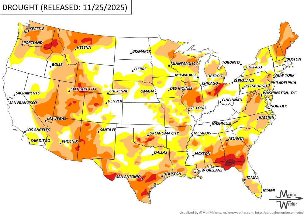
UN-DROUGHTABLY DRY:
There’s been notable drought relief across parts of the West, Lower Midwest, Northeast, and South this week, thanks to recent storms and rainfall. Southern California, Arizona, and southern Nevada have seen some of the most dramatic improvements, with several cities recording record or near-record precipitation since October 1. However, not all areas are seeing gains—the Pacific Northwest continues to run drier than normal with lagging snowpack, and drought has intensified across the Florida Panhandle, southern Alabama, and southern Georgia due to persistent warmth and dryness.
Reservoir levels are holding strong in California, with key sites above seasonal averages, but remain very low in parts of the Southwest, including Lake Mead and Elephant Butte in New Mexico, which sits at just 5% full. -U.S. Department of Agriculture
ARE YOU CIRRUS?!
1876 Official government forecasts, since beginning in 1871, had been called probabilities (rather than forecasts). On this day the term probabilities was replaced with the term indications.
1962 The Grey Cup (Canadian Football Championship) continued for 2 days in Toronto in dense fog. The fog was so thick that spectators in the upper stands could not see the other side of the field.
1912 A dispute over hauling coal lead to an attempt to blow up the Trent River Bridge in British Columbia. Twenty five sticks of dynamite were planted under the bridge and attached to a 50 meter fuse. The dynamite must have frozen solid by the time the lighted fuse reached the cap, because the dynamite never exploded.
A drawn-out storm pattern will keep much of the country active through the first week of April. A slow-moving front stretching from the Great Lakes into the Plains will separate late-season snow and ice to the north from heavy rain and severe thunderstorms to the south. The setup brings the greatest impacts to parts of the Midwest, Ohio Valley, Southern Plains, Mississippi Valley, and eventually the East Coast, while the West sees mountain snow and then a warming trend heading into the weekend.