


Weekly Weather Watch: Tuesday, November 18th, 2025
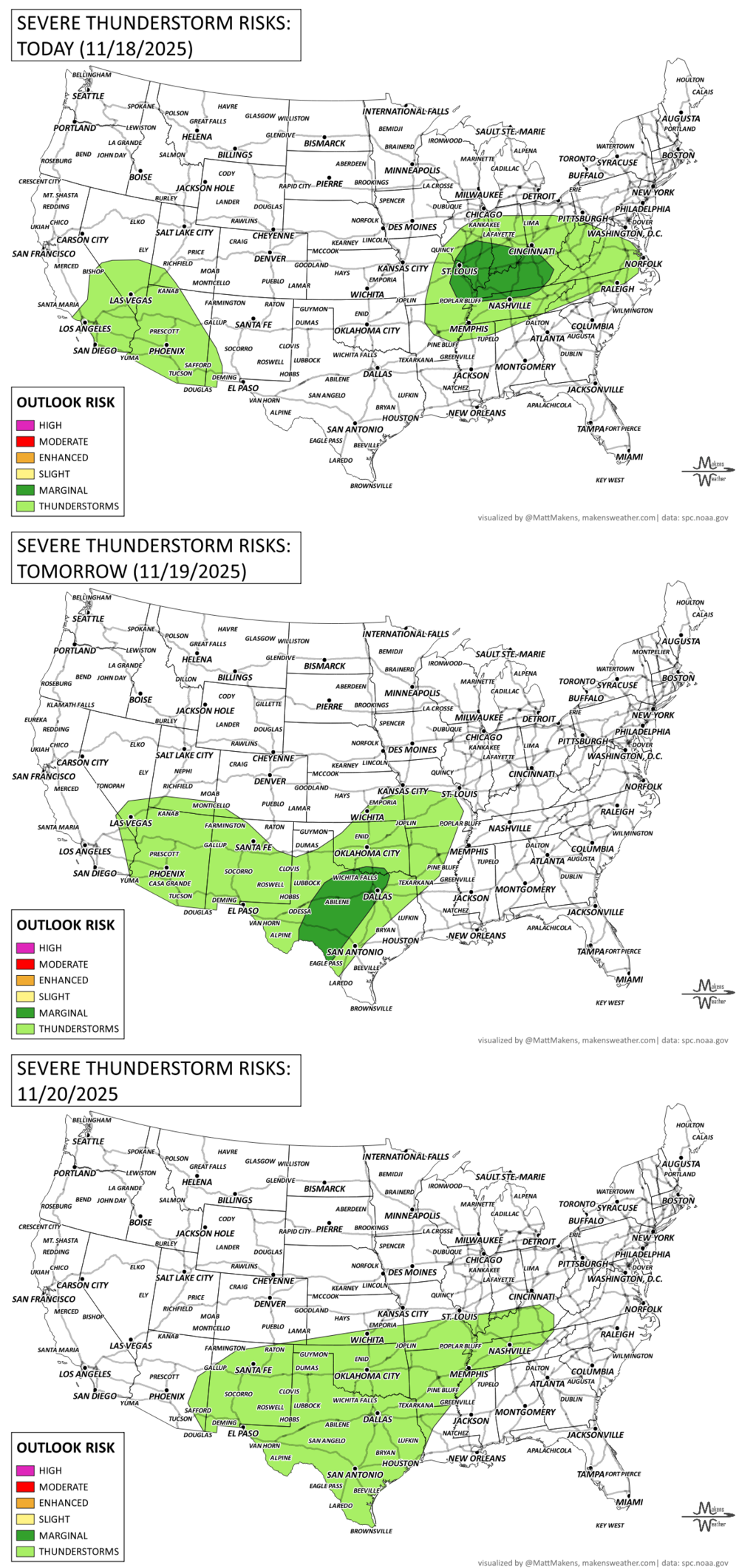
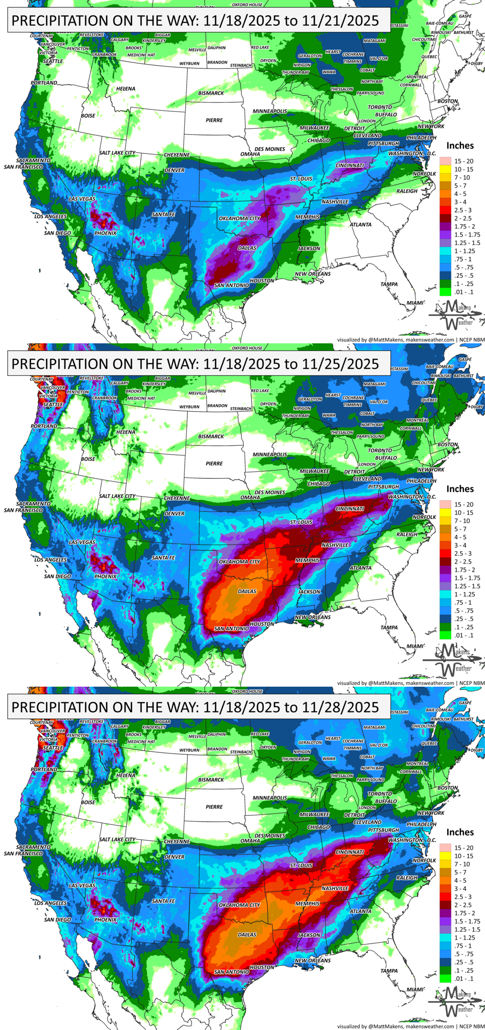
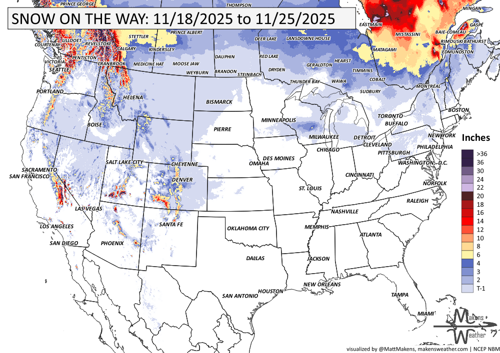
A slow-moving storm system is soaking the Southwest U.S. with widespread rain and embedded thunderstorms through Thursday. Snow is falling at higher elevations in the Sierra Nevada and southern Utah mountains, with isolated flash flooding possible across southern California. Meanwhile, a broad area of above-average warmth is expanding across the southern Plains and Southeast, breaking records in some spots. The next system will return wet weather to the central U.S. this weekend into early next week. Across Canada, the heaviest precipitation falls on the mountains and coastal British Columbia. The coldest nights, dropping to -10°C (~14°F) will be in the mountains and across the East.
last call!!!💧PRF INSURANCE
For those in agriculture, PRF insurance isn’t due until December, but I’m already processing many requests for 2026 rainfall grid outlooks. Members receive discounts on custom PRF grid analyses.
📈 The latest outlooks and conditions - track it 👉 Join Now to Access the Dashboard
HEADLINERS:
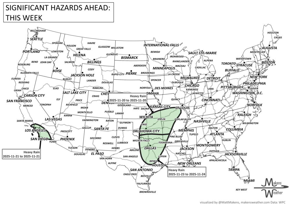
Key Weather Impacts:
Tuesday–Wednesday
Heavy rain and isolated thunderstorms in southern California and Arizona
Moderate to heavy mountain snow in the southern Sierra Nevada and southern Utah
Isolated flooding risk, especially near recent burn scars
Wednesday–Thursday
Showers and a few storms reach the Southern Rockies and Southern Plains
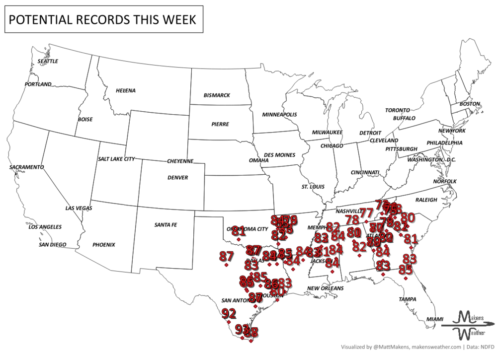
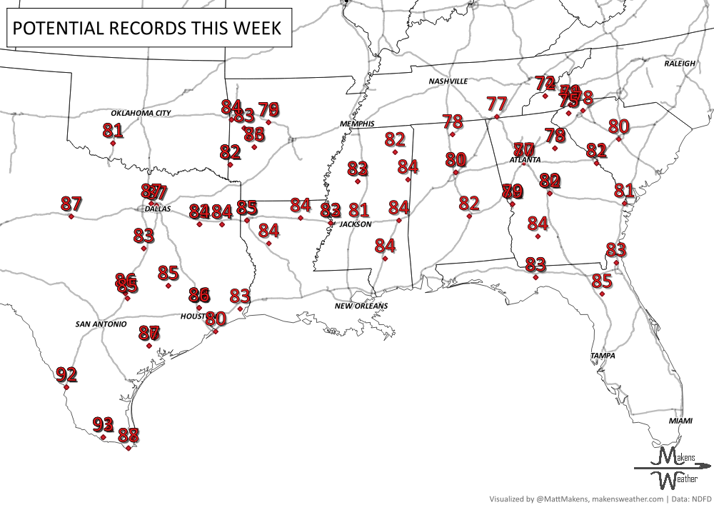
Warmth peaks across the Southeast and southern Plains, challenging record highs
Friday–Saturday
Rain spreads into the Lower Mississippi Valley and Tennessee Valley
Snow possible in parts of the Northern Rockies and Pacific Northwest
Sunday–Monday
Another round of rain and storms likely for the South-Central U.S.
Continued snow in the Northern Rockies
Cooler weather in California
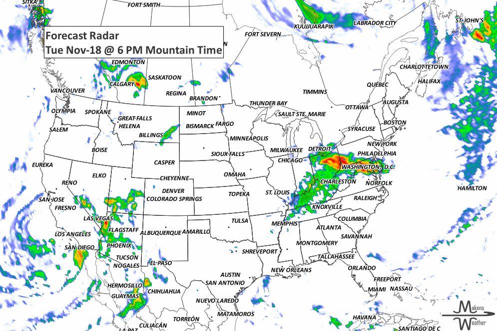
ON THE RADAR:
KEEP AN EYE TO THE SKY:
IN THE GAUGES:
GRAB A RULER:
RECORDS MADE TO BE BROKEN:
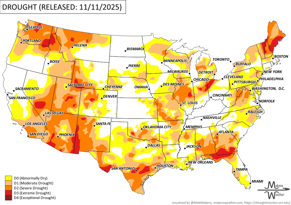
UN-DROUGHTABLY DRY:
This past week brought mostly dry weather to much of the Great Plains, South-Central U.S., and parts of the Southeast, leading to worsening drought conditions—especially in Texas, Oklahoma, and Louisiana. Meanwhile, storm systems dropped over 3 inches of rain from northern California into the Pacific Northwest, helping ease drought in Oregon and Idaho. Montana saw mixed results, with wet weather improving the west and continued dryness worsening the north-central areas. Parts of the Northeast, Great Lakes, and New England saw improvements following recent rain and snow, but the Southeast, particularly Florida, southern Georgia, and Virginia, saw further drought expansion.. -U.S. Department of Agriculture
TROPICAL TIDINGS:
The tropics are quiet.
ARE YOU CIRRUS?!
1421 72 Dutch villages were swept away when waves from an intense storm system breached coastal dikes on the North Sea Coast of the Netherlands. The so-called St.Elizabeth Flood killed 10,000 people.
A drawn-out storm pattern will keep much of the country active through the first week of April. A slow-moving front stretching from the Great Lakes into the Plains will separate late-season snow and ice to the north from heavy rain and severe thunderstorms to the south. The setup brings the greatest impacts to parts of the Midwest, Ohio Valley, Southern Plains, Mississippi Valley, and eventually the East Coast, while the West sees mountain snow and then a warming trend heading into the weekend.