


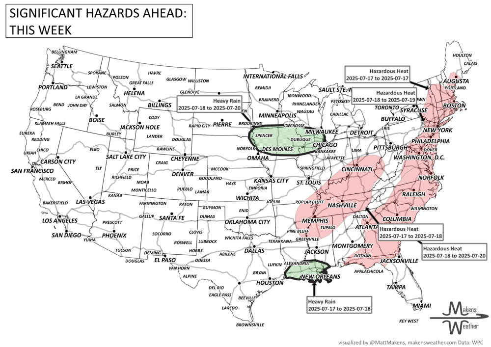
A busy stretch of summer weather is unfolding across the U.S., with dangerous thunderstorms, heavy rainfall, flash flooding, and scorching heat all in the mix. Severe storms with damaging winds and large hail are expected across the Central and Northern Plains, while heavy downpours raise flash flood concerns from the Mid-Atlantic to Florida. A tropical disturbance is moving across Florida and into the northern Gulf Coast, adding to the flood threat. Meanwhile, extreme heat builds across the East, and fire danger increases across the Great Basin. Severe thunderstorms are possible from Ontario to the Maritimes; meanwhile, air quality related to wildfire smoke is impacting central and western Canada.
Read More
The weather pattern remains active as we head through the final week of June. Severe thunderstorms and heavy rainfall will continue to impact parts of the Plains, Midwest, Ohio Valley, and Mid-Atlantic through the week, while dangerous heat remains locked in across portions of the South and expands eastward by early next week. Meanwhile, wildfire concerns are increasing across the Four Corners region, and a cooling trend is finally on the way for parts of the West this weekend. Residents in several regions should be prepared for rapidly changing weather conditions, including flash flooding, severe storms, and periods of dangerous heat.