


A series of Pacific storms is taking aim at the Northwest this week, delivering heavy rain, mountain snow, and gusty winds that could lead to flooding. While the West braces for more moisture, the Central and Western U.S. will bask in record-challenging warmth, with temperatures soaring 15 to 25 degrees above normal. Meanwhile, the chill that's gripped the Eastern U.S. finally begins to ease midweek, ushering in a brief break from the Arctic air. Flash freeze, snow, and wind will hit much of the Canadian Prairies, first with Alberta on Wednesday, then spreading eastward.
Read More
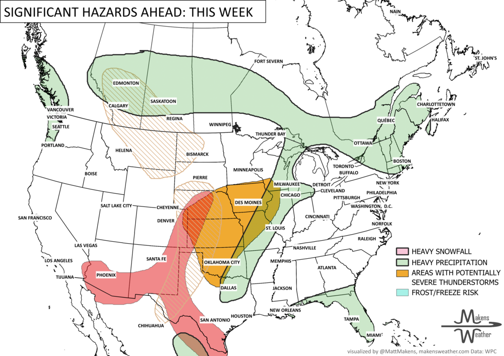
An active and impactful weather pattern is setting up across much of North America through next week. Multiple rounds of severe thunderstorms are expected from the eastern Canadian Prairies, U.S. Plains into the Mississippi Valley, bringing the risk of damaging winds, large hail, and tornadoes. Heavy rainfall may lead to localized flooding from the Northern Plains to the Southeast, while wildfire concerns continue across the Four Corners region. At the same time, summer heat is building, with the East experiencing its hottest temperatures of the season late this week before above-average warmth expands westward during the weekend.