


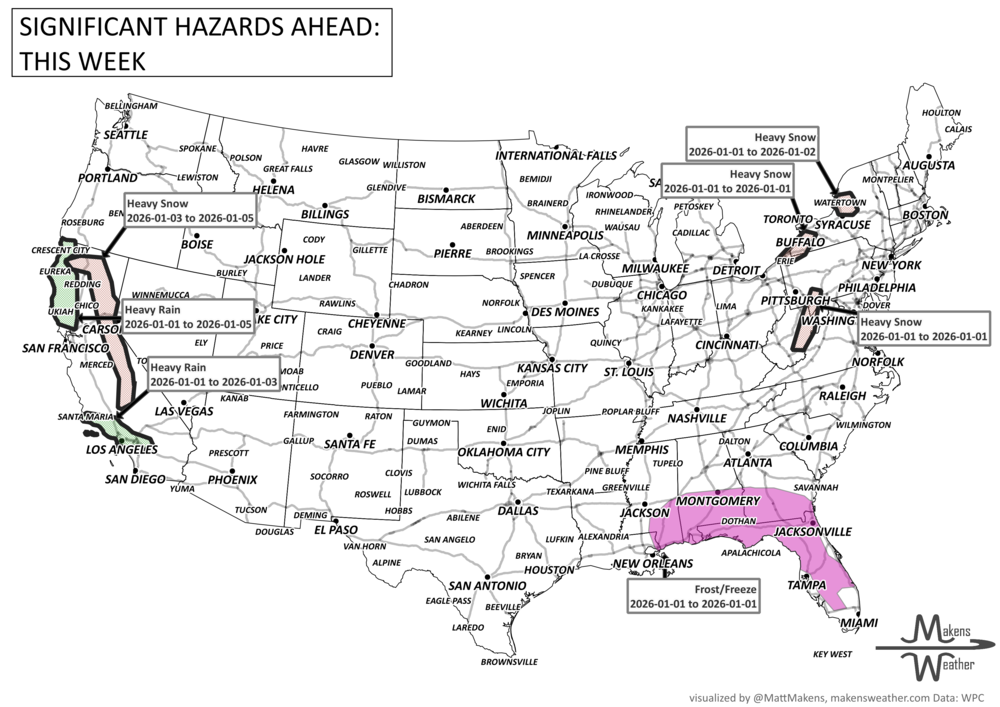
As we close out 2025 and ring in the new year, the weather pattern stays anything but quiet. A multi-day lake-effect snow event is burying areas downwind of Lakes Erie and Ontario, where over 3 feet of snow could fall in the most persistent bands—creating whiteout squalls and treacherous travel through New Year's Day. Meanwhile, Arctic air is spilling deep into the Southeast, sending temperatures below freezing as far south as Florida, with frost and freeze alerts in place. On the other side of the country, a Pacific storm system will bring rounds of heavy rain and a flash flood threat to Southern California, especially around Los Angeles, starting late New Year's Eve. Elsewhere, a couple of fast-moving clippers will spread freezing rain and snow to Alberta, then snow across the Midwest, Ohio Valley, and into New England, while a developing storm may bring soaking rain and thunderstorms from the Deep South to the Southeast Coast by the weekend. Even Northern California faces an atmospheric river event late week, setting the stage for an active and disruptive start to 2026.
Read More
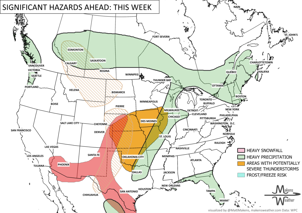
An active and impactful weather pattern is setting up across much of North America through next week. Multiple rounds of severe thunderstorms are expected from the eastern Canadian Prairies, U.S. Plains into the Mississippi Valley, bringing the risk of damaging winds, large hail, and tornadoes. Heavy rainfall may lead to localized flooding from the Northern Plains to the Southeast, while wildfire concerns continue across the Four Corners region. At the same time, summer heat is building, with the East experiencing its hottest temperatures of the season late this week before above-average warmth expands westward during the weekend.