


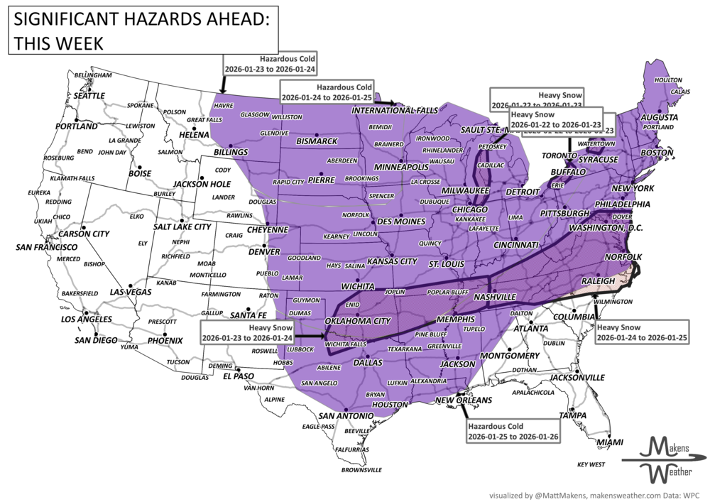
Dangerous weather for many - a very active winter pattern is unfolding across the U.S. Lake-effect snow continues around the Great Lakes through midweek, while dangerous Arctic cold grips much of the central and eastern states. Attention then shifts to Friday through the weekend, when a potentially high-impact winter storm could spread snow and ice from the Southern Plains into the Mid-Atlantic. Travel disruptions, power issues, and prolonged cold are all on the table. For Canada, dangerous cold, particularly for Central to Eastern Provinces. Snow squalls are possible in Alberta and Saskatchewan.
Read More
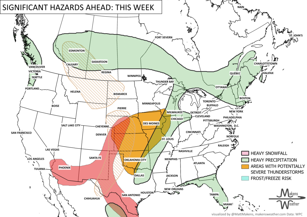
An active and impactful weather pattern is setting up across much of North America through next week. Multiple rounds of severe thunderstorms are expected from the eastern Canadian Prairies, U.S. Plains into the Mississippi Valley, bringing the risk of damaging winds, large hail, and tornadoes. Heavy rainfall may lead to localized flooding from the Northern Plains to the Southeast, while wildfire concerns continue across the Four Corners region. At the same time, summer heat is building, with the East experiencing its hottest temperatures of the season late this week before above-average warmth expands westward during the weekend.