
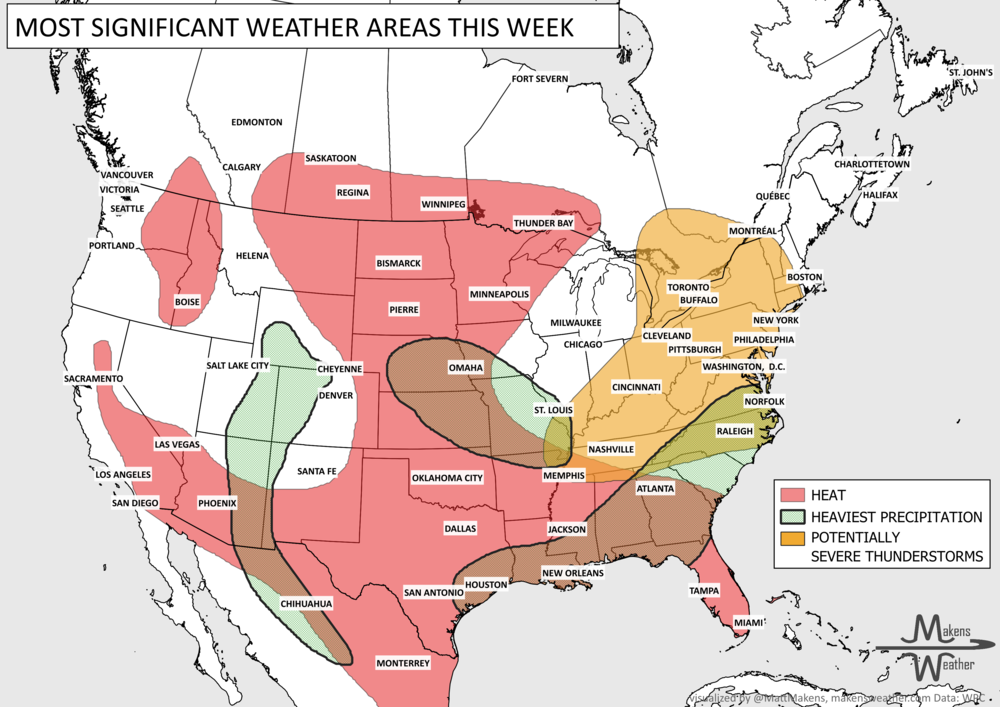
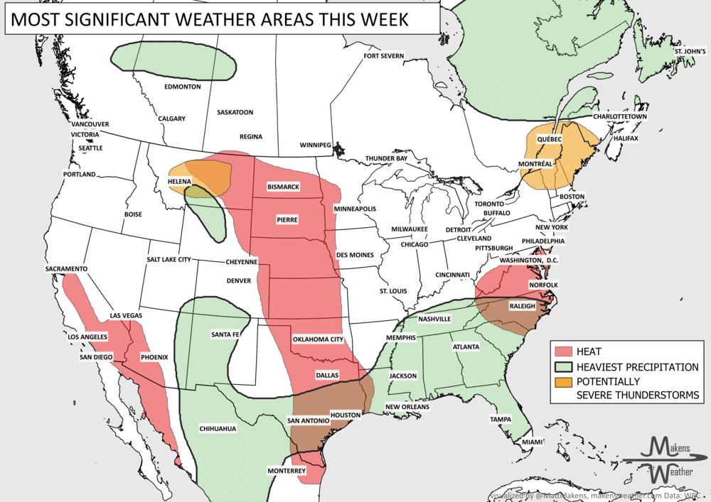


A big split in the weather pattern will drive the story over the next week. Early-season heat will continue across parts of the Southwest, Plains, and Mississippi Valley, with some areas running more like late spring than late March. At the same time, a strong cold front will sweep across the northern half of the country, bringing rounds of rain, some mountain and northern-tier snow, a chance for strong thunderstorms, and a sharp return to cooler air for the East. By early next week, warmth expands again from the West into the Plains, while increasing Pacific moisture may begin pushing back into the Southwest.
Read More
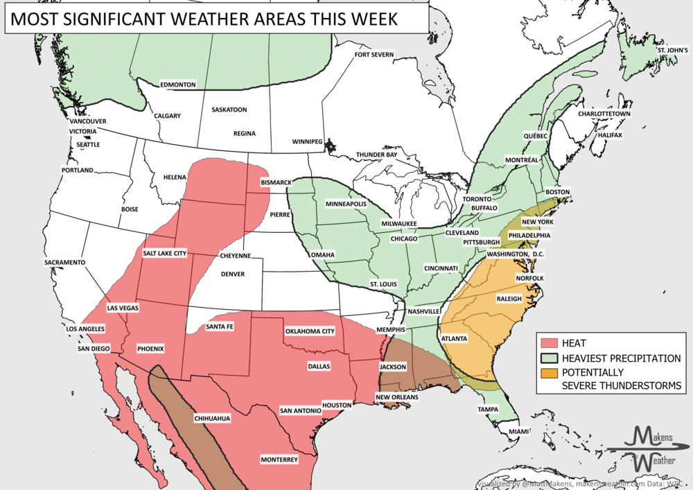
The weather pattern across the United States and Canada remains highly active this week, with two major stories dominating the forecast. Dangerous, long-lasting heat continues across much of the South before expanding into the western United States by the weekend. At the same time, repeated rounds of thunderstorms will bring the threat of flash flooding and severe weather from the Mid-Atlantic and Northeast to parts of the Midwest and Gulf Coast. Residents across these regions should stay weather-aware as heavy rain, damaging winds, and dangerous heat create multiple hazards over the coming week.