

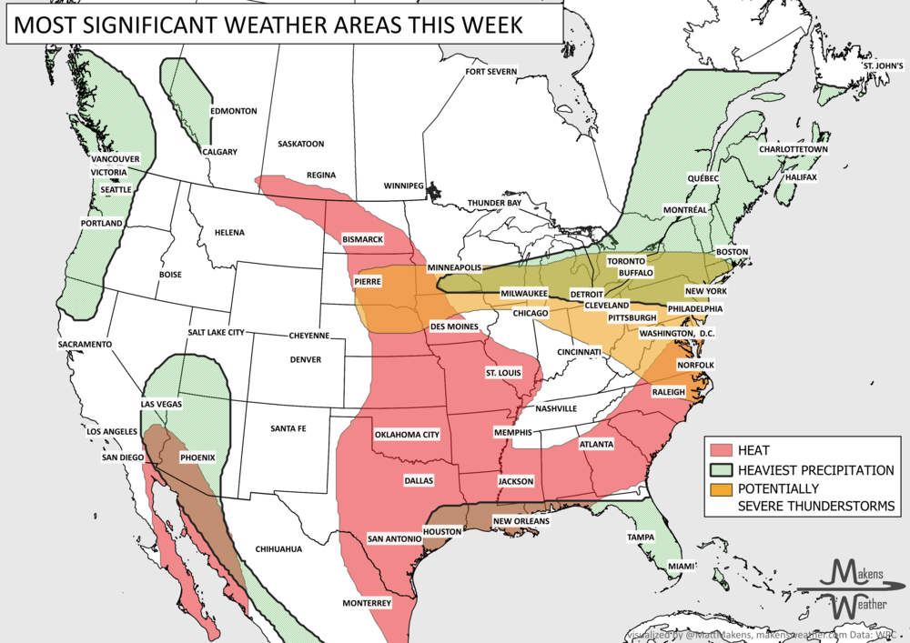
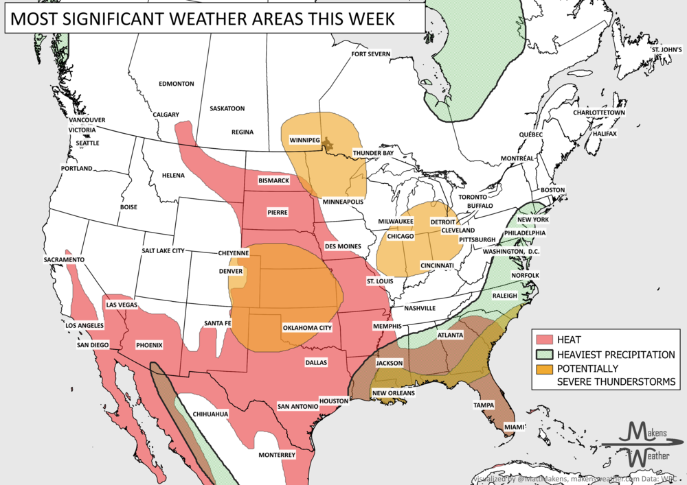
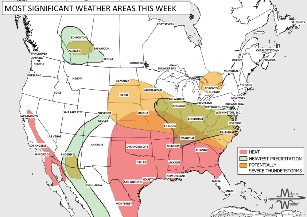
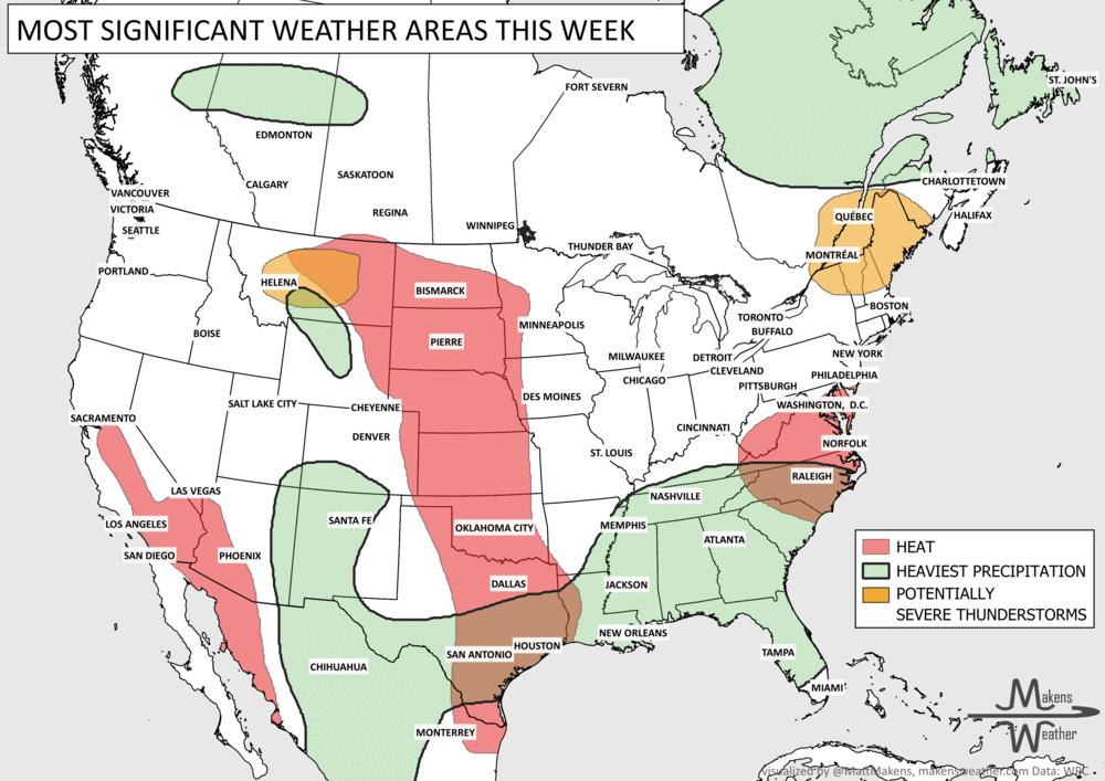
A prolonged and dangerous weather pattern continues across much of the United States this week. A powerful dome of high pressure will keep dangerous heat locked over the Northern Plains, Upper Midwest, and eventually parts of the Northeast and Mid-Atlantic, while repeated rounds of thunderstorms bring a serious flash flood threat to southwest Texas. At the same time, the Southwest monsoon is becoming increasingly active, bringing daily thunderstorms and localized flooding concerns across the Four Corners and Intermountain West.
Read More
The main story this week is a sharp contrast across the country. Tropical Storm Edouard brings heavy rain, coastal flooding concerns and strong winds to Upper Texas and southwestern Louisiana through Wednesday, while rounds of thunderstorms may produce severe weather and localized flash flooding from the Great Lakes and Northeast into the Mid-Atlantic. Meanwhile, a stubborn late-summer heat wave holds across the Central and Southern Plains and spreads east before a cold front brings some relief this weekend. Out West, the Pacific Northwest stays unusually cool and showery, while monsoonal moisture increases the chance for locally heavy rain and flash flooding across the Southwest.