
The weather pattern across the United States and Canada remains highly active this week, with two major stories dominating the forecast. Dangerous, long-lasting heat continues across much of the South before expanding into the western United States by the weekend. At the same time, repeated rounds of thunderstorms will bring the threat of flash flooding and severe weather from the Mid-Atlantic and Northeast to parts of the Midwest and Gulf Coast. Residents across these regions should stay weather-aware as heavy rain, damaging winds, and dangerous heat create multiple hazards over the coming week.
Read MoreWeekly Weather Watch
THE LATEST UPDATE:
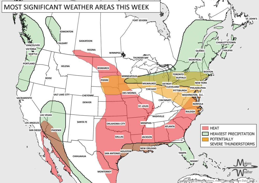
The main story this week is a sharp contrast across the country. Tropical Storm Edouard brings heavy rain, coastal flooding concerns and strong winds to Upper Texas and southwestern Louisiana through Wednesday, while rounds of thunderstorms may produce severe weather and localized flash flooding from the Great Lakes and Northeast into the Mid-Atlantic. Meanwhile, a stubborn late-summer heat wave holds across the Central and Southern Plains and spreads east before a cold front brings some relief this weekend. Out West, the Pacific Northwest stays unusually cool and showery, while monsoonal moisture increases the chance for locally heavy rain and flash flooding across the Southwest.
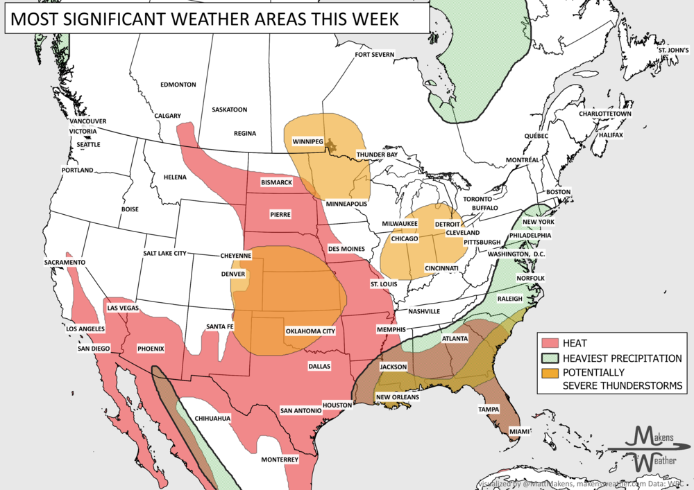
Late August is bringing two very different weather stories across the country. Dangerous heat remains locked in from the Desert Southwest into Texas and the Southern Plains, with little relief at night. To the north and east, a more active storm track will bring rounds of thunderstorms from the Plains into the Midwest and Great Lakes, including some severe storms and locally heavy rain. Monsoon moisture will also keep scattered thunderstorms going across the Four Corners and Rockies, where isolated flash flooding remains possible. By the weekend, the heat begins expanding farther east toward the Lower Mississippi Valley and Mid-South.
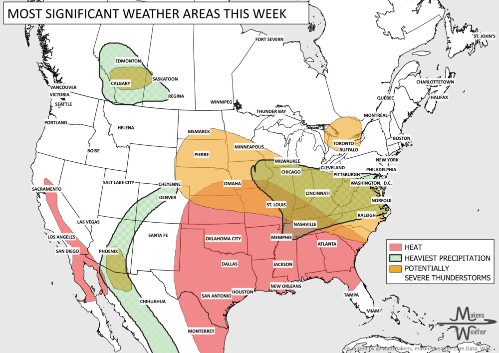
The main weather story this week is a sharp split between stormy weather across the nation’s midsection and persistent summer heat farther south. Severe thunderstorms threaten parts of the central Plains and Lower Missouri Valley through tonight, with large hail, damaging winds and locally heavy rain possible. Another round of strong storms shifts toward the mid-Mississippi Valley Wednesday. Meanwhile, dangerous heat continues from the southern Plains through the Southeast, while expanding back into the Southwest. Later in the week, the Southeast finally gets some relief, but the heat hangs on farther west.
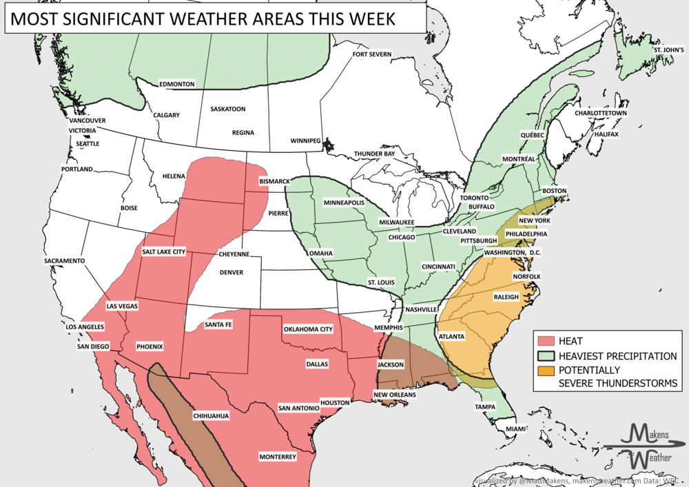
An active summer weather pattern will bring several areas to watch through early next week. The most immediate concern is across the Ohio Valley, where additional heavy rain falling on already saturated areas could produce considerable flash and urban flooding, while severe thunderstorms bring a damaging wind threat. Farther south, persistent heat and humidity will continue from the Southern Plains through the Southeast, with little overnight relief in some areas. Meanwhile, increasing monsoon moisture will bring repeated thunderstorms and a flash flood threat to the Southwest and Rockies, while additional rounds of storms and heavy rain remain possible from the Central Plains and Midwest into the East later this week.
The main story this week is a sharp contrast across the country. Tropical Storm Edouard brings heavy rain, coastal flooding concerns and strong winds to Upper Texas and southwestern Louisiana through Wednesday, while rounds of thunderstorms may produce severe weather and localized flash flooding from the Great Lakes and Northeast into the Mid-Atlantic. Meanwhile, a stubborn late-summer heat wave holds across the Central and Southern Plains and spreads east before a cold front brings some relief this weekend. Out West, the Pacific Northwest stays unusually cool and showery, while monsoonal moisture increases the chance for locally heavy rain and flash flooding across the Southwest.