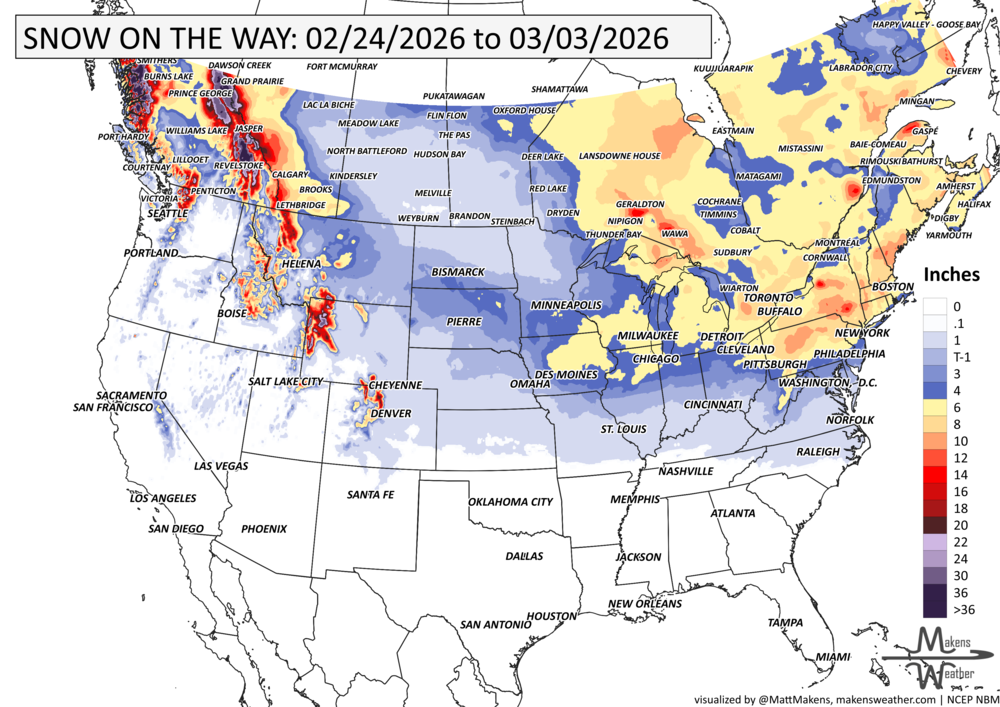
Approaching the U.S.’s Thanksgiving holiday with heavy mountain snows to the West, slowing drivers through the Rockies. That’s the leading topic, but there’s a lot more to get to in this week’s Weather Watch. A significant arctic outbreak will arrive in the northern Rockies and Northern Plains on Thanksgiving into Friday and advance farther south and east through much of the Plains and Midwest this weekend. Dangerous wind chill temperatures are expected with a significant long duration lake effect snow event possible downwind of the Great Lakes. Severe thunderstorms may be possible in the Southeast. Heavy precipitation stretches across British Columbia and Alberta and freezing rain with snow squalls for Ontario and Quebec.
Read More
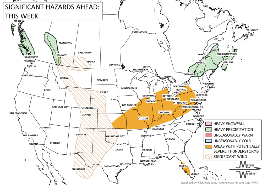
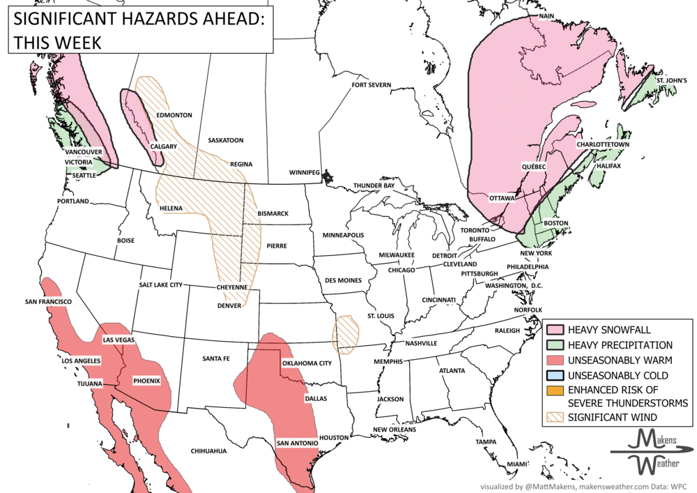
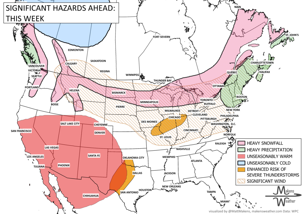
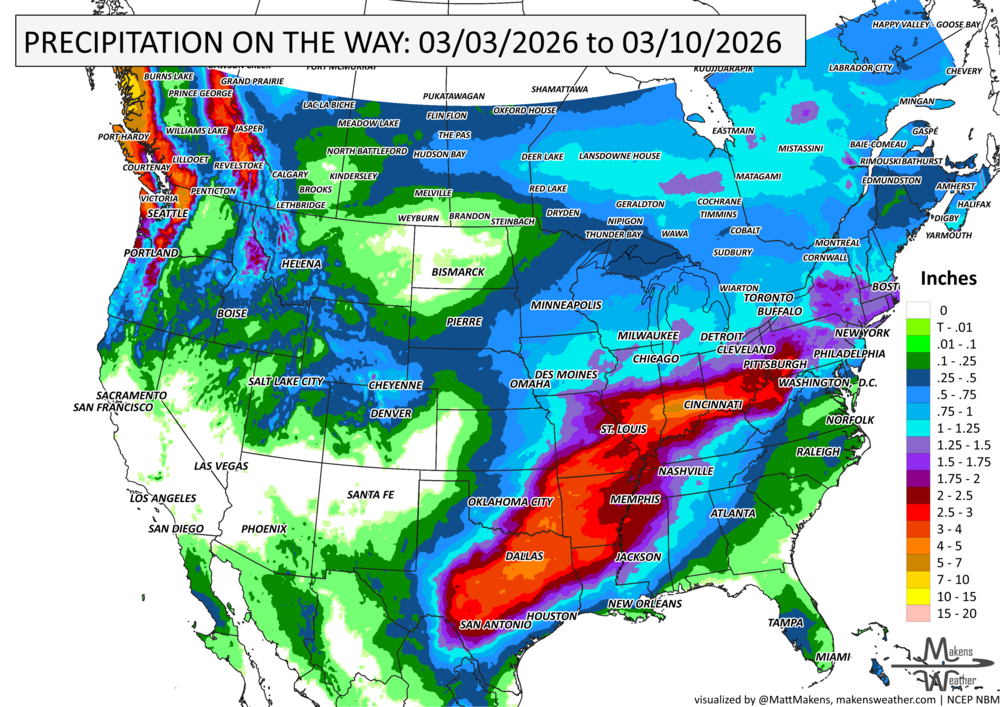

A big split in the weather pattern will drive the story over the next week. Early-season heat will continue across parts of the Southwest, Plains, and Mississippi Valley, with some areas running more like late spring than late March. At the same time, a strong cold front will sweep across the northern half of the country, bringing rounds of rain, some mountain and northern-tier snow, a chance for strong thunderstorms, and a sharp return to cooler air for the East. By early next week, warmth expands again from the West into the Plains, while increasing Pacific moisture may begin pushing back into the Southwest.