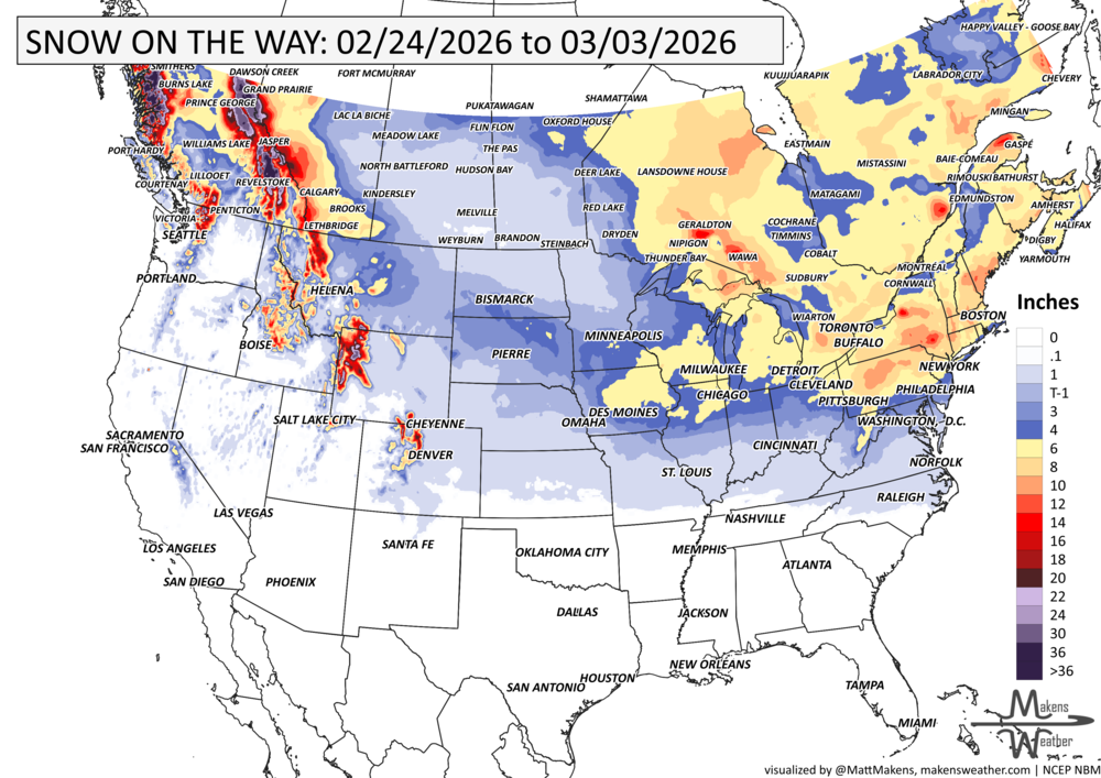
A couple of strong winter storm systems are crossing the country. Through Wednesday, heavy snow and ice to the Ohio Valley into the Mid-Atlantic, ice for the Central Appalachians, and heavy snow and ice to the Central Plains. Heavy rain will result in flash and river flooding in the Lower Mississippi and Tennessee Valleys. Canada remain cold to the West where the heaviest snow will be in the mountains but also some heavy snowfall east focused on the Maritimes. Later this week, another very wet setup for the West arrives.
Read More
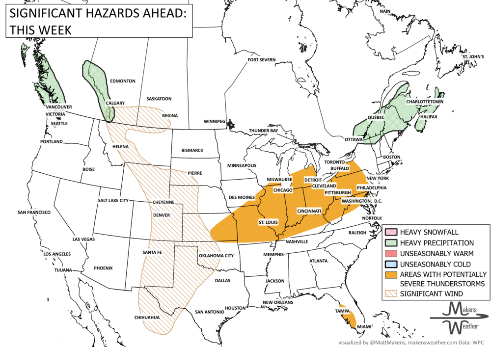
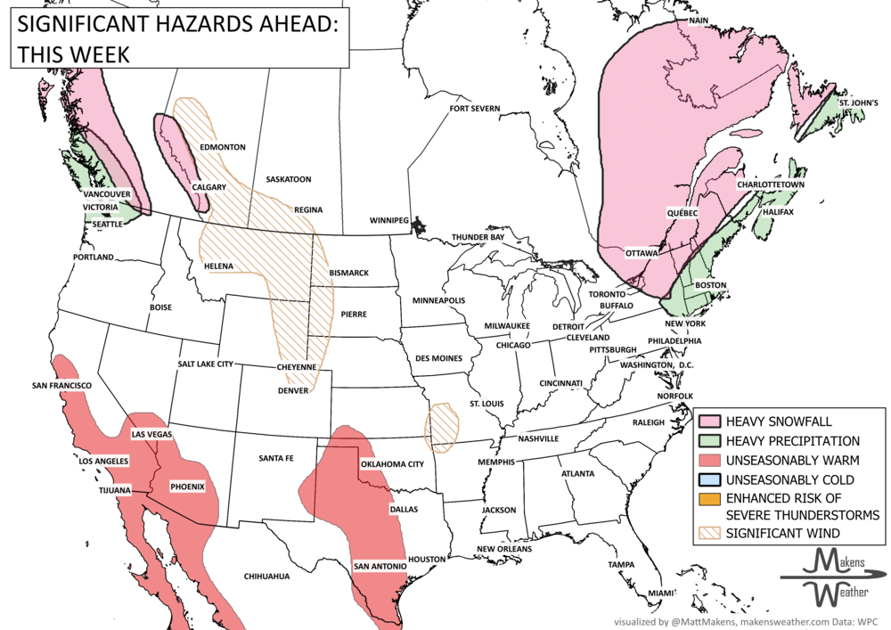
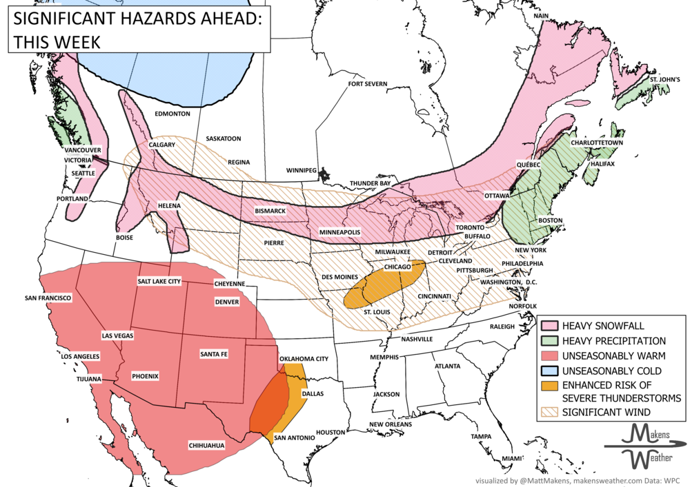
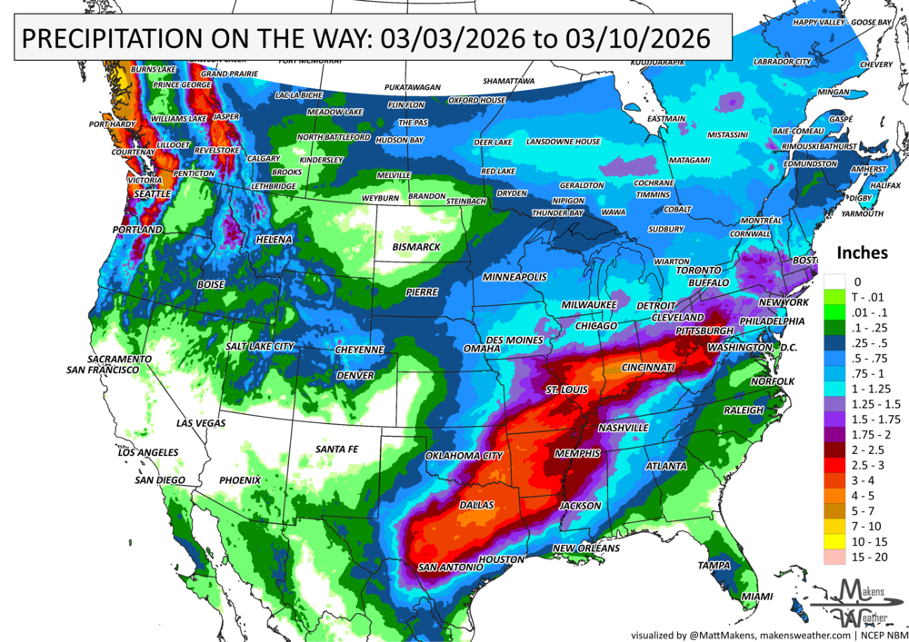

A big split in the weather pattern will drive the story over the next week. Early-season heat will continue across parts of the Southwest, Plains, and Mississippi Valley, with some areas running more like late spring than late March. At the same time, a strong cold front will sweep across the northern half of the country, bringing rounds of rain, some mountain and northern-tier snow, a chance for strong thunderstorms, and a sharp return to cooler air for the East. By early next week, warmth expands again from the West into the Plains, while increasing Pacific moisture may begin pushing back into the Southwest.