Showers and thunderstorms are expected to linger across the South over the next couple of days as a trailing front stalls in the region. Isolated severe storms could bring large hail, strong wind gusts, and heavy rain, particularly in the southern Plains. This weather system will gradually spread eastward, with widespread thunderstorms and heavy rain moving into the east-central and northeastern U.S. later this week. At the same time, an upper-level trough moving across the West will bring moderate precipitation to the Northwest, including snow at higher elevations in the north-central Rockies. This unsettled weather will continue to increase rain and thunderstorm chances across the central U.S. into the weekend.
Read More
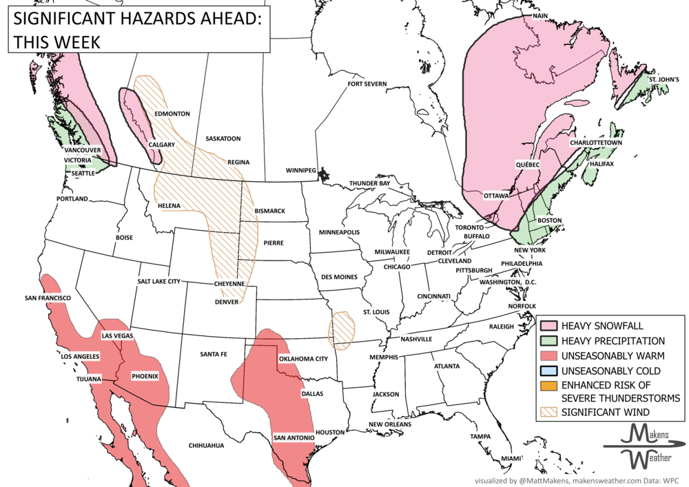
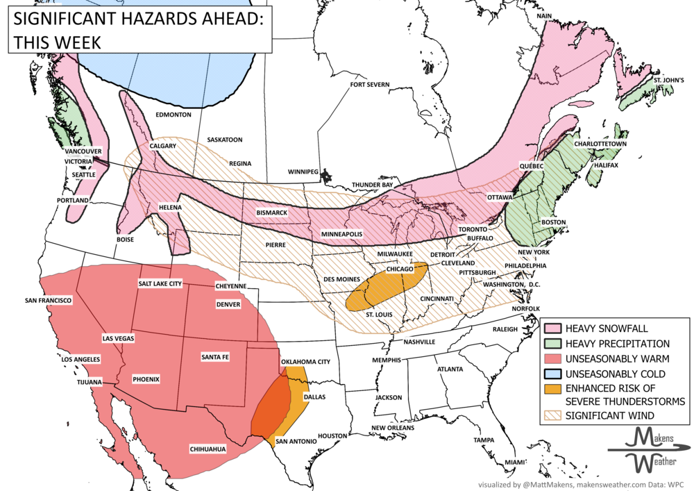
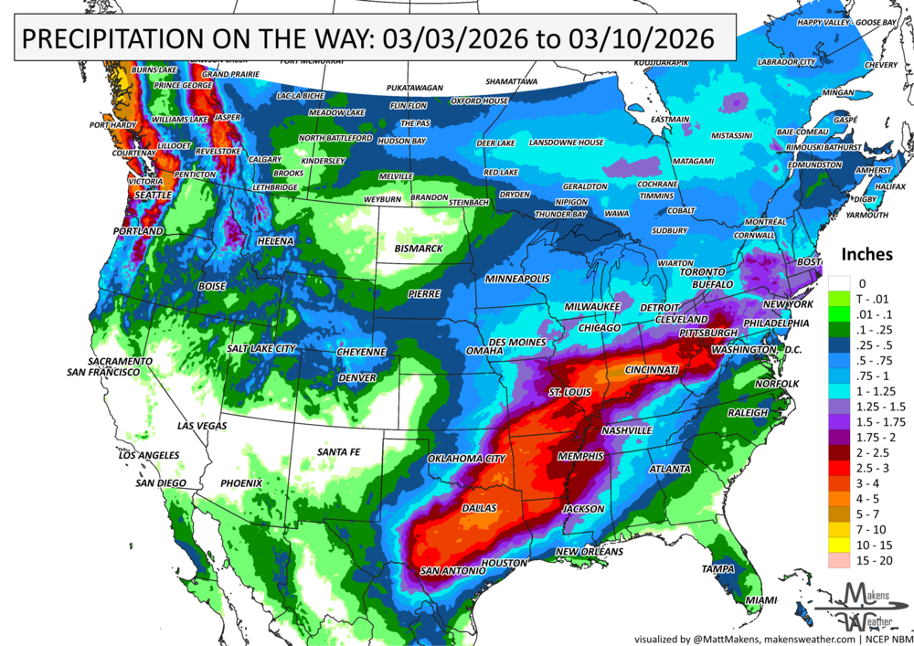
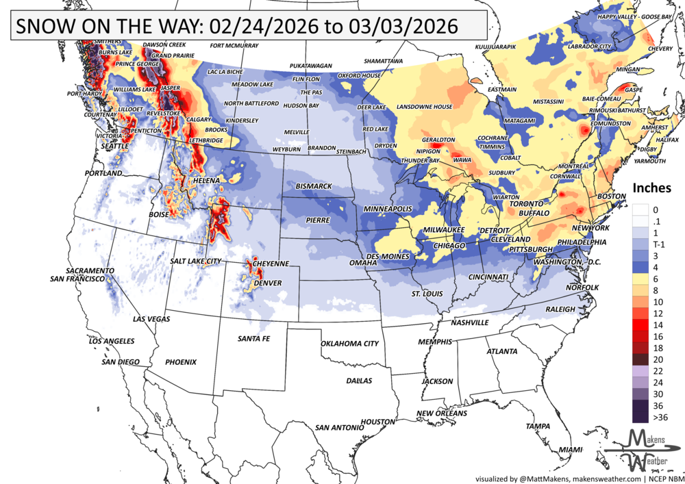

An unusually early taste of summer is taking hold across the western U.S., with dangerous heat building through the Southwest and spreading into parts of the Plains over the next several days. While the biggest headline is the expanding heat, elevated to critical fire weather conditions will also raise concerns across the High Plains and southern Plains. Elsewhere, the Pacific Northwest stays wet for a bit longer, and the East remains stuck in a cooler, unsettled pattern with occasional rain and snow before conditions gradually settle.