


Major Hurricane Erin is churning just north of the Bahamas, bringing dangerous surf and rip currents to much of the U.S. East Coast this week. While Erin should stay offshore, its outer bands may brush the Outer Banks later in the week. Elsewhere, extreme heat grips the Southern Plains and Mississippi Valley, and multiple storm systems keep rainfall active across the South, East, and Southwest.
Read More
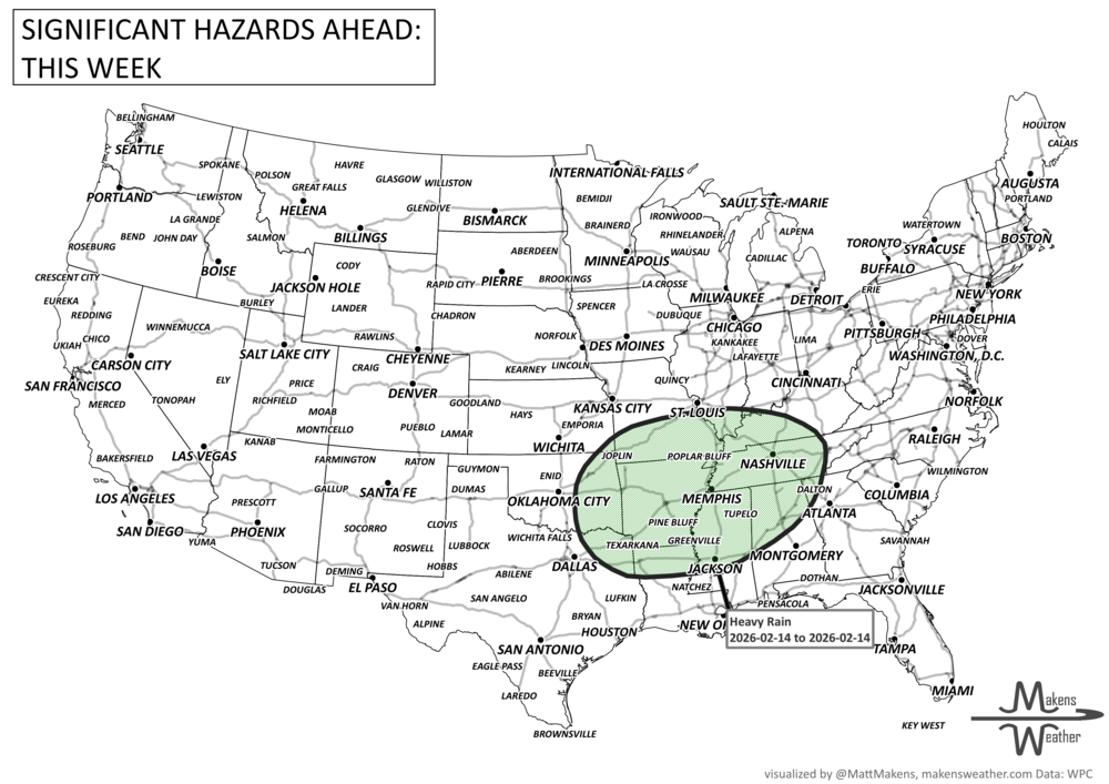
An active weather pattern is unfolding across much of the United States this week. Severe thunderstorms and flooding rains will develop from the Plains into the Midwest, while late-season snow and icy conditions affect parts of the Great Lakes and northern New England. Meanwhile, the Pacific Northwest faces heavy rain and mountain snow, and unusually warm spring temperatures continue across much of the East and Southwest.
Several storm systems will move across the country through mid-week and into the weekend, bringing a mix of severe storms, winter weather, heavy rain, and record-setting warmth depending on location.