


Weekly Weather Watch: Tuesday, February 10th, 2026
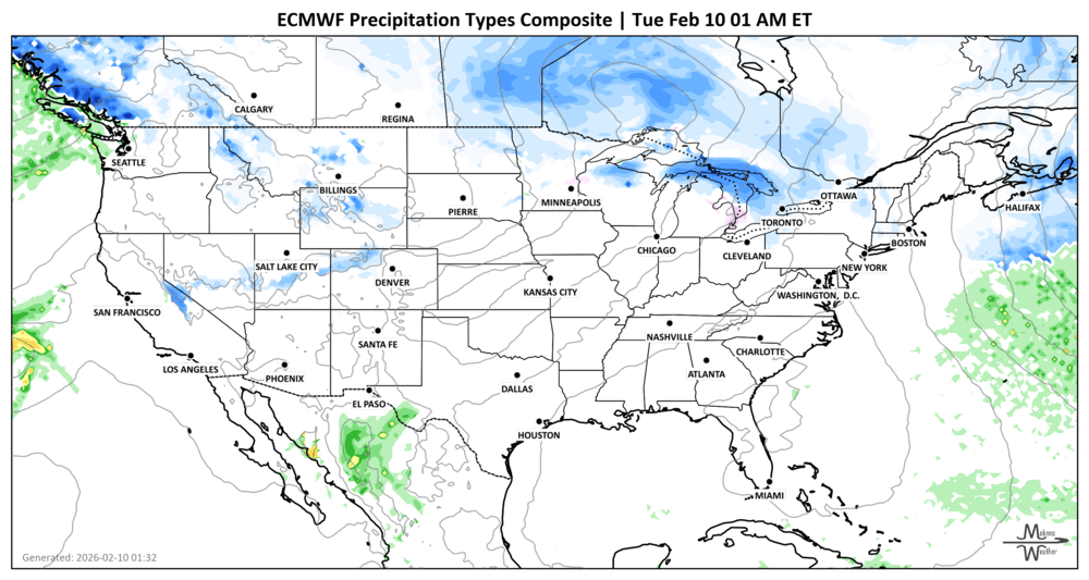
A strong and stormy pattern is setting up across the U.S. and Canada this week. A Pacific system will dump rain and mountain snow across California, while a fast-moving clipper spreads snow through New England and the Maritimes. Meanwhile, a major storm will slam Alaska with dangerous blizzard conditions. By the weekend, attention shifts to a new system that may bring heavy rain to the Southern U.S. and wintry mix potential in the Mid-Atlantic and Northeast then heavy snowfall back into the Maritimes.
Unlock the Makens Weather Advantage ☀️📊
Your membership includes:
✔️ Real-time dashboard with the latest weather observations and long-range projections
✔️ Monthly-lead forecasts to plan weeks ahead
✔️ Discounts on personalized consultations for ag, energy, or risk planning
All built for decision-makers who need weather insight, not just data.
🎯 Join now and put the forecast to work for you.
📈 The latest outlooks and conditions - track it 👉 Join Now to Access the Dashboard
HEADLINERS:
Weekly Timeline Snapshot
Tuesday-Wednesday
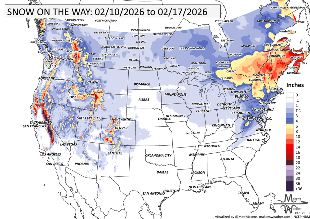
• California sees moderate rain, thunderstorms, and heavy Sierra snow.
• Great Basin to the Rockies sees increasing snow chances by Wednesday.
• A fast-moving clipper brings snow from Upstate New York into New England across Quebec and the Maritimes, with some lake-effect and upslope snow lingering behind.
Wednesday-Thursday
• Rain and a few storms spread from Texas into the Southeast.
Friday-Saturday
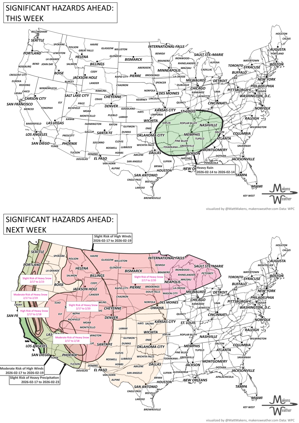
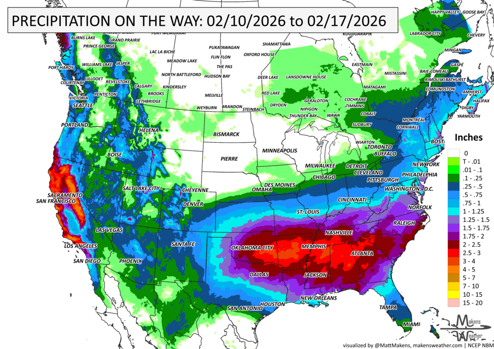
• A new system pushes across the Southwest into the Southern Plains and Lower Mississippi Valley with moderate to heavy rain.
• Isolated flooding is possible if rainfall lines up along a slow-moving front.
Sunday-Monday
• Rain spreads into the East, and there is a chance for wintry precipitation from the Mid-Atlantic into New England, then the Maritimes, depending on how the system evolves.
All Week
• Above-average temperatures hold across much of the Central and Eastern U.S., with pockets of 20+°F warmth in the Plains by the weekend.
• Temperatures remain closer to average along the West Coast and New England due to storm activity.
• Colder temperatures remain across much of Canada, albeit the coldest grip holds on central to eastern Provinces.
IN THE GAUGES, precipitation through the 17th:
GRAB A RULER, snowfall through the 17th:
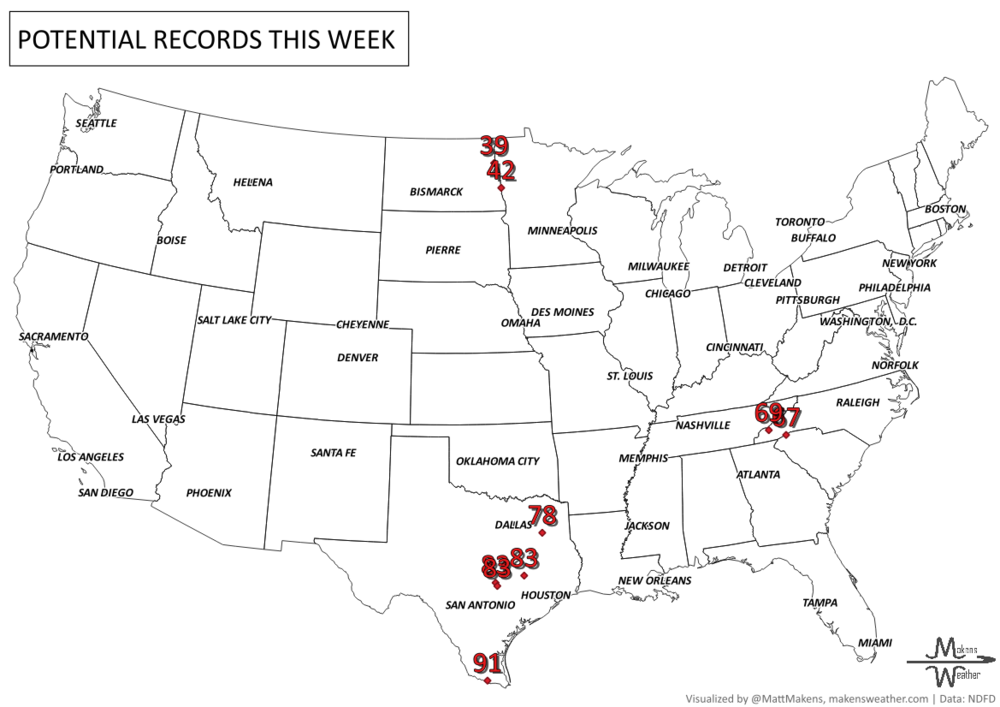
RECORDS MADE TO BE BROKEN, daily highs (RED) and lows (BLUE):
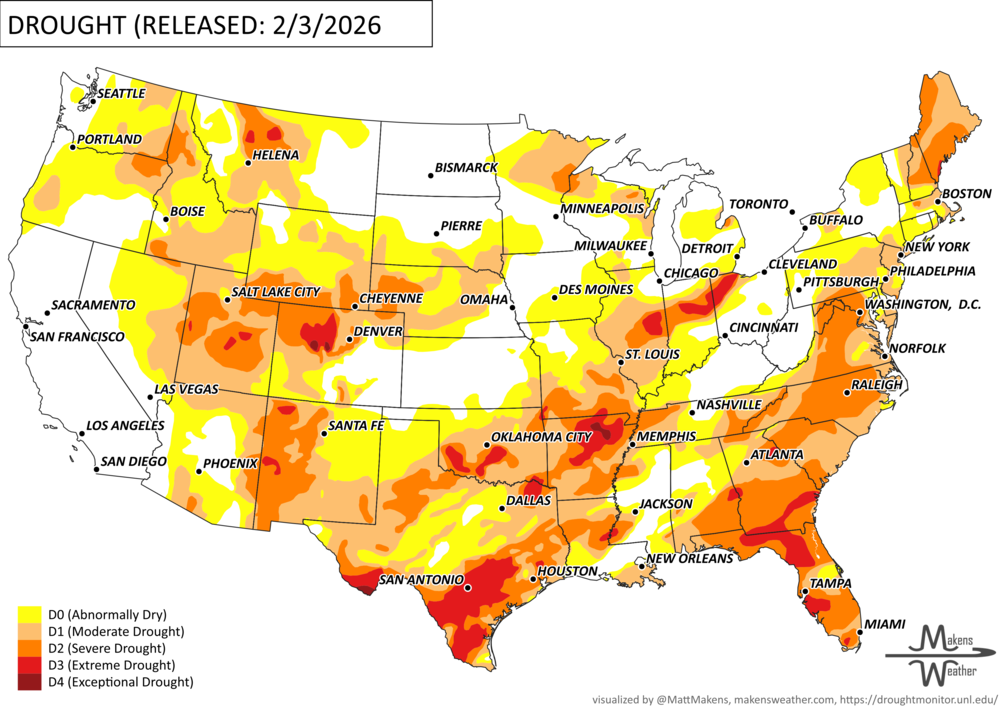
UN-DROUGHTABLY DRY:
Most of the country saw little to no rain or snow this past week, which added to ongoing drought issues in several areas. Here’s the simple breakdown:
West: Snowpack is still well below normal, even where snow fell. Dry soils and low streamflow are worsening drought in parts of the Intermountain West and spreading across western Oregon, southern Washington, and northwest California.
South & Southeast: Another dry week led to worsening drought in many areas. However, a few spots, especially where last week’s snow hit, saw slight improvement.
Midwest & Northeast: It was colder than normal, and although mostly dry, some areas did get light snow, helping ease drought slightly in a few spots.
Tennessee Valley & Carolinas: A winter storm brought snow and mixed precipitation, with heavier snow in some places.
Bottom line: Most regions stayed dry, and drought conditions are holding or getting worse in many parts of the country. -U.S. Department of Agriculture
ARE YOU CIRRUS?!
Today in weather history:
1921: Gardner, Georgia, was devastated by a massive, estimated F4 tornado that caused an entire small town section to disappear. The tornado killed an estimated 31 people and injured 100.
1959: St. Louis, Missouri, was hit by a massive F4 tornado that killed 21 and injured 345. More than 2,000 buildings were damaged or destroyed, including the St. Louis Arena.
1981: A morning tornado at Bay Minette, AL, struck the local middle school, severely damaging the gymnasium. The tornado hurt 62 people, 44 of whom were students.
2010: Cyclone Pat slams The Cook Islands with 125 mph winds, which destroyed about 80 percent of the island of Aitutaki.
2017: Denver saw their all-time warmest temperature in February with a reading of 79 degrees.
A drawn-out storm pattern will keep much of the country active through the first week of April. A slow-moving front stretching from the Great Lakes into the Plains will separate late-season snow and ice to the north from heavy rain and severe thunderstorms to the south. The setup brings the greatest impacts to parts of the Midwest, Ohio Valley, Southern Plains, Mississippi Valley, and eventually the East Coast, while the West sees mountain snow and then a warming trend heading into the weekend.