


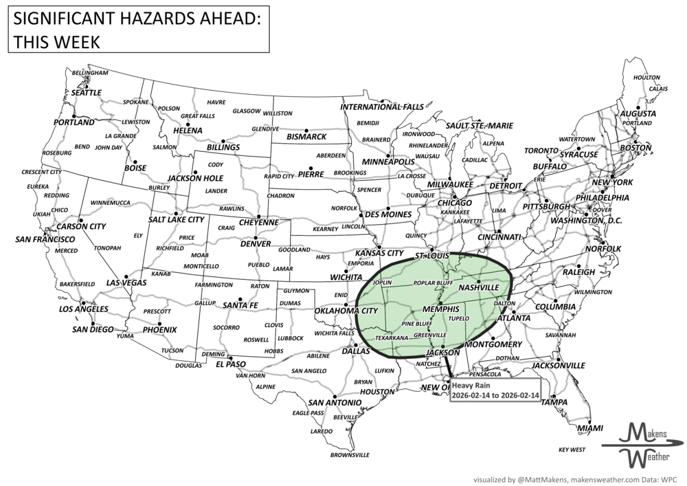

A stormy stretch continues across the central and southern Plains early this week, with widespread thunderstorms and a risk of flash flooding and severe weather, including hail and isolated tornadoes. As a cold front advances, the rain shifts eastward, soaking the Ohio Valley, Mid-South, and Gulf Coast midweek before spreading into the Southeast and Mid-Atlantic by Friday. The Southwest also turns wetter later this week as tropical moisture feeds daily downpours. Cooler temperatures will follow the front into the central U.S., while the Northeast and West remain seasonably warm.
Read More
An active weather pattern is unfolding across much of the United States this week. Severe thunderstorms and flooding rains will develop from the Plains into the Midwest, while late-season snow and icy conditions affect parts of the Great Lakes and northern New England. Meanwhile, the Pacific Northwest faces heavy rain and mountain snow, and unusually warm spring temperatures continue across much of the East and Southwest.
Several storm systems will move across the country through mid-week and into the weekend, bringing a mix of severe storms, winter weather, heavy rain, and record-setting warmth depending on location.