


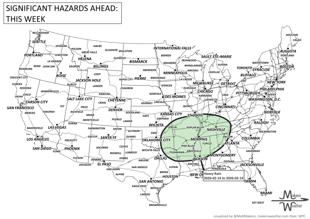

A potent Pacific storm is bringing a wet and wintry start to the week for the western U.S., with Southern California and the Southern Rockies facing the risk of flash flooding. Heavy snow is piling up in the Sierra Nevada and will shift to the Northern Rockies by Wednesday. As the week continues, the storm moves east, bringing widespread rain to the Plains, Mid-South, and eventually the East Coast. Meanwhile, another storm system is set to push into the Pacific Northwest by late weekend, keeping the unsettled weather going into next week. Tropical Storm Lorenzo remains out in the Atlantic with no expected U.S. impact. Across Canada, heavy western moisture, including snow in the mountains. Elsewhere, semi-heavy moisture will move across the central and eastern Prairies toward Ontario. Also, widespread frost and freezing temperatures are possible for all provinces.
Read More
An active weather pattern is unfolding across much of the United States this week. Severe thunderstorms and flooding rains will develop from the Plains into the Midwest, while late-season snow and icy conditions affect parts of the Great Lakes and northern New England. Meanwhile, the Pacific Northwest faces heavy rain and mountain snow, and unusually warm spring temperatures continue across much of the East and Southwest.
Several storm systems will move across the country through mid-week and into the weekend, bringing a mix of severe storms, winter weather, heavy rain, and record-setting warmth depending on location.