


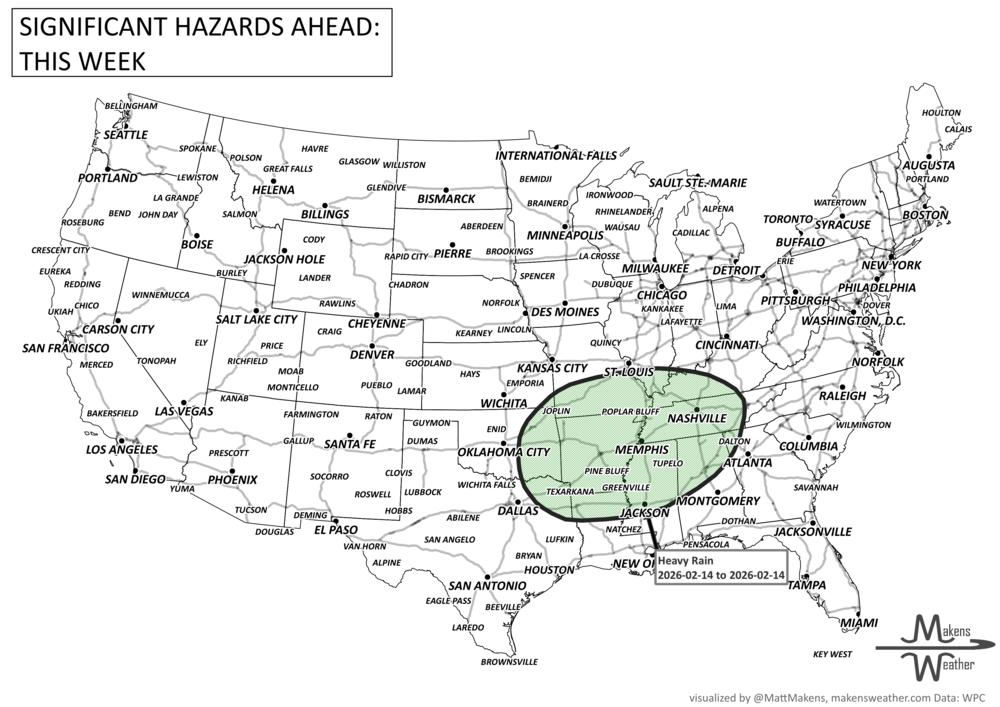

A series of Pacific storms is taking aim at the Northwest this week, delivering heavy rain, mountain snow, and gusty winds that could lead to flooding. While the West braces for more moisture, the Central and Western U.S. will bask in record-challenging warmth, with temperatures soaring 15 to 25 degrees above normal. Meanwhile, the chill that's gripped the Eastern U.S. finally begins to ease midweek, ushering in a brief break from the Arctic air. Flash freeze, snow, and wind will hit much of the Canadian Prairies, first with Alberta on Wednesday, then spreading eastward.
Read More
An active weather pattern is unfolding across much of the United States this week. Severe thunderstorms and flooding rains will develop from the Plains into the Midwest, while late-season snow and icy conditions affect parts of the Great Lakes and northern New England. Meanwhile, the Pacific Northwest faces heavy rain and mountain snow, and unusually warm spring temperatures continue across much of the East and Southwest.
Several storm systems will move across the country through mid-week and into the weekend, bringing a mix of severe storms, winter weather, heavy rain, and record-setting warmth depending on location.