


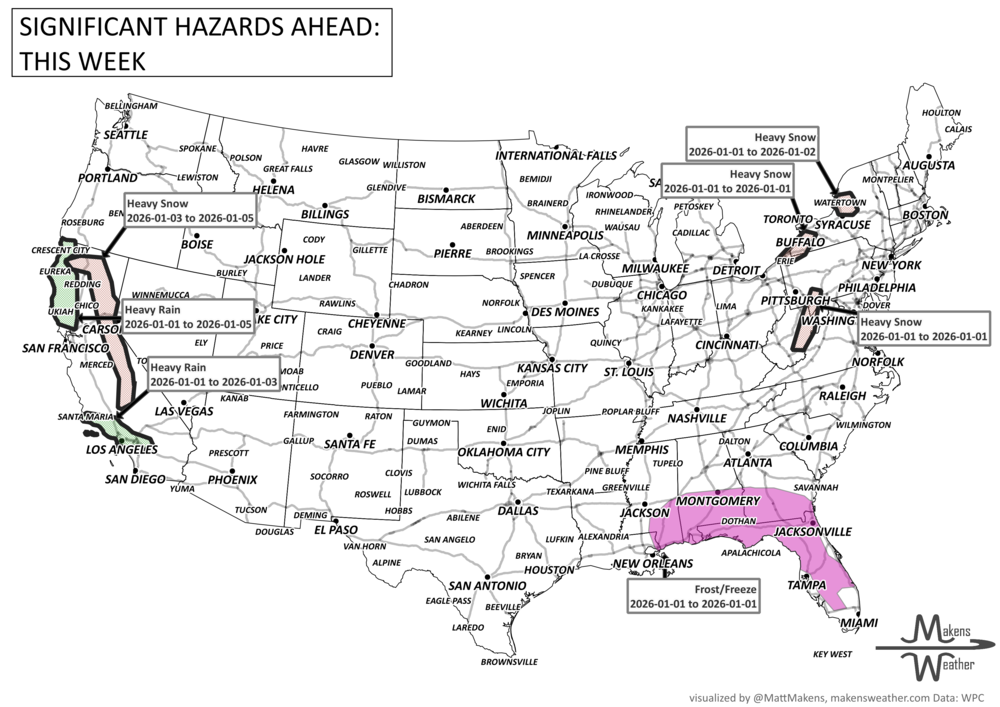
As we close out 2025 and ring in the new year, the weather pattern stays anything but quiet. A multi-day lake-effect snow event is burying areas downwind of Lakes Erie and Ontario, where over 3 feet of snow could fall in the most persistent bands—creating whiteout squalls and treacherous travel through New Year's Day. Meanwhile, Arctic air is spilling deep into the Southeast, sending temperatures below freezing as far south as Florida, with frost and freeze alerts in place. On the other side of the country, a Pacific storm system will bring rounds of heavy rain and a flash flood threat to Southern California, especially around Los Angeles, starting late New Year's Eve. Elsewhere, a couple of fast-moving clippers will spread freezing rain and snow to Alberta, then snow across the Midwest, Ohio Valley, and into New England, while a developing storm may bring soaking rain and thunderstorms from the Deep South to the Southeast Coast by the weekend. Even Northern California faces an atmospheric river event late week, setting the stage for an active and disruptive start to 2026.
Read More
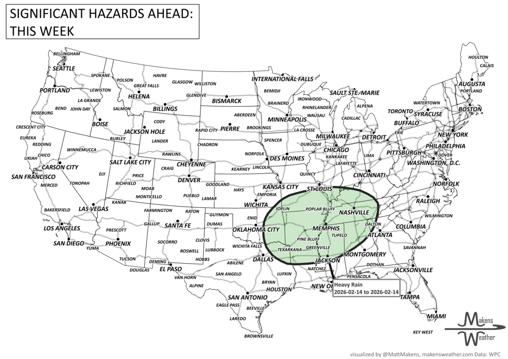
An active weather pattern is unfolding across much of the United States this week. Severe thunderstorms and flooding rains will develop from the Plains into the Midwest, while late-season snow and icy conditions affect parts of the Great Lakes and northern New England. Meanwhile, the Pacific Northwest faces heavy rain and mountain snow, and unusually warm spring temperatures continue across much of the East and Southwest.
Several storm systems will move across the country through mid-week and into the weekend, bringing a mix of severe storms, winter weather, heavy rain, and record-setting warmth depending on location.