


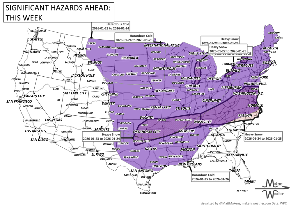
Dangerous weather for many - a very active winter pattern is unfolding across the U.S. Lake-effect snow continues around the Great Lakes through midweek, while dangerous Arctic cold grips much of the central and eastern states. Attention then shifts to Friday through the weekend, when a potentially high-impact winter storm could spread snow and ice from the Southern Plains into the Mid-Atlantic. Travel disruptions, power issues, and prolonged cold are all on the table. For Canada, dangerous cold, particularly for Central to Eastern Provinces. Snow squalls are possible in Alberta and Saskatchewan.
Read More
An active weather pattern is unfolding across much of the United States this week. Severe thunderstorms and flooding rains will develop from the Plains into the Midwest, while late-season snow and icy conditions affect parts of the Great Lakes and northern New England. Meanwhile, the Pacific Northwest faces heavy rain and mountain snow, and unusually warm spring temperatures continue across much of the East and Southwest.
Several storm systems will move across the country through mid-week and into the weekend, bringing a mix of severe storms, winter weather, heavy rain, and record-setting warmth depending on location.